Off-Road Trails in Oregon
Discover off-road trails in Oregon
Learn more about Kart - FS 1004158
Kart - FS 1004158
Total Miles
0.8
Tech Rating
Easy
Best Time
Spring, Summer, Fall
Learn more about Karth Road
Karth Road
Total Miles
4.1
Tech Rating
Easy
Best Time
Spring, Summer, Fall, Winter

Learn more about Keeps Mill North Access
Keeps Mill North Access
Total Miles
3.5
Tech Rating
Easy
Best Time
Summer, Fall
Learn more about Keeps Mill South
Keeps Mill South
Total Miles
18.2
Tech Rating
Easy
Best Time
Summer, Fall
Learn more about Kendall Skyline - FS 6403
Kendall Skyline - FS 6403
Total Miles
11.2
Tech Rating
Easy
Best Time
Spring, Summer, Fall
Learn more about Kiger Mustang Viewing Area Road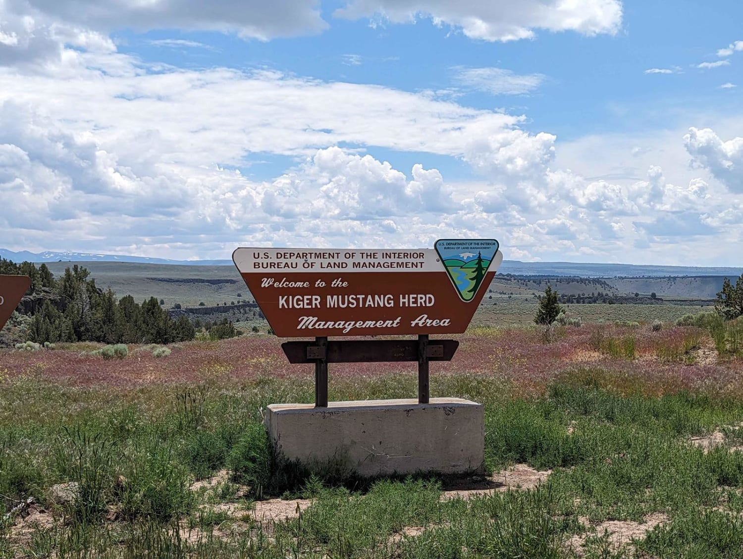
Kiger Mustang Viewing Area Road
Total Miles
21.5
Tech Rating
Easy
Best Time
Spring, Summer, Fall
Learn more about Kiger's Rocky Ridge
Kiger's Rocky Ridge
Total Miles
6.5
Tech Rating
Moderate
Best Time
Summer, Fall
Learn more about Kilchis Falls Spur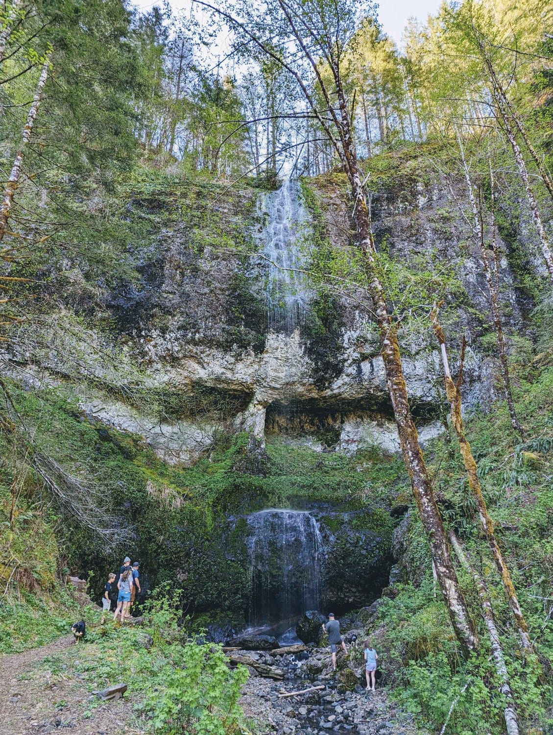
Kilchis Falls Spur
Total Miles
2.0
Tech Rating
Easy
Best Time
Spring, Summer, Fall
Learn more about Kilchis Lookout Road
Kilchis Lookout Road
Total Miles
7.7
Tech Rating
Easy
Best Time
Spring, Summer, Fall
Learn more about King of the Hill 
King of the Hill
Total Miles
8.8
Tech Rating
Easy
Best Time
Spring, Summer, Fall
Learn more about Kruger Rock Road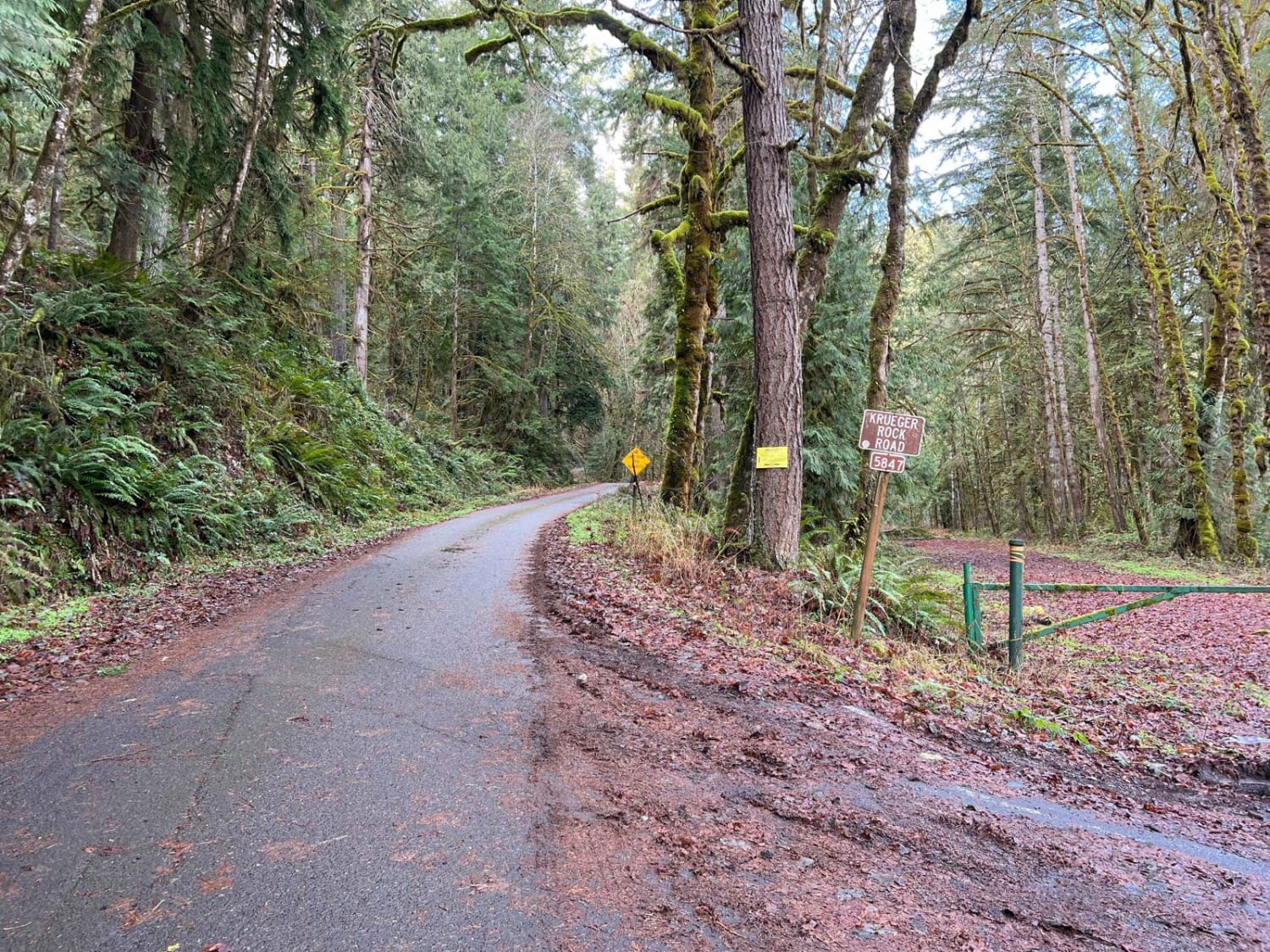
Kruger Rock Road
Total Miles
8.0
Tech Rating
Easy
Best Time
Spring, Summer, Fall, Winter
Learn more about Kwiskwis - FR 5871
Kwiskwis - FR 5871
Total Miles
7.6
Tech Rating
Easy
Best Time
Spring, Summer, Fall
Learn more about Kwiskwis Butte 2408
Kwiskwis Butte 2408
Total Miles
12.9
Tech Rating
Easy
Best Time
Spring, Summer, Fall
Learn more about La Dee Flats
La Dee Flats
Total Miles
4.4
Tech Rating
Easy
Best Time
Spring, Summer, Fall, Winter
ATV trails in Oregon


UTV/side-by-side trails in Oregon
Learn more about 10 Mile OHV Trail
10 Mile OHV Trail
Total Miles
1.6
Tech Rating
Easy
Best Time
Spring, Summer, Fall


The onX Offroad Difference
onX Offroad combines trail photos, descriptions, difficulty ratings, width restrictions, seasonality, and more in a user-friendly interface. Available on all devices, with offline access and full compatibility with CarPlay and Android Auto. Discover what you’re missing today!