Mapping Apps for Outdoor Adventures
From the palm of your hand or the big screen on your desktop, find a way to achieve your next outdoor pursuit.
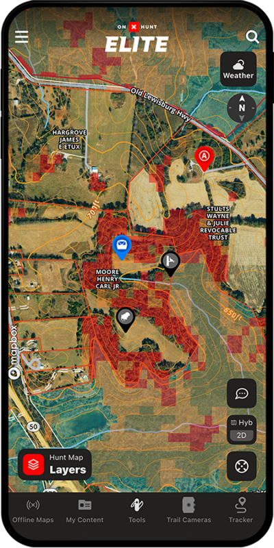
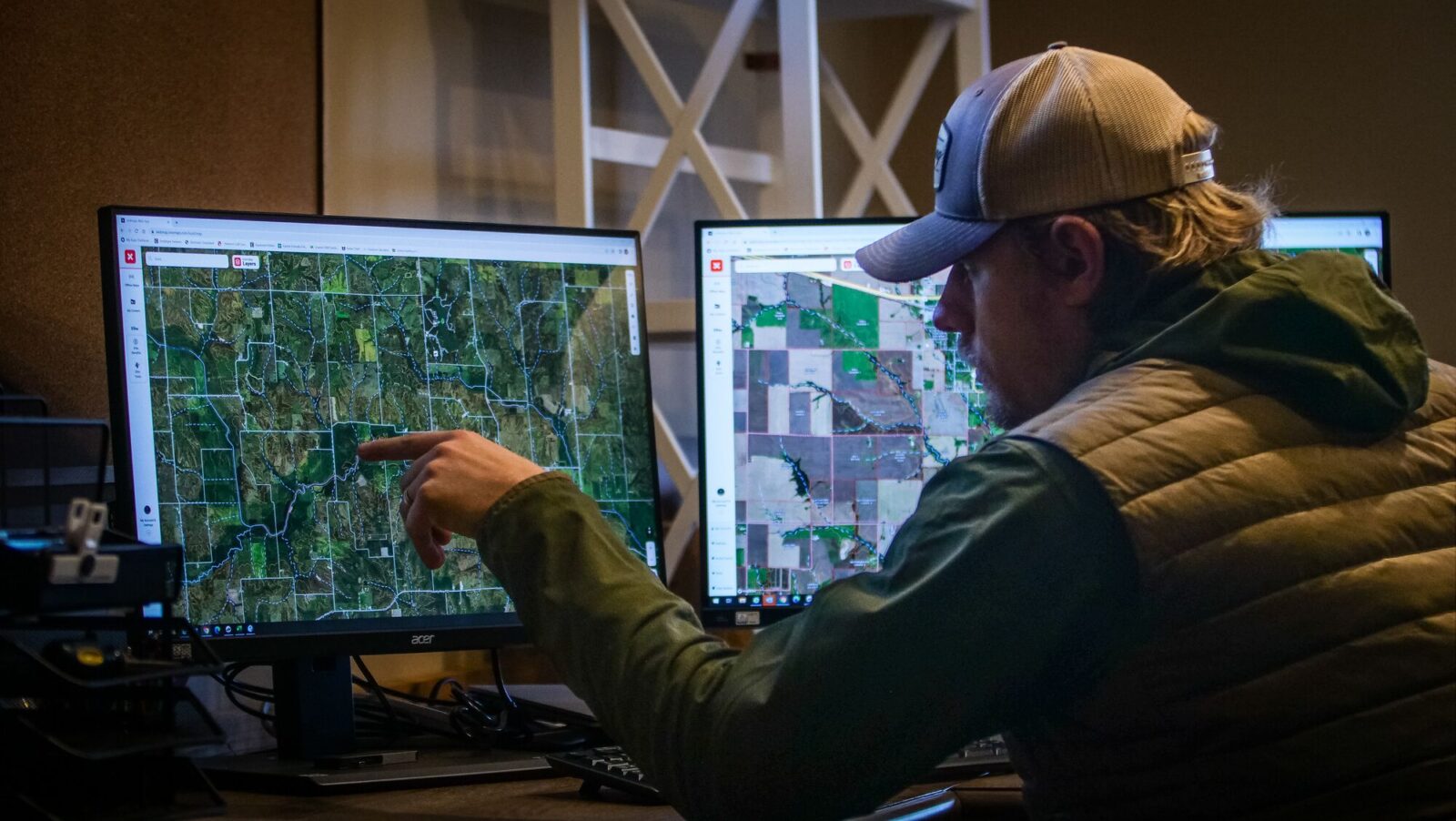
Every Species. Every State. Every Hunt.
Find new hunting opportunities and better understand your go-to locations.
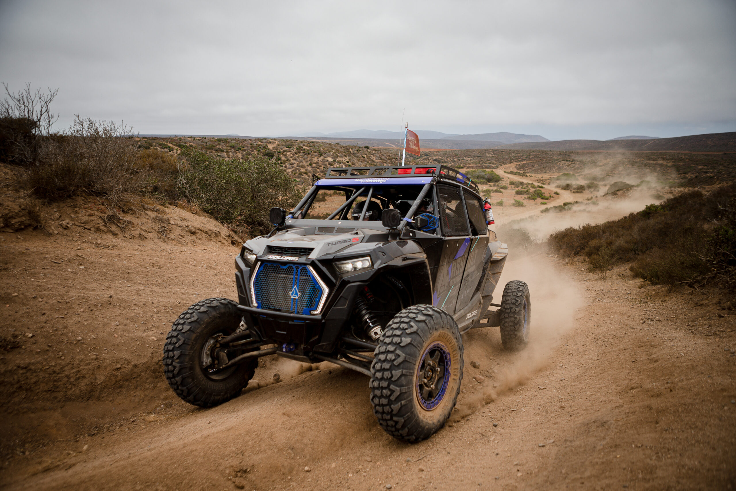
Off-road Trails Mapped by Real People
Explore more than 650K miles of trails.


Navigate with Confidence
Discover new adventures with comprehensive trail and ski line information.

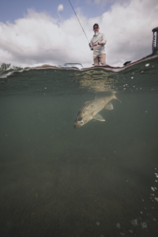
Find. Filter. Fish.
Find new lakes and get there with confidence.
Powering Pursuits For


Around 170,000 Miles Of Trails and Growing
Rich trail data like elevations, distances, and average trail completion time in one App.

Find Singletrack, 50-Inch, and 60-Inch Trails
The tools you need for a day on the trail are in onX Offroad.


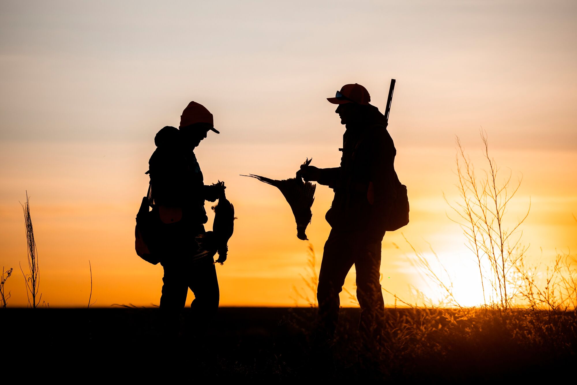
Master the Migration
Tools to dial in roosts, feeds, and loafs to make the most of your next hunt.
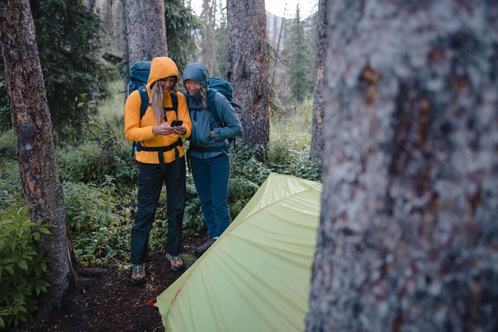

Backpacking Navigation Made Simple
Enjoy the moments and landscapes, let us handle the navigation.
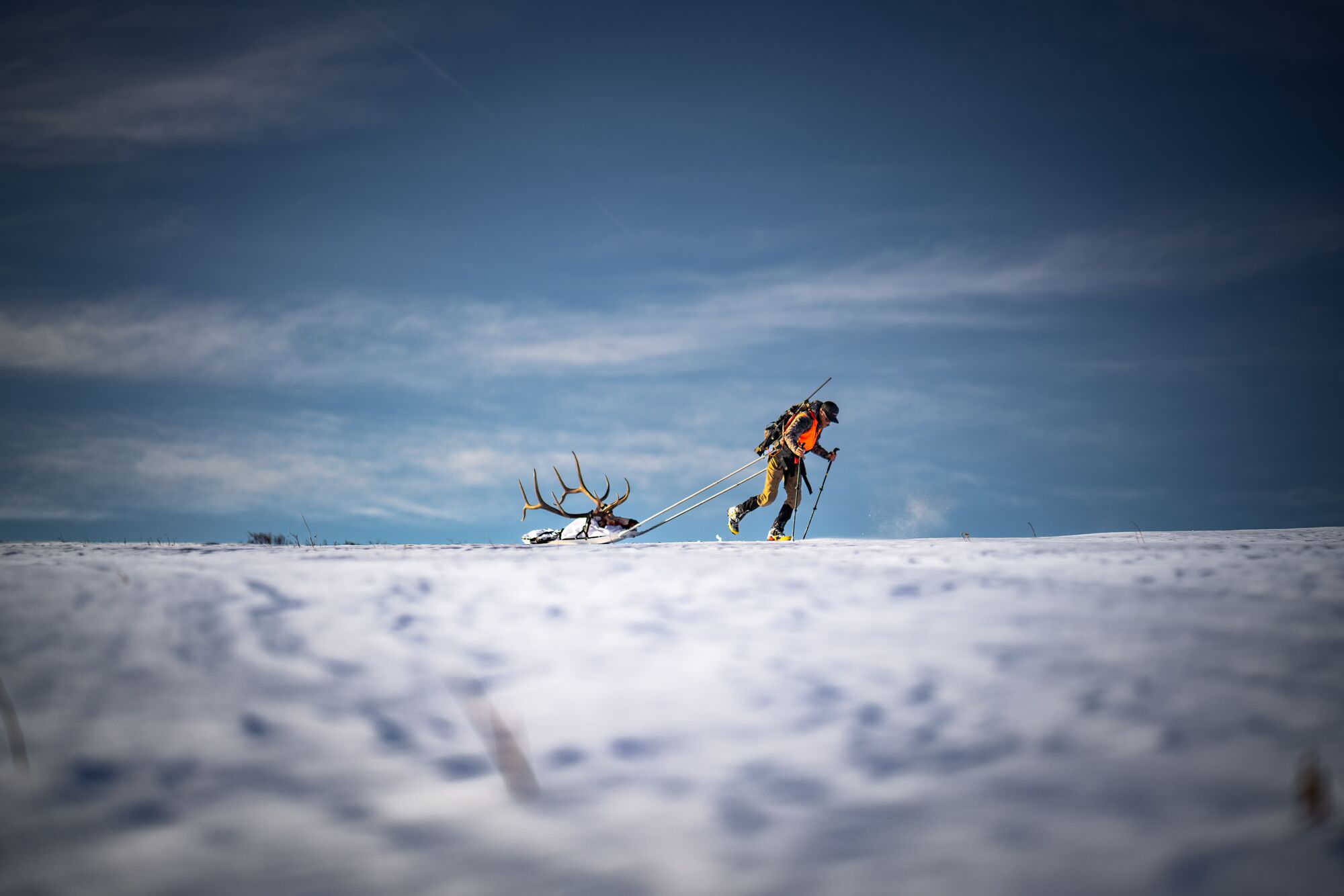

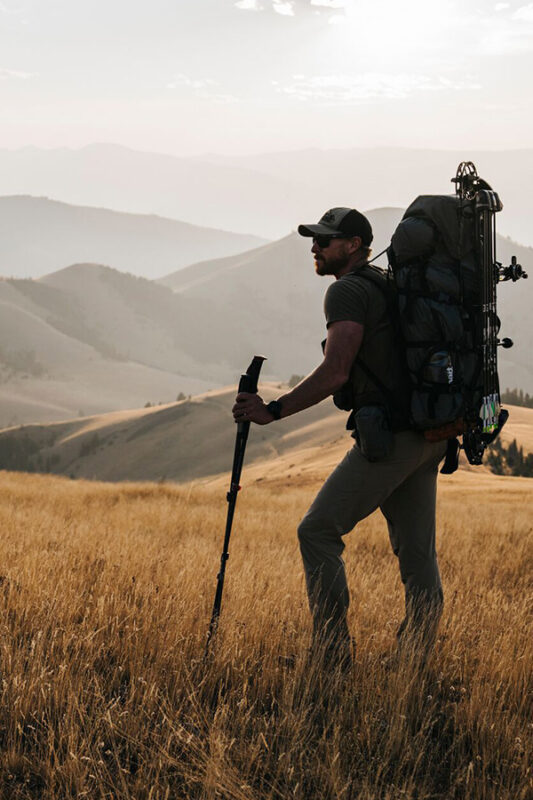
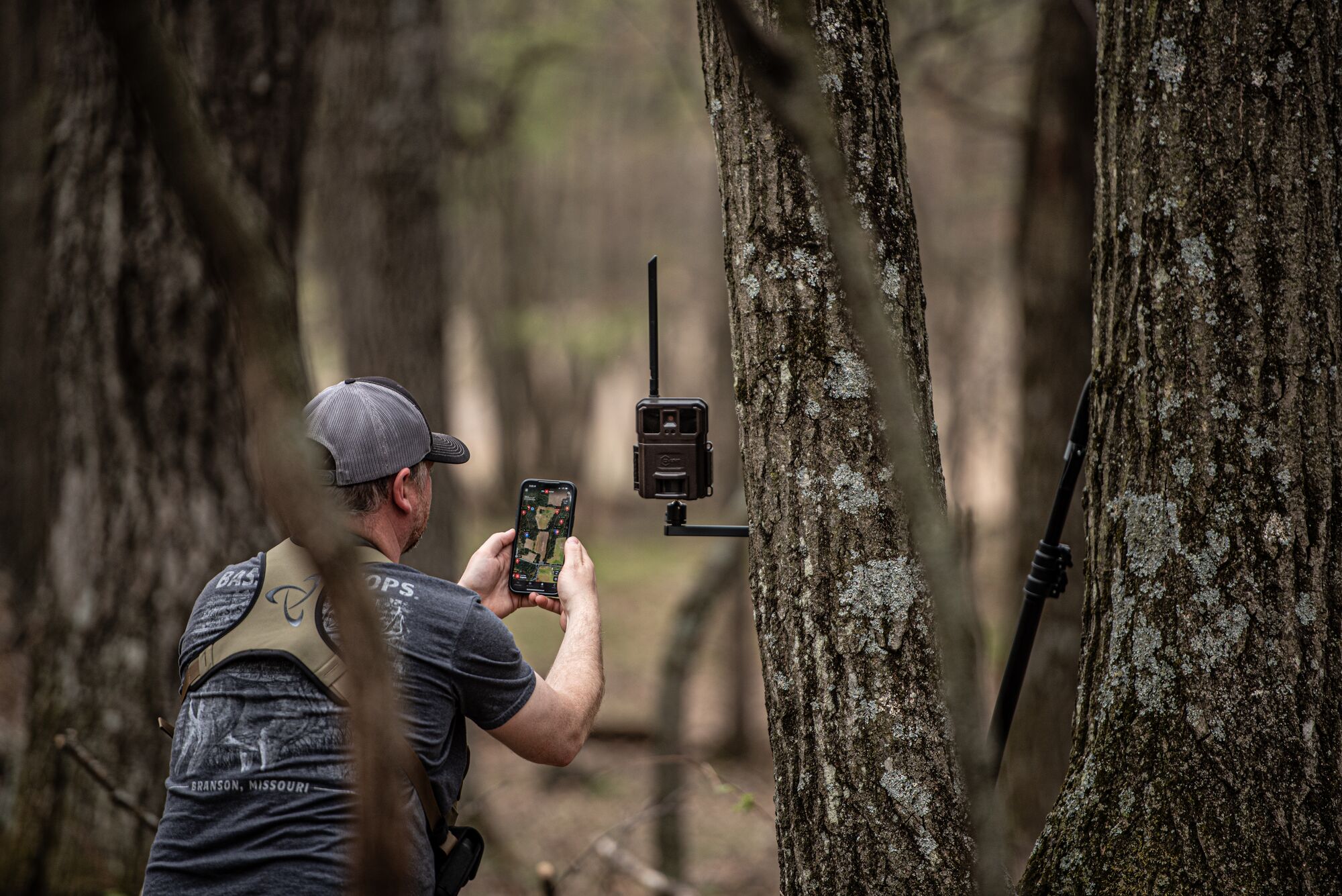
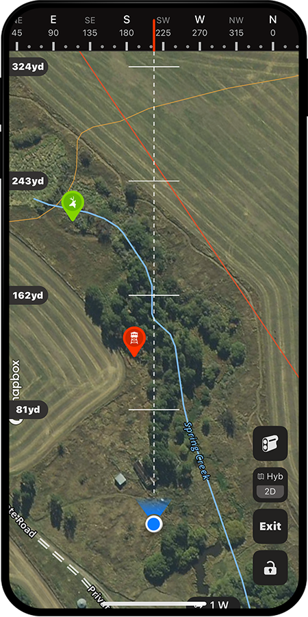
Your Next Great Hunt Is in Range
Understand the terrain, put more tags in your pocket, and unlock your potential with onX Hunt.

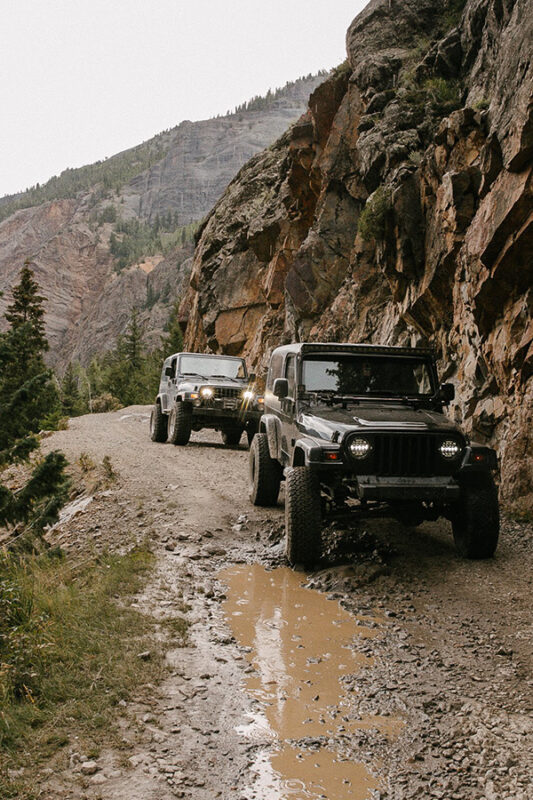
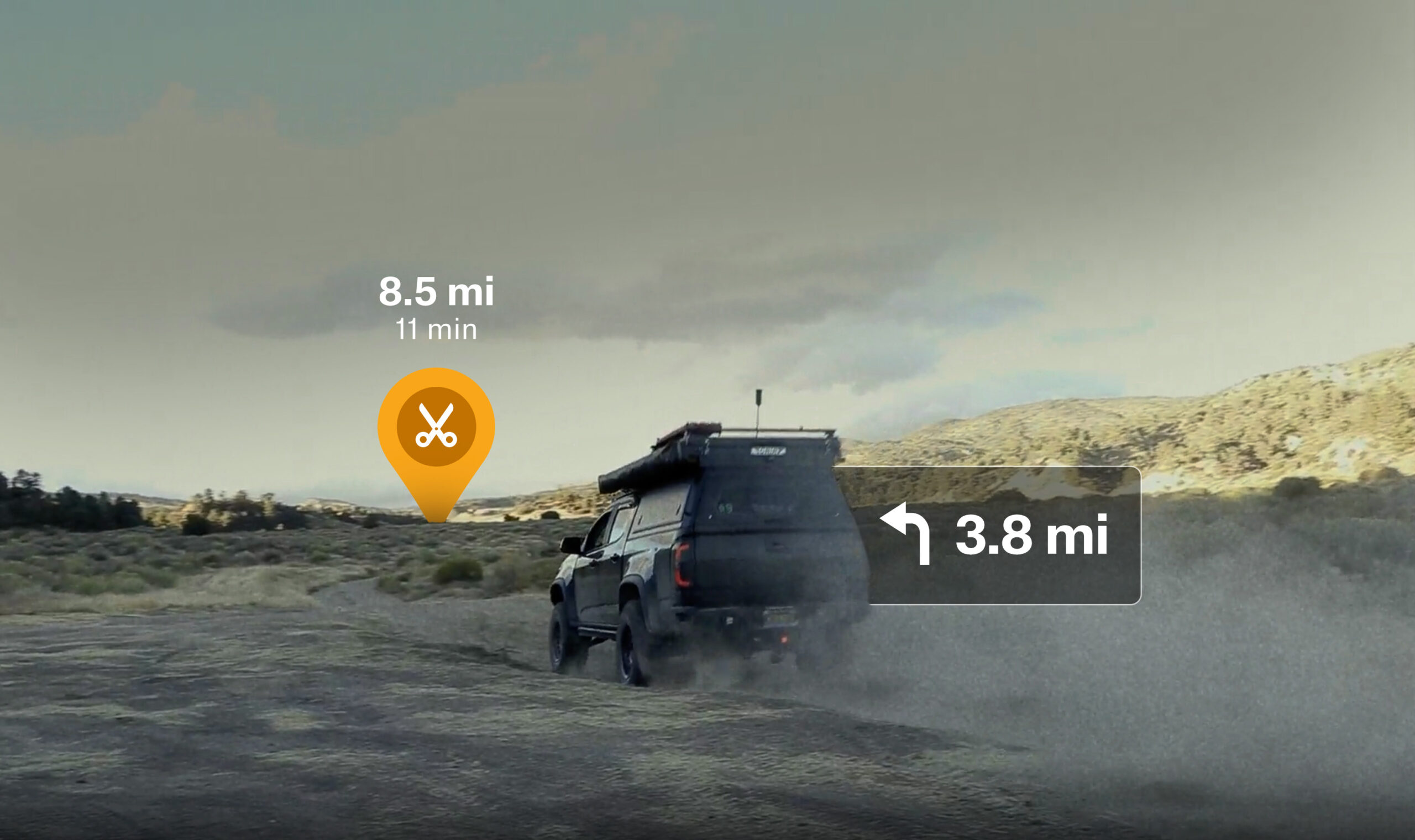
Navigate Confidently With onX Offroad
Offline and offroad is where onX Offroad shines with Turn by Turn navigation and other features for a seamless day of wheeling.
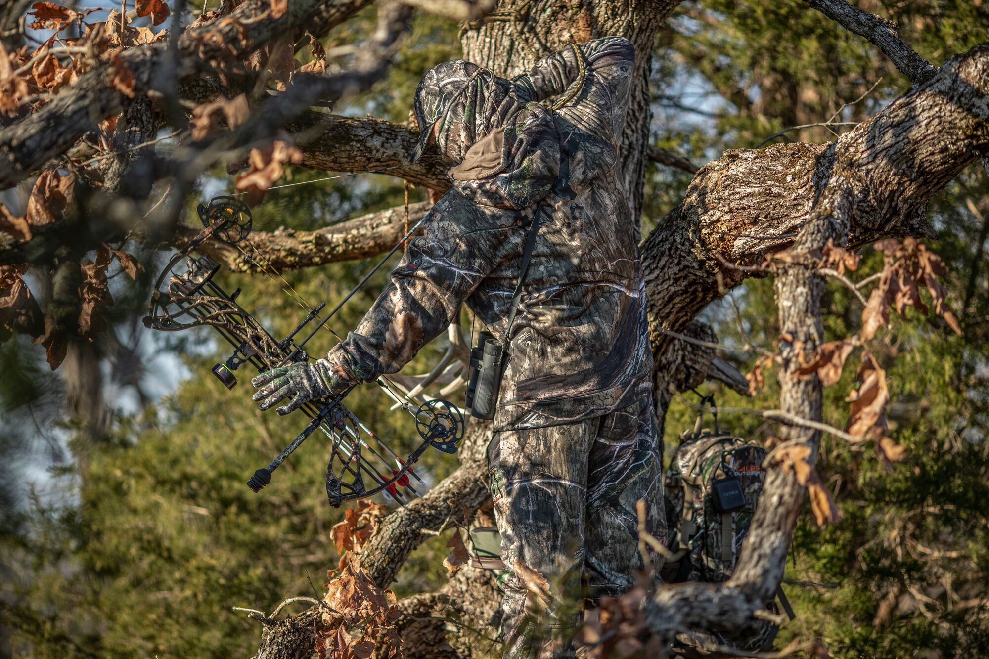

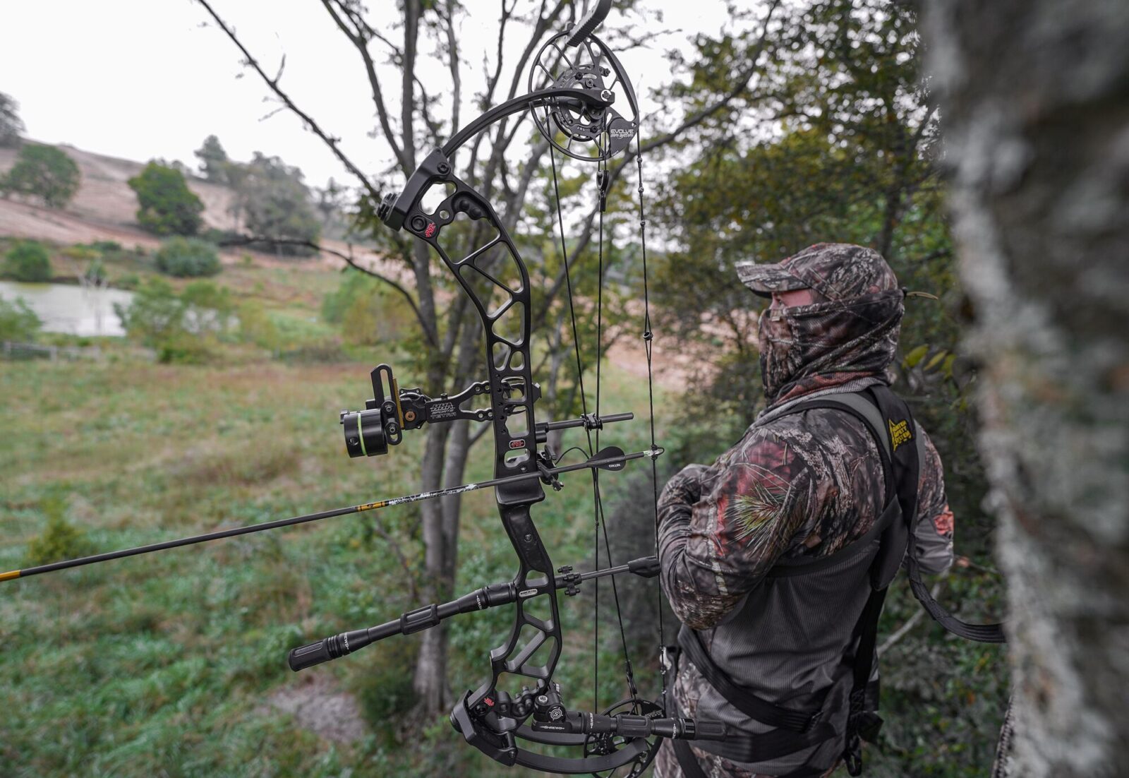
Harvest the Big Buck of Fall
Explore the tools built by whitetail hunters, for whitetail hunters that will help put you in the right tree this autumn.
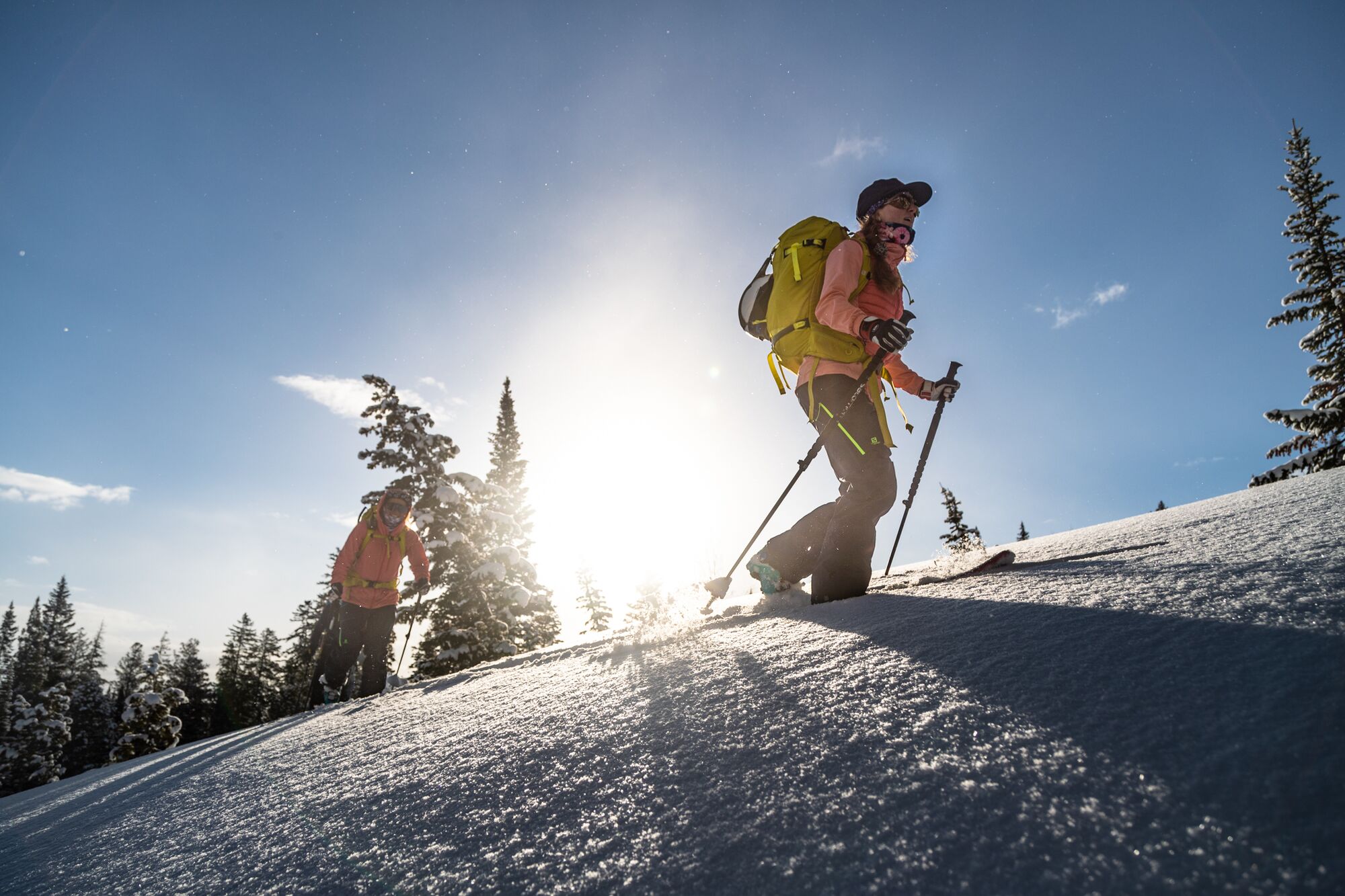

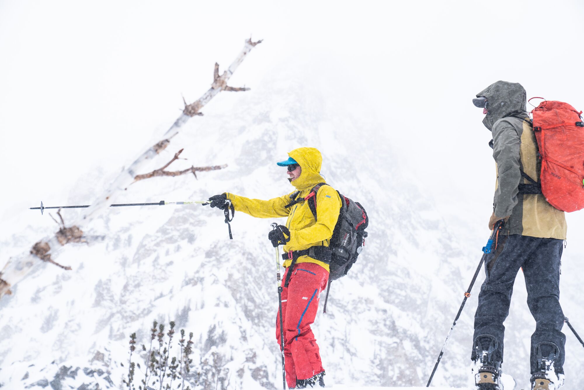
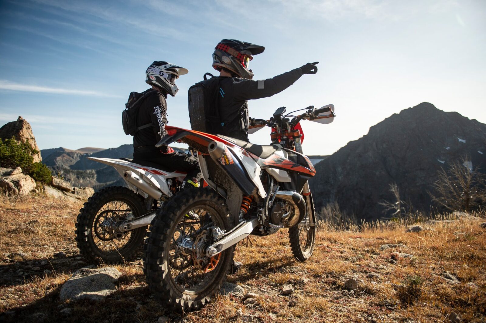
Make Your Touring Days Count
Make safer decisions, prepare your routes, and analyze terrain in one comprehensive App.
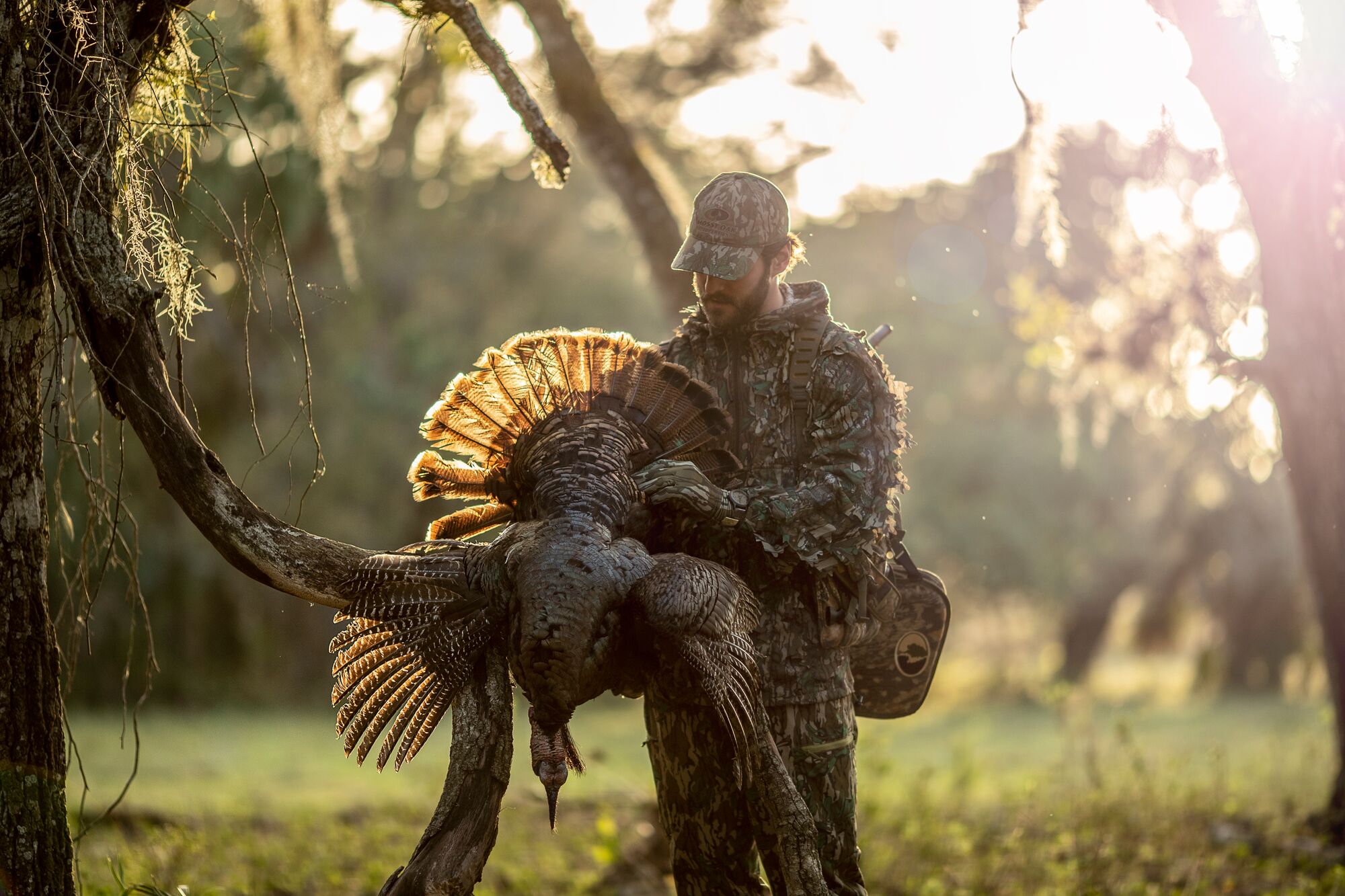

Pinpoint Gobblers
The most comprehensive tools and knowledge you need to locate and harvest more gobblers.
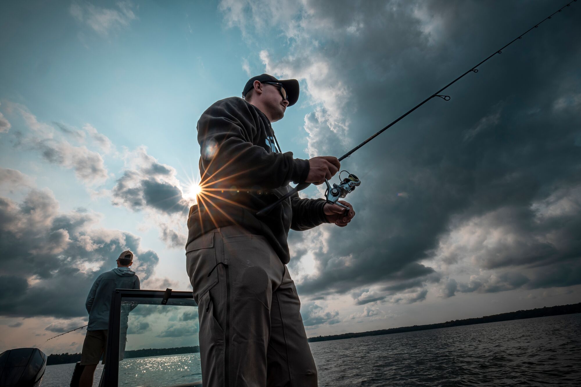

Find, Filter, Fish.
Find and filter new lakes — identify target species, including their size and abundance.


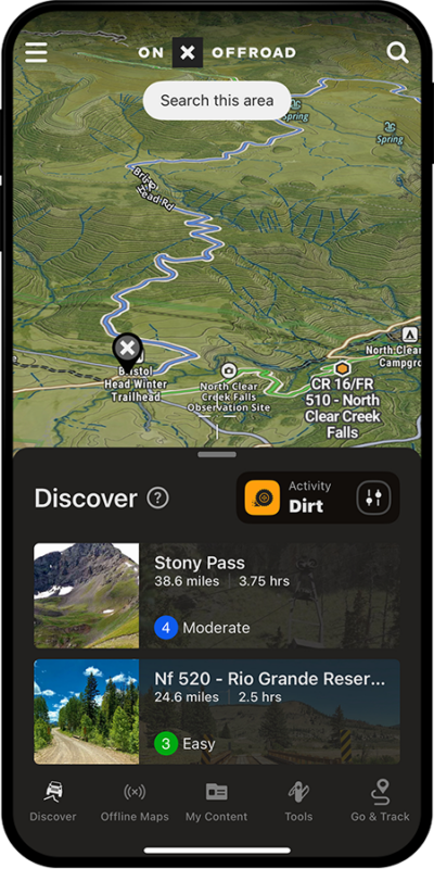
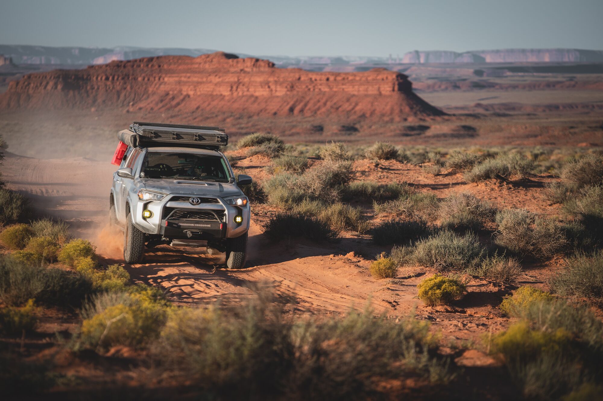
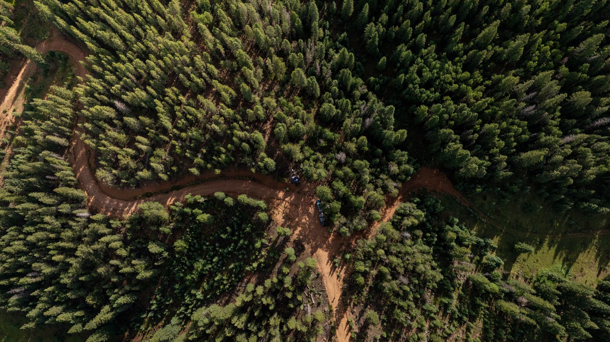
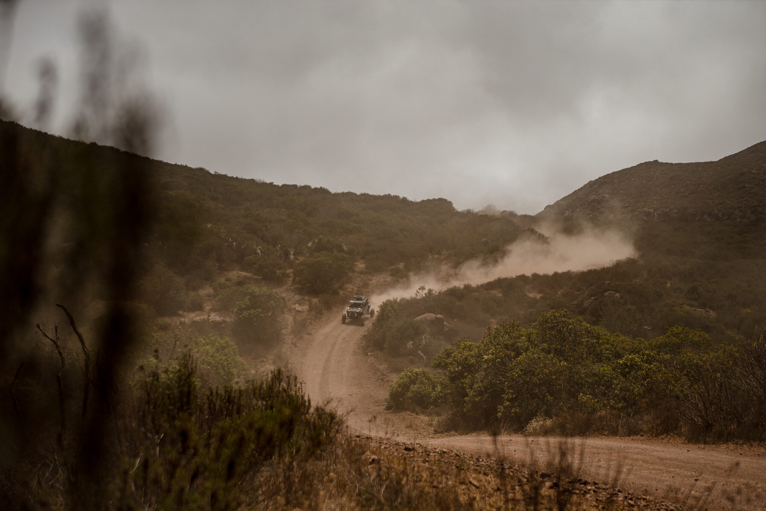
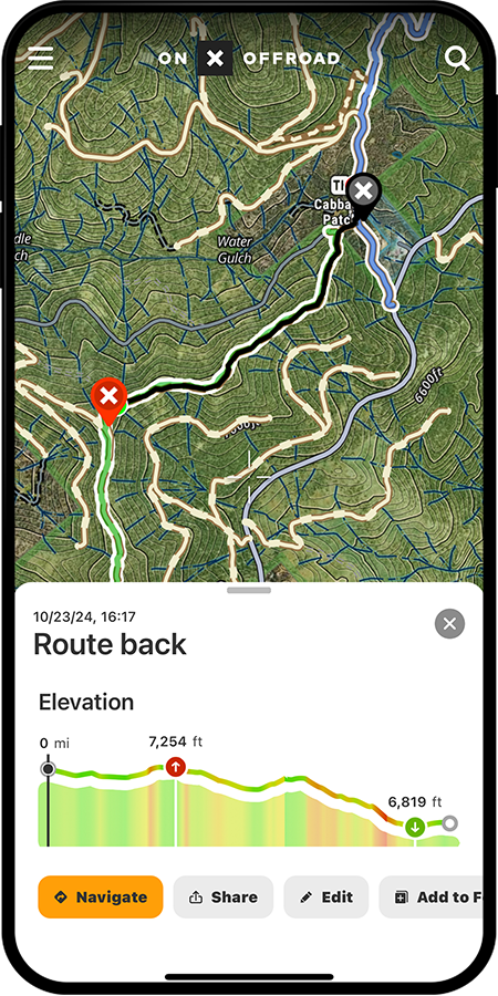
Your Offroad Trail Guide
Find offroading trails for every vehicle type across the country. From desert dunes to mountain madness, your next adventure awaits in onX Offroad.

Discover Where They’re Holding
Pinpoint your next spot with upland-specific tools and layers tailored for bird hunters.
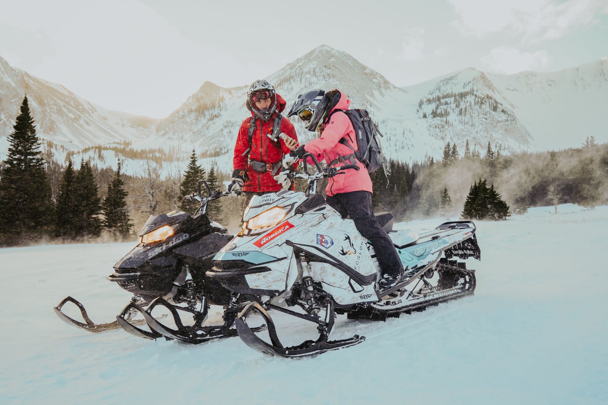

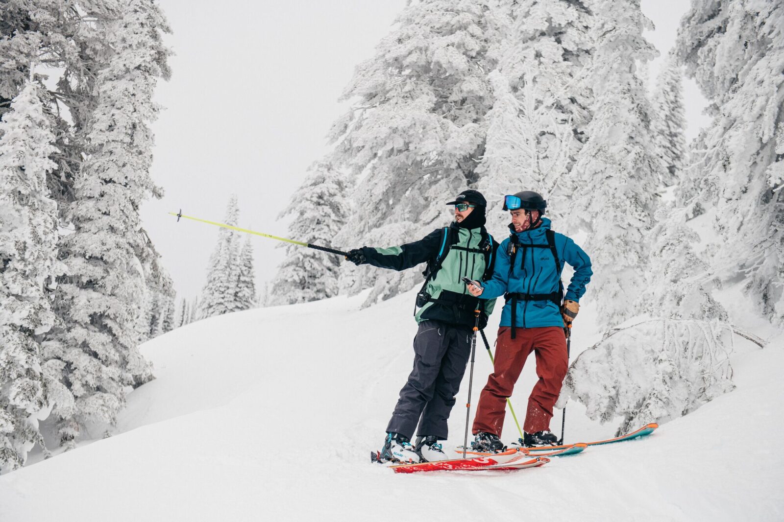
Avalanche Forecasts, Slope Angle, and More
Better days await snowmobiling in the backcountry with onX Offroad.
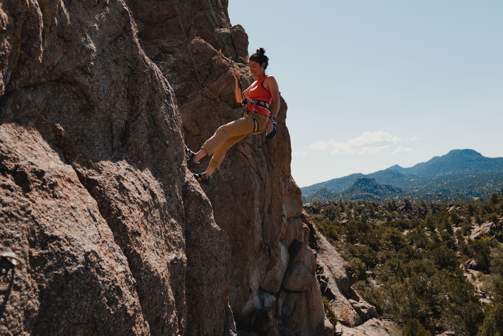

Climb with onX Backcountry
Find routes in your area using Mountain Project data in the onX Backcountry App.

Multi-day Trips with a Variety of Trails
Discover epic off-road adventures mapped by local experts.
Around 170,000 Miles Of Trails and Growing
Rich trail data like elevations, distances, and average trail completion time in one App.
Find Singletrack, 50-Inch, and 60-Inch Trails
The tools you need for a day on the trail are in onX Offroad.
Master the Migration
Tools to dial in roosts, feeds, and loafs to make the most of your next hunt.
Backpacking Navigation Made Simple
Enjoy the moments and landscapes, let us handle the navigation.
Your Next Great Hunt Is in Range
Understand the terrain, put more tags in your pocket, and unlock your potential with onX Hunt.
Navigate Confidently With onX Offroad
Offline and offroad is where onX Offroad shines with Turn by Turn navigation and other features for a seamless day of wheeling.
Harvest the Big Buck of Fall
Explore the tools built by whitetail hunters, for whitetail hunters that will help put you in the right tree this autumn.
Make Your Touring Days Count
Make safer decisions, prepare your routes, and analyze terrain in one comprehensive App.
Pinpoint Gobblers
The most comprehensive tools and knowledge you need to locate and harvest more gobblers.
Find, Filter, Fish.
Find and filter new lakes — identify target species, including their size and abundance.
Your Offroad Trail Guide
Find offroading trails for every vehicle type across the country. From desert dunes to mountain madness, your next adventure awaits in onX Offroad.
Discover Where They’re Holding
Pinpoint your next spot with upland-specific tools and layers tailored for bird hunters.
Avalanche Forecasts, Slope Angle, and More
Better days await snowmobiling in the backcountry with onX Offroad.
Climb with onX Backcountry
Find routes in your area using Mountain Project data in the onX Backcountry App.
Multi-day Trips with a Variety of Trails
Discover epic off-road adventures mapped by local experts.
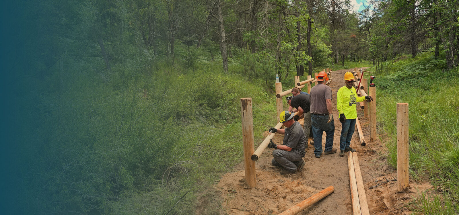

Protect Adventure Forever
Land access depends on good stewardship, whether you recreate on private or public land. We give back to organizations that are cleaning up trails, developing wildlife habitats, and creating more access through our Adventure Forever Grants. We support our staff engaging with their communities through dedicated volunteer hours and we partner with like-minded organizations on campaigns throughout the year. These efforts, coupled with your ongoing commitment, will allow us to enjoy the outdoors for generations to come.
The Latest

Support When You Need It
We’re with you at every step of your adventure. Can’t find something in the App? Want to master how to use all the best features? Need to update your subscription information? Check out our FAQs and help articles, or give our Montana-based Customer Service team a call.
What People Are Saying—onX Reviews
![]()
“What a game changer for deer hunting. I was able to harvest a sika deer out on public land in Maryland after e-scouting in the app. Now we’re planning a trip to hunt mule deer out west and I just finished a successful season out in Ohio for Whitetails.”
Eric O., onX Hunt Elite Customer

![]()
“After getting snowed into a mountaintop campsite with a historic amount of snow, onX Backcountry gave us the confidence we needed to return to the base when we couldn’t see any trails. Without onX Backcountry, we would’ve gotten frostbite!”
Ben, onX Backcountry Premium Customer
![]()
“We had been out riding for about three hours when we ran across a family of four broken-down and lost. We used onX Offroad to assess the situation and recommend a trail fix to get them out. It wouldn’t have been at all possible without y’alls amazing app.“
Steven, onX Offroad Premium Customer

![]()
The DNR Fisheries data on onX Fish is a valuable tool to both find and quickly identify some great fishing opportunities. We use this data for all species to make data-driven decisions that put us on the fish.”
James L., onX Fish Customer