
onX for Business: Field Mapping for Professionals
Empower your team to plan, operate, and succeed where it matters most. With offline mapping, terrain intelligence, and seamless invoicing, onX simplifies field operations for every kind of professional crew.
*Priced per user
Empower your team to plan, operate, and succeed where it matters most. With offline mapping, terrain intelligence, and seamless invoicing, onX simplifies field operations for every kind of professional crew.
*Priced per user
Why Organizations Choose onX for Business

Familiar Apps, Scaled for Teams
Staff and volunteers already know onX → faster adoption.

Team Wide Consistency
Keep everyone aligned with the same data and layers.
Collaborate Without Friction
When every user is on the same platform, coordination becomes effortless.

One Simple Invoice, Single Renewal Date
No scattered payments or surprise renewals.

Business-Use Approved
Every license includes rights for business and professional use.
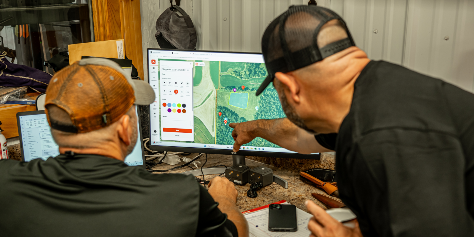
Built for Professionals in the Field

Emergency Response
- Real-time situational awareness with 100+ layers + offline maps.
- Route to even the most remote areas with turn by turn navigation.
- Faster coordination between crews, incident commanders, and agencies.
- Tactical mapping with advanced terrain analysis and land ownership data
- Map sharing & coordination across agencies.
- Faster response times = more lives saved.

Conservation
- Easement monitoring, habitat mapping, land stewardship tools.
- Affordable, scalable access for staff and volunteers.
- Visitor management, staff operations, and trail/asset monitoring.
- Unified mapping for planning and maintenance.
- Data layers for project siting and compliance.
- Site planning, environmental monitoring, and landowner coordination.

Agriculture
- Visualize land boundaries, grazing areas, & irrigation.
- Manage operations efficiently across large tracts.
- Offline maps for remote operations.
- Boundary management, harvest planning, conservation overlays.
- Harvest planning & yield measurement.
- Keep cost predictable and ROI clear.
Trusted by Thousands of Field Professionals
“The folder feature has been a game changer for crew operations.”
Sam, Wildland Hotshot
“This has made a huge impact on my readiness and response.”
Micheal, Colorado Parks & Wildlife
“Very intuitive and easy to use! Map layers extremely useful”
USDA, Minnesota
From Sign-Up to Team Access in Minutes
Step 1
Choose how many team members need access
Step 2
Assign licenses to each member
Step 3
Your whole crew starts mapping
Save Time, Save Money, Stay Aligned
1 admin → 20+ licenses managed in minutes
50% faster adoption with familiar apps
Trusted by 1,000s of professionals