Off-Road Trails in Idaho
Discover off-road trails in Idaho
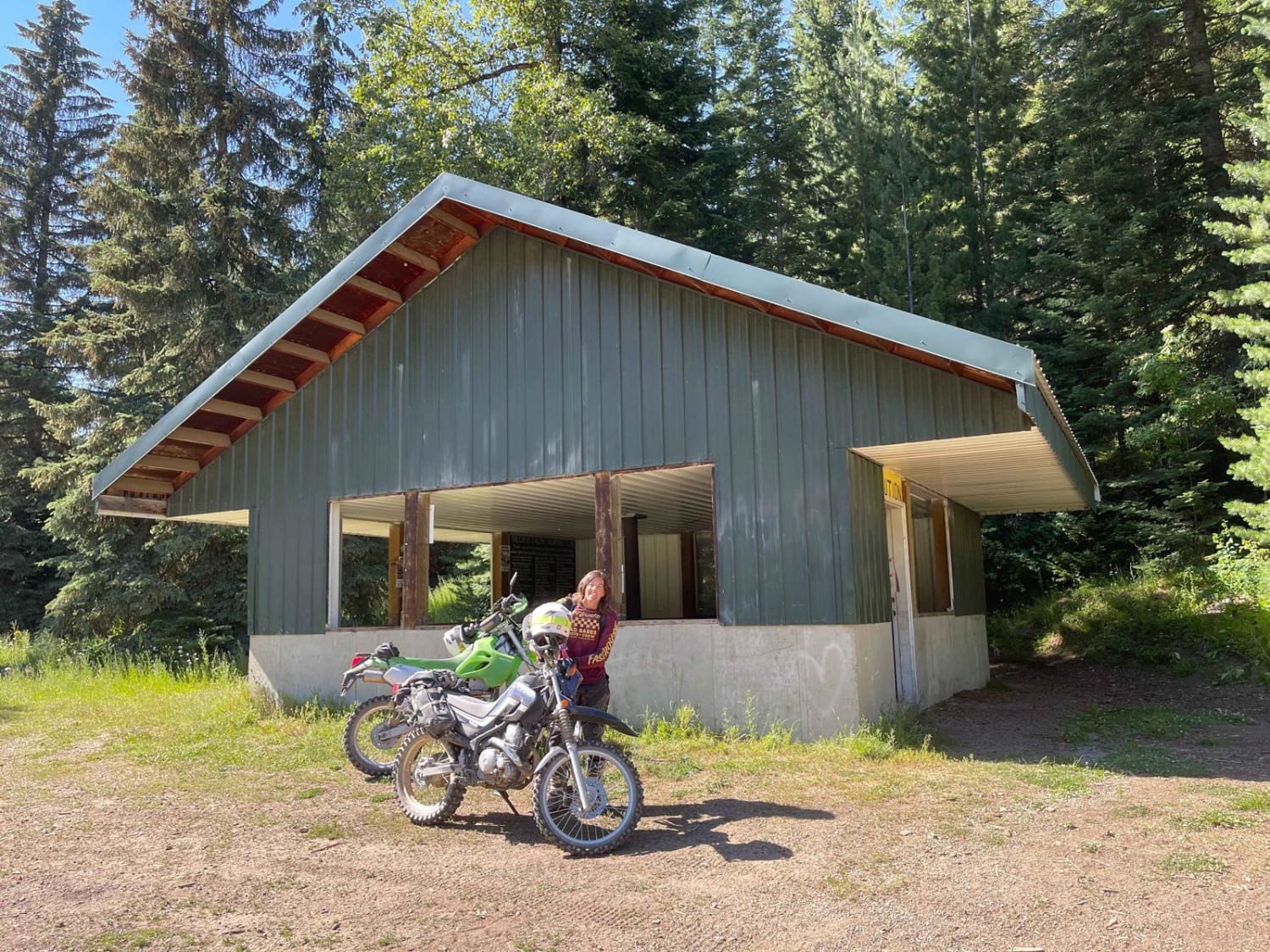
Learn more about Horse Haven Airfield
Horse Haven Airfield
Total Miles
4.8
Tech Rating
Easy
Best Time
Spring, Summer, Fall, Winter
Learn more about Horse Heaven Pass - NF 117/118
Horse Heaven Pass - NF 117/118
Total Miles
8.0
Tech Rating
Easy
Best Time
Spring, Summer, Fall
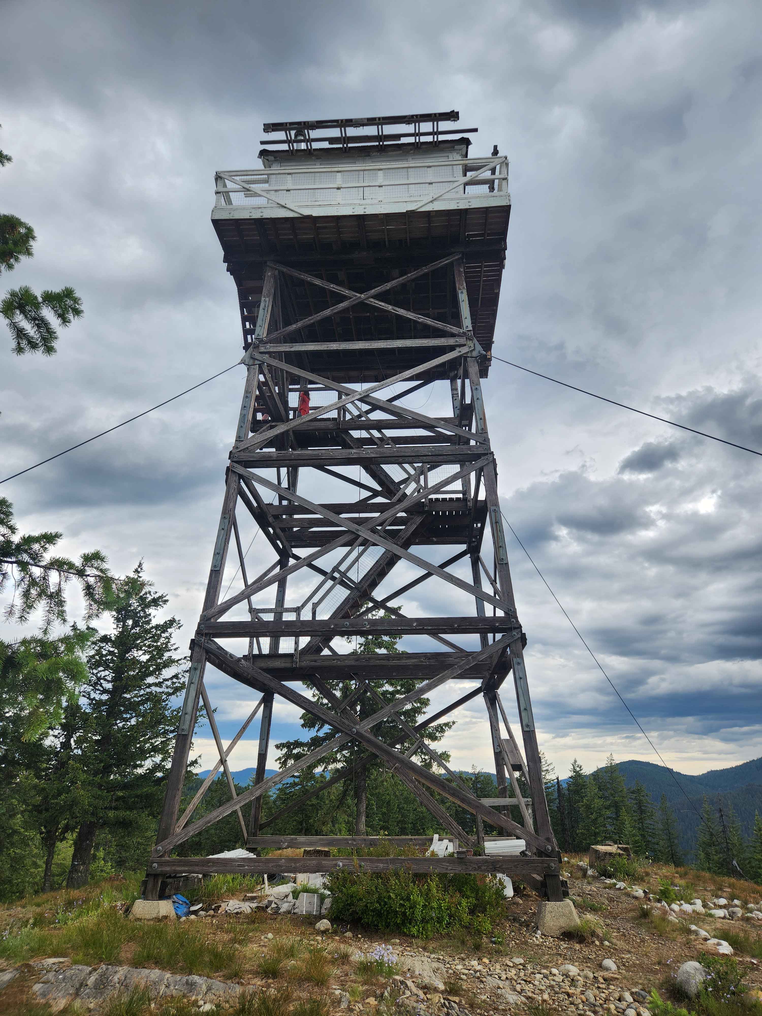
Learn more about Horse Mountain Fire Lookout
Horse Mountain Fire Lookout
Total Miles
5.9
Tech Rating
Easy
Best Time
Spring, Summer, Fall
Learn more about Horse Ridge Clop Clop
Horse Ridge Clop Clop
Total Miles
5.8
Tech Rating
Easy
Best Time
Fall, Summer, Spring
Learn more about Horse Ridge Trail
Horse Ridge Trail
Total Miles
7.4
Tech Rating
Easy
Best Time
Summer, Fall
Learn more about Horseshoe to Harrington #5212
Horseshoe to Harrington #5212
Total Miles
1.2
Tech Rating
Moderate
Best Time
Summer, Fall
Learn more about Hot Shot
Hot Shot
Total Miles
2.9
Tech Rating
Moderate
Best Time
Winter, Fall, Summer, Spring
Learn more about Hoteling Creek C - FS 73680
Hoteling Creek C - FS 73680
Total Miles
1.0
Tech Rating
Easy
Best Time
Summer, Fall

Learn more about Howard's Trail 
Howard's Trail
Total Miles
3.6
Tech Rating
Moderate
Best Time
Fall, Summer, Spring
Learn more about Howe Peak Ridge
Howe Peak Ridge
Total Miles
7.1
Tech Rating
Moderate
Best Time
Fall, Summer, Spring
Learn more about Hughes Creek 
Hughes Creek
Total Miles
3.7
Tech Rating
Moderate
Best Time
Spring, Summer, Fall
Learn more about Idaho Centennial to Clover Three
Idaho Centennial to Clover Three
Total Miles
8.0
Tech Rating
Easy
Best Time
Summer, Spring, Fall
Learn more about Idaho Centennial to Echo Trail
Idaho Centennial to Echo Trail
Total Miles
4.0
Tech Rating
Easy
Best Time
Spring, Summer, Fall
Learn more about Idaho Centennial Trail
Idaho Centennial Trail
Total Miles
8.9
Tech Rating
Easy
Best Time
Summer, Spring, Fall
Learn more about Idaho Centennial Trail 7
Idaho Centennial Trail 7
Total Miles
4.5
Tech Rating
Easy
Best Time
Summer, Spring, Fall
Learn more about Idaho City to Horseshoe Bend Road
Idaho City to Horseshoe Bend Road
Total Miles
29.5
Tech Rating
Easy
Best Time
Spring, Summer, Fall
ATV trails in Idaho
Learn more about Aspen Range - Middle Sulphur #5248 
Aspen Range - Middle Sulphur #5248
Total Miles
1.9
Tech Rating
Easy
Best Time
Summer, Fall
Learn more about Dry Fork - Meadow Springs #5226 
Dry Fork - Meadow Springs #5226
Total Miles
0.4
Tech Rating
Easy
Best Time
Summer, Fall
Learn more about South Foothill Road
South Foothill Road
Total Miles
8.2
Tech Rating
Moderate
Best Time
Summer, Fall

UTV/side-by-side trails in Idaho
Learn more about South Foothill Road
South Foothill Road
Total Miles
8.2
Tech Rating
Moderate
Best Time
Summer, Fall

Learn more about 21 To Nip & Tuck
21 To Nip & Tuck
Total Miles
1.4
Tech Rating
Easy
Best Time
Fall, Summer, Spring

The onX Offroad Difference
onX Offroad combines trail photos, descriptions, difficulty ratings, width restrictions, seasonality, and more in a user-friendly interface. Available on all devices, with offline access and full compatibility with CarPlay and Android Auto. Discover what you’re missing today!