Off-Road Trails in Utah
Discover off-road trails in Utah
Learn more about Roller Coaster
Roller Coaster
Total Miles
1.1
Tech Rating
Extreme
Best Time
Spring, Summer, Fall, Winter
Learn more about Roost Road - BLM0123
Roost Road - BLM0123
Total Miles
20.9
Tech Rating
Easy
Best Time
Spring, Summer, Fall, Winter
Learn more about Rose Canyon
Rose Canyon
Total Miles
7.5
Tech Rating
Easy
Best Time
Spring, Summer, Fall, Winter
Learn more about Rose Garden Hill
Rose Garden Hill
Total Miles
14.7
Tech Rating
Difficult
Best Time
Spring, Summer, Fall
Learn more about Rose Meadows- FS 40058
Rose Meadows- FS 40058
Total Miles
4.7
Tech Rating
Easy
Best Time
Spring, Summer, Fall
Learn more about Round The Bend
Round The Bend
Total Miles
0.8
Tech Rating
Easy
Best Time
Spring, Summer, Fall, Winter
Learn more about Roundup Cuddy Back-NFS30566
Roundup Cuddy Back-NFS30566
Total Miles
4.6
Tech Rating
Easy
Best Time
Summer, Spring, Fall
Learn more about Route 6764
Route 6764
Total Miles
2.3
Tech Rating
Easy
Best Time
Spring, Summer, Fall, Winter
Learn more about Row of Pines
Row of Pines
Total Miles
6.5
Tech Rating
Moderate
Best Time
Fall, Summer, Spring
Learn more about Roy's Elk Bugling Trail
Roy's Elk Bugling Trail
Total Miles
17.8
Tech Rating
Moderate
Best Time
Spring, Fall, Summer
Learn more about Ruby Fenceline 
Ruby Fenceline
Total Miles
1.3
Tech Rating
Moderate
Best Time
Spring, Winter, Fall
Learn more about Ruby Ranch Road
Ruby Ranch Road
Total Miles
11.7
Tech Rating
Easy
Best Time
Spring, Winter, Fall
Learn more about Ruin Park Road
Ruin Park Road
Total Miles
6.2
Tech Rating
Easy
Best Time
Spring, Summer, Fall
Learn more about Running Water Spring Road
Running Water Spring Road
Total Miles
2.4
Tech Rating
Easy
Best Time
Summer, Fall
Learn more about Rush Valley Overlook Loop
Rush Valley Overlook Loop
Total Miles
1.9
Tech Rating
Easy
Best Time
Spring, Summer, Fall
Learn more about Rusty Drum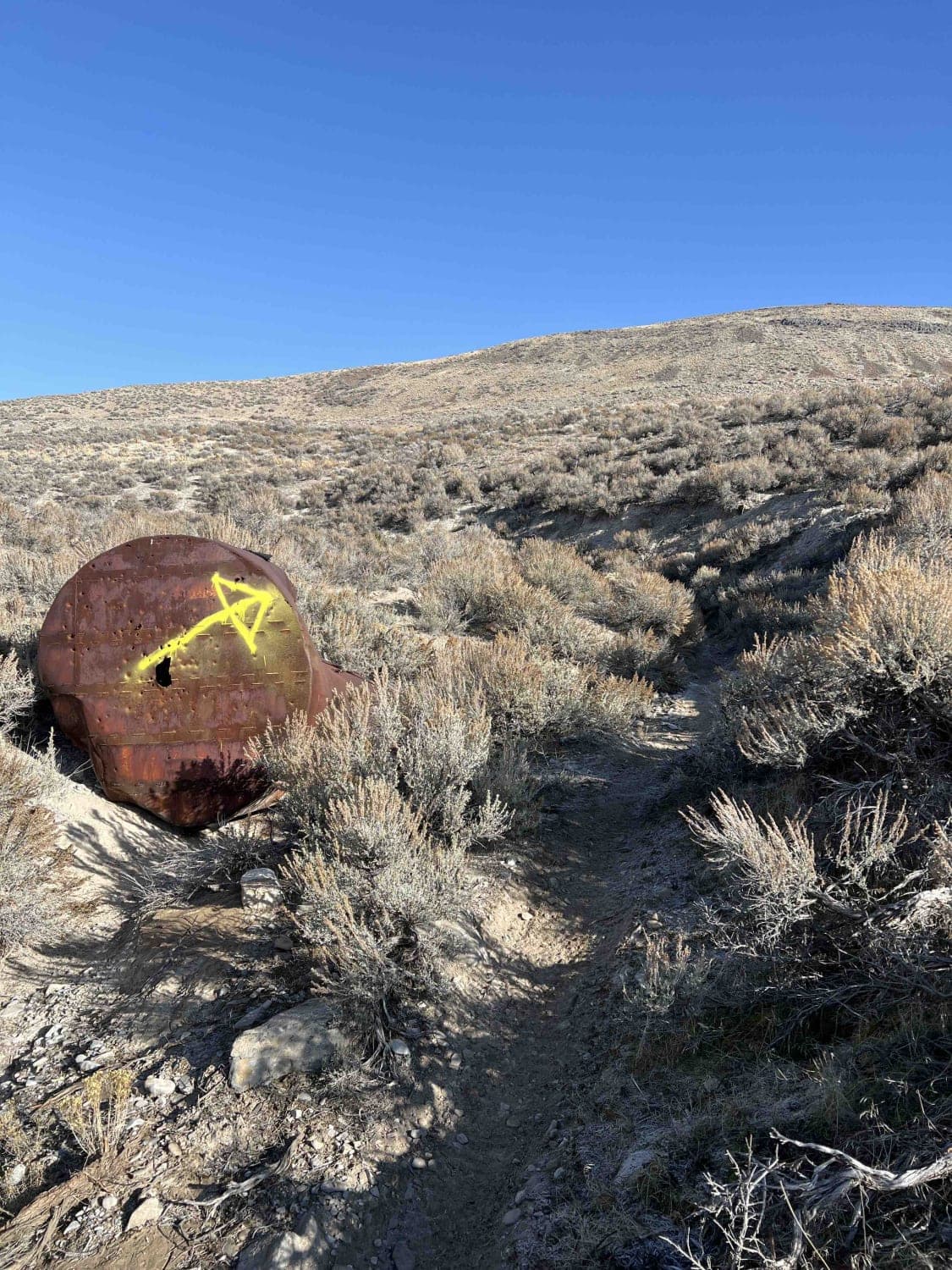
Rusty Drum
Total Miles
3.4
Tech Rating
Moderate
Best Time
Winter, Fall, Summer, Spring
Learn more about Rusty Nail
Rusty Nail
Total Miles
1.9
Tech Rating
Difficult
Best Time
Spring, Summer, Fall, Winter
Learn more about Rydalch pass
Rydalch pass
Total Miles
5.3
Tech Rating
Easy
Best Time
Spring, Summer, Fall, Winter
ATV trails in Utah

Learn more about 14 Mile Road
14 Mile Road
Total Miles
14.7
Tech Rating
Easy
Best Time
Spring, Summer, Fall, Winter


UTV/side-by-side trails in Utah
Learn more about 14 Mile Road
14 Mile Road
Total Miles
14.7
Tech Rating
Easy
Best Time
Spring, Summer, Fall, Winter
The onX Offroad Difference
onX Offroad combines trail photos, descriptions, difficulty ratings, width restrictions, seasonality, and more in a user-friendly interface. Available on all devices, with offline access and full compatibility with CarPlay and Android Auto. Discover what you’re missing today!