Off-Road Trails in Utah
Discover off-road trails in Utah
Learn more about Shay Ridge OHV Trail N0. 162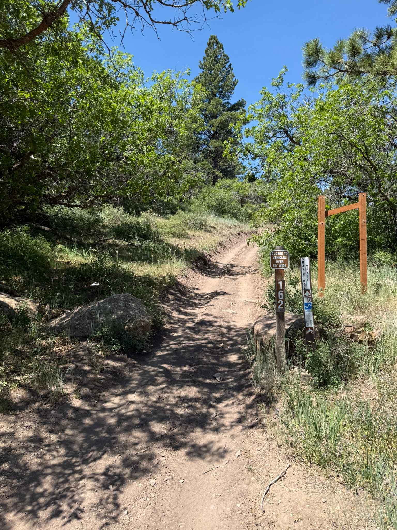
Shay Ridge OHV Trail N0. 162
Total Miles
5.1
Tech Rating
Easy
Best Time
Summer, Fall
Learn more about Sheep Bridge Road
Sheep Bridge Road
Total Miles
4.8
Tech Rating
Easy
Best Time
Winter, Fall, Spring
Learn more about Sheep Creek - FS 70051
Sheep Creek - FS 70051
Total Miles
5.4
Tech Rating
Easy
Best Time
Summer, Fall, Spring
Learn more about Sheep Creek Connector ATV Trail 
Sheep Creek Connector ATV Trail
Total Miles
6.0
Tech Rating
Easy
Best Time
Fall, Summer, Spring
Learn more about Sheep Creek Road
Sheep Creek Road
Total Miles
1.6
Tech Rating
Easy
Best Time
Spring, Summer, Fall
Learn more about Sheep Valley Road
Sheep Valley Road
Total Miles
11.5
Tech Rating
Easy
Best Time
Spring, Summer, Fall
Learn more about Sheep Valley-Tommy Hollow Trail
Sheep Valley-Tommy Hollow Trail
Total Miles
6.1
Tech Rating
Easy
Best Time
Spring, Summer, Fall
Learn more about Sheepherder Hill - FS 8099
Sheepherder Hill - FS 8099
Total Miles
4.8
Tech Rating
Difficult
Best Time
Summer, Fall
Learn more about Sheepherder's Park (FS# 41080)
Sheepherder's Park (FS# 41080)
Total Miles
0.4
Tech Rating
Easy
Best Time
Summer, Fall
Learn more about Shepherd Road
Shepherd Road
Total Miles
8.7
Tech Rating
Easy
Best Time
Spring, Summer, Fall, Winter
Learn more about Shoemaker Flat
Shoemaker Flat
Total Miles
2.5
Tech Rating
Easy
Best Time
Spring, Summer, Fall
Learn more about Shootaring Road
Shootaring Road
Total Miles
13.1
Tech Rating
Easy
Best Time
Spring, Summer, Fall, Winter
Learn more about Short Canyon Road
Short Canyon Road
Total Miles
15.3
Tech Rating
Easy
Best Time
Spring, Summer, Fall, Winter
Learn more about Shotgun Alley
Shotgun Alley
Total Miles
0.4
Tech Rating
Easy
Best Time
Winter, Fall, Summer, Spring
Learn more about Shram Creek - FS 8124
Shram Creek - FS 8124
Total Miles
2.3
Tech Rating
Easy
Best Time
Summer, Fall
Learn more about Shunesburg Maildrop-Warrior Walk Loop
Shunesburg Maildrop-Warrior Walk Loop
Total Miles
23.1
Tech Rating
Moderate
Best Time
Spring, Summer, Fall
Learn more about Side Canyon Road
Side Canyon Road
Total Miles
3.2
Tech Rating
Moderate
Best Time
Spring, Summer, Fall, Winter
Learn more about Side Track to Red Rock - Single Track
Side Track to Red Rock - Single Track
Total Miles
2.2
Tech Rating
Moderate
Best Time
Spring, Summer, Fall, Winter
ATV trails in Utah

Learn more about 14 Mile Road
14 Mile Road
Total Miles
14.7
Tech Rating
Easy
Best Time
Spring, Summer, Fall, Winter


UTV/side-by-side trails in Utah
Learn more about 14 Mile Road
14 Mile Road
Total Miles
14.7
Tech Rating
Easy
Best Time
Spring, Summer, Fall, Winter
The onX Offroad Difference
onX Offroad combines trail photos, descriptions, difficulty ratings, width restrictions, seasonality, and more in a user-friendly interface. Available on all devices, with offline access and full compatibility with CarPlay and Android Auto. Discover what you’re missing today!