Off-Road Trails in Nevada
Discover off-road trails in Nevada
Learn more about Lunchtime Rip
Lunchtime Rip
Total Miles
3.9
Tech Rating
Easy
Best Time
Winter, Fall, Summer, Spring
Learn more about LV0001301P Loop
LV0001301P Loop
Total Miles
5.0
Tech Rating
Moderate
Best Time
Spring, Fall, Winter
Learn more about Mackie Reservoir Road
Mackie Reservoir Road
Total Miles
11.3
Tech Rating
Easy
Best Time
Spring, Summer, Fall
Learn more about Magnesite Mine Trail
Magnesite Mine Trail
Total Miles
4.8
Tech Rating
Easy
Best Time
Summer, Fall, Winter
Learn more about Mailbox Canyon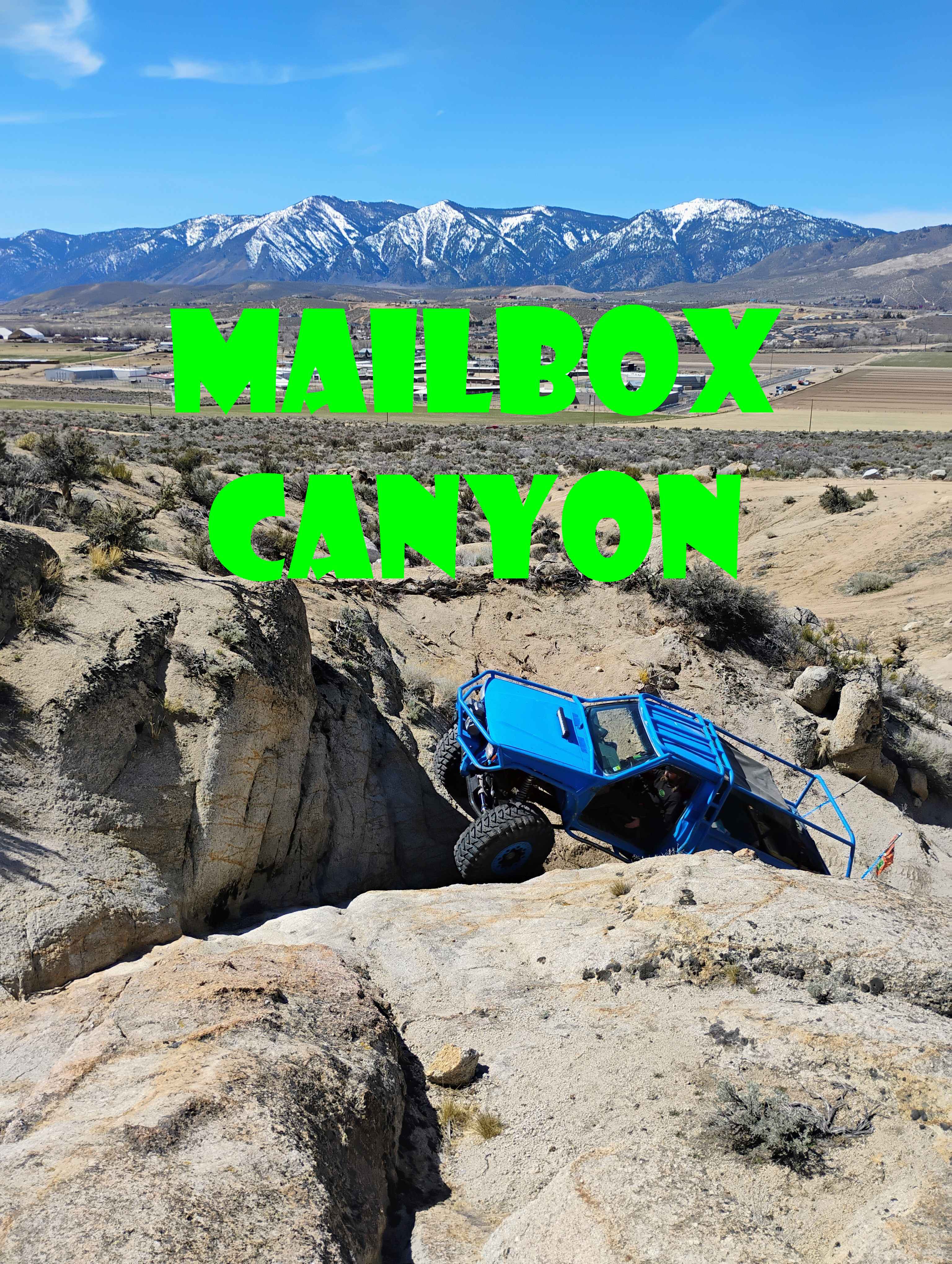
Mailbox Canyon
Total Miles
0.2
Tech Rating
Difficult
Best Time
Fall, Spring, Winter
Learn more about Matterhorn Trail
Matterhorn Trail
Total Miles
1.4
Tech Rating
Difficult
Best Time
Spring, Summer, Fall, Winter
Learn more about McAfee Rd.
McAfee Rd.
Total Miles
53.0
Tech Rating
Moderate
Best Time
Spring, Summer, Fall
Learn more about McAfee Rd.
McAfee Rd.
Total Miles
52.9
Tech Rating
Moderate
Best Time
Spring, Summer, Fall
Learn more about McCullough Pass
McCullough Pass
Total Miles
19.8
Tech Rating
Moderate
Best Time
Winter, Fall, Spring
Learn more about Mcmaughn Canyon Trail
Mcmaughn Canyon Trail
Total Miles
6.7
Tech Rating
Moderate
Best Time
Spring, Summer, Fall
Learn more about Mead Davis Power Road
Mead Davis Power Road
Total Miles
38.7
Tech Rating
Easy
Best Time
Spring, Summer, Fall, Winter
Learn more about Mead Davis Powerline Road
Mead Davis Powerline Road
Total Miles
13.8
Tech Rating
Easy
Best Time
Spring, Fall, Winter
Learn more about Mesa Straightaway
Mesa Straightaway
Total Miles
2.9
Tech Rating
Easy
Best Time
Spring, Summer, Fall, Winter
Learn more about Mesquite American Flag Overlook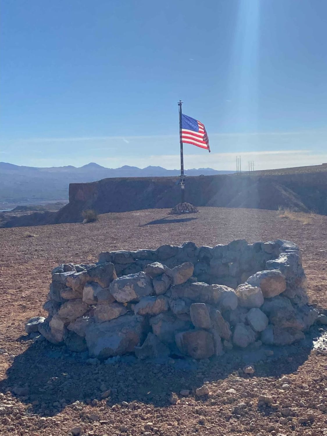
Mesquite American Flag Overlook
Total Miles
0.5
Tech Rating
Easy
Best Time
Fall, Winter, Spring, Summer
Learn more about Microwave Road FS 42192
Microwave Road FS 42192
Total Miles
17.1
Tech Rating
Easy
Best Time
Spring, Summer, Fall
Learn more about Mid Basin Cove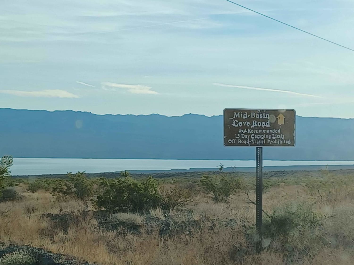
Mid Basin Cove
Total Miles
3.6
Tech Rating
Easy
Best Time
Spring, Summer, Fall, Winter
Learn more about Middle Carp Elgin
Middle Carp Elgin
Total Miles
4.1
Tech Rating
Easy
Best Time
Spring, Fall, Winter
Learn more about Middle Elk Meadow Connector Trail
Middle Elk Meadow Connector Trail
Total Miles
1.0
Tech Rating
Easy
Best Time
Winter
ATV trails in Nevada
Learn more about "Just Found It" Trail
"Just Found It" Trail
Total Miles
3.4
Tech Rating
Easy
Best Time
Spring, Summer, Fall, Winter
Learn more about 13-Mile Loop
13-Mile Loop
Total Miles
17.4
Tech Rating
Easy
Best Time
Spring, Summer, Fall, Winter
Learn more about 1947 Bunker Trail
1947 Bunker Trail
Total Miles
6.5
Tech Rating
Easy
Best Time
Summer, Fall
Learn more about 265 Camping Crossover
265 Camping Crossover
Total Miles
2.3
Tech Rating
Easy
Best Time
Fall, Spring, Winter
UTV/side-by-side trails in Nevada
Learn more about "Just Found It" Trail
"Just Found It" Trail
Total Miles
3.4
Tech Rating
Easy
Best Time
Spring, Summer, Fall, Winter
Learn more about 13-Mile Loop
13-Mile Loop
Total Miles
17.4
Tech Rating
Easy
Best Time
Spring, Summer, Fall, Winter
Learn more about 1947 Bunker Trail
1947 Bunker Trail
Total Miles
6.5
Tech Rating
Easy
Best Time
Summer, Fall
Learn more about 265 Camping Crossover
265 Camping Crossover
Total Miles
2.3
Tech Rating
Easy
Best Time
Fall, Spring, Winter
The onX Offroad Difference
onX Offroad combines trail photos, descriptions, difficulty ratings, width restrictions, seasonality, and more in a user-friendly interface. Available on all devices, with offline access and full compatibility with CarPlay and Android Auto. Discover what you’re missing today!