
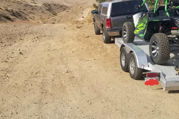
Off-Road Trails in Nevada
Discover off-road trails in Nevada
Off-Road Trails in Nevada
Discover the best off-road trails in Nevada. Browse trail maps, check difficulty ratings, and find your next adventure — whether you're looking for a quick ride or an all-day expedition.
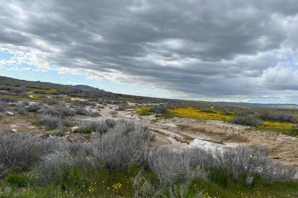
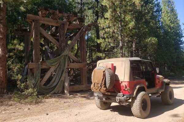
Elkhorn Road
The majority of the road is smooth and graded. However, there are sections that can have sticky mud, washed out from seasonal creeks that have a potential for high clearance. Carrizo Plain can get very hot in the summer and very cold in the winter. The best time to go in the spring to check out the ...
Learn more about Elkhorn Road
Harry Wade Exit Route - DVNP
A historical route at the southern end of Death Valley National Park. The route is 32 miles in length through one of the most remote and arid parts of Death Valley - be prepared. The HWER is a bit of a chameleon in that it can range from easily passable by a passenger car to completely impassable by...
Learn more about Harry Wade Exit Route - DVNP
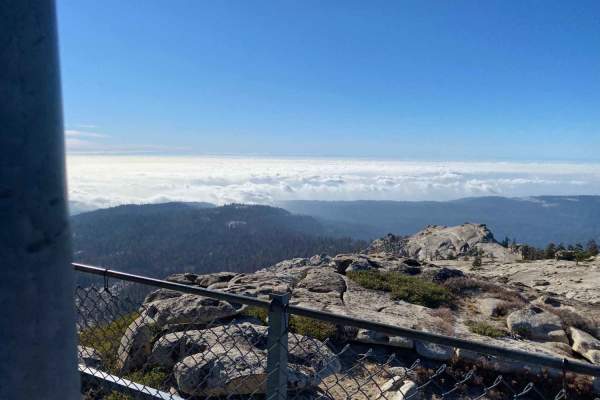
Shuteye Peak
4WD section starts at 8.1 miles from the Start of Central Camp Road. There are some off-camber areas and a little "crawling". Water crossings, steep switchbacks, moderate rock obstacles, and amazing views at the Shuteye Peak fire watchtower. In the Bass Lake Ranger District of the Sierra National Fo...
Learn more about Shuteye Peak
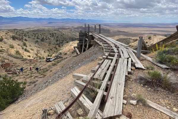
South Relief Canyon
This canyon is comprised of old mining roads that have seen decades of erosion. You start down at Packard Flat. This area has flour-fine dirt that will cover everything in dust. Proceeding to the top of the hill is Red Bird Mine. The road is cut narrow into the side mountain and has been eroded over...
Learn more about South Relief Canyon
Soda Creek Logging Camp
From the Highway 4 side, this all-day adventure is on ungraded logging roads. They still log here on these roads, so please drive slowly and be aware of logging trucks possibly coming at you. You will drive on pavement and then it turns to deep dust that is rocky in some spots but nothing too hard. ...
Learn more about Soda Creek Logging Camp
Wallace Canyon Road
Located on the west side of the Spring Mountains and east of Pahrump NV, this trail starts on BLM land. Eventually, it crosses into the Spring Mountains National Recreation Area on the Toiyabe National Forest. The trail gradually climbs through several Mojave Desert life zones, including Joshua Tree...
Learn more about Wallace Canyon Road
Hughes Cabin-Horse Springs Road
Wide and well-maintained gravel road crosses BLM land, steadily climbing from valley floor at approximately 2,900ft to an elevation of 4,500ft. A locked gate with a "no trespassing" sign marks the end of the line for this trail. Desert flora include Yucca and Joshua Tree. Good views of Pahrump Valle...
Learn more about Hughes Cabin-Horse Springs Road
Mazourka Canyon
Starts off easy from Independence to Badger Flat. After which it turns into a very rocky adventure with many angled ledges and some narrow sections. Do not attempt to continue past Badger Flat without high clearance and 4WD. The views throughout are incredible, you can see across the valley and into...
Learn more about Mazourka Canyon
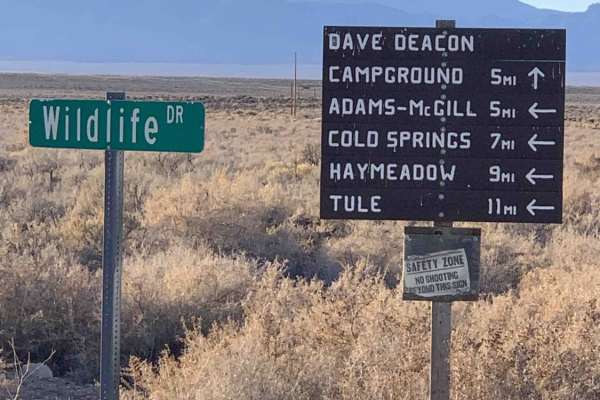
Dave Deacon Camp Dr. and Hot Creek
A nice graded main route into the area. This trail ends at the warm springs recreation area inside the Kirch Wildlife Management Area. It passes a nice established campground with large sites complete with shade structures, fire rings, and picnic tables. The campground has pit toilets and an RV dump...
Learn more about Dave Deacon Camp Dr. and Hot Creek
Goler Canyon Road
Goler Canyon Road climbs up through Goler Wash from Wingate Road in Panamint Valley to Mengel Pass in the Panamint Range. It is a nine-mile rock road that is straightforward and easy until mile six near the Barker Ranch site and then gets gradually harder as it approaches the pass. In late April 202...
Learn more about Goler Canyon Road
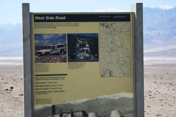
West Side Road - DVNP
Easy route around the west side of the dry lake bed in Death Valley. This route offers a different, and remote, perspective of the Devil's Golf Course and Badwater Basin. The route starts about 11 miles north of Badwater Basin and continues for 40 miles ending near Ashford Mill Ruins. Eagle Borax ...
Learn more about West Side Road - DVNP
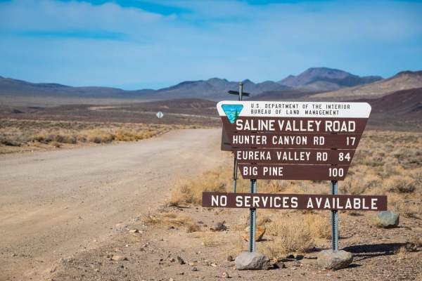
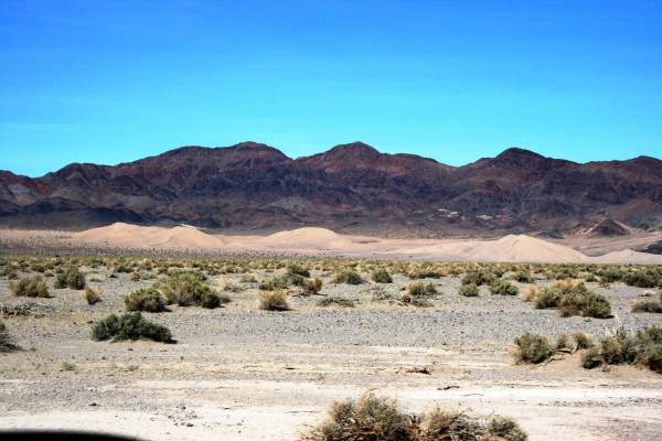
Saline Valley Road
Death Valley is famous for its barren valleys and soaring vistas, but few people wander into its more remote regions like Saline Valley. The road into this area is dirt and often heavily corrugated and strewn with rocks or sand. Most vehicles with AWD or 4WD can tackle the trail, but good tires, a s...
Learn more about Saline Valley Road
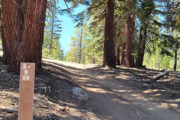
Logan House Loop 14n33
This trail has beautiful scenery that includes tree-filtered views of Lake Tahoe, Aspen groves, grassy meadows, a couple of small year-round streams, and the classic Sierra Nevada Mountain Forest. It is recommended for 4WD or AWD vehicles with higher clearance. Both ends of the trail offer paved sta...
Learn more about Logan House Loop 14n33
Spaulding Canyon Trail
This is a super easy trail, with tons of offroading to explore. When we did the trail the snow melt was in full swing tons of water flowing in creeks everywhere. There are tons of offroading to explore from this main trail. Lots of camping spots and just places to stop and explore as well.
Learn more about Spaulding Canyon Trail
Mead Davis Powerline Road
The first half of the trail is hard pack dirt with rutted areas and uneven grades, single-car wide. The second half of the trail is washes with two-car wide areas most of the way and single-car wide as you get closer to the lake. Large boulders are in the wash so if you are in the dust drive careful...
Learn more about Mead Davis Powerline Road

Gold Butte Loop
A long trip, 54 miles, starts and ends at Whitney Pockets. The trail is pretty much half washes, half gravel. I did this trip in my Highlander but loads more fun in my Jeep or RZR. Whitney Pockets is 25 miles from Gold Butte trailhead. If using RZR, take fuel, or you can stage the trailer at Whitney...
Learn more about Gold Butte Loop
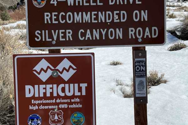
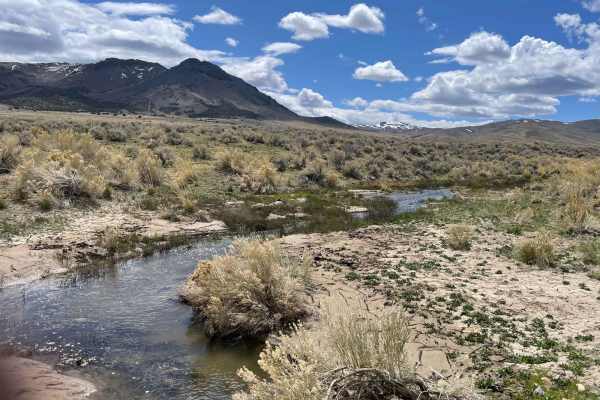
Big Pine to Silver Canyon
Hard Pack dirt with small water crossings and mud holes the trail runs close to the Owens River so there is plenty of fishing, a small freshwater pond for summer swimming, plenty of off-grid camping spots, and a lot of side spurs. A lifted stock 2-wheel drive should have no problem crossing this tra...
Learn more about Big Pine to Silver Canyon
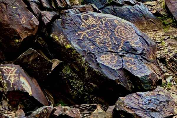
Cohenour Loop
This 17.5-mile loop trail takes you through a petroglyph wash and passes the Old Cohenour Mine. Don't miss the petroglyphs at 3 miles into the trail (right before the loop). This trail is passable by stock 4WD vehicles. Enjoy the scenic canyon views or take a weekend and camp in one of the several b...
Learn more about Cohenour Loop

Moapa to Caliente Via Barclay
All of the maintained dirt roads can be done in a stock truck or SUV, with the exception of the short loop we took off of Sams Camp Road. That is narrow and would require a modified high clearance jeep or SUV. Graded roads through the desert ascending into trees and beautiful scenery. Many camping s...
Learn more about Moapa to Caliente Via Barclay
Peavine Prospector Run
Spectacular views of Reno abound from high above on this trail that traverses historic Peavine Mountain. In stark contrast to the urban hustle and bustle of Reno, Peavine showcases the desolate beauty of the harsh high desert that defines much of Nevada. Standing as the City of Reno's northwest boun...
Learn more about Peavine Prospector Run
ATV trails in Nevada
Explore ATV-friendly trails in Nevada. These trails are accessible for vehicles up to 50 inches wide, perfect for ATVs and smaller off-road machines.
South Relief Canyon
This canyon is comprised of old mining roads that have seen decades of erosion. You start down at Packard Flat. This area has flour-fine dirt that will cover everything in dust. Proceeding to the top of the hill is Red Bird Mine. The road is cut narrow into the side mountain and has been eroded over...
Learn more about South Relief Canyon
Wallace Canyon Road
Located on the west side of the Spring Mountains and east of Pahrump NV, this trail starts on BLM land. Eventually, it crosses into the Spring Mountains National Recreation Area on the Toiyabe National Forest. The trail gradually climbs through several Mojave Desert life zones, including Joshua Tree...
Learn more about Wallace Canyon Road
Hughes Cabin-Horse Springs Road
Wide and well-maintained gravel road crosses BLM land, steadily climbing from valley floor at approximately 2,900ft to an elevation of 4,500ft. A locked gate with a "no trespassing" sign marks the end of the line for this trail. Desert flora include Yucca and Joshua Tree. Good views of Pahrump Valle...
Learn more about Hughes Cabin-Horse Springs Road
Dave Deacon Camp Dr. and Hot Creek
A nice graded main route into the area. This trail ends at the warm springs recreation area inside the Kirch Wildlife Management Area. It passes a nice established campground with large sites complete with shade structures, fire rings, and picnic tables. The campground has pit toilets and an RV dump...
Learn more about Dave Deacon Camp Dr. and Hot Creek
UTV/side-by-side trails in Nevada
Find UTV and side-by-side trails in Nevada. These trails accommodate vehicles up to 60 inches wide, ideal for UTVs, side-by-sides, and wider off-road rigs.
South Relief Canyon
This canyon is comprised of old mining roads that have seen decades of erosion. You start down at Packard Flat. This area has flour-fine dirt that will cover everything in dust. Proceeding to the top of the hill is Red Bird Mine. The road is cut narrow into the side mountain and has been eroded over...
Learn more about South Relief Canyon
Wallace Canyon Road
Located on the west side of the Spring Mountains and east of Pahrump NV, this trail starts on BLM land. Eventually, it crosses into the Spring Mountains National Recreation Area on the Toiyabe National Forest. The trail gradually climbs through several Mojave Desert life zones, including Joshua Tree...
Learn more about Wallace Canyon Road
Hughes Cabin-Horse Springs Road
Wide and well-maintained gravel road crosses BLM land, steadily climbing from valley floor at approximately 2,900ft to an elevation of 4,500ft. A locked gate with a "no trespassing" sign marks the end of the line for this trail. Desert flora include Yucca and Joshua Tree. Good views of Pahrump Valle...
Learn more about Hughes Cabin-Horse Springs Road
Dave Deacon Camp Dr. and Hot Creek
A nice graded main route into the area. This trail ends at the warm springs recreation area inside the Kirch Wildlife Management Area. It passes a nice established campground with large sites complete with shade structures, fire rings, and picnic tables. The campground has pit toilets and an RV dump...
Learn more about Dave Deacon Camp Dr. and Hot Creek
The onX Offroad Difference
onX Offroad combines trail photos, descriptions, difficulty ratings, width restrictions, seasonality, and more in a user-friendly interface. Available on all devices, with offline access and full compatibility with CarPlay and Android Auto. Discover what you're missing today!
Open Trail Map