
Off-Road Trails in Illinois
Discover off-road trails in Illinois
Off-Road Trails in Illinois
Discover the best off-road trails in Illinois. Browse trail maps, check difficulty ratings, and find your next adventure — whether you're looking for a quick ride or an all-day expedition.
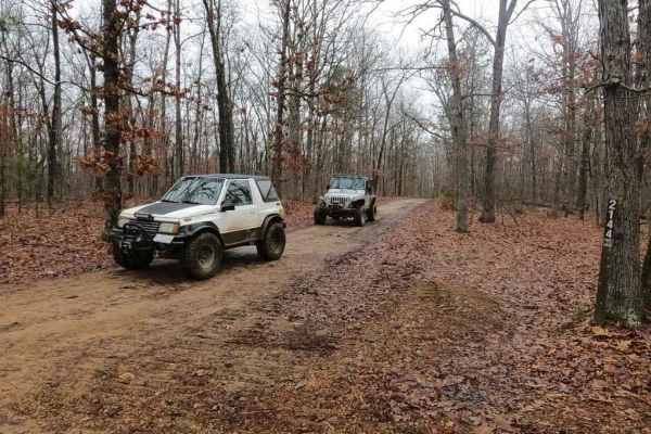
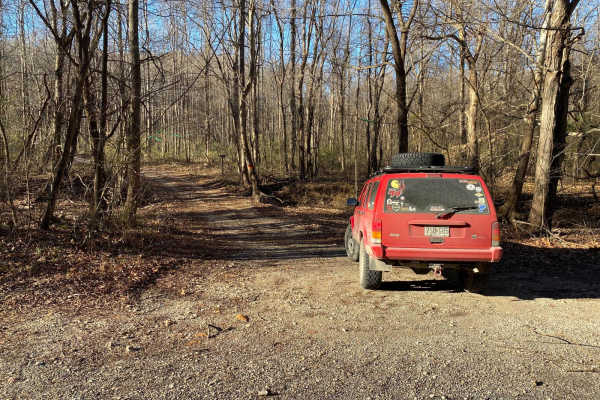
Central Pond FSR 2144
The Central Pond FSR 2144 is a mild-weight gravel forestry road that leads through the St Francis Mountains within Mark Twain National Forest. The road features gravel at its foundation, but in spots, the trail fades to dirt or mud. On the hills and grades, it has a tendency to form ruts and washes,...
Learn more about Central Pond FSR 2144
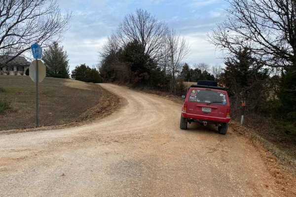
Hamburg SFR 266A
As a branch of Atwood Road 266, the Hamburg 266A is a bit more of an offroading road and less of a scenic road within Shawnee National Forest. It has an off-camber hill within .2 of the entrance followed by many water collection areas that get muddy, the gravel fades in on the hilltops and out in th...
Learn more about Hamburg SFR 266A
Pine Union Hill FSR 2137
The Pine Union Hill FSR 2137 is the first portion of the Pine Union in Mark Twain National Forest before it spilts to the 2137A and the Hilltop portion of the 2137. It begins at the Bo-Co Road 872 in the bottoms of the Grounds Creek, leading you past the Sycamore Valley Artisan Well where the Pine U...
Learn more about Pine Union Hill FSR 2137
Old Baptist Church Bo-Co Road 920
The Old Baptist Church Road (Bollinger County Road 920) is a county gravel road that leads to the old church, finishing with some fun along the way. The road is mostly an easy gravel ride with a few hills and water collection spots. But as it leads into the bottoms past the church, there is a modera...
Learn more about Old Baptist Church Bo-Co Road 920

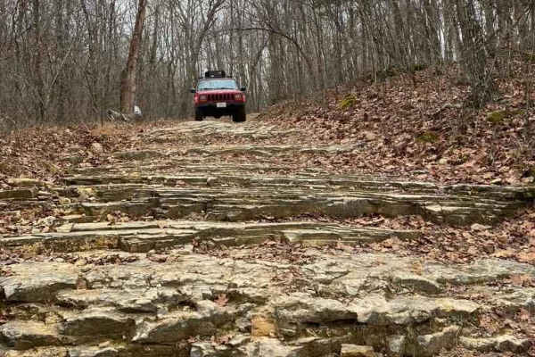
Rock Top SFR 233
The Rock Top SFR 233 is a forestry road on top of Silica Hill within Shawnee National Forest. The Rock Top is just that, natural rock pops out on top of the hill where the trail meets with the Silica Hill Road SFR 645. The trail features steep off-camber grades some being strictly on dirt and some b...
Learn more about Rock Top SFR 233
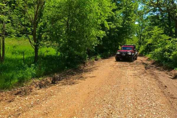
Old Goat SFR 625 & 625A
Old Goat SFR 625 and 625A is a State Forest Road in Shawnee National Forest. The road is short at only 1.1 miles long, but packs a punch, dipping through a creek bottom shortly after climbing a steep grade while circling around the first main hill. The hill features small ruts and gravel fading to d...
Learn more about Old Goat SFR 625 & 625A
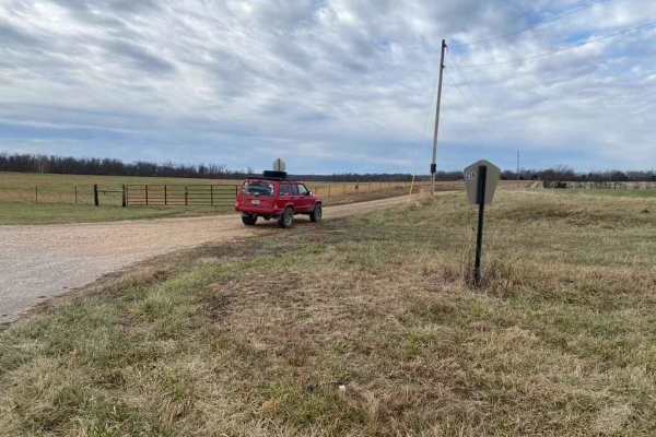
Current River Conservation Area
The Current River Conservation was created by combining Deer Run, Carrs Creek, Cardareva and Paint Rock State Forests combining 28,000 acres. The trail starts as #1 on the map which is provided at the beginning of the trail. Current River Conservation trail leads you down an easy gravel road however...
Learn more about Current River Conservation Area
Wash Creek FSR 2177
Wash Creek FSR 2177 is a mild single-lane forestry road through Mark Twain National Forest. The road is mostly scenic and features trees all around. The road has a few small water collection spots, but the depth is very shallow. The road also has a few spots where natural rock sticks out through the...
Learn more about Wash Creek FSR 2177
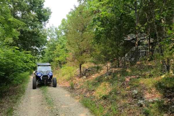
Silica Hill Road SFR 645
The West Silica Hill Road SFR 645 is a 1.3-mile-long forestry road through Shawnee National Forest. As you travel the road, grades come in waves from gradual incline to steep grades. These steep grades include tight turns, medium-sized ruts, bare dirt sections, and some mild water collection spots. ...
Learn more about Silica Hill Road SFR 645
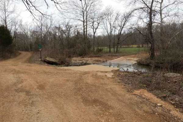
Bo-Co Road 918
The Bollinger County 918 is a gravel county road connecting to other county roads in the area. It has mild rutting, washboarding, and mounding and shows signs of wear near its low-water bridge and hilly sections. This adds excitement to using it as a route to get around. Water collection spots, natu...
Learn more about Bo-Co Road 918

Kathy's Bridge Road
Kathy's Bridge Road, also known as Bollinger County Road 334, is a branch off the Bo-Co Road 342 and continues following the last stretch of James Creek while heading Southwest off the 342 to connect with Missouri Route-M. The road's base is course gravel in true Bollinger county fashion leading thr...
Learn more about Kathy's Bridge Road
McCraven SFR 220
McCraven SFR 220 is a very scenic nature-viewing gravel road in Shawnee National Forest. It is a very easy trail with a minimal challenge, but there are a few muddy crossings and water collection spots within its medium-grade graveled hills. It also features a couple of branch trails, the SFR 504 an...
Learn more about McCraven SFR 220

Bill Smith Hollow FSR 2064
Bill Smith Hollow FSR 2064, is a naturally surfaced trail through the Fredericktown Sector of Mark Twain National Forest. This trail is a short trail that packs a punch, first, it begins on Madison County Road 408, in the bottoms near Captain Creek. The 408 fades into a mild natural trail shortly af...
Learn more about Bill Smith Hollow FSR 2064
Carmack Bay FSR 121/121C
Carmack Bay FSR 121/121C is a Forest Service Road through Land Between The Lakes National Recreation Area. It is primarily a gravel road that shows serious degradation and wears throughout its path. It has major rutting, mud pits, heavy water collection areas, and one main steep grade leading down t...
Learn more about Carmack Bay FSR 121/121C
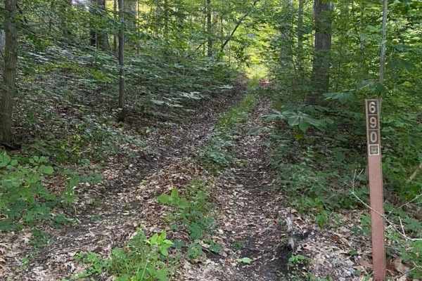
Diswood FSR 690
The Diswood FSR 690 is a natural forest road in the southern portion of the Mississippi Bluffs sector of Shawnee National Forest. Talk about a pinstripe expo, it is tight, tight, tight for the first .3 mile, either commit to go to the top or do a 10-point turn to get spun around. In the bottoms ther...
Learn more about Diswood FSR 690
Trashcan Hill
Trashcan Hill, or Bollinger County Road 258 and Perry County Road 624, is a set of county roads that trek through a rather difficult natural hillside. Coming from South to North, the road starts as a simple gravel road, but quickly degrades into a rough rutted unmaintained road, with a fair mix of d...
Learn more about Trashcan Hill
Whitewater Presbyterian Church Road
Whitewater Presbyterian Church Road, or the Bo-Co Road 256, is a gravel county road that traverses passed the church and into the valley below. The bottom section of the road features mild rutting, natural rock popping up at the surface, and gravel fading to dirt, potentially muddy with wet conditio...
Learn more about Whitewater Presbyterian Church Road
Cedar Bottom FSR 2159
Cedar Bottom FSR 2159, also referred to as Copper Mountain, is a gravel forestry road that is within the Fredericktown Sector of Mark Twain National Forest. It is a mild ride with a slow grade up and a slow grade back down ending at a turnaround spot at the end. The most this road has to challenge i...
Learn more about Cedar Bottom FSR 2159
Bo-Co Road 376
The Bollinger County Road 376 is a gravel-based road that traverses the northern Bollinger County Hills and parallels the Little Whitewater Creek. The road goes from being well maintained at the ends to mildly rough at the center, in typical Bollinger County fashion. It features a handful of low wat...
Learn more about Bo-Co Road 376
Blind Raccoon Bo-Co Road 360
The Blind Raccoon or Bollinger County Road 360 is a gravel county road going through the rocky rolling hills of the area, down into the creek bottoms, the north end features a hill that has some miner erosion ruts and can become sloppy when wet, it also crosses the Little Whitewater Creek with a low...
Learn more about Blind Raccoon Bo-Co Road 360
ATV trails in Illinois
Explore ATV-friendly trails in Illinois. These trails are accessible for vehicles up to 50 inches wide, perfect for ATVs and smaller off-road machines.
Current River Conservation Area
The Current River Conservation was created by combining Deer Run, Carrs Creek, Cardareva and Paint Rock State Forests combining 28,000 acres. The trail starts as #1 on the map which is provided at the beginning of the trail. Current River Conservation trail leads you down an easy gravel road however...
Learn more about Current River Conservation Area
McCraven SFR 220
McCraven SFR 220 is a very scenic nature-viewing gravel road in Shawnee National Forest. It is a very easy trail with a minimal challenge, but there are a few muddy crossings and water collection spots within its medium-grade graveled hills. It also features a couple of branch trails, the SFR 504 an...
Learn more about McCraven SFR 220
Redbird Trail 5x
Trail 5x is located in Redbird State Recreational Area (Linton, IN), a 1.5-hour drive from Indianapolis, IN. Redbird State Recreational Area is a state-owned and maintained offroad park. Trail 5x is a good beginning trail to get to Trail 5. The trail does have one mud hole halfway through that may b...
Learn more about Redbird Trail 5x
Bull Durham SFR 642
The Bull Durham SFR 642 is a branch trail of the Opossum Trot Trail System in Shawnee National Forest. The Bull Durham is quick to thrill with not much time in between its obstacles, it features a rutted hill within .2 mile of the entrance, followed by small mud puddles. Then, leading to a rutted co...
Learn more about Bull Durham SFR 642
UTV/side-by-side trails in Illinois
Find UTV and side-by-side trails in Illinois. These trails accommodate vehicles up to 60 inches wide, ideal for UTVs, side-by-sides, and wider off-road rigs.
Hamburg SFR 266A
As a branch of Atwood Road 266, the Hamburg 266A is a bit more of an offroading road and less of a scenic road within Shawnee National Forest. It has an off-camber hill within .2 of the entrance followed by many water collection areas that get muddy, the gravel fades in on the hilltops and out in th...
Learn more about Hamburg SFR 266A
Pine Union Hill FSR 2137
The Pine Union Hill FSR 2137 is the first portion of the Pine Union in Mark Twain National Forest before it spilts to the 2137A and the Hilltop portion of the 2137. It begins at the Bo-Co Road 872 in the bottoms of the Grounds Creek, leading you past the Sycamore Valley Artisan Well where the Pine U...
Learn more about Pine Union Hill FSR 2137
Current River Conservation Area
The Current River Conservation was created by combining Deer Run, Carrs Creek, Cardareva and Paint Rock State Forests combining 28,000 acres. The trail starts as #1 on the map which is provided at the beginning of the trail. Current River Conservation trail leads you down an easy gravel road however...
Learn more about Current River Conservation Area
McCraven SFR 220
McCraven SFR 220 is a very scenic nature-viewing gravel road in Shawnee National Forest. It is a very easy trail with a minimal challenge, but there are a few muddy crossings and water collection spots within its medium-grade graveled hills. It also features a couple of branch trails, the SFR 504 an...
Learn more about McCraven SFR 220
The onX Offroad Difference
onX Offroad combines trail photos, descriptions, difficulty ratings, width restrictions, seasonality, and more in a user-friendly interface. Available on all devices, with offline access and full compatibility with CarPlay and Android Auto. Discover what you're missing today!
Open Trail Map