Off-Road Trails in Oregon
Discover off-road trails in Oregon
Learn more about Brown's Powerline Connector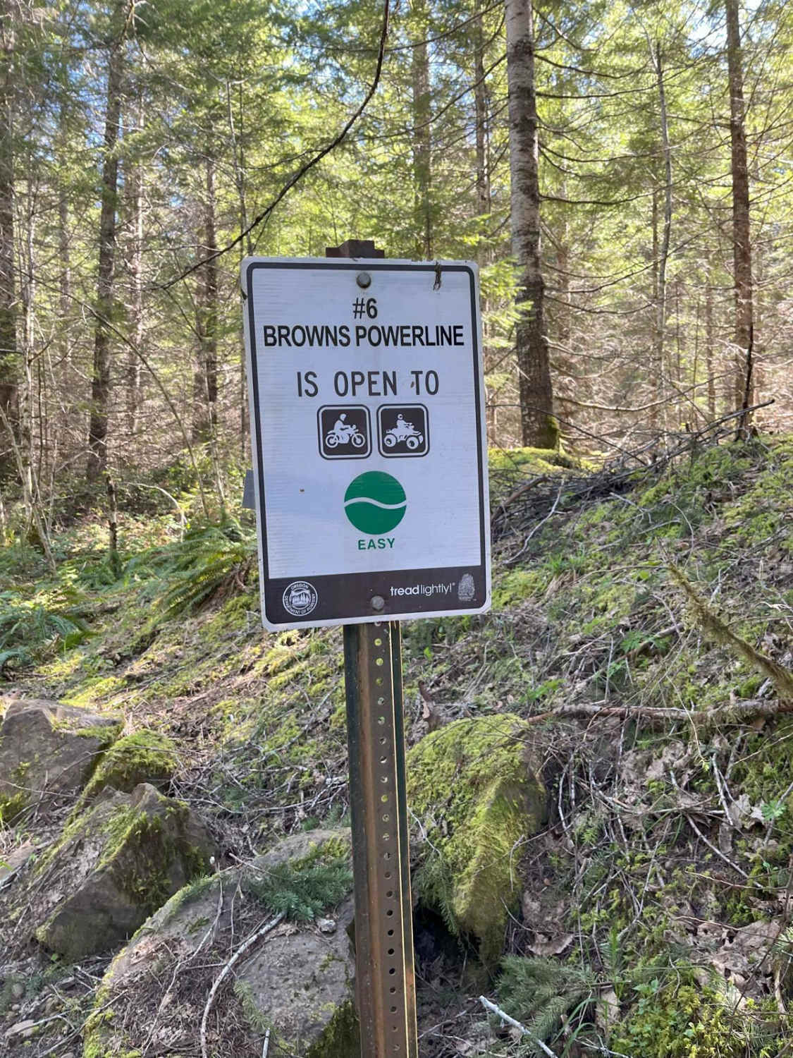
Brown's Powerline Connector
Total Miles
0.9
Tech Rating
Easy
Best Time
Spring, Summer, Fall
Learn more about Buck Creek 2120
Buck Creek 2120
Total Miles
20.9
Tech Rating
Easy
Best Time
Spring, Summer, Fall
Learn more about Buck Mountain
Buck Mountain
Total Miles
7.7
Tech Rating
Easy
Best Time
Summer, Spring, Fall
Learn more about Buckhorn Loop
Buckhorn Loop
Total Miles
3.0
Tech Rating
Easy
Best Time
Spring, Summer, Fall, Winter
Learn more about Buckhorn Overlook Spur
Buckhorn Overlook Spur
Total Miles
1.2
Tech Rating
Easy
Best Time
Summer, Fall, Spring
Learn more about Bun Creek - NF1004
Bun Creek - NF1004
Total Miles
10.0
Tech Rating
Easy
Best Time
Spring, Summer, Fall
Learn more about Burnt Flat Road
Burnt Flat Road
Total Miles
10.6
Tech Rating
Easy
Best Time
Spring, Fall, Summer
Learn more about Butler Creek Mainline
Butler Creek Mainline
Total Miles
5.4
Tech Rating
Easy
Best Time
Spring, Summer, Fall, Winter
Learn more about Buzzards Point #35
Buzzards Point #35
Total Miles
2.5
Tech Rating
Difficult
Best Time
Spring, Fall
Learn more about Cache Mountain - NF 2067900
Cache Mountain - NF 2067900
Total Miles
3.7
Tech Rating
Easy
Best Time
Summer, Fall

Learn more about Calamity Butte Lookout
Calamity Butte Lookout
Total Miles
9.6
Tech Rating
Moderate
Best Time
Spring, Summer, Fall
Learn more about Calamut Lake
Calamut Lake
Total Miles
1.5
Tech Rating
Moderate
Best Time
Summer, Fall, Spring
ATV trails in Oregon


UTV/side-by-side trails in Oregon
Learn more about 10 Mile OHV Trail
10 Mile OHV Trail
Total Miles
1.6
Tech Rating
Easy
Best Time
Spring, Summer, Fall


The onX Offroad Difference
onX Offroad combines trail photos, descriptions, difficulty ratings, width restrictions, seasonality, and more in a user-friendly interface. Available on all devices, with offline access and full compatibility with CarPlay and Android Auto. Discover what you’re missing today!