
Off-Road Trails in North Carolina
Discover off-road trails in North Carolina
Off-Road Trails in North Carolina
Discover the best off-road trails in North Carolina. Browse trail maps, check difficulty ratings, and find your next adventure — whether you're looking for a quick ride or an all-day expedition.
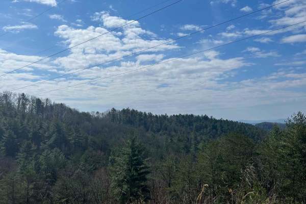
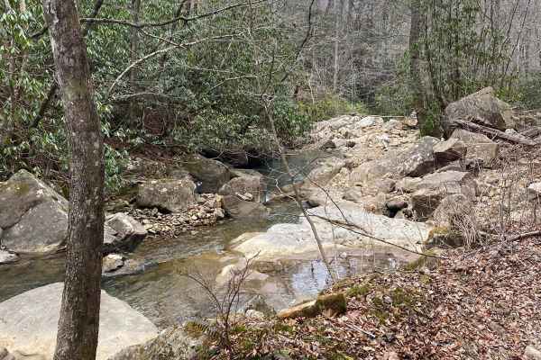
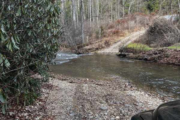
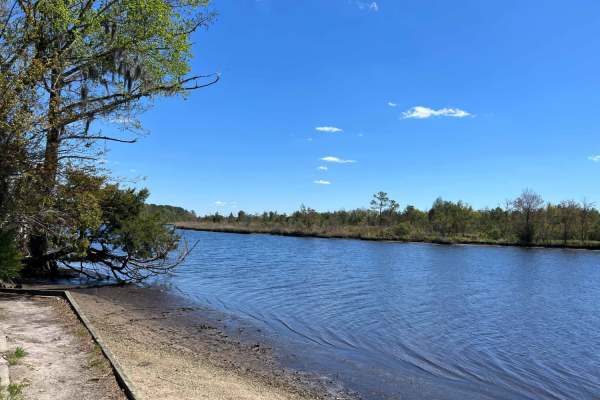
Shuler Creek
This trail has easy access gravel road off Highway 68 in Farner. The road is 2 vehicles wide and has mostly gentle elevations. It starts out running parallel to the Hiwassee River and then a branch of Shuler Creek. Along the way, there are pullovers and an occasional campsite. The creek is wide and ...
Learn more about Shuler Creek
Jumping Off - SCAR Alternate
West of Table Rock you will find this scenic out-and-back diversion. It's a nice addition to add some more challenging riding or driving to the main South Carolina Adventure Route loop. Along its path, you will encounter steep grades which are often rutted and loose.
About the SCAR: The South Carol...
Learn more about Jumping Off - SCAR Alternate
Old NC 105
Old NC-105 is a popular trail and is most well-known for its outstanding views of the Linville Gorge. It offers unparalleled views of the gorge and Table Rock Mountain. Numerous overlooks and campsites offer scenery nearly unheard of east of the Mississippi. Plan to spend 2-3 hours on the trail.
Learn more about Old NC 105
Inside Road to Cape Point
Lighthouse road is a beach access road between Cape Hatteras Lighthouse and Frisco Campground that offers challenging deep sand and whoops in some of the most remote areas of the island. If driving in the morning or evening hours, lots of wildlife can be seen along the road and dunes. If coming from...
Learn more about Inside Road to Cape Point
Trail 86 Windrock
Trail 86 runs along Round Rock Creek. The trail not only runs along the creek but you will have a creek crossing. Please make sure you stay safe during the creek crossing since the area might have excessive rain that could lead to fast-moving water. 86 also will have some mud and rock. There is no c...
Learn more about Trail 86 Windrock
Dicks Creek to Dark Hollow (Unicoi to Erwin)
This is an intermediate to advanced trail depending on the vehicle being used. There are multiple water crossings, logs, rocks, and steep-off camber sections. If you're using a full-size vehicle be cautious of narrow trail spots and low-hanging tree branches. Water crossings can be dangerous after a...
Learn more about Dicks Creek to Dark Hollow (Unicoi to Erwin)
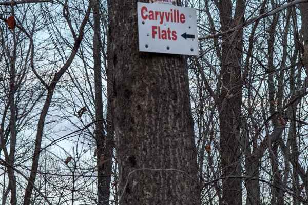
62
This trail is one of the recommended Windrock Park trails to get to the Caryville Flats (G54,62,66). It is a moderate trail with some mild washouts, small to medium rocks, and medium ledges. My only concern would be how the washouts hold up in excessive rain.
Learn more about 62
SCAR Northeast Alternate
Covering the northeast portion of the state, this significant addition transits Sandhills State Forest and the Carolina National Wildlife Refuge, providing an alternate route between Liberty Hill WMA and Francis Marion National Forest. Campsites marked along this route require reservations (see meta...
Learn more about SCAR Northeast Alternate
Long Point
Long Point is a wide and well-maintained access road to Long Point campsite along the White Oak River. This road can easily be driven in 2wd, but very large potholes need to be watched for as you start to gain speed along the road. The campsite at the end is only suited for tents or class B or small...
Learn more about Long Point

Holland Point
Holland Point is a quick out and back trail that rides along the edges of private property. This is an easy drive with only a few large potholes in the middle of the trail. Following dense coastal forest, it's a perfect short drive if looking for wildlife along the coast with an incredible revealing...
Learn more about Holland Point
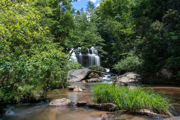
Long Creek Falls - FSR 757
This is the 4x4 segment of Turkey Ridge Road or FSR 757 to Long Creek Falls. This is a technical route that leads down to Long Creek Falls and an overlook over the Chattoga River. After rains the trail gets very muddy and slippery due to the red clay base road. During the Fall and Winter months the ...
Learn more about Long Creek Falls - FSR 757
Shad Road
The two ends of Shad Road that connect to Hurricane Gap are rather misleading. While it starts out as a relatively tame gravel two-track, the middle section is much more difficult than you may be led to believe in the first half mile at each end. A few campsites are scattered along each end, but non...
Learn more about Shad Road
Buzzard Roost Road
While less exciting in terrain than the closely named Old Buzzard Roost Road, this route has some fantastic views and other exciting features. The road is mostly gravel, with a few sections holding water or small washouts. You can travel the Southern terminus up towards the ridgeline and trace along...
Learn more about Buzzard Roost Road
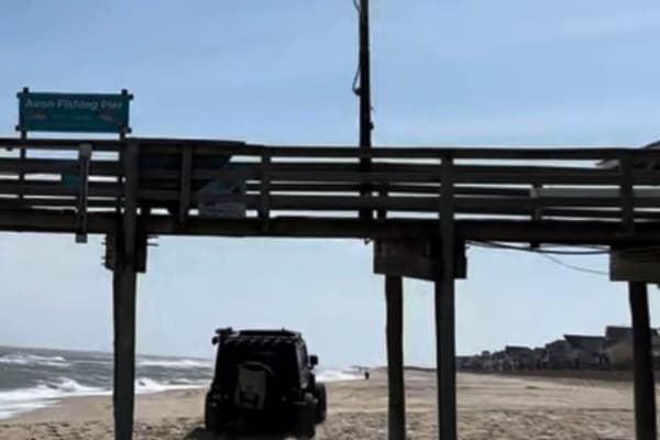
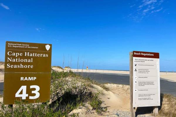
Cape Hatteras 34 to 38 Avon Beach
This Beach access is only open from October 15- April 14. However, if you are there during this time it's a great way to access Avon Beach and have a front-row seat to an amazing beach. 4x4 is required to be able to drive on the beach as well as airing down your tires to 20 psi or less. Recovery equ...
Learn more about Cape Hatteras 34 to 38 Avon Beach
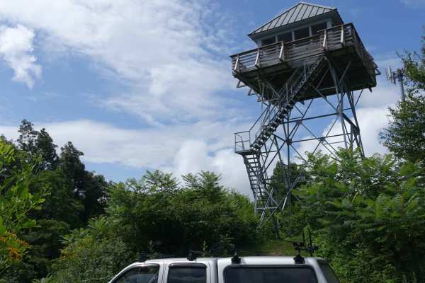
Rich Mountain Lookout
This short route is a must-see if you're in the area. If you're traveling Hurricane Gap it's well worth the detour. There area few campsites on the way up the mountain. Cell service is available, but be prepared to bring water since none is available. The tower itself is a relatively new constructi...
Learn more about Rich Mountain Lookout
Brown Gap Road
This route will take you from the higher elevations back towards Hartford. It generally a mild road, but a few sections include ruts and mud holes that might be more challenging during rainy weather. Be on the lookout for wildlife as you travel this road. Bear are common in the area and it's great g...
Learn more about Brown Gap Road
Hurricane Gap
Hurrican Gap is a well-maintained gravel road that travels from the Houston Valley area to just outside of Hot Springs, NC. While it's not particularly challenging, there are some great side trips along the way. The Rich Mountain Lookout Tower is just a mile off of the road, and if you're looking fo...
Learn more about Hurricane Gap
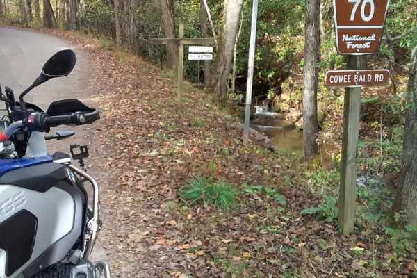
Cowee Bald
This trail features elevation changes, switchbacks, some rocky terrain, a few washboard areas, and blind curves with potential oncoming vehicles. The path is one vehicle wide with places to pass. Not a high degree of difficulty. The Forest Service Gate is closed to access the fire tower. All around ...
Learn more about Cowee Bald
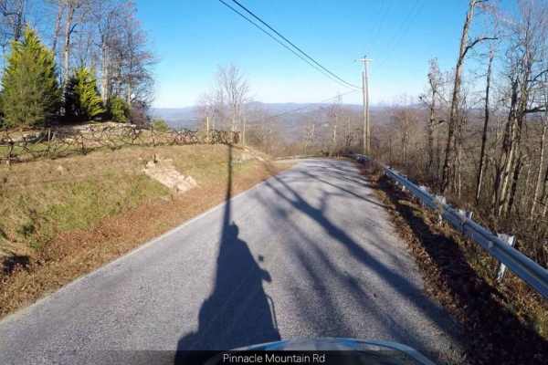
Pinnacle - SCAR Alternate
This trail might suit you if you're looking for a scenic side trip on the South Carolina Adventure Route. It runs along the outskirts of the Dupont State Forest and provides ridgetop views. The trail is dirt and will include some steep and rutted grades. About the SCAR: The South Carolina Adventure ...
Learn more about Pinnacle - SCAR Alternate
Trans America Trail / SCAR Connector
If you want to connect the Trans America Trail with the South Carolina Adventure Route, this is your path. It's located North of Walhalla, and connects the SCAR to both the TAT and the Smokey Mountain 500 (SM500). The track is primarily gravel and pavement, but contains some steep grades and ruts wh...
Learn more about Trans America Trail / SCAR Connector
ATV trails in North Carolina
Explore ATV-friendly trails in North Carolina. These trails are accessible for vehicles up to 50 inches wide, perfect for ATVs and smaller off-road machines.
Shuler Creek
This trail has easy access gravel road off Highway 68 in Farner. The road is 2 vehicles wide and has mostly gentle elevations. It starts out running parallel to the Hiwassee River and then a branch of Shuler Creek. Along the way, there are pullovers and an occasional campsite. The creek is wide and ...
Learn more about Shuler Creek
Jumping Off - SCAR Alternate
West of Table Rock you will find this scenic out-and-back diversion. It's a nice addition to add some more challenging riding or driving to the main South Carolina Adventure Route loop. Along its path, you will encounter steep grades which are often rutted and loose.
About the SCAR: The South Carol...
Learn more about Jumping Off - SCAR Alternate
Dicks Creek to Dark Hollow (Unicoi to Erwin)
This is an intermediate to advanced trail depending on the vehicle being used. There are multiple water crossings, logs, rocks, and steep-off camber sections. If you're using a full-size vehicle be cautious of narrow trail spots and low-hanging tree branches. Water crossings can be dangerous after a...
Learn more about Dicks Creek to Dark Hollow (Unicoi to Erwin)
62
This trail is one of the recommended Windrock Park trails to get to the Caryville Flats (G54,62,66). It is a moderate trail with some mild washouts, small to medium rocks, and medium ledges. My only concern would be how the washouts hold up in excessive rain.
Learn more about 62
UTV/side-by-side trails in North Carolina
Find UTV and side-by-side trails in North Carolina. These trails accommodate vehicles up to 60 inches wide, ideal for UTVs, side-by-sides, and wider off-road rigs.
Shuler Creek
This trail has easy access gravel road off Highway 68 in Farner. The road is 2 vehicles wide and has mostly gentle elevations. It starts out running parallel to the Hiwassee River and then a branch of Shuler Creek. Along the way, there are pullovers and an occasional campsite. The creek is wide and ...
Learn more about Shuler Creek
Jumping Off - SCAR Alternate
West of Table Rock you will find this scenic out-and-back diversion. It's a nice addition to add some more challenging riding or driving to the main South Carolina Adventure Route loop. Along its path, you will encounter steep grades which are often rutted and loose.
About the SCAR: The South Carol...
Learn more about Jumping Off - SCAR Alternate
Dicks Creek to Dark Hollow (Unicoi to Erwin)
This is an intermediate to advanced trail depending on the vehicle being used. There are multiple water crossings, logs, rocks, and steep-off camber sections. If you're using a full-size vehicle be cautious of narrow trail spots and low-hanging tree branches. Water crossings can be dangerous after a...
Learn more about Dicks Creek to Dark Hollow (Unicoi to Erwin)
62
This trail is one of the recommended Windrock Park trails to get to the Caryville Flats (G54,62,66). It is a moderate trail with some mild washouts, small to medium rocks, and medium ledges. My only concern would be how the washouts hold up in excessive rain.
Learn more about 62
The onX Offroad Difference
onX Offroad combines trail photos, descriptions, difficulty ratings, width restrictions, seasonality, and more in a user-friendly interface. Available on all devices, with offline access and full compatibility with CarPlay and Android Auto. Discover what you're missing today!
Open Trail Map