2A Hang Glide Hill
Total Miles
0.2
Technical Rating
Best Time
Spring, Fall, Summer, Winter
Trail Type
60" Trail
Accessible By
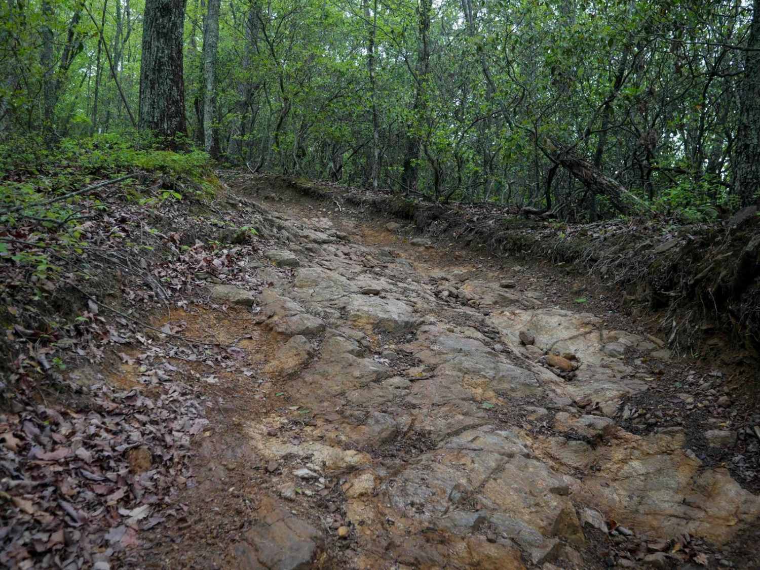
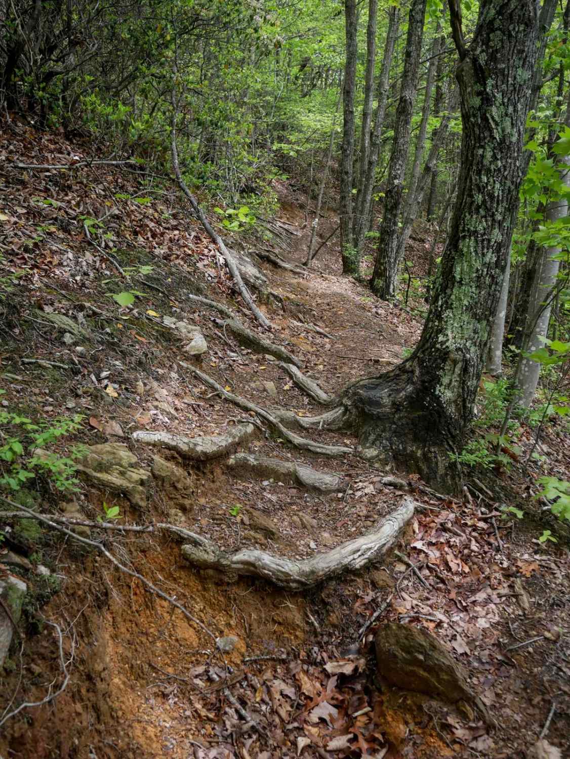
Trail Overview
Trail 2A, ridden west to east, serves as an Office Bailout option after you are 8.5 miles into the 11-mile 1A OHV route. It features a steep descent dropping 270 feet in elevation over less than a quarter mile. The trail is a challenging, loose, rocky descent, filled with cobble and bedrock outcroppings that are uneven and off-camber. They are often ramped rock faces, not blunt drop-offs, but still will require some careful navigation. Ruts, roots, and troughs add to the technical difficulty. This trail offers a fun final challenge for those exiting the 1A route, requiring riders to navigate through all the obstacles as they make their way down.
Photos of 2A Hang Glide Hill

Difficulty
This is an intermediate OHV route due to several moderate rock obstacles on the steep descent.
Status Reports
2A Hang Glide Hill can be accessed by the following ride types:
- SxS (60")
- ATV (50")
- Dirt Bike
2A Hang Glide Hill Map
Popular Trails

FS 206 Spur 1
Webb Mill Road
The onX Offroad Difference
onX Offroad combines trail photos, descriptions, difficulty ratings, width restrictions, seasonality, and more in a user-friendly interface. Available on all devices, with offline access and full compatibility with CarPlay and Android Auto. Discover what you’re missing today!