Off-Road Trails in Idaho
Discover off-road trails in Idaho
Learn more about Upper Dry Gulch 
Upper Dry Gulch
Total Miles
4.0
Tech Rating
Easy
Best Time
Fall, Summer, Spring, Winter
Learn more about Upper Fivemile Road 7436 
Upper Fivemile Road 7436
Total Miles
1.5
Tech Rating
Moderate
Best Time
Fall, Summer, Spring
Learn more about Upper Graves Creek
Upper Graves Creek
Total Miles
3.9
Tech Rating
Easy
Best Time
Summer, Fall
Learn more about Upper Harden Creek ATV 
Upper Harden Creek ATV
Total Miles
2.7
Tech Rating
Easy
Best Time
Summer, Fall
Learn more about Upper Pahsimeroi River
Upper Pahsimeroi River
Total Miles
14.0
Tech Rating
Moderate
Best Time
Summer, Fall
Learn more about Upper Red Ives Creek
Upper Red Ives Creek
Total Miles
8.6
Tech Rating
Easy
Best Time
Summer, Fall
Learn more about Upper Slate Creek
Upper Slate Creek
Total Miles
6.5
Tech Rating
Easy
Best Time
Fall, Summer, Spring
Learn more about Upper Sugarloaf 
Upper Sugarloaf
Total Miles
4.1
Tech Rating
Moderate
Best Time
Winter, Fall, Summer, Spring
Learn more about USFS 8234 Mid-Section
USFS 8234 Mid-Section
Total Miles
3.0
Tech Rating
Easy
Best Time
Summer, Spring, Fall
Learn more about Valley Creek Bridge and Stanley Historic Museum
Valley Creek Bridge and Stanley Historic Museum
Total Miles
0.4
Tech Rating
Easy
Best Time
Spring, Summer, Fall, Winter
Learn more about Valley Spur A
Valley Spur A
Total Miles
2.9
Tech Rating
Easy
Best Time
Fall, Summer, Spring
Learn more about Van Noy-Stoddard Road
Van Noy-Stoddard Road
Total Miles
0.7
Tech Rating
Easy
Best Time
Spring, Summer, Fall
Learn more about Van Noy-Stoddard Trail
Van Noy-Stoddard Trail
Total Miles
4.3
Tech Rating
Moderate
Best Time
Summer, Fall
Learn more about Virginia Gulch - FS 7037
Virginia Gulch - FS 7037
Total Miles
1.1
Tech Rating
Easy
Best Time
Summer
Learn more about Wahlstrom Fork
Wahlstrom Fork
Total Miles
1.2
Tech Rating
Easy
Best Time
Spring, Summer, Fall
Learn more about Wahlstrom Hollow Trail
Wahlstrom Hollow Trail
Total Miles
3.1
Tech Rating
Moderate
Best Time
Spring, Summer, Fall
Learn more about War Eagle Lookout Tower Trail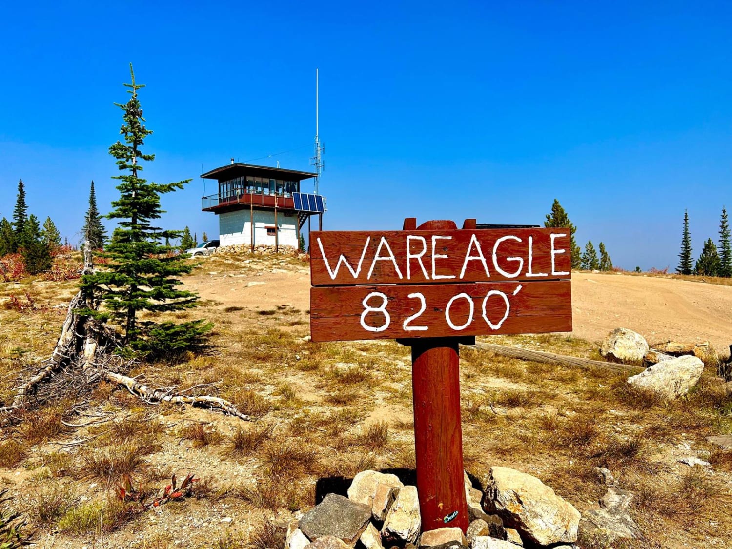
War Eagle Lookout Tower Trail
Total Miles
14.1
Tech Rating
Easy
Best Time
Summer
ATV trails in Idaho
Learn more about Aspen Range - Middle Sulphur #5248 
Aspen Range - Middle Sulphur #5248
Total Miles
1.9
Tech Rating
Easy
Best Time
Summer, Fall
Learn more about Dry Fork - Meadow Springs #5226 
Dry Fork - Meadow Springs #5226
Total Miles
0.4
Tech Rating
Easy
Best Time
Summer, Fall
Learn more about South Foothill Road
South Foothill Road
Total Miles
8.2
Tech Rating
Moderate
Best Time
Summer, Fall

UTV/side-by-side trails in Idaho
Learn more about South Foothill Road
South Foothill Road
Total Miles
8.2
Tech Rating
Moderate
Best Time
Summer, Fall

Learn more about 21 To Nip & Tuck
21 To Nip & Tuck
Total Miles
1.4
Tech Rating
Easy
Best Time
Fall, Summer, Spring

The onX Offroad Difference
onX Offroad combines trail photos, descriptions, difficulty ratings, width restrictions, seasonality, and more in a user-friendly interface. Available on all devices, with offline access and full compatibility with CarPlay and Android Auto. Discover what you’re missing today!