
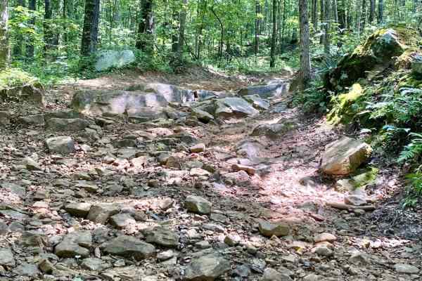
Off-Road Trails in Arkansas
Discover off-road trails in Arkansas
Off-Road Trails in Arkansas
Discover the best off-road trails in Arkansas. Browse trail maps, check difficulty ratings, and find your next adventure — whether you're looking for a quick ride or an all-day expedition.
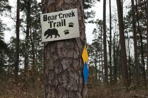
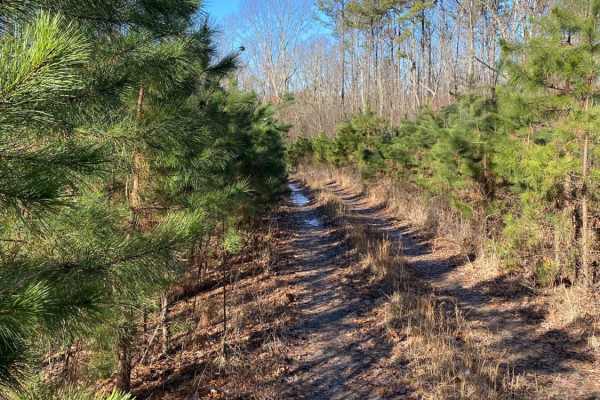
Bear Creek Trail
ATV trail follows the Lake Greeson shoreline offering panoramic views of the lake and Ouachita Mountain range. The 31 miles cross rocky outlays through mixed pine and oak forest. It begins at Daisy State Park and travels near Kirby Landing and Bear Creek Recreation Areas, ending on the west end of R...
Learn more about Bear Creek Trail
The Arkansas Overland Route - Section 1 - Falcon Bottoms Back Roads
This route will start from off Highway 82, East of Texarkana, Arkansas. You will head north along Falcon Bottoms Natural Area and end up going east towards Poison Springs WMA. This is the beginning of several trail sections. This section has a lot of very rough asphalt with some gravel sections. The...
Learn more about The Arkansas Overland Route - Section 1 - Falcon Bottoms Back Roads
Prison Fence Trail
This is an easy scenic trail with various terrain types, including gravel, dirt, mud holes, rock ledges, and shallow water crossings. The elevation varies from around 1100' to just over 2400' as it follows along the Little Mulberry River. This trail runs north and south between Highway 16 and Highwa...
Learn more about Prison Fence Trail
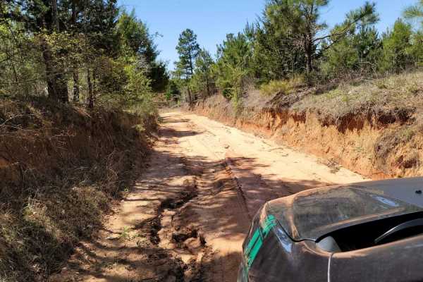
Barnhart Road 796
Most of the trails in the ONF are easy gravel roads, this one included. There isn't much elevation gain or descent on this trail. Even when it rains, the roads don't really get muddy, however, you may find mud puddles or potholes along this road. There are two water crossings, so a car isn't recomme...
Learn more about Barnhart Road 796
The Arkansas Overland Route - TrailHawk Loop - Section 14 - The Beginning
These are gravel roads that are dusty when dry and can be nasty when wet. They seem well maintained, and there is awesome scenery. Watch for farm equipment on the roads and cattle. This is the first section of The TrailHawk Loop, Section 14 of The Arkansas Overland Route. This section starts the hea...
Learn more about The Arkansas Overland Route - TrailHawk Loop - Section 14 - The Beginning
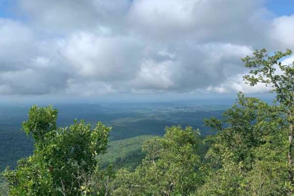
Pilot Knob Mountain
This will take you to the top of Pilot Knob Mountain. It is a short road, but the beautiful view is worth a detour if you haven't been. The elevation is 2,080 feet at the top. The first 200 feet of the climb is a rocky step that is mildly steep but doable in any 4x4 with a low range.
Learn more about Pilot Knob Mountain
Howard County WMA 485RD Circle
Gravel roads that are in the Howard County WMA. These gravel roads are well maintained but can be muddy when wet. This trail ends at a circle turn around. Gates can be closed at times. There is a gate at the beginning of this trail. A free annual General Use Permit (WMP) is required to hunt or trap ...
Learn more about Howard County WMA 485RD Circle

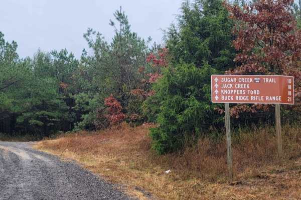
Knoppers Ford
Knopper's Ford, situated along Sugar Creek is a day-use facility built by the CCC. It is accessible by passenger cars or low-clearance vehicles. Knopper's Ford is popular with Off-Highway Vehicle (OHV) and Equestrian enthusiasts, as it is a very short distance from the fabulous Sugar Creek Multi-Us...
Learn more about Knoppers Ford
The Arkansas Overland Route - Section 2 - Highway 371 to Road 113
This trail starts off on Highway 371, going east. It is a continuation of the Falcon Bottoms Back Roads Trail and Section 2 of the Arkansas Overland Route. This trail is almost all gravel and dirt and is the second part of several trails heading to Poison Springs WMA. This section of the trail will ...
Learn more about The Arkansas Overland Route - Section 2 - Highway 371 to Road 113
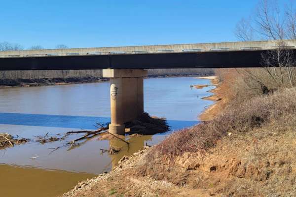
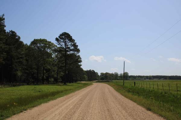
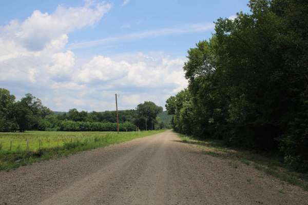
Follow the Red River
This 30-mile route follows along the Northside of the Red River. This East to West route is almost completely gravel roads. The roads are maintained but can be nasty after or during rains. Although you may not see a lot of the river, you will see lots of pasture land with livestock, creeks with brid...
Learn more about Follow the Red River

Lake Sylvia to Winona Lake and HWY9
This trail starts at Lake Sylvia State Park where camping, swimming and water/electric sites are available if needed. Its a great place to explore. After leaving Lake Sylvia this route takes you to LAKE WINONA (you will see the intersection where you can pick up a rule pamphlet and turn right to Win...
Learn more about Lake Sylvia to Winona Lake and HWY9
Hawks Peak
This trail starts off on the east side of Highway 71 a few miles north of Waldron Arkansas. Waldron Arkansas has gas stations and a grocery store for last-minute items or fill up. The trail is on the south side of Pilot Knob Mountain. This is a maintained gravel road that can be messy when wet. This...
Learn more about Hawks Peak
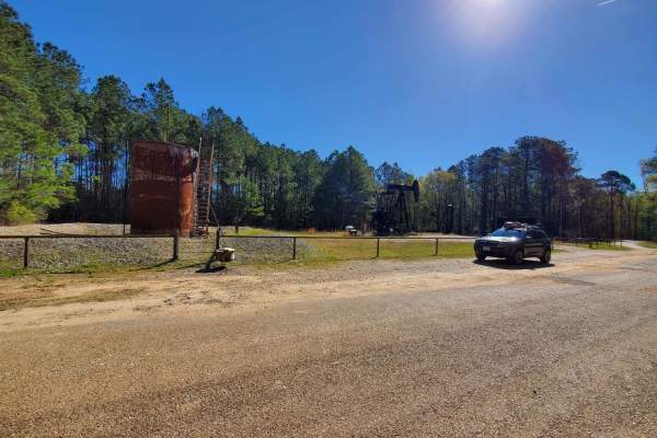
Bois d'Ark Arkansas Spillway & Dam
This 13,626-acre area is composed of 5,866 acres of state-owned land and 7,760 acres leased from International Paper and Potlatch timber companies.The primary objective of this management area is to provide high-quality wildlife habitat and public hunting opportunities. Bois d'Arc Lake provides exc...
Learn more about Bois d'Ark Arkansas Spillway & Dam
G3 Fun Run
You will find ups, downs, and all arounds. You'll see some granite rock slabs climbs, and some off-camber twists and turns. Overall, the description is in the name at just under a mile long, this trail has a little something for everyone. Probably the second most difficult (or easiest) of the Jeep ...
Learn more about G3 Fun Run
Middle Fork Illinois Bayou
This route starts as an easy downhill descent into the middle fork of the Illinois Bayou. The trail is very tight on both sides through its entirety, and pinstriping is a guarantee. The trail is easy to moderate downhill into the bayou traveling from east to west. There are tight bypasses around lar...
Learn more about Middle Fork Illinois Bayou
The Arkansas Overland Route - Section 4 - Poison Springs WMA and Purifoy Cemetery
This trail is gravel and dirt that can be sloppy during or after rains. There is a small section is pavement before turning to go to Purifoy Cemetery. Some areas you might want to avoid during or right after rains. Primitive camping sites can be found along parts of these roads. For camping, get a f...
Learn more about The Arkansas Overland Route - Section 4 - Poison Springs WMA and Purifoy Cemetery
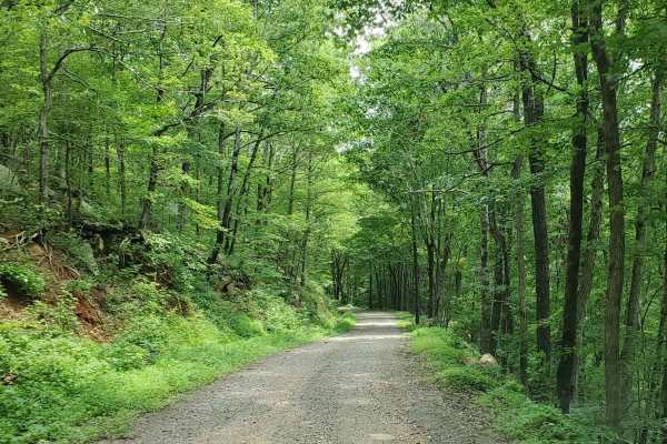
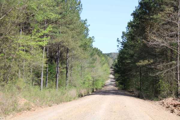
Moss Creek Road
Moss Creek Road is a well-maintained gravel road that goes into the Ouachita National Forest. Passing scenic old buildings on this short stretch of road adds to the adventure into this section of the Forest. This right-of-way road passes through a section of Deltic Timber Company. There is a private...
Learn more about Moss Creek Road
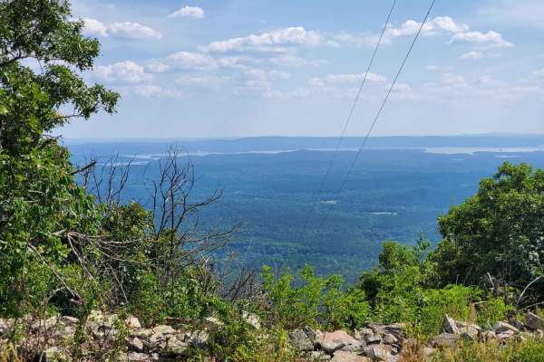
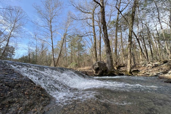
Ouachita Pinnacle 1952 FT
This trail picks up from Old North Fork Road and takes you to a 1952 ft elevation. This trail has a decent climb and the trail going up the mountain is rough in places. You will see a great view of Lake Ouachita from the top. There are some cell towers on top of the mountain but no lookout tower. Th...
Learn more about Ouachita Pinnacle 1952 FT
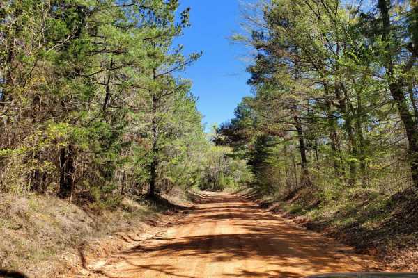
Forest Road - N09A
This route turns off Nunley Road and leads to a small parking area where ATVs and SXS only can ride the Ouachita Wolf Pen Gap trail system. It travels through a rural area. Wildlife, as well as tractors, were both encountered on a short section of road. The parking area is small and can only accomm...
Learn more about Forest Road - N09A
Wolf Ridge
Wolf Ridge is an intermediate trail that starts as a gravel road and transitions to steep rock switchbacks with loose rocks and boulders up to 24" in height. Stock rigs will need careful spotting in sections. This trail also contains a few mud moles up to 24" deep in spots. As you progress farther u...
Learn more about Wolf Ridge
ATV trails in Arkansas
Explore ATV-friendly trails in Arkansas. These trails are accessible for vehicles up to 50 inches wide, perfect for ATVs and smaller off-road machines.
Bear Creek Trail
ATV trail follows the Lake Greeson shoreline offering panoramic views of the lake and Ouachita Mountain range. The 31 miles cross rocky outlays through mixed pine and oak forest. It begins at Daisy State Park and travels near Kirby Landing and Bear Creek Recreation Areas, ending on the west end of R...
Learn more about Bear Creek Trail
Prison Fence Trail
This is an easy scenic trail with various terrain types, including gravel, dirt, mud holes, rock ledges, and shallow water crossings. The elevation varies from around 1100' to just over 2400' as it follows along the Little Mulberry River. This trail runs north and south between Highway 16 and Highwa...
Learn more about Prison Fence Trail
Barnhart Road 796
Most of the trails in the ONF are easy gravel roads, this one included. There isn't much elevation gain or descent on this trail. Even when it rains, the roads don't really get muddy, however, you may find mud puddles or potholes along this road. There are two water crossings, so a car isn't recomme...
Learn more about Barnhart Road 796
Pilot Knob Mountain
This will take you to the top of Pilot Knob Mountain. It is a short road, but the beautiful view is worth a detour if you haven't been. The elevation is 2,080 feet at the top. The first 200 feet of the climb is a rocky step that is mildly steep but doable in any 4x4 with a low range.
Learn more about Pilot Knob Mountain
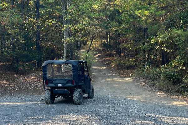
UTV/side-by-side trails in Arkansas
Find UTV and side-by-side trails in Arkansas. These trails accommodate vehicles up to 60 inches wide, ideal for UTVs, side-by-sides, and wider off-road rigs.
Bear Creek Trail
ATV trail follows the Lake Greeson shoreline offering panoramic views of the lake and Ouachita Mountain range. The 31 miles cross rocky outlays through mixed pine and oak forest. It begins at Daisy State Park and travels near Kirby Landing and Bear Creek Recreation Areas, ending on the west end of R...
Learn more about Bear Creek Trail
Prison Fence Trail
This is an easy scenic trail with various terrain types, including gravel, dirt, mud holes, rock ledges, and shallow water crossings. The elevation varies from around 1100' to just over 2400' as it follows along the Little Mulberry River. This trail runs north and south between Highway 16 and Highwa...
Learn more about Prison Fence Trail
Barnhart Road 796
Most of the trails in the ONF are easy gravel roads, this one included. There isn't much elevation gain or descent on this trail. Even when it rains, the roads don't really get muddy, however, you may find mud puddles or potholes along this road. There are two water crossings, so a car isn't recomme...
Learn more about Barnhart Road 796
Pilot Knob Mountain
This will take you to the top of Pilot Knob Mountain. It is a short road, but the beautiful view is worth a detour if you haven't been. The elevation is 2,080 feet at the top. The first 200 feet of the climb is a rocky step that is mildly steep but doable in any 4x4 with a low range.
Learn more about Pilot Knob Mountain
The onX Offroad Difference
onX Offroad combines trail photos, descriptions, difficulty ratings, width restrictions, seasonality, and more in a user-friendly interface. Available on all devices, with offline access and full compatibility with CarPlay and Android Auto. Discover what you're missing today!
Open Trail Map