
Off-Road Trails in Virginia
Discover off-road trails in Virginia
Off-Road Trails in Virginia
Discover the best off-road trails in Virginia. Browse trail maps, check difficulty ratings, and find your next adventure — whether you're looking for a quick ride or an all-day expedition.
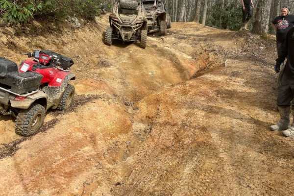
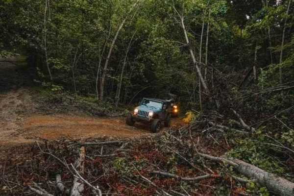
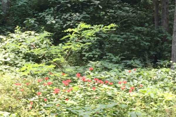
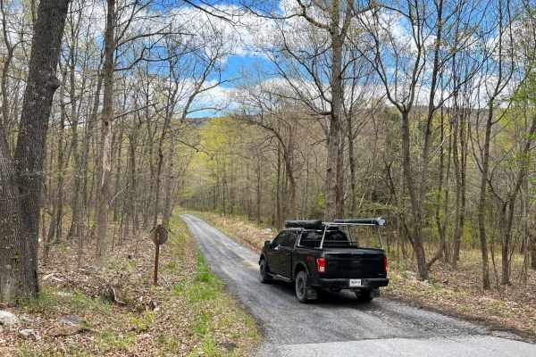
Belcher Ridge Run
This trail has everything you want in an awesome trail with the exception of a water crossing. This trail is best traveled west to east for a few reasons. First: food and drink are on the east side. Second: the difficult/exciting stuff is on the west side, and it's best to get through it first. Thir...
Learn more about Belcher Ridge Run
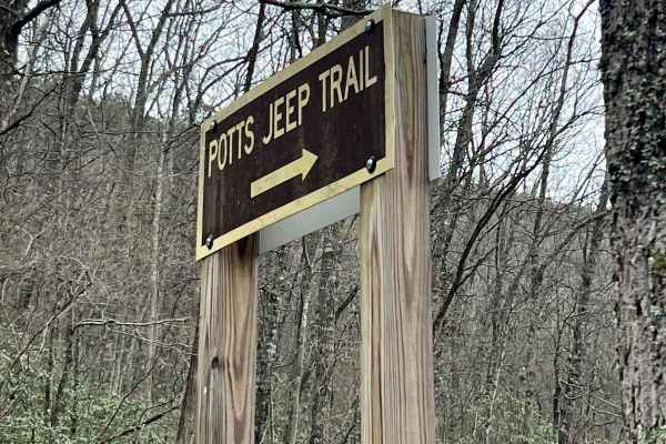
Potts Mountain Jeep Trail
Potts Mountain Jeep Trail is no joke! This was a very challenging trial for my Jeep with a 3.5" lift on 37's I drug and winched several times. Potts Mountain is rocks, rocks, and more rocks. Several obstacles were too big for my taste, and even the bypass areas were challenging. The trail starts ...
Learn more about Potts Mountain Jeep Trail
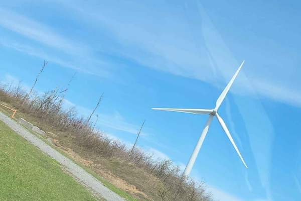
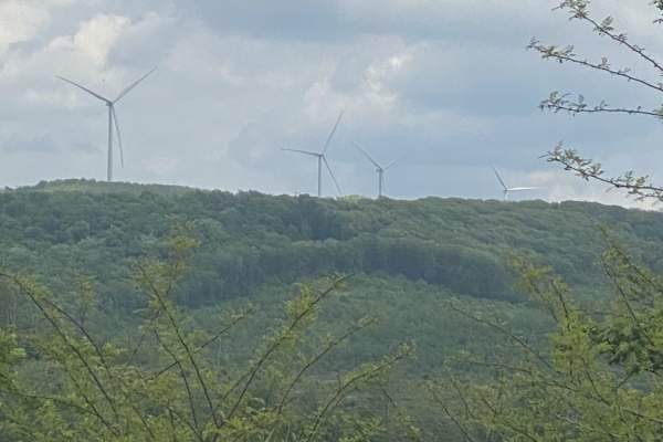
Bald Knob
Road is hilly and rocky at first until you hit a water crossing. Then you will be in gravel for awhile and the views are amazing. Great ride in WV Mountains if you want to get lost for awhile. You will pass strip mines and timber jobs. There are windmills on top of Bald Knob.
Learn more about Bald Knob
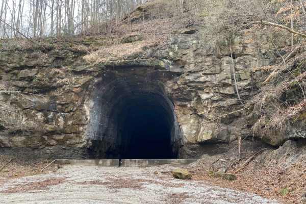
Vinton County Tunnels Tour Part 2
This is Radcliff to Campbell Tunnel Vinton County Tunnel Loop West. This starts at Lake Hope in this section and runs counterclockwise south through Vinton county passing Campbell Tunnel which was recently closed through the Appalachian Foothills. Gas and food can be found along the way. Good for a ...
Learn more about Vinton County Tunnels Tour Part 2
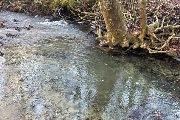
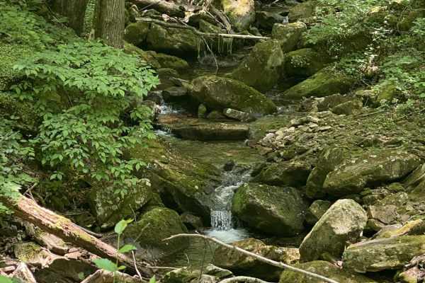
Camel Road - Splash but Don't Crash
This trail follows a creek bed for the majority of the route. With running water, and some great places to get your flex on. This trail is centered towards the off-roader that likes more technical and difficult trails. But is still completely doable solo. There is very limited cell service here, so ...
Learn more about Camel Road - Splash but Don't Crash
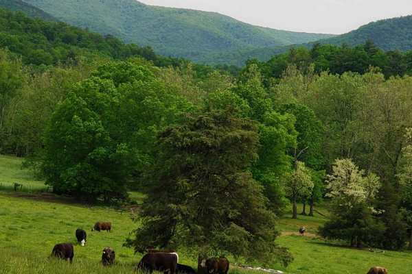
Bailey Gap to Butte Mountain
Bailey Gap and Butt Mountain are two trails that are near the Mountain Lake Lodge, which was made famous by the movie "Dirty Dancing". Both trails are beginner-friendly, with Butt Mountain being the easier of the two. Butt Mountain is mostly gravel and dirt, with very little in the way of mud or obs...
Learn more about Bailey Gap to Butte Mountain
Stoney Run
Stoney Run (WV61) is a dirt and gravel road that more or less runs parallel to the trail to Reddish Knob. The trail is sufficiently wide enough for two vehicles to pass each other, and can easily be run in 2WD. The trail begins at county route 32 and descends into a valley before eventually ascendin...
Learn more about Stoney Run
Parsons to Stone Lake Run
This beautiful, twisting, winding country gravel road leads from Parsons to Stone Lake Run and eventually down to Bear Haven Campgrounds in Otter Creek Recreational Area. There are many gorgeous rock overhangs and narrow shelf roadways. The entire route follows the Cheat Creek River. Fuel, food, and...
Learn more about Parsons to Stone Lake Run
Decoy-Magoffin Loop
As with many trails in the under-development system that will become Eastern Kentucky's expansive off-road trail offerings, this route is a DIY adventure created by locals that know these mountains like the backs of their hands. Accessed from established trailheads like Mine Made Adventure Park and ...
Learn more about Decoy-Magoffin Loop
Westside Road
Westside Road travels along the western slope of Shenandoah mountain in WV. Be respectful while travelling through private property, from WV Co Route 34 to the National Forest boundary. The route is generally dirt with crushed stone in high erosion areas with some exposed natural rock. The route inc...
Learn more about Westside Road
Nettie to Richwood
If you like dirt roads, this place is for you--it's miles upon miles of dirt/gravel roads. This route takes about 3.5 hours over almost 40 miles of some of the prettiest country Nicholas County, West Virginia, has to offer. Along these trails, you will more than likely see about every wild animal th...
Learn more about Nettie to Richwood
Beech Fork
This in probably one of the best adventures we went on in 2021. This trail starts in Nicholas County WV and ends in Clay County WV. There are about 50 creek crossings, mud, ruts, and several sport where you actually ride in the creek hundreds of yards at a time. This is a must if you like a view and...
Learn more about Beech Fork
Trans American Trail WV
Some of the West Virginia TAT. Started in Marlington WV and went to Williams River, Planned on going all the way to Sutton WV but due to flood damage part of this trail is expected to be closed until 2023.History of the TAT The Trans America Trail is the cross-country adventure ride of a lifetime wi...
Learn more about Trans American Trail WV
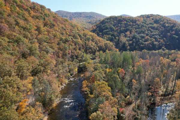
New River Gorge
New River Gorge OHV Route is a 12.5-mile moderately trafficked point-to-point trail located near Prince, West Virginia, that features a river and is rated as moderate. The trail is primarily used for OHV/off-road driving and is best used from September until October. This trail has some beautiful ov...
Learn more about New River Gorge
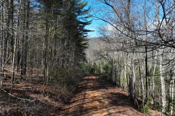
Archer Run
Archer Run is a basic trail in Virginia's George Washington National Forest. It is mainly a dirt road, with some areas of minor rockiness. It meanders through the mountains of western Virginia, offering good views of the surrounding ridge lines and valleys. The trail has several switchbacks, which b...
Learn more about Archer Run
Meadow & Gauley Rivers Access Trail
This trail was developed from old railroad tracks, making it perfect for various activities. There are plenty of primitive camping sites along the river. There are two old railroad tunnels and multiple railroad bridges you can cross and hike, bike, drive, or ride to. There is plenty of swimming acce...
Learn more about Meadow & Gauley Rivers Access Trail
Vances Cove
Vances Cove trail is a meandering gravel road starting at Cold Spring Gap. Descending into the valley along cold spring creek. The road can become washed out in some areas after heavy rain, as the trail so closely follows it. Tight and narrow, the trail winds down to an intersection at Vances Cove, ...
Learn more about Vances Cove
Clinch Mountain Fire Tower
Clinch Mountain Fire Tower is an ideal scenic route for beginners, families, and overland travelers looking for stunning Appalachian vistas without the stress of highly technical terrain. This unpaved mountain passage winds up and over the ridge of Clinch Mountain, connecting the historic community ...
Learn more about Clinch Mountain Fire Tower
Dry Gap Ridge
Dry Gap is a short step, out and back trail climbing along a ridge leading to a cell tower. The beginning climb is the most challenging part due to its steep nature; 4WD is recommended. The sweeping views from the ridge are incredible when no leaves are on the trees following the border of Virginia ...
Learn more about Dry Gap Ridge
Camp Creek Trail
There are a variety of different obstacles on this ride. From gravel to Rock. You will encounter mud and washed out segments and ruts. This trail also has various low hanging limbs and downed trees at times. Will also encounter 2 creek crossings one of which has a steep entry and exit point.
Learn more about Camp Creek Trail
ATV trails in Virginia
Explore ATV-friendly trails in Virginia. These trails are accessible for vehicles up to 50 inches wide, perfect for ATVs and smaller off-road machines.
Belcher Ridge Run
This trail has everything you want in an awesome trail with the exception of a water crossing. This trail is best traveled west to east for a few reasons. First: food and drink are on the east side. Second: the difficult/exciting stuff is on the west side, and it's best to get through it first. Thir...
Learn more about Belcher Ridge Run
Decoy-Magoffin Loop
As with many trails in the under-development system that will become Eastern Kentucky's expansive off-road trail offerings, this route is a DIY adventure created by locals that know these mountains like the backs of their hands. Accessed from established trailheads like Mine Made Adventure Park and ...
Learn more about Decoy-Magoffin Loop
Nettie to Richwood
If you like dirt roads, this place is for you--it's miles upon miles of dirt/gravel roads. This route takes about 3.5 hours over almost 40 miles of some of the prettiest country Nicholas County, West Virginia, has to offer. Along these trails, you will more than likely see about every wild animal th...
Learn more about Nettie to Richwood
New River Gorge
New River Gorge OHV Route is a 12.5-mile moderately trafficked point-to-point trail located near Prince, West Virginia, that features a river and is rated as moderate. The trail is primarily used for OHV/off-road driving and is best used from September until October. This trail has some beautiful ov...
Learn more about New River Gorge
UTV/side-by-side trails in Virginia
Find UTV and side-by-side trails in Virginia. These trails accommodate vehicles up to 60 inches wide, ideal for UTVs, side-by-sides, and wider off-road rigs.
Belcher Ridge Run
This trail has everything you want in an awesome trail with the exception of a water crossing. This trail is best traveled west to east for a few reasons. First: food and drink are on the east side. Second: the difficult/exciting stuff is on the west side, and it's best to get through it first. Thir...
Learn more about Belcher Ridge Run
Parsons to Stone Lake Run
This beautiful, twisting, winding country gravel road leads from Parsons to Stone Lake Run and eventually down to Bear Haven Campgrounds in Otter Creek Recreational Area. There are many gorgeous rock overhangs and narrow shelf roadways. The entire route follows the Cheat Creek River. Fuel, food, and...
Learn more about Parsons to Stone Lake Run
Decoy-Magoffin Loop
As with many trails in the under-development system that will become Eastern Kentucky's expansive off-road trail offerings, this route is a DIY adventure created by locals that know these mountains like the backs of their hands. Accessed from established trailheads like Mine Made Adventure Park and ...
Learn more about Decoy-Magoffin Loop
Nettie to Richwood
If you like dirt roads, this place is for you--it's miles upon miles of dirt/gravel roads. This route takes about 3.5 hours over almost 40 miles of some of the prettiest country Nicholas County, West Virginia, has to offer. Along these trails, you will more than likely see about every wild animal th...
Learn more about Nettie to Richwood
The onX Offroad Difference
onX Offroad combines trail photos, descriptions, difficulty ratings, width restrictions, seasonality, and more in a user-friendly interface. Available on all devices, with offline access and full compatibility with CarPlay and Android Auto. Discover what you're missing today!
Open Trail Map