Off-Road Trails in Missouri
Discover off-road trails in Missouri
Learn more about Lakeview - FS 3827
Lakeview - FS 3827
Total Miles
1.3
Tech Rating
Easy
Best Time
Spring, Summer, Fall, Winter
Learn more about Landing Strip
Landing Strip
Total Miles
0.0
Tech Rating
Easy
Best Time
Spring, Summer, Fall, Winter
Learn more about Last Chance
Last Chance
Total Miles
0.0
Tech Rating
Difficult
Best Time
Spring, Summer, Fall, Winter
Learn more about Launcher
Launcher
Total Miles
0.0
Tech Rating
Difficult
Best Time
Spring, Summer, Fall, Winter

Learn more about Left or Right 138
Left or Right 138
Total Miles
0.0
Tech Rating
Difficult
Best Time
Spring, Summer, Fall
Learn more about Leo Drey Forest 2221
Leo Drey Forest 2221
Total Miles
15.7
Tech Rating
Moderate
Best Time
Spring, Summer, Fall
Learn more about Leopold Road - BCR 402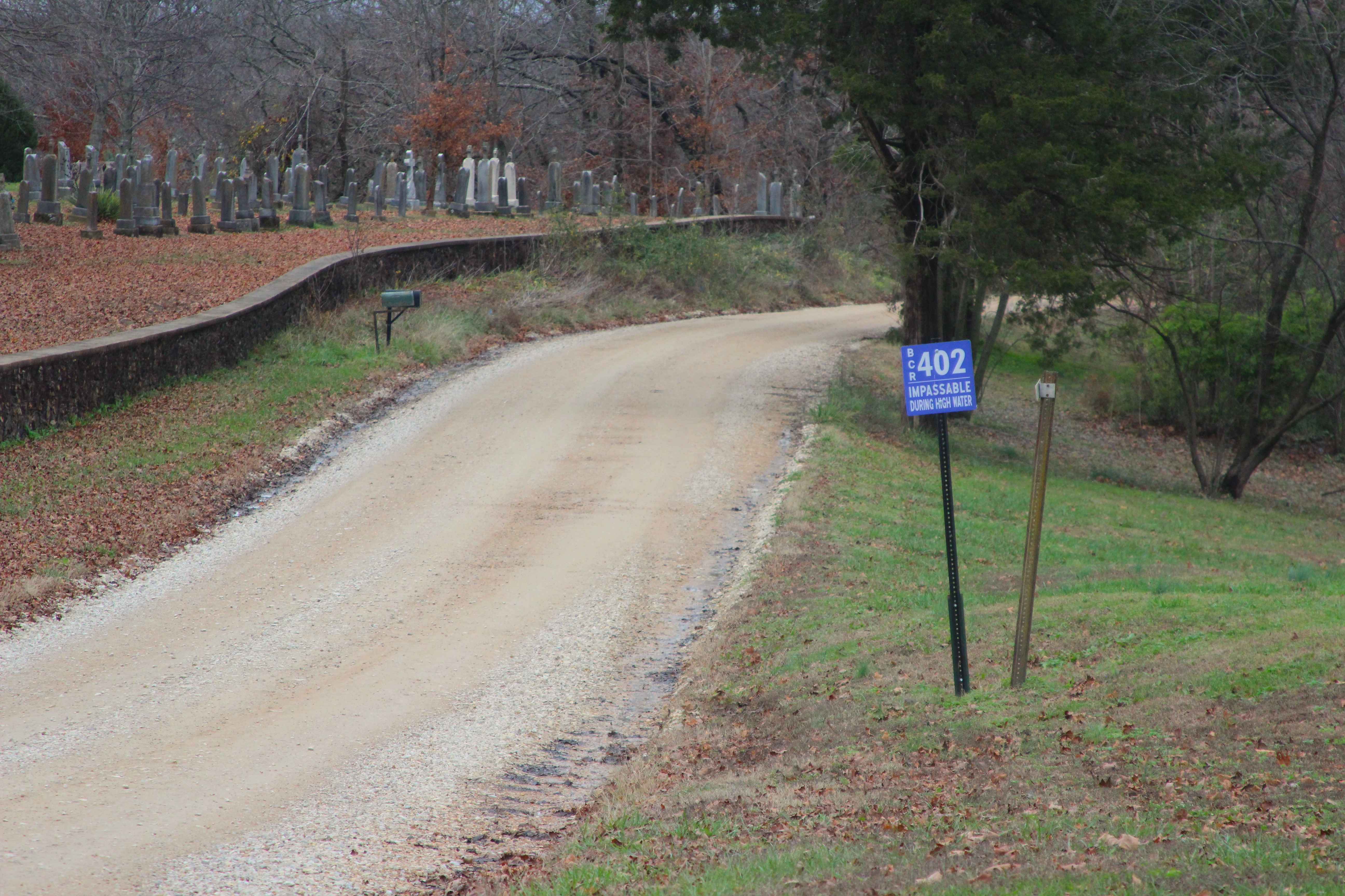
Leopold Road - BCR 402
Total Miles
4.0
Tech Rating
Easy
Best Time
Spring, Summer, Fall, Winter
Learn more about Lindsey Mountain - FS 2359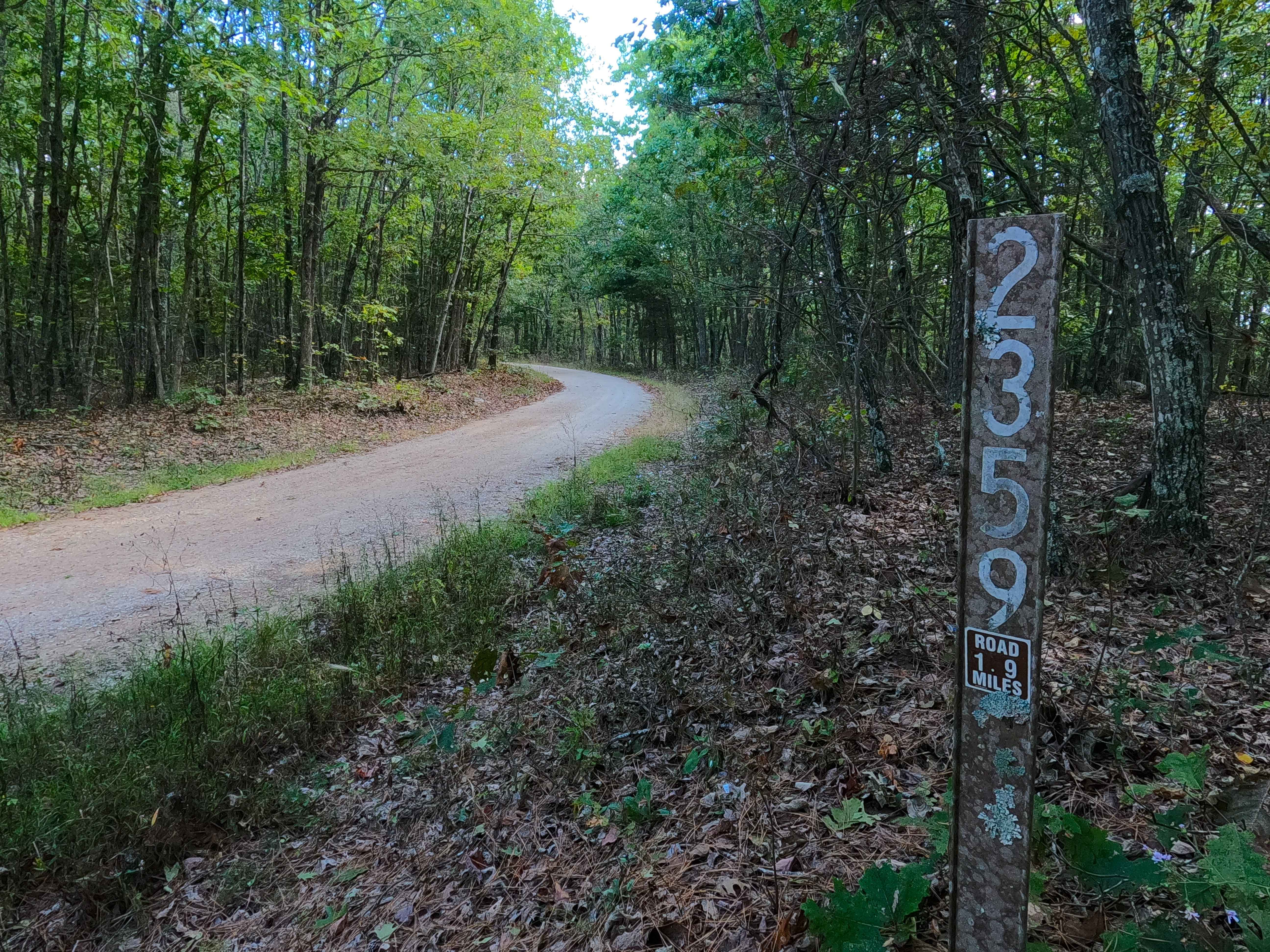
Lindsey Mountain - FS 2359
Total Miles
1.9
Tech Rating
Easy
Best Time
Spring, Summer, Fall, Winter
Learn more about Little Brushy Ridge
Little Brushy Ridge
Total Miles
2.9
Tech Rating
Easy
Best Time
Summer, Spring, Winter, Fall
Learn more about Little Gravois Creek North Trail
Little Gravois Creek North Trail
Total Miles
0.8
Tech Rating
Easy
Best Time
Summer, Fall, Winter, Spring
Learn more about Little Gravois Creek South Trail #1
Little Gravois Creek South Trail #1
Total Miles
0.3
Tech Rating
Easy
Best Time
Winter, Summer, Fall, Spring
Learn more about Little Gravois Creek South Trail #2
Little Gravois Creek South Trail #2
Total Miles
0.1
Tech Rating
Easy
Best Time
Spring, Summer, Fall, Winter
Learn more about Little Gravois Woodland Trail #1
Little Gravois Woodland Trail #1
Total Miles
0.6
Tech Rating
Easy
Best Time
Spring, Summer, Fall, Winter
Learn more about Little Rock
Little Rock
Total Miles
0.1
Tech Rating
Easy
Best Time
Spring, Summer, Fall, Winter
Learn more about Log Lick Hollow
Log Lick Hollow
Total Miles
1.3
Tech Rating
Easy
Best Time
Spring, Fall, Summer, Winter
Learn more about Logan Mtn FSR 2780
Logan Mtn FSR 2780
Total Miles
1.8
Tech Rating
Easy
Best Time
Spring, Summer, Fall, Winter
Learn more about Loggers Trail
Loggers Trail
Total Miles
1.0
Tech Rating
Easy
Best Time
Spring, Summer, Fall, Winter
ATV trails in Missouri


Learn more about 4 of 5
4 of 5
Total Miles
0.0
Tech Rating
Difficult
Best Time
Spring, Summer, Fall, Winter
UTV/side-by-side trails in Missouri
Learn more about 4 of 5
4 of 5
Total Miles
0.0
Tech Rating
Difficult
Best Time
Spring, Summer, Fall, Winter
The onX Offroad Difference
onX Offroad combines trail photos, descriptions, difficulty ratings, width restrictions, seasonality, and more in a user-friendly interface. Available on all devices, with offline access and full compatibility with CarPlay and Android Auto. Discover what you’re missing today!