
Off-Road Trails in Georgia
Discover off-road trails in Georgia
Off-Road Trails in Georgia
Discover the best off-road trails in Georgia. Browse trail maps, check difficulty ratings, and find your next adventure — whether you're looking for a quick ride or an all-day expedition.
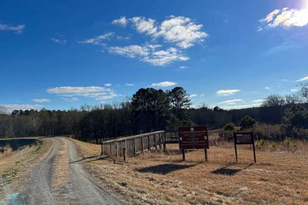
Little Rock Wildlife Drive
Little Rock Wildlife Drive offers a gentle and highly scenic four-wheel-drive route through the heart of Piedmont National Wildlife Refuge, making it an exceptional trip for families, wildlife photographers, and novice offroaders looking to explore Georgia's rich natural beauty. This 4.75-mile maint...
Learn more about Little Rock Wildlife Drive
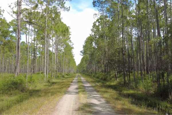
Cary State Forest - Cary Tract
The Cary Tract is one of the tracts of forest that makes up the Cary State Forest. The trail begins as hard-packed limestone before eventually transitioning to dirt. The trails are not challenging, and most passenger vehicles can navigate them without issue. There is a campground in the forest, alon...
Learn more about Cary State Forest - Cary Tract
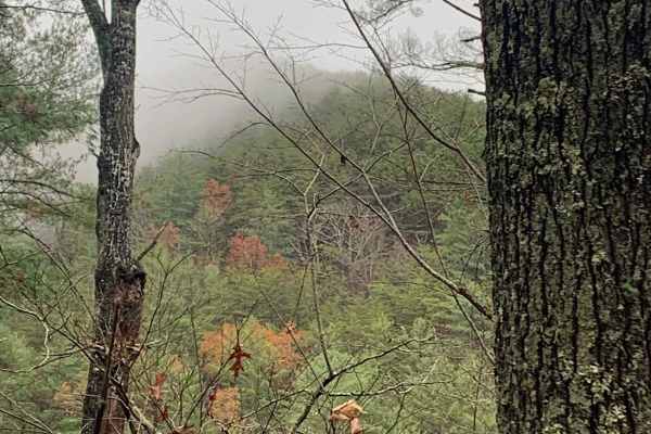
Big Frog - FS 62
Big Frog - FS 62 is an excellent forest road route for intermediate offroaders looking to explore the scenic, lesser-maintained mountain terrain bordering Georgia and Tennessee. Spanning approximately 11.4 miles, this trail is a key segment of the famous Georgia Traverse, offering a rugged trek thro...
Learn more about Big Frog - FS 62
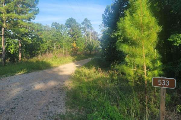
533 - Vaughn Road
533 - Vaughn Road is a lesser-known road that leads into the Shoal Creek District of the Talladega National Forest and leads to Forest Service RD (FSR) 500, which is the primary road in and out of the Management Area. This gated road is normally an open road and eventually lands in the small town of...
Learn more about 533 - Vaughn Road

Bush Head Gap Road
Relatively easy trail with no serious obstacles, but the route is very overgrown and only one vehicle wide. If you drive a full-size vehicle, prepare for scratches on the vehicle. If you look at a map of Bush Head Gap Road, the map will show that the trail is 1-2 miles longer than shown. However, th...
Learn more about Bush Head Gap Road
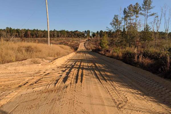
SCAR Southeast Alternate
This route traverses the heart of the Sandhills region (which spans the state betwen Columbia and I-95), and it definitely delivers sand. It is approximately 80% off-pavement, and some of the sandy sections can be very loose and deep when conditions are dry. It also passes through some quaint towns ...
Learn more about SCAR Southeast Alternate
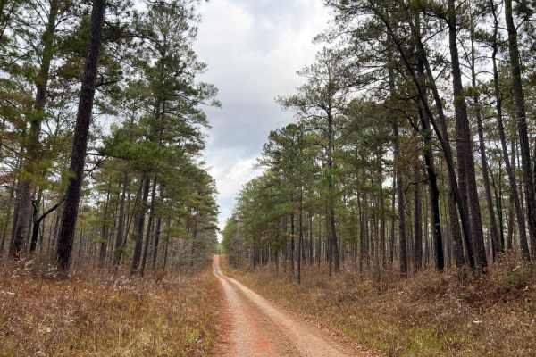
Oconee Starr
Oconee Starr is a fun and easy drive showcasing vibrant red dirt roads, southern pine forests, hardwood forests, and natural streams. This trail is split between Oconee National Forest and Piedmont National Wildlife Refuge, spanning eight miles in length. The road is mostly gravel with some sections...
Learn more about Oconee Starr
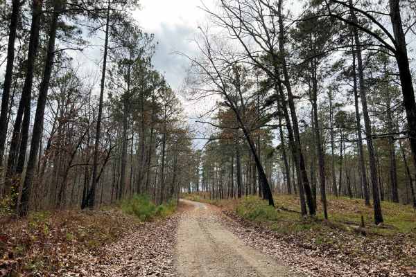
Scenic Juliette
Scenic Juliette stands true to its name, passing through highland forests of southern pines before slowly descending down to hardwood forest with revealing views of the Ocmulgee River. This fun drive is best started from the North in Ocmulgee National Forest before entering Piedmont National Wildlif...
Learn more about Scenic Juliette
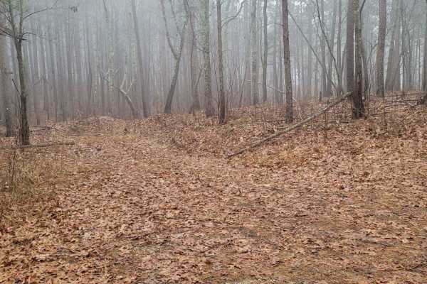
USFSR #500K
USFSR #500K is the last trail that spurs off the primary road going in and out of the Shoal Creek Ranger District portion of the Talladega National Forest. This Northernmost trail is outside the Choccolocco Wildlife Management Area but is part of the beautiful Dugger Mountain Wilderness. It is a pop...
Learn more about USFSR #500K
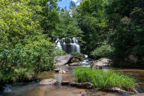
Long Creek Falls - FSR 757
This is the 4x4 segment of Turkey Ridge Road or FSR 757 to Long Creek Falls. This is a technical route that leads down to Long Creek Falls and an overlook over the Chattoga River. After rains the trail gets very muddy and slippery due to the red clay base road. During the Fall and Winter months the ...
Learn more about Long Creek Falls - FSR 757
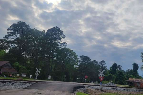
Oconee Southern Traverse - 1068 (Segment 2)
This portion of the Oconee forest has well maintained service roads throughout with minimal-to-no obstacles to encounter. Wildlife such as deer and turkey are often seen so situational awareness should be maintained while driving to ensure safe travel. While the majority of the route is gravel/dirt,...
Learn more about Oconee Southern Traverse - 1068 (Segment 2)
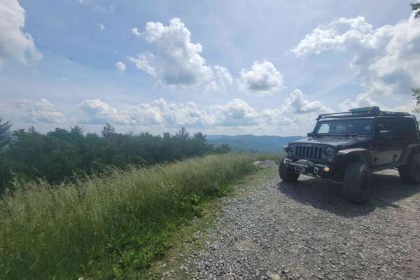
Old CCC Camp Road
This route has many wonderful views and is accessible by most vehicles. Connecting to the Georgia Traverse, it provides many options to continue your travels through the mountains and camping along the way. Depending on the weather, traveling in most vehicles that are not high clearance is possible;...
Learn more about Old CCC Camp Road
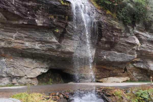
Trans America Trail / SCAR Connector
If you want to connect the Trans America Trail with the South Carolina Adventure Route, this is your path. It's located North of Walhalla, and connects the SCAR to both the TAT and the Smokey Mountain 500 (SM500). The track is primarily gravel and pavement, but contains some steep grades and ruts wh...
Learn more about Trans America Trail / SCAR Connector
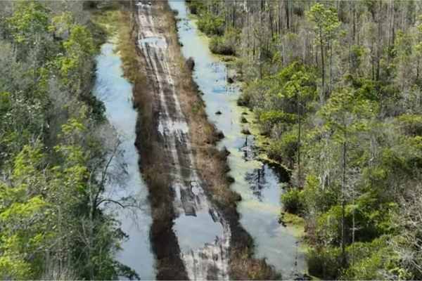
Osceola National Forest - Swamp Thing
"Swamp Thing" is a route in the central part of the Osceola National Forest. It starts out as hard-packed dirt and limestone that almost any vehicle should be able to handle without issue. The trail winds through the forest, gradually becoming wetter and muddier, before eventually entering Big Gum S...
Learn more about Osceola National Forest - Swamp Thing

Barrington Ferry
Barrington Ferry is a sandy run down to Barrington County Campground and boat launch. Free camping and river access are available to Harper Lake, connecting to the Altamaha River. It is a fairly well-maintained road that can become soft and challenging after some rain. While towing, you have to pick...
Learn more about Barrington Ferry
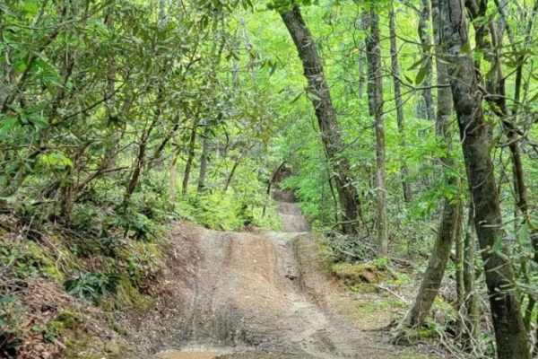
Gold Mine Road (Willis Knob)
The trail starts out as a gravel one to two-lane road. Once you get in a few miles, it becomes a very overgrown, narrow at times, dirt road with several areas of mud and obstacles. The trail dead ends, so be prepared to backtrack everything you go through. It has a few side roads, one being an old c...
Learn more about Gold Mine Road (Willis Knob)

LR White - SCAR Alternate
This section of the South Carolina Adventure Route is found southeast of McCormick. It consistently contains sections of shallow mud and standing water across the road, as well as significant encroachment of tree limbs. If you're looking for a more adventurous track, you'll find it here. This trail ...
Learn more about LR White - SCAR Alternate
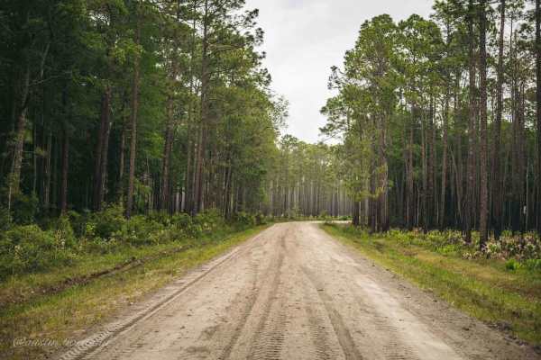
Osceola National Forest FR 235/17 Mile Camp Rd
FR 235/17 Mile Camp Rd is a North-South easy trail through Osceola National Forest that gets you into the heart of the forest. 95% of the trail is packed sand and light gravel with a few sections of loosely packed sand. 4WD and high clearance are not required on the trail except for a fun little wat...
Learn more about Osceola National Forest FR 235/17 Mile Camp Rd
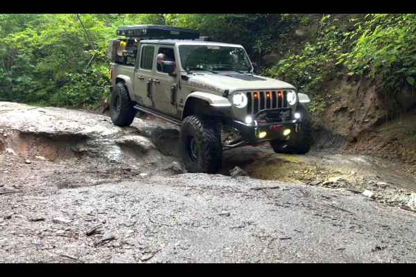
Sarah's Creek
Sarah's Creek is a nice ride that is close to Clayton, GA. The trail starts off with a nice forest service road with spread-out dispersed camping spots with a few pit-style bathrooms. There is no cell service in this area. Toward the end of the trail is where it gets difficult there are three obstac...
Learn more about Sarah's Creek
Hopewell Church - Lost wilderness traverse (661/669B)
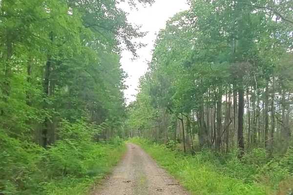
This trail consists of two well-maintained dirt roads that cross the southern portion of the Sumter National Forest. Muddy conditions can be expected during the rainy season with possible down trees. The roads seem to be well maintained and can be traveled with most vehicles during any season.
Learn more about Hopewell Church - Lost wilderness traverse (661/669B)
ATV trails in Georgia
Explore ATV-friendly trails in Georgia. These trails are accessible for vehicles up to 50 inches wide, perfect for ATVs and smaller off-road machines.
Big Frog - FS 62
Big Frog - FS 62 is an excellent forest road route for intermediate offroaders looking to explore the scenic, lesser-maintained mountain terrain bordering Georgia and Tennessee. Spanning approximately 11.4 miles, this trail is a key segment of the famous Georgia Traverse, offering a rugged trek thro...
Learn more about Big Frog - FS 62
Bush Head Gap Road
Relatively easy trail with no serious obstacles, but the route is very overgrown and only one vehicle wide. If you drive a full-size vehicle, prepare for scratches on the vehicle. If you look at a map of Bush Head Gap Road, the map will show that the trail is 1-2 miles longer than shown. However, th...
Learn more about Bush Head Gap Road
Long Creek Falls - FSR 757
This is the 4x4 segment of Turkey Ridge Road or FSR 757 to Long Creek Falls. This is a technical route that leads down to Long Creek Falls and an overlook over the Chattoga River. After rains the trail gets very muddy and slippery due to the red clay base road. During the Fall and Winter months the ...
Learn more about Long Creek Falls - FSR 757
Osceola National Forest FR 235/17 Mile Camp Rd
FR 235/17 Mile Camp Rd is a North-South easy trail through Osceola National Forest that gets you into the heart of the forest. 95% of the trail is packed sand and light gravel with a few sections of loosely packed sand. 4WD and high clearance are not required on the trail except for a fun little wat...
Learn more about Osceola National Forest FR 235/17 Mile Camp Rd
UTV/side-by-side trails in Georgia
Find UTV and side-by-side trails in Georgia. These trails accommodate vehicles up to 60 inches wide, ideal for UTVs, side-by-sides, and wider off-road rigs.
Big Frog - FS 62
Big Frog - FS 62 is an excellent forest road route for intermediate offroaders looking to explore the scenic, lesser-maintained mountain terrain bordering Georgia and Tennessee. Spanning approximately 11.4 miles, this trail is a key segment of the famous Georgia Traverse, offering a rugged trek thro...
Learn more about Big Frog - FS 62
Bush Head Gap Road
Relatively easy trail with no serious obstacles, but the route is very overgrown and only one vehicle wide. If you drive a full-size vehicle, prepare for scratches on the vehicle. If you look at a map of Bush Head Gap Road, the map will show that the trail is 1-2 miles longer than shown. However, th...
Learn more about Bush Head Gap Road
Long Creek Falls - FSR 757
This is the 4x4 segment of Turkey Ridge Road or FSR 757 to Long Creek Falls. This is a technical route that leads down to Long Creek Falls and an overlook over the Chattoga River. After rains the trail gets very muddy and slippery due to the red clay base road. During the Fall and Winter months the ...
Learn more about Long Creek Falls - FSR 757
Osceola National Forest FR 235/17 Mile Camp Rd
FR 235/17 Mile Camp Rd is a North-South easy trail through Osceola National Forest that gets you into the heart of the forest. 95% of the trail is packed sand and light gravel with a few sections of loosely packed sand. 4WD and high clearance are not required on the trail except for a fun little wat...
Learn more about Osceola National Forest FR 235/17 Mile Camp Rd
The onX Offroad Difference
onX Offroad combines trail photos, descriptions, difficulty ratings, width restrictions, seasonality, and more in a user-friendly interface. Available on all devices, with offline access and full compatibility with CarPlay and Android Auto. Discover what you're missing today!
Open Trail Map