Bush Head Gap Road
Total Miles
4.7
Technical Rating
Best Time
Spring, Summer, Fall, Winter
Trail Type
Full-Width Road
Accessible By
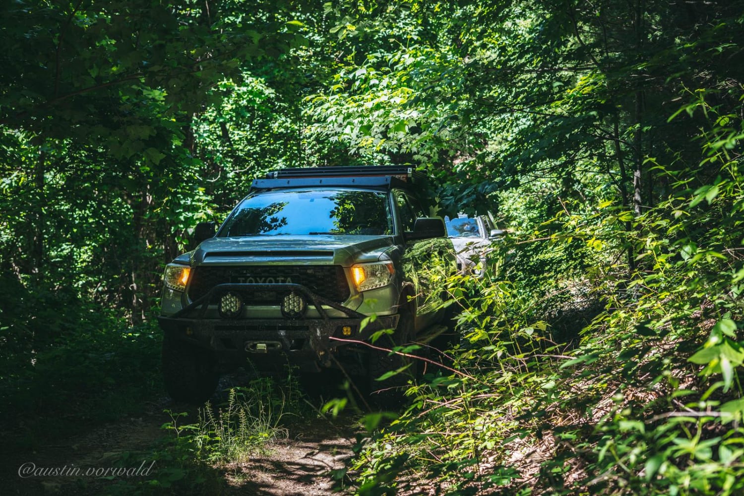
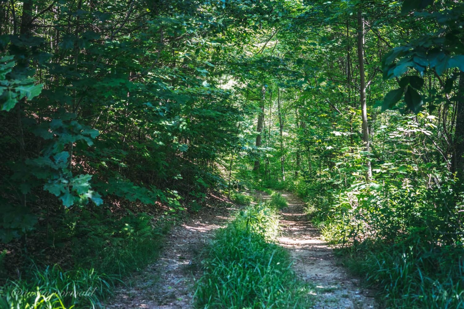
Trail Overview
Relatively easy trail with no serious obstacles, but the route is very overgrown and only one vehicle wide. If you drive a full-size vehicle, prepare for scratches on the vehicle. If you look at a map of Bush Head Gap Road, the map will show that the trail is 1-2 miles longer than shown. However, the forest service put a large berm 2/3 of the way down the trail, making it impassible. Bush Head Gap Road has a camping spot at the end of the trail and a small spot at Hudson Gap. These spots look to have little use other than the occasional backpacker from Benton Mackaye Trail. This trail makes a great detour for a short exploration off the Georgia Traverse.
Photos of Bush Head Gap Road
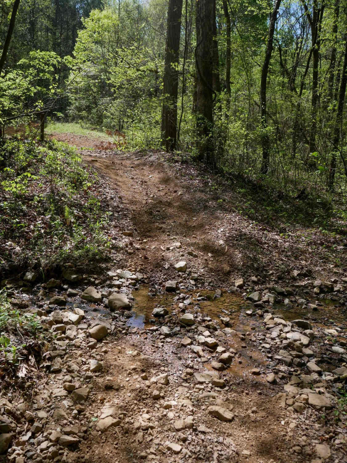
Difficulty
Only one steep section with small rock ledges (pictured).
Status Reports
Bush Head Gap Road can be accessed by the following ride types:
- High-Clearance 4x4
- SUV
- SxS (60")
- ATV (50")
- Dirt Bike
Bush Head Gap Road Map
Popular Trails
Pinhoti Horse Alternative
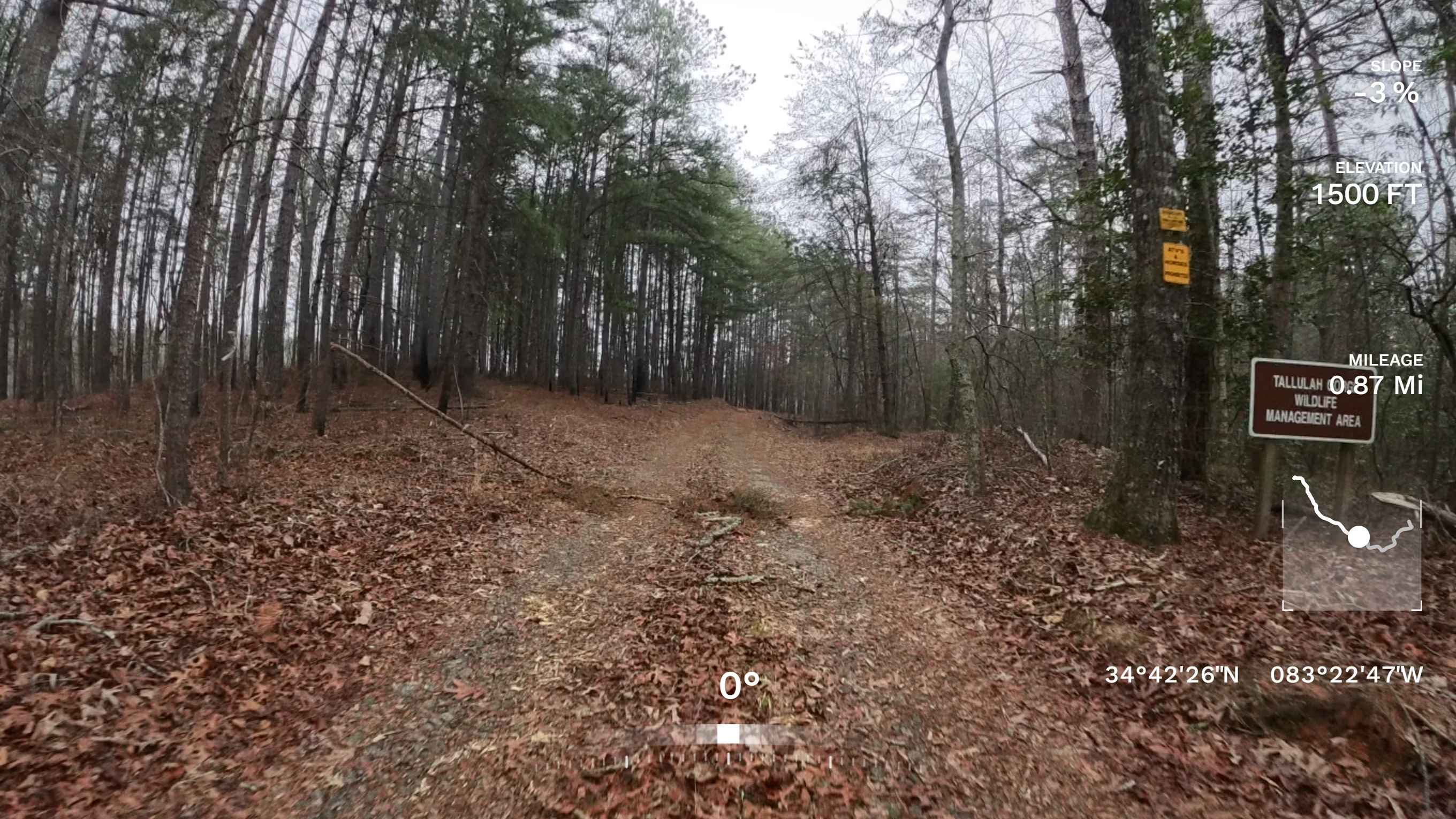
Tallulah Gorge WMA - 1597
East Entrance Trail

Dry Creek Branch C - Forest Road 226C
The onX Offroad Difference
onX Offroad combines trail photos, descriptions, difficulty ratings, width restrictions, seasonality, and more in a user-friendly interface. Available on all devices, with offline access and full compatibility with CarPlay and Android Auto. Discover what you’re missing today!