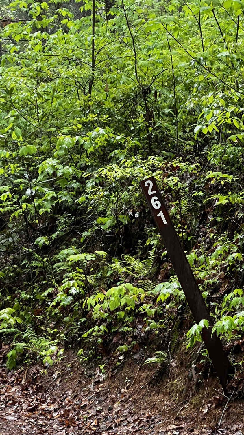
Burnette Creek FS Road 261
Total Miles
3.3
Technical Rating
Best Time
Spring, Summer, Fall, Winter
Trail Type
Full-Width Road
Accessible By
Trail Overview
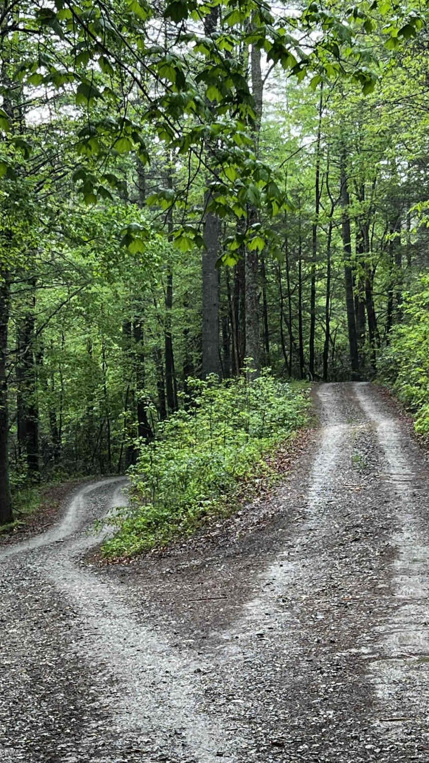
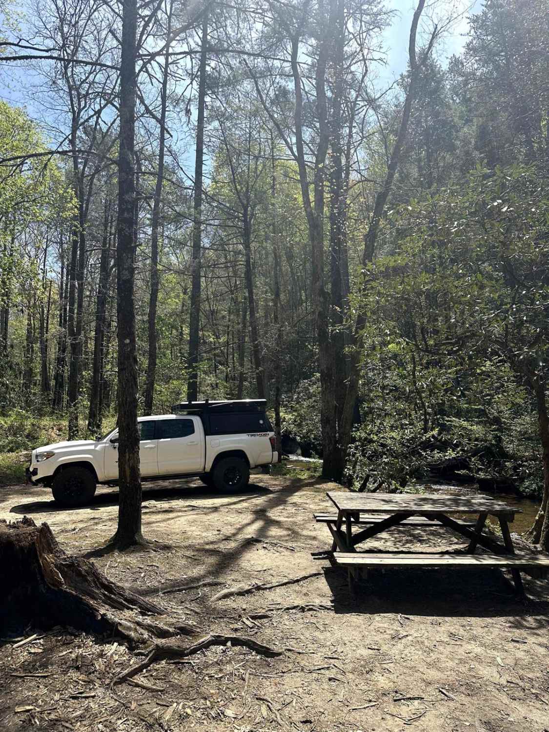
This trail offers a few great camping sites and plenty of pinstriping toward the end for those looking to get adventurous. It is accessible from the north via Duncan Ridge (always open) then south a little via FS Road 33A (seasonally open from 3/15-1/1), or other seasonal roads to the south leading to FS Road 33A. When approaching from the south of the trailhead, stay to the right and drive uphill for this seasonally open trail. The trail starts with a gentle winding climb on an all-gravel, well-maintained, and graded road. The trail is one lane with wide-open vegetation. Almost halfway through the trail is a very large, dispersed campground with room for a good number of vehicles to park and a few fire pits. The last fifth of the trail begins with a split in the road. To the left is a roundabout/potential campsite with a closed gate on the right. The official trail continues to the right. Note there is not much room to turn around after the road splits, so once you continue from here, it is a commitment. As you continue down the trail from here, it is a downward slope where the vegetation begins to close in tighter to the point of absolute pinstriping on both sides and the roof. It appears this back part of the trail was a part of the wildfires in 2023 and has a lot of leftover burned and downed trees. Expect to find several trees fallen across this section of the trail. The good news is most trees are very thin and can be easily moved by hand as they are small and easily released from the ground. The trail ends with a larger tree down right in front of a dead end. Before the downed tree, there is a small turnaround spot on the right. This trail is seasonally open from 3/15-1/1 and is part of the Chattahoochee National Forest in the Blue Ridge Ranger District. The status of this and other trails can be found on the FS website here: https://www.fs.usda.gov/recmain/conf/recreation. Links include information on passes, day rates, and an interactive map to check on trail status. On the interactive map page, you can also access the Google Map of the FS trails for real-time status and trail information. This trail is not considered part of the GA OHV trails, which require a special pass. Depending on the activity you'd like to do on this trail or before/after, a pass could be required. The Chattahoochee-Oconee National Forest accepts a few different passes including National Forest Annual Passes. Note that most activities in the area do not require a day rate, but check the website for updated information.
Photos of Burnette Creek FS Road 261
Difficulty
The front half of this trail is well-maintained and easy to navigate on the gravel road. The second half of the trail is not as maintained and can become a little more of a challenge to navigate around the overgrown vegetation and potentially downed trees. During the winter months when the vegetation dies off, it may be more accessible.
Status Reports
Burnette Creek FS Road 261 can be accessed by the following ride types:
- High-Clearance 4x4
- SUV
- SxS (60")
- ATV (50")
- Dirt Bike
Burnette Creek FS Road 261 Map
Popular Trails

Stanley Gap - FSR 338
Bob Creek - FS 292

Tallulah River Trail - FR 70
The onX Offroad Difference
onX Offroad combines trail photos, descriptions, difficulty ratings, width restrictions, seasonality, and more in a user-friendly interface. Available on all devices, with offline access and full compatibility with CarPlay and Android Auto. Discover what you’re missing today!