Off-Road Trails in New Mexico
Discover off-road trails in New Mexico
Learn more about Smooth Sailing
Smooth Sailing
Total Miles
10.1
Tech Rating
Easy
Best Time
Spring, Summer, Fall, Winter
Learn more about South Baldy Road
South Baldy Road
Total Miles
7.7
Tech Rating
Easy
Best Time
Spring, Summer, Fall
Learn more about South Canyon Rd.
South Canyon Rd.
Total Miles
3.5
Tech Rating
Easy
Best Time
Winter, Fall, Summer, Spring
Learn more about South Canyon Rd.
South Canyon Rd.
Total Miles
3.5
Tech Rating
Easy
Best Time
Winter, Fall, Summer, Spring
Learn more about South Pipeline Road
South Pipeline Road
Total Miles
7.3
Tech Rating
Easy
Best Time
Summer, Spring, Fall, Winter
Learn more about Southern Circle
Southern Circle
Total Miles
19.2
Tech Rating
Easy
Best Time
Winter, Fall, Summer, Spring
Learn more about Southern Crossing
Southern Crossing
Total Miles
2.4
Tech Rating
Moderate
Best Time
Spring, Fall, Winter
Learn more about Sparky's Loop
Sparky's Loop
Total Miles
21.4
Tech Rating
Moderate
Best Time
Spring, Fall, Winter
Learn more about Spook to Monument Hill Loop
Spook to Monument Hill Loop
Total Miles
5.9
Tech Rating
Moderate
Best Time
Spring, Summer, Fall, Winter
Learn more about Springtime
Springtime
Total Miles
22.3
Tech Rating
Easy
Best Time
Spring, Summer, Fall, Winter
Learn more about Squeeze Canyon
Squeeze Canyon
Total Miles
0.5
Tech Rating
Difficult
Best Time
Spring, Summer, Fall, Winter
Learn more about St. Peters Dome Wilderness Exploration Route
St. Peters Dome Wilderness Exploration Route
Total Miles
19.1
Tech Rating
Easy
Best Time
Spring, Summer, Fall, Winter
Learn more about Strozzi Road FS505
Strozzi Road FS505
Total Miles
6.3
Tech Rating
Easy
Best Time
Spring, Summer, Fall, Winter
Learn more about Sulphur Springs Road
Sulphur Springs Road
Total Miles
2.1
Tech Rating
Easy
Best Time
Spring, Summer, Fall
Learn more about Swingle Canyon FS62
Swingle Canyon FS62
Total Miles
7.9
Tech Rating
Easy
Best Time
Spring, Summer, Fall, Winter
Learn more about SXS/ATV Test Your Skills Trail
SXS/ATV Test Your Skills Trail
Total Miles
1.2
Tech Rating
Moderate
Best Time
Spring, Summer, Fall, Winter
Learn more about T Bar T
T Bar T
Total Miles
4.2
Tech Rating
Moderate
Best Time
Spring, Summer, Fall, Winter
ATV trails in New Mexico
Learn more about 1000 Mile Canyon - FS 9216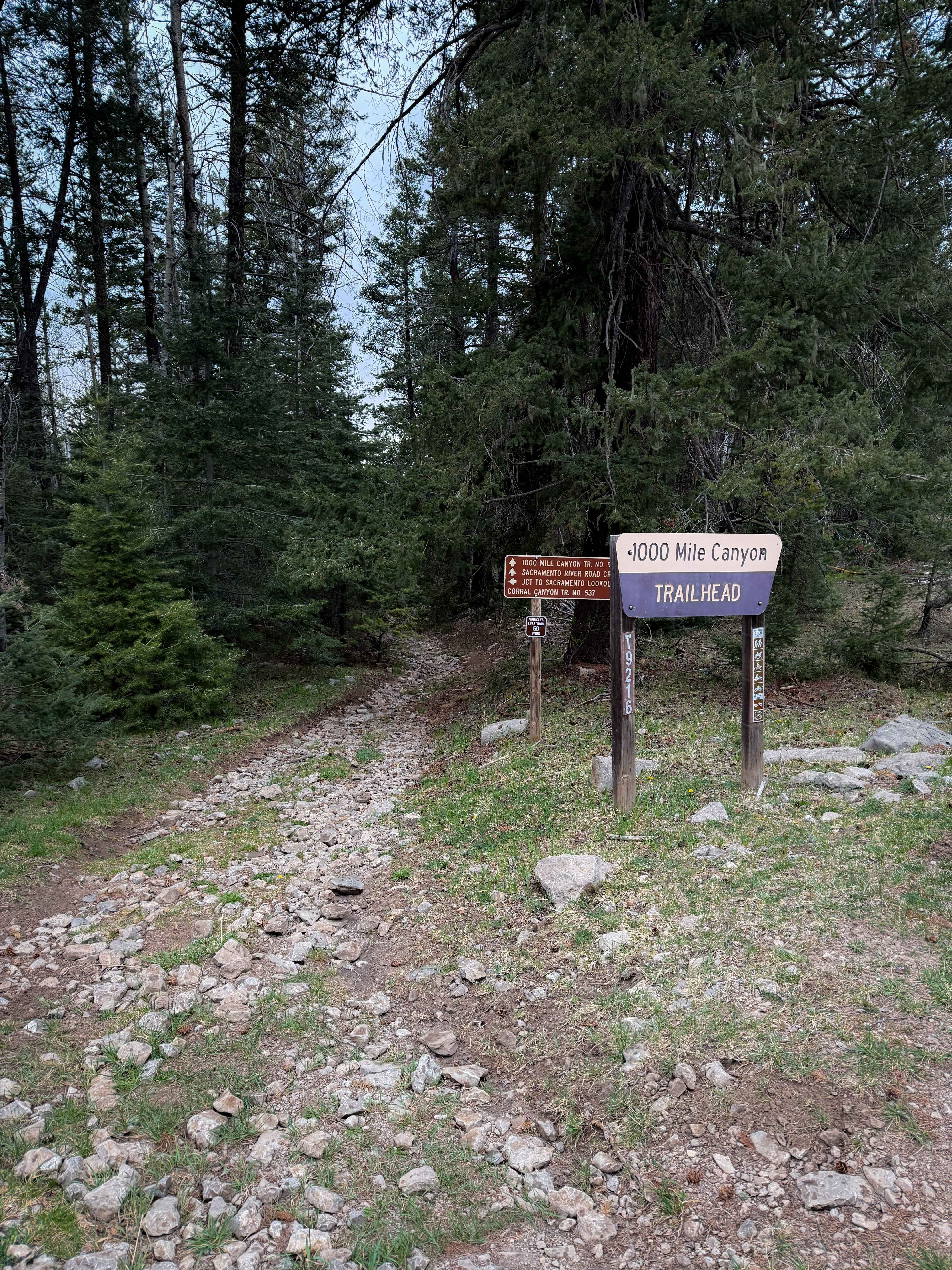
1000 Mile Canyon - FS 9216
Total Miles
1.5
Tech Rating
Moderate
Best Time
Summer, Spring, Fall
Learn more about 2nd Chance
2nd Chance
Total Miles
0.2
Tech Rating
Difficult
Best Time
Summer, Fall, Winter, Spring
Learn more about 3 Stooges
3 Stooges
Total Miles
0.1
Tech Rating
Difficult
Best Time
Spring, Summer, Fall, Winter
UTV/side-by-side trails in New Mexico
Learn more about 2nd Chance
2nd Chance
Total Miles
0.2
Tech Rating
Difficult
Best Time
Summer, Fall, Winter, Spring
Learn more about 3 Stooges
3 Stooges
Total Miles
0.1
Tech Rating
Difficult
Best Time
Spring, Summer, Fall, Winter

The onX Offroad Difference
onX Offroad combines trail photos, descriptions, difficulty ratings, width restrictions, seasonality, and more in a user-friendly interface. Available on all devices, with offline access and full compatibility with CarPlay and Android Auto. Discover what you’re missing today!