
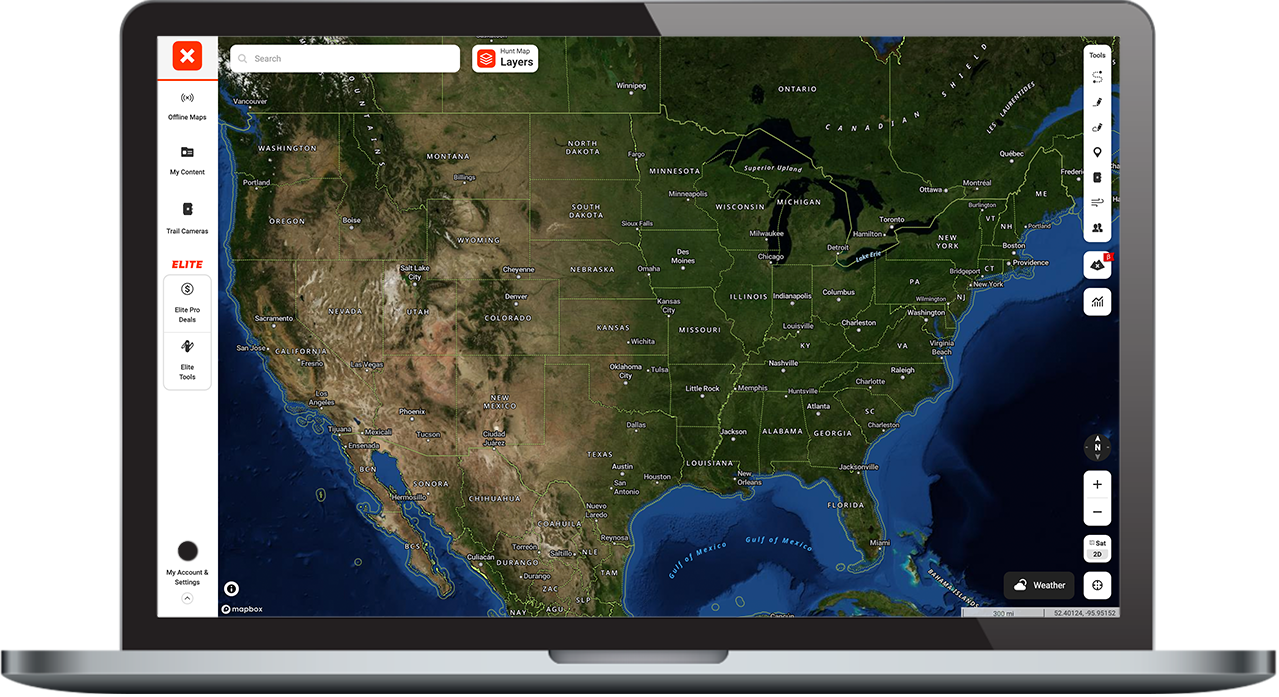
onX Hunt Desktop
Take in the “big picture” and view terrain in greater detail on your computer.
See the Bigger Picture
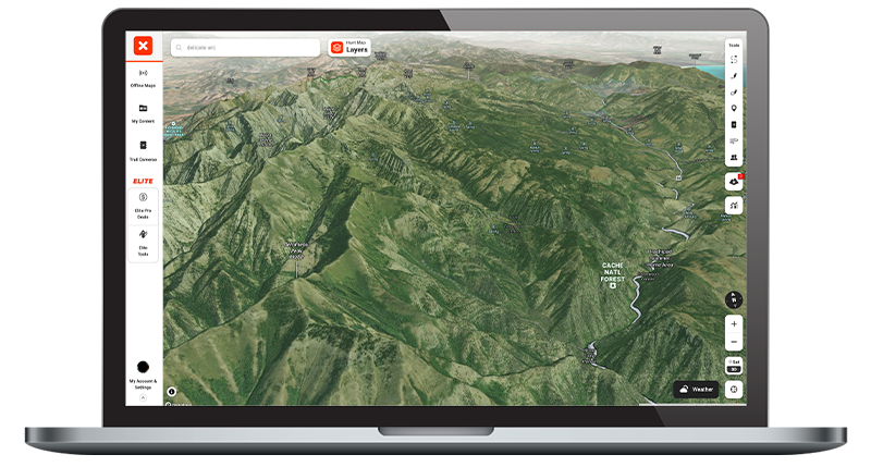
The ultimate e-scouting tool, the desktop Web Map makes viewing maps on your computer easy, letting you take in the “big picture” of the landscape and formulate a plan for success in the field.
onX Hunt Desktop Breakdown
Larger Screen for Detailed E-Scouting + Planning
Take advantage of your computer’s larger screen to plan complex trips, analyze terrain, and e-scout new areas more effectively. onX Hunt on your computer is ideal for pre-trip planning when more precision is needed, and for seeing the broader landscape on a bigger screen.
Only With 
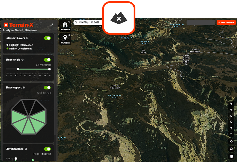
Access TerrainX
TerrainX gives you the ability to hone in on specific slope angles as well as slope aspects such as north-facing, south-facing, and more. You can also dive into and plan around specific elevation bands for those early and late season hunts.
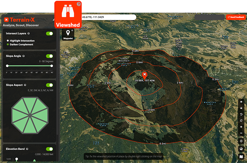
Viewshed
Finding glassing knobs has never been easier. Use the Viewshed Tool to visualize what can be seen from any point on the map. Once enabled, the Viewshed will follow your cursor. Areas of the map that are visible from the location of the Viewshed are highlighted on the map, allowing you to visualize what terrain you’ll be able to see from any given location.
Seamless Connectivity
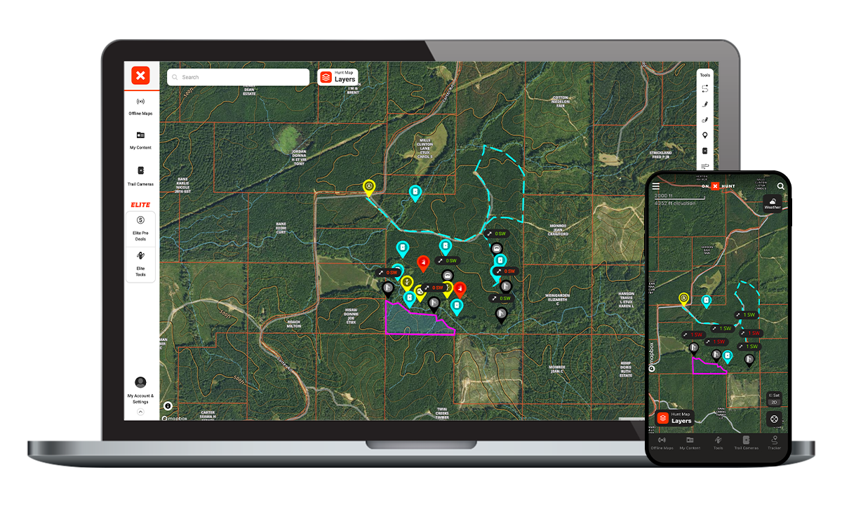
Everything you plan—every Waypoint, Line Distance, and Area Shape you add to your map on desktop—will automatically sync to the onX Hunt App to bring all your e-scouting plans right to your phone.
Use the larger screen of your computer to plan and explore terrain details, and rest assured your research will be reflected on your phone in the Hunt App.
One of my best scouting tools is onX on desktop. In the field, the phone app is king, but at home doing the in-depth work on the computer is super beneficial. You’re able to get a broader map field of view, which directly translates to a better perception of what the deer are doing on the landscape.
– KC Smith, The Element
Expand Your E-Scouting
Take your e-scouting to the next level with onX Hunt on your computer.
The Most Powerful 3D Mapping Solution
Below is an interactive map sample. Log in or create an account to gain full functionality.
Frequently Asked Questions
Yes, you can access onX Hunt on your laptop or desktop computer by logging into your account through a web browser, giving you access to the same tools and capabilities available on mobile.
Yes, Waypoints, Tracks, Routes, Areas, and other map content sync automatically across devices. Note that downloaded Offline Maps and toggled Map Layers are device-specific, so you will need to manage those separately on each device.
Yes, TerrainX and Viewshed are only available on desktop and are exclusive to Elite subscribers.
TerrainX lets you filter by specific slope angles, slope aspects, and elevation bands, making it easier to plan hunts around terrain features for early and late season trips.
The Viewshed tool highlights all terrain visible from any point on the map as you move your cursor, making it easier to identify ideal glassing locations before you head into the field.
The larger screen allows you to analyze terrain, plan complex trips, and view the broader landscape with more precision, which is especially helpful during pre-trip planning.
No, the desktop Web Map is browser-based, so you only need to log into your onX Hunt account through a supported web browser to get started.