What Are Basemaps?
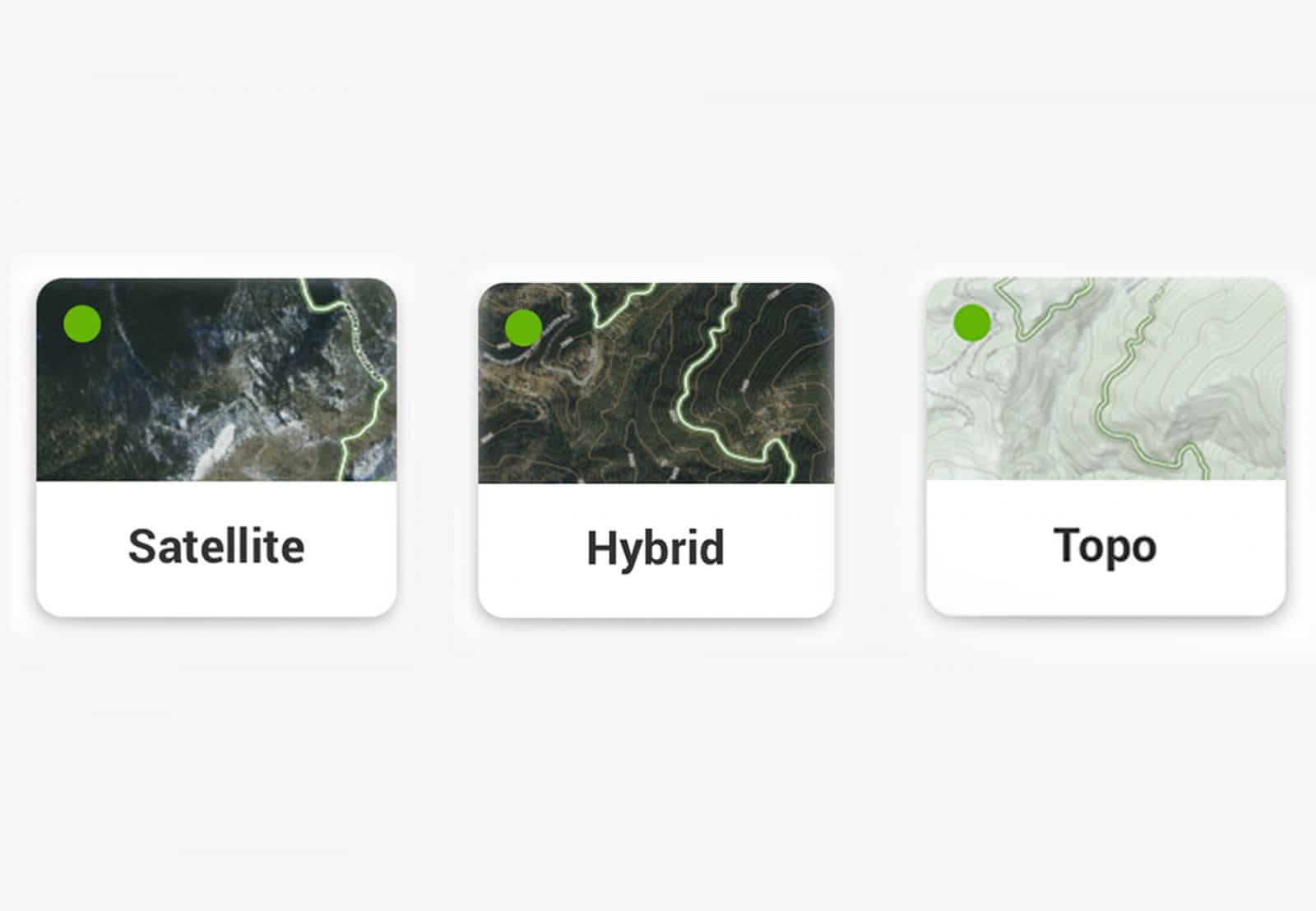
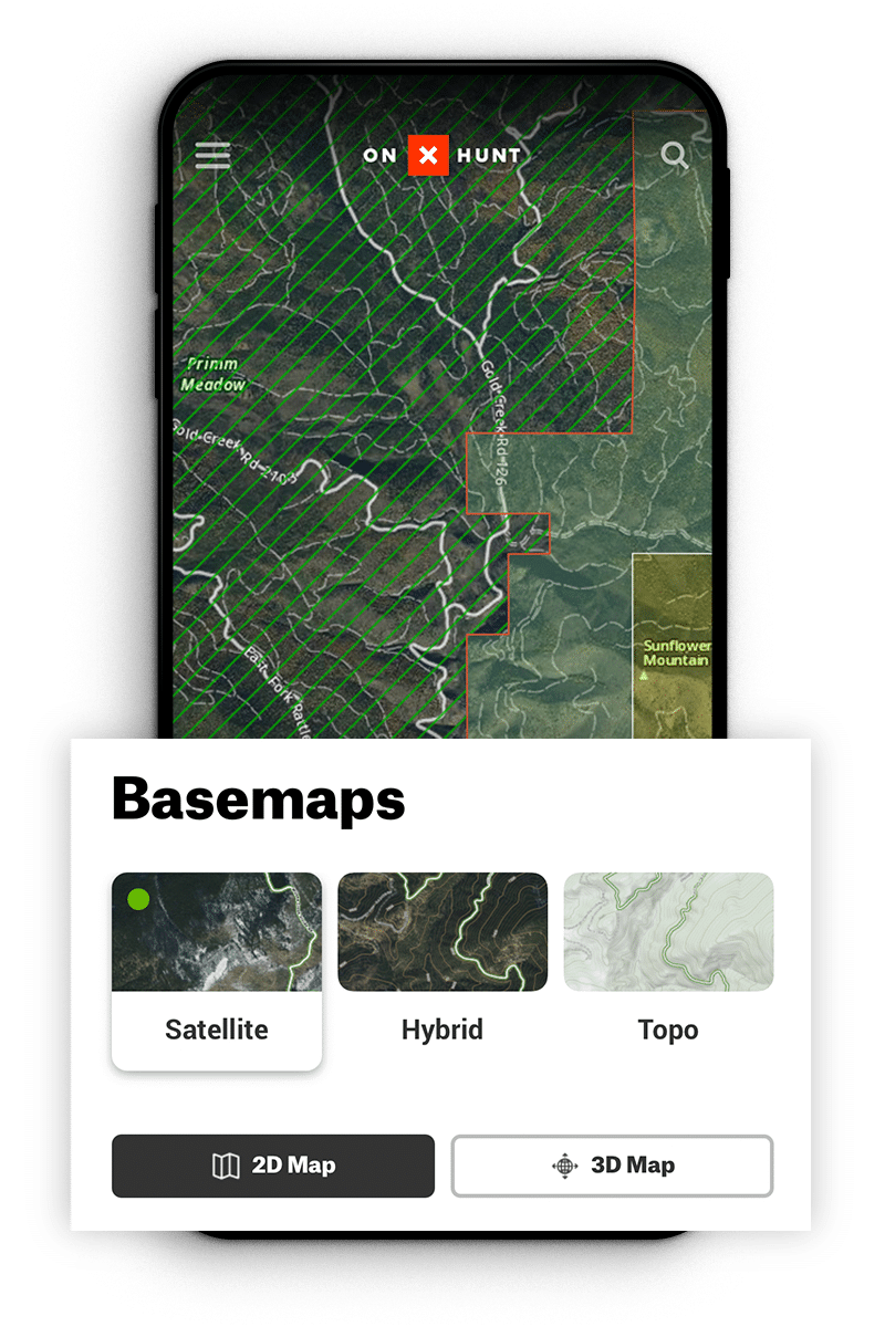
Basemaps are the reference maps shown on onX Hunt. They are the foundation on which our 400+ layers are displayed. onX Hunt has three different Basemaps you can choose: Satellite, Topo, or Hybrid.
Why Multiple Basemaps?
Different views offer different advantages when scouting and in the field. By selecting the right map for your needs with Satellite, Topo, or Hybrid to highlight real-world images, traditional topographic lines, or both, you can get the best view for the moment as well as swap views to make the most of additional markups and layers you’ve added to your own map.
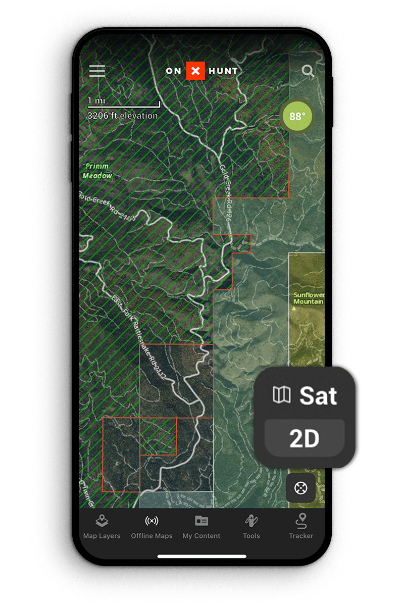
How To Choose Different Basemaps
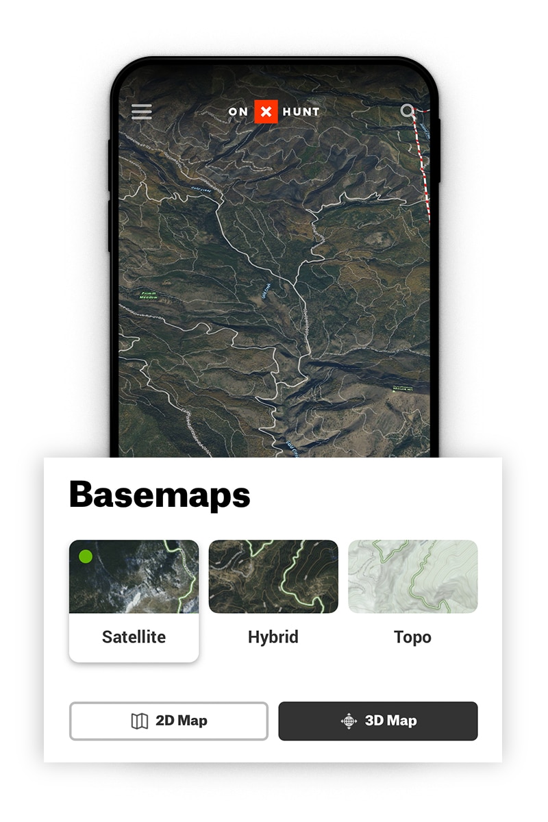
What Is a Satellite Basemap?
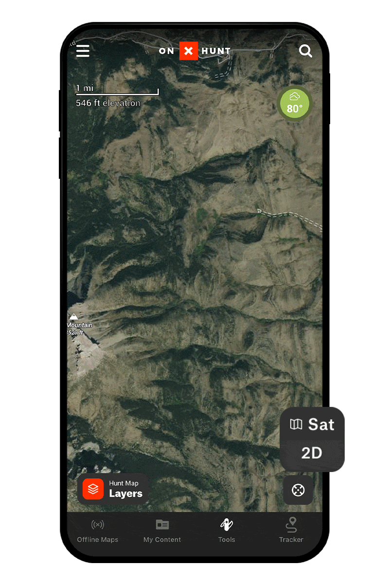
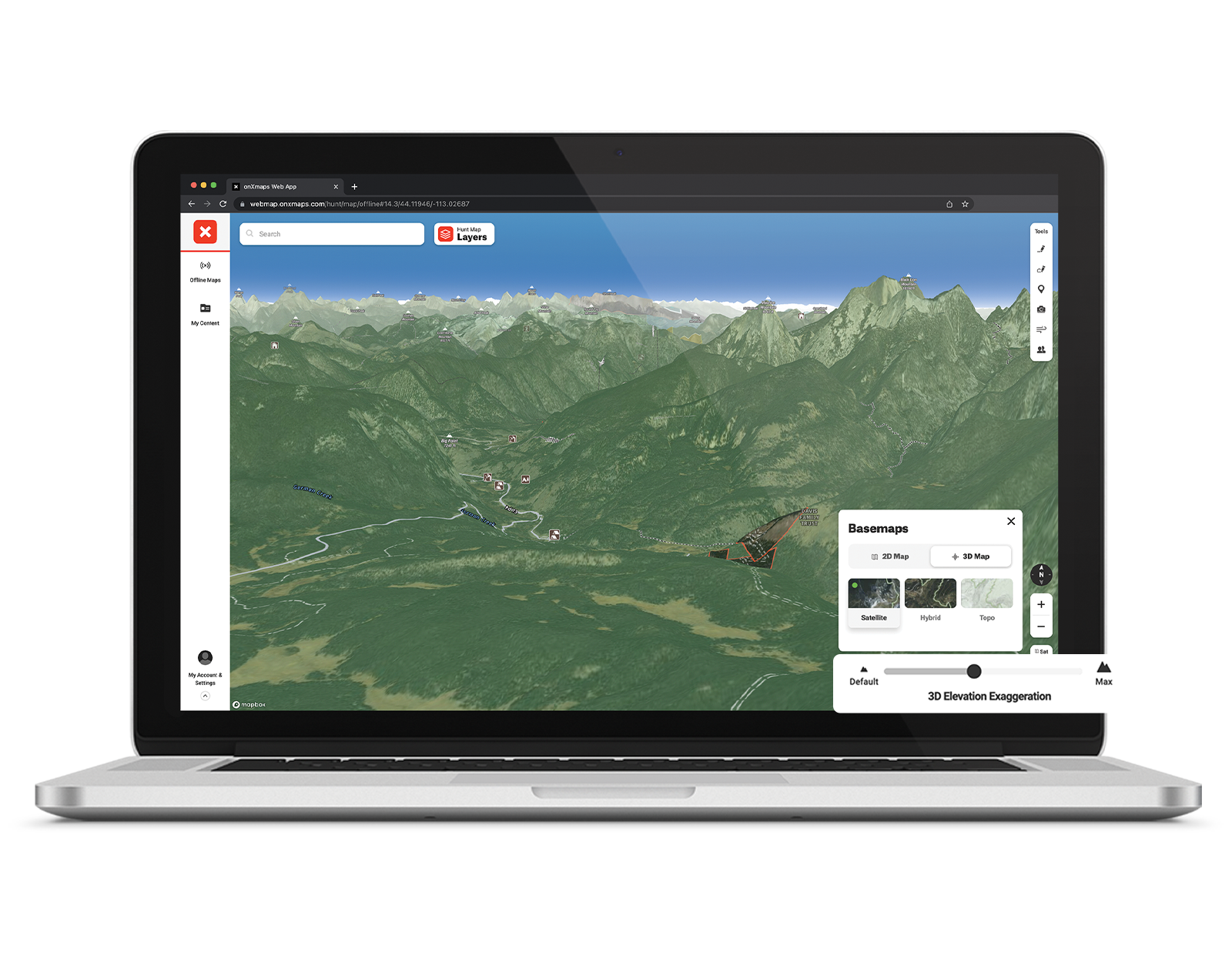
The Satellite Basemap is an aerial perspective of the terrain. It is particularly useful for identifying major natural features as well as road and trail systems.
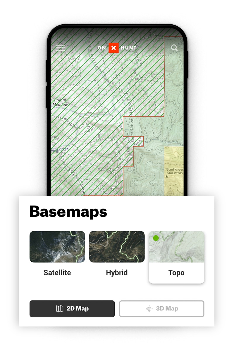
What Is a Topo Basemap?
The Topo Basemap is a 1:24k topographic map that is a two-dimensional representation of a three-dimensional landscape. onX builds its Topo Basemap in-house. They are particularly useful for visualizing elevation gains and contours of the land you plan to hunt.
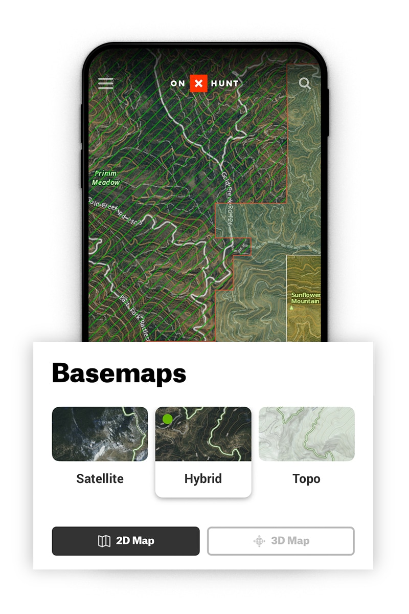
What Is a Hybrid Basemap?
A Hybrid Basemap is a combination of the Satellite and Topo Basemaps. It features aerial imagery and contour lines, giving you the best representation of the landscape. The topography scale on the Hybrid Basemap is 1:24k (1:25k in Alaska). At this scale, there is a 40-foot elevation change between topographic lines.
Learn about introduction to the map tools or see all of our app tutorials.
onX Hunt Basemaps FAQ
Most hunters prefer using the Hybrid Basemap for e-scouting areas before a hunt and for use in the field during a hunt. With the combination of aerial imagery and topographic contour lines, a hunter has the best picture of the landscape that might be encountered.
A 3D map is a landscape profile in three dimensions. It represents the scale of the actual environment and is useful for putting the real-world topography of a place in perspective.
Yes, Offline Maps allow you to view your saved maps without the need for cell service. All three Basemaps are saved, allowing you to toggle between different Basemaps on your saved Offline Map.
The satellite imagery may be different ages depending on location and zoom levels. Satellite imagery is intended to provide a general idea of the terrain, not necessarily to show current conditions on the ground.
Free users have access to the Satellite map view. To gain access to the Topographic and Hybrid Maps, as well as other essential mapping tools, Map Layers, and more, upgrade to a Premium or Elite Membership.