onX Hunt
App Tutorials
We’ve created a series of instructional guides and tutorials so you can get the most out of the onX Hunt App. From understanding the basics to applying detailed Layers and going Offline, it’s all here in our App Guide.

Getting Started
We’ve designed the Hunt App to be the most-reliable and user-friendly GPS hunting app available. Ready to get started?

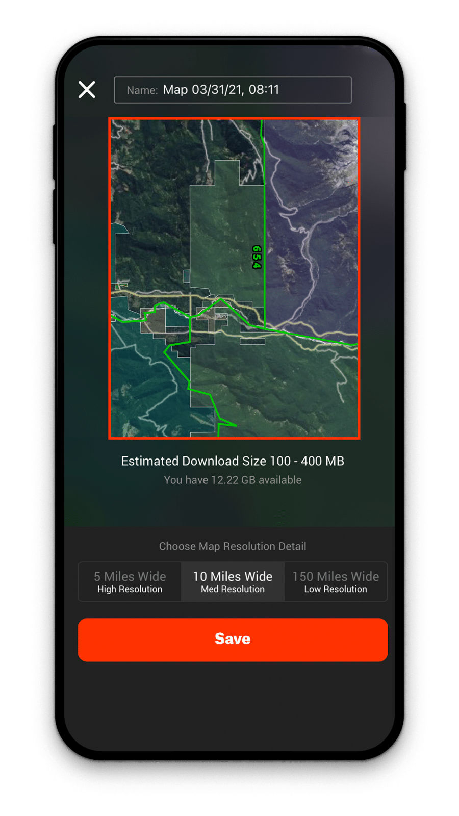
Offline Maps
onX Hunt makes it easy to download maps to your phone before heading into areas where cell service is spotty or nonexistent. These Offline Maps allow you to view your maps without the need for cell service.

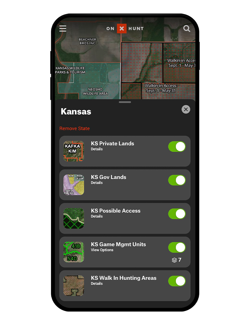
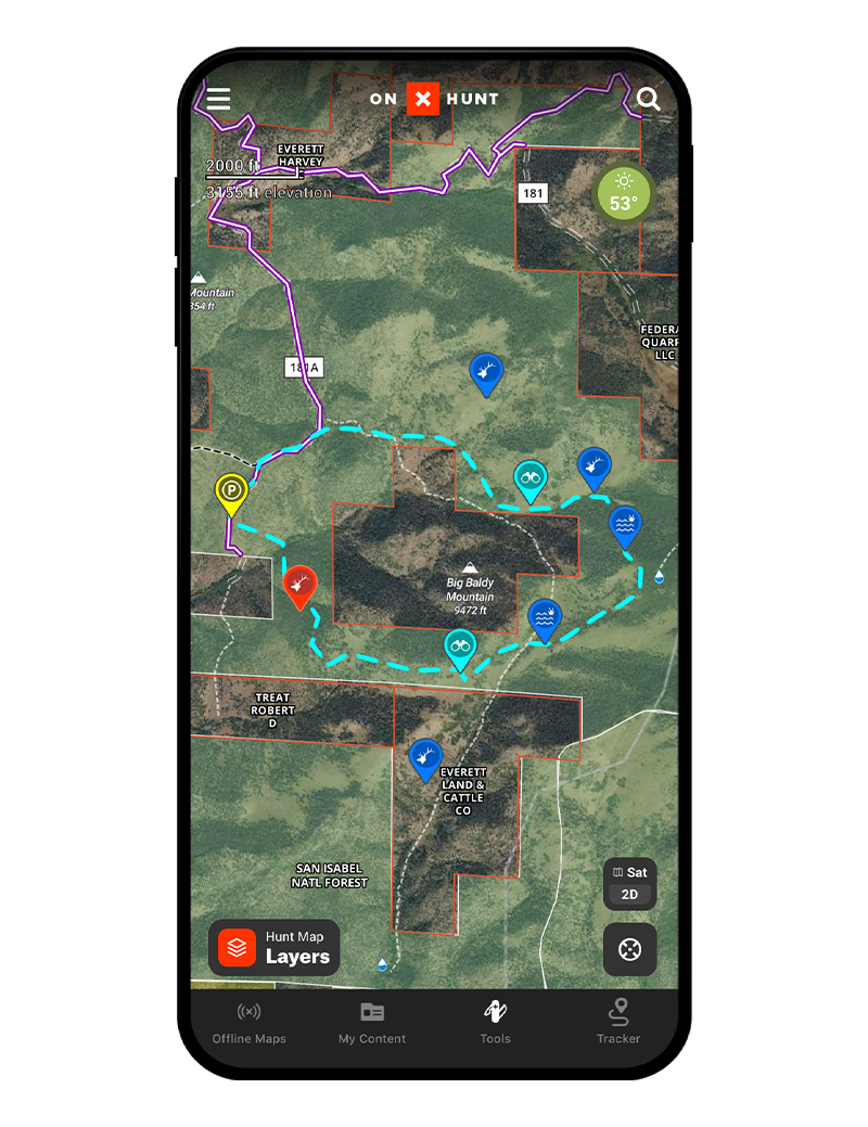
Layers
A Map Layer is simply an overlay on the map that shows land ownership boundaries, game management units, or hundreds of other options. Layers can be toggled on or off, and they can be used in tandem to view multiple layers of interest at the same time.

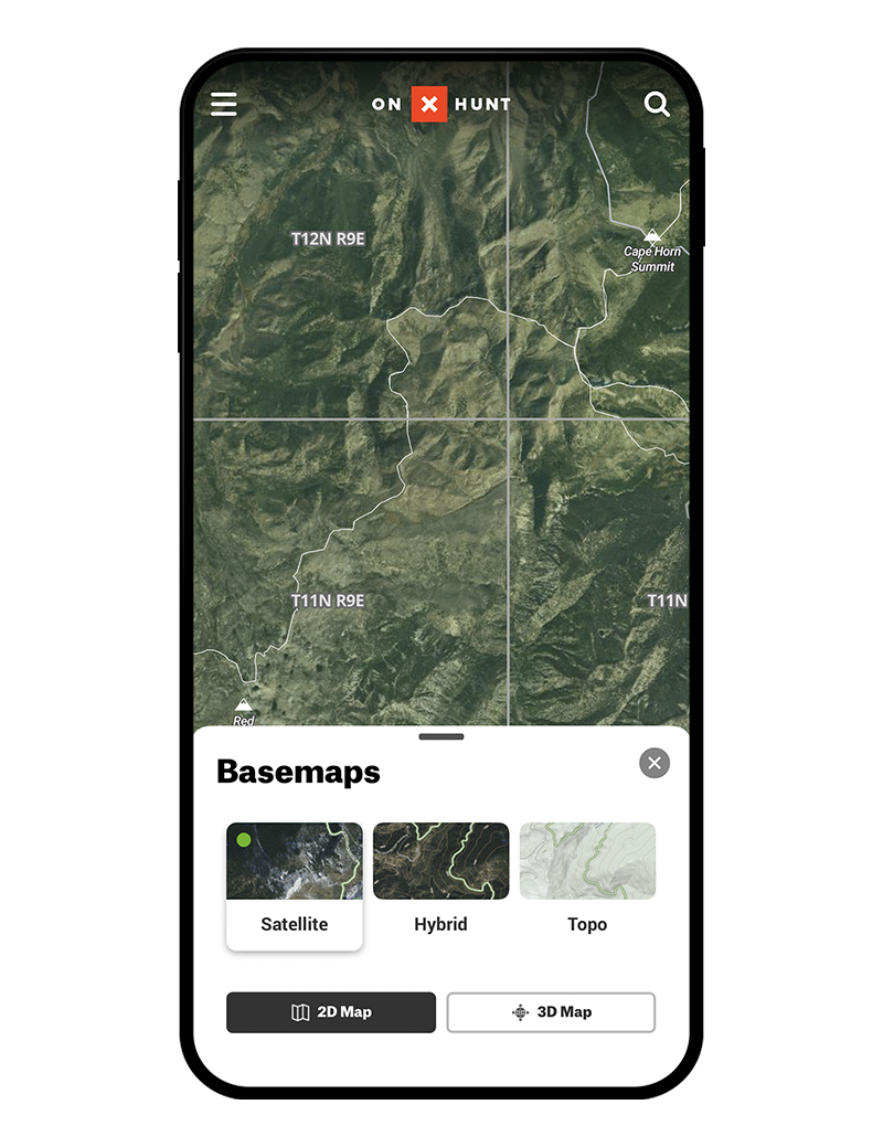
Basemaps
The building blocks of onX Hunt maps display the landscape in Satellite, Topo, and Hybrid views to make e-scouting and time in the field as productive as possible.

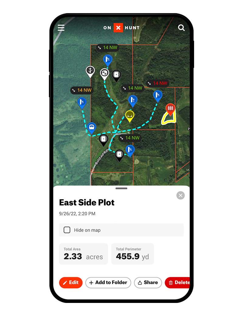
Map Tools
Map Tools are a collection of features that makes onX Hunt the most versatile hunting GPS app available. Map Tools include sorting and filtering your map content, Waypoints, Area Shapes, Line Distances, and Tracking.

The #1 GPS
Hunting App
985 million acres of public land
9,568 unique hunting units
421 map overlays and counting
2,000 game wardens approve