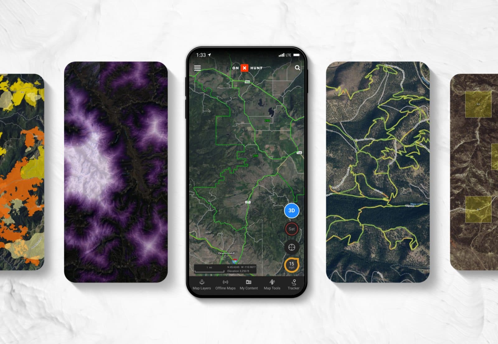
What Is a Map Layer?
A Map Layer is an overlay on the map that shows additional information, such as land ownership boundaries, game management units, or hundreds of other options. Layers can be toggled on or off, and they can be used in tandem to view multiple layers of interest at the same time.
Map Layers
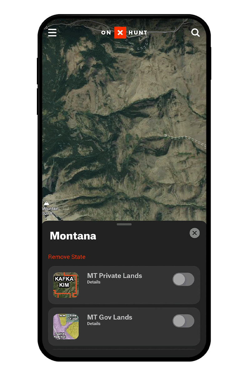
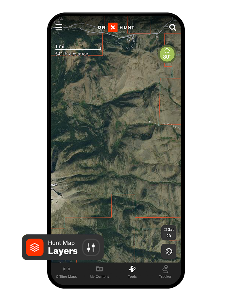
The Map Layers button contains all available Layers in one convenient place. Select the Map Layers button, then choose a Layer Collection (an individual state or Current Conditions, for example) to find your Layer of interest. Turn that Layer on, and you’ll see it added to your map.
Layers vs. Basemaps
While Layers function as overlays on the map, onX Hunt’s three Basemap options (Satellite, Topographic, and Hybrid) determine what the actual map looks like. Basemap options are detailed below.
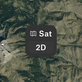
The Satellite Basemap shows detailed satellite imagery and is useful for viewing major natural features as well as extensive road and trail networks.
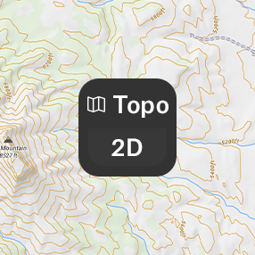
The Topo Basemap shows a two-dimensional representation of the earth’s three-dimensional surface and allows hunters to understand things that satellite imagery cannot address, such as how steep a terrain feature is or the elevation change between two points.
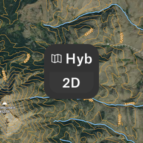
The Hybrid Basemap blends the Satellite and Topographic Basemaps by adding contour lines to satellite imagery. This reveals the true nature of a landscape and provides a hunter with the most comprehensive view of the land.
Layer Types
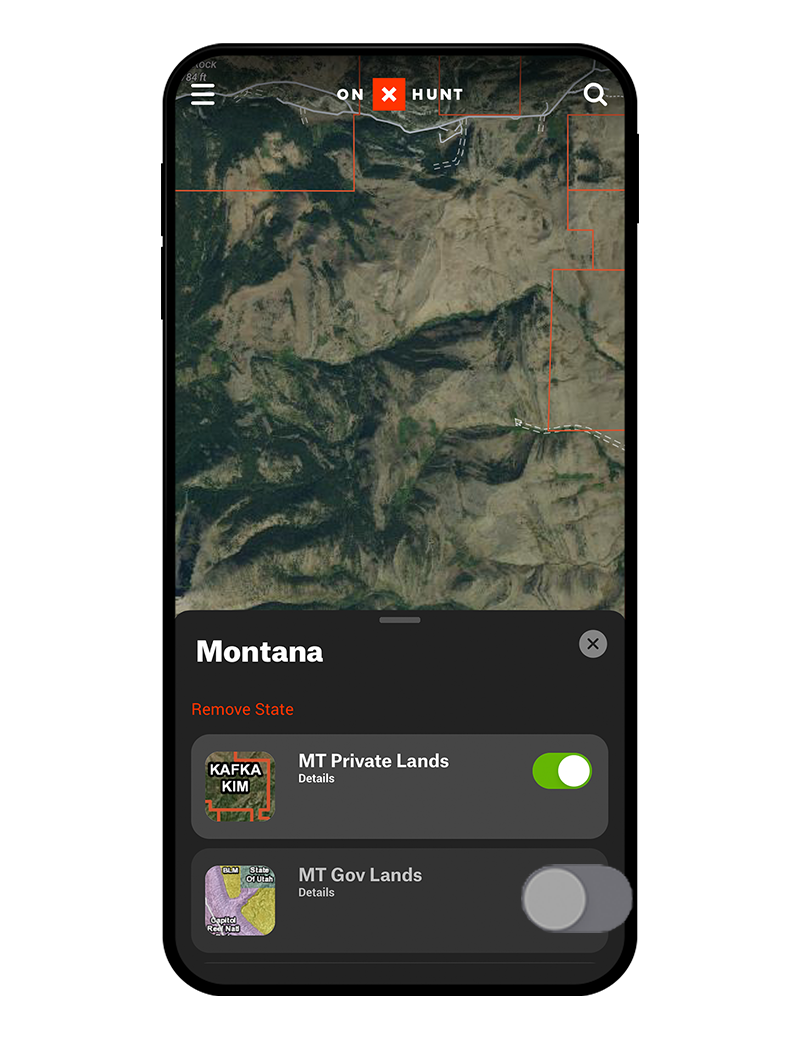
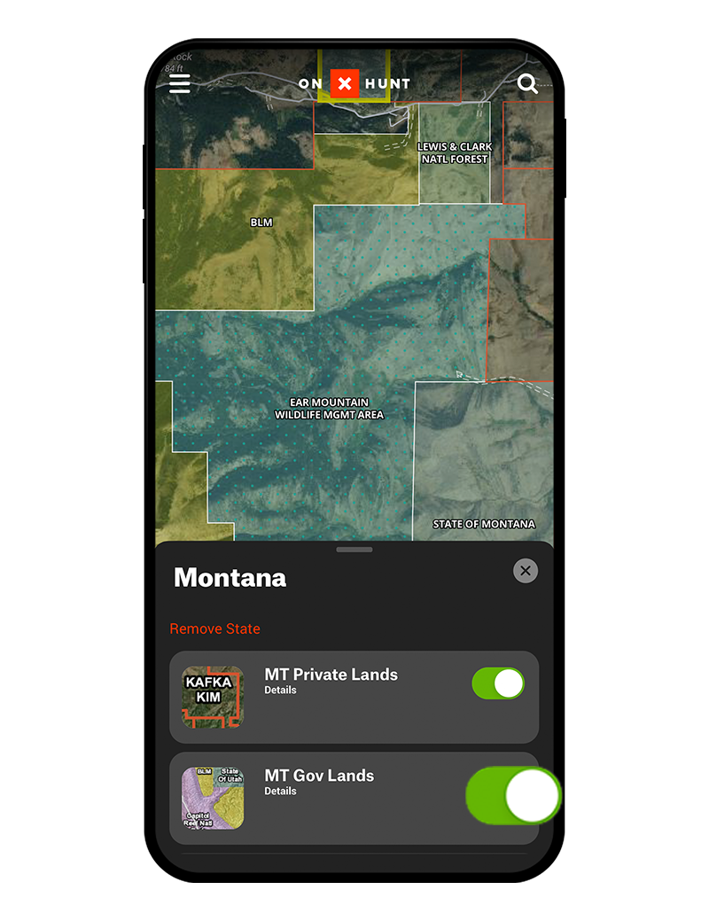
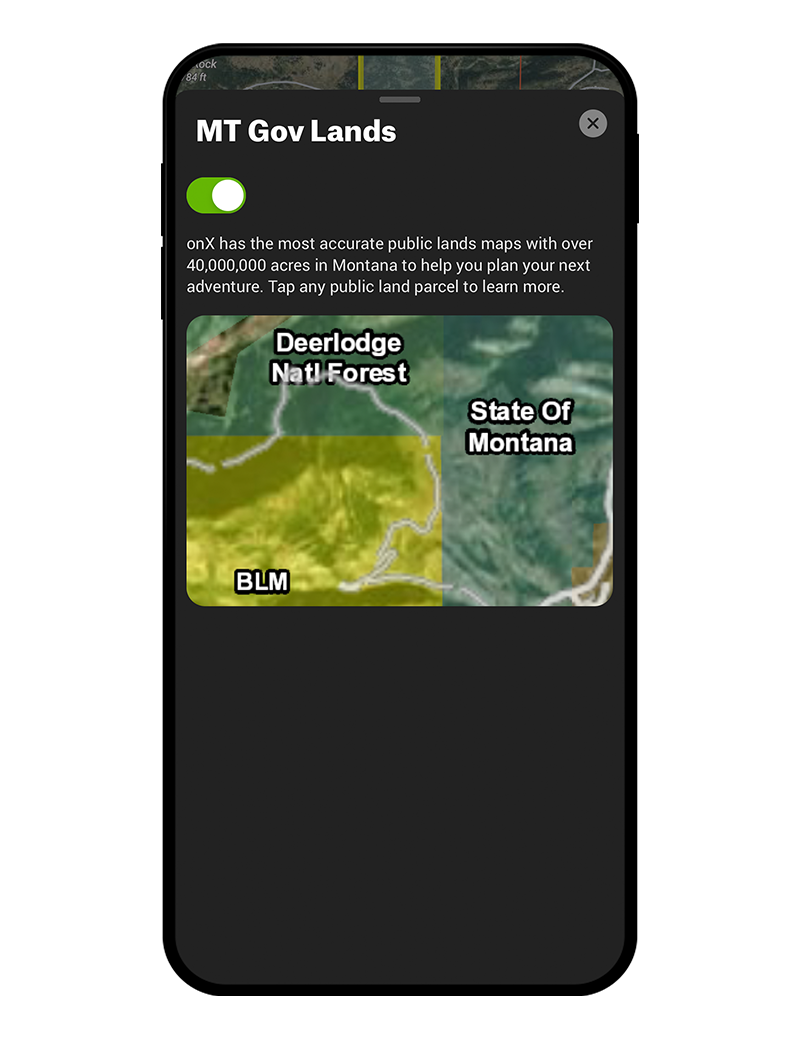
You’ll find property boundaries, landowner names, and state-specific hunting information. When planning a hunt or using your Offline Maps in the field, the state-specific Map Layers will make your hunt more productive and efficient.
Current Conditions Map Layers provide up-to-date information about conditions on the ground. View current wildfires and smoke forecasts, check air quality or precipitation radar, and see if CWD is spreading through an area.
The Land and Access Map Layers provide a few unique looks at the landscape. To better understand the lay of the land, check out the Slope Angle Layer. Additionally, view Fish and Wildlife Service lands or RMEF conservation projects.
In Roads, Trails, & Rec, you’ll find recreation sites and other points of interest as well as trails, trail mileages, and trail slopes. For that Georgia whitetail hunter on public land, this allows you to identify everything from good places to camp to fishing access sites to keep you busy during that midday lull.
Don’t miss this powerful layer collection. For some historical perspective, check out past timber cuts and burn areas. View the Crop Distribution Layer to see what’s been planted on agricultural land. Use the Tree Species Layers to pinpoint acorn-producing oaks or young aspen forests, and toggle the Soil Capability Layer on to understand the soil in any area.
Open Wildlife Map Layers to zero-in on your species of interest. From the Southern Rut Heat Map Layer to several layers including data from Boone and Crockett, you’re sure to learn something new about your target animal.
How To Turn On a Layer
Learn about the app’s basemaps feature or see all of our map tutorials.
onX Hunt Layer FAQ
Double-check that your layers of interest are, in fact, turned on. You’ll know that they’re turned on when the toggle next to the layer name is green.
Hunting zone information is found in state-specific Map Layers. Open “Hunt Map Layers,” scroll until you see your state, be sure that state is toggled on, tap into the state, and toggle on the relevant hunting zone-related Map Layer(s). You can find species information in “Hunt Map Layers,” too. Scroll to “Wildlife Layers” for more.
An onX Hunt Premium Membership provides access to all the Map Layers you need to hunt within a single state. To access state-specific Layers for another state, upgrade to a Premium Two-State or Elite Membership. Elite Memberships are available for an annual fee or a monthly subscription. If you have an Elite Membership and are unable to view Map Layers in a particular state, ensure that your state and layers of interest are turned on. You’ll know they’re on when the toggle next to the state name or layer is green.
Free users have access to the Satellite map view. To gain access to Map Layers and other advanced mapping tools, upgrade to a Premium or Elite Membership. Want to try before you buy? Start your 7-day free trial to customize your map with Map Layers such as Historic Wildfire, Air Quality, Public and Private Lands, Possible Access, Motorized Roads and Trails, Roadless Areas, and more.
onX Hunt is the most accurate GPS hunting app on the market. We source our data from county offices, federal agencies, and a number of private organizations. The Hunt App is trusted by game wardens and outfitters around the country, so you can trust that the information you see is correct.
To update your Hunt App, head to the App Store on Apple devices or the Google Play Store for Android phones. Find the App in the store and click the update button. You can also set your phone to automatically update when new product versions become available. Learn more here.
To view property lines, ensure that the Private Land Layer within your State Layer Category is turned on. If you are still unable to view property lines, ensure that you have an active Hunt App Membership.