
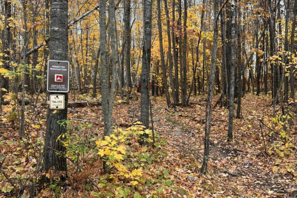
Off-Road Trails in Ontario
Discover off-road trails in Ontario
Off-Road Trails in Ontario
Discover the best off-road trails in Ontario. Browse trail maps, check difficulty ratings, and find your next adventure — whether you're looking for a quick ride or an all-day expedition.
Wildwood Trail/Partridge Trail
This ride can become three loops with the trails that split off from the main trail, with the ability to create one long ride north of Lakewood and Townsend. Tight twisty terrain flows throughout the forest. Ups and downs in elevation are the norm on this trail.
Learn more about Wildwood Trail/Partridge Trail
Atlanta Trail's - Center Loop
Atlanta Trail's - Center Loop is a 50-inch ORV trail that lends itself more towards a Motorcycle single track. The trail is generally an easy, well-burmed, flowing trail that has few obstacles and limited whoops. The catch comes for the wider machine riders that attempt this trail. The edges of the ...
Learn more about Atlanta Trail's - Center Loop
Tomahawk B Loop - Blackberry Ridge Section
Single track segment of Tomahawk B Loop Motorcycle only. This track travels through mostly wooded areas filled with tight and sometimes technical areas and then opens to a very overgrown area of Blackberry bushes. Riders beware! Proper protective riding gear is recommended as to avoid being cut by t...
Learn more about Tomahawk B Loop - Blackberry Ridge Section
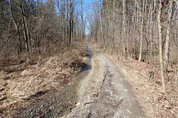
South Weldon Road
South Weldon Road Trail is another seasonal road. This trail is managed by the Traverse City Forest MGMT unit. This trail was great for a spring ride. I still could see this being an amazing ride in the fall. The trail was dry but we did go through an area that during heavy rain could flood.
Learn more about South Weldon Road
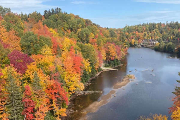
Old Bridge Overlook
Start the day at the CR 510 Old Bridge Overlook to check out the fall colors. Jump back on CR 510 to the trails and take UP 14/CR 510 then took CR GGA to CR GGB. This will bring you to Red Road/North Country Trail. This will bring you back to CR 510. The fall colors on this route are nothing short o...
Learn more about Old Bridge Overlook
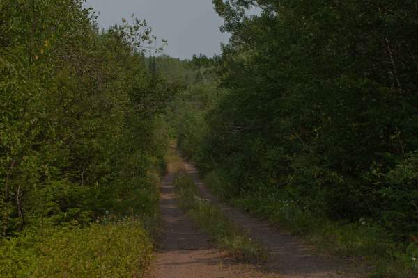
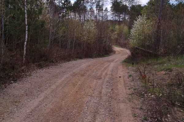
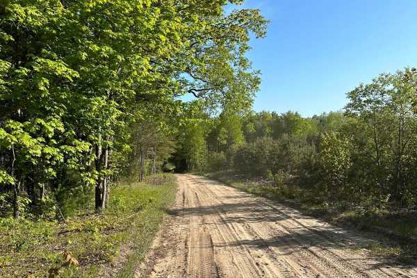
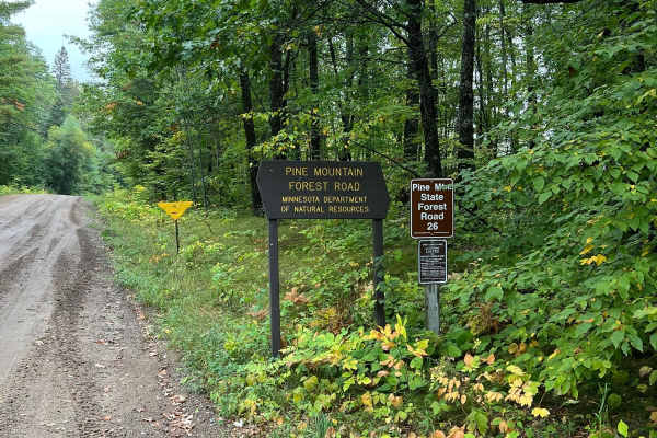
Pine Mountain Forest Road
A maintained gravel road with many spurs off of it. While the spurs can be narrow and heavily wooded, the main road is standard gravel with regular potholes and bumps, and wide enough to accommodate two lane traffic. There are several official forest service trails that fork off the main road, these...
Learn more about Pine Mountain Forest Road
West Hill Trail
This is a spur trail off Burnt Hill Road, this trail leads you into the western side of Finger Lakes National Forest. It drops you in a small clearing with a primitive campsite. If there has been any rain, there is a wet area with a solid base on the drive-in.
Learn more about West Hill Trail
Thompson Minimum Maintenance Forest Road
Typical narrow minimum maintenance forest road. Some areas of rough mud and gravel. Overall nothing to really be worried about even in a stock SUV. There may be extra water or down branches depending on the weather. Typically 1-2 cars wide or space to pull off to get around other vehicles. Pine Moun...
Learn more about Thompson Minimum Maintenance Forest Road
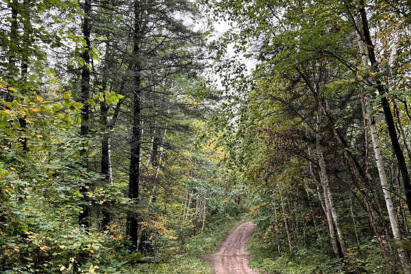
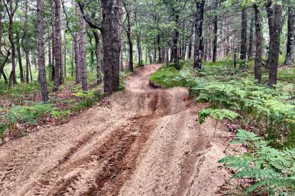
Spider Lake North State Forestry Rd
This is a smooth well maintained forest road with access to some small lakes and dispersed camping. This road continues on to connect with perch lake minimum maintenance forest road which has some other really pretty lakes and camping spots. The road is primarily sand and gravel and seems to be grad...
Learn more about Spider Lake North State Forestry Rd
Great Bear Trail
There are a variety of dirt, sand, and gravel routes through forest roads that span from this route. It winds along a few small lakes through Oconto County. The trail runs from Lakewood south through the mountain area and wraps up close to Boulder Lake with a few route alternatives if you want to ex...
Learn more about Great Bear Trail
Ward Hills Loop
This is all the trails and seasonal roads around Ward Hills. The main road into Ward Hills is accessed off of US10 in a large piece of Manistee National Forest. There are many different trails that spur off the main loop. If you are just doing the main loop you could realistically get it done in und...
Learn more about Ward Hills Loop
Cedar Creek Motorsport Trail (South Loop)
Cedar Creek terrain is flat to rolling with sandy soil and feels like a motocross track through the woods. The North loop is 10 miles long and the South loop is 14 miles long. The Northern loop is somewhat more difficult, as there are many sections where the sand is very deep. The Southern loop is ...
Learn more about Cedar Creek Motorsport Trail (South Loop)
St. Lawrence County - Connector ATV Multi-Use Trail
St. Lawrence County - Connector ATV Multi-Use Trail from GT's in Russell, NY to Parking Lot/Trailhead in South Colton. It is a mix between a little black top, Season roads, and Gravel Logging roads through state forests and hunting clubs. A few parts can get somewhat muddy. Most of the logging trail...
Learn more about St. Lawrence County - Connector ATV Multi-Use Trail
Black Lake North Loop
The Black Lake North Loop is a 50" ATV and motorcycle trail. The trail is mostly compacted sand and some black dirt. The trail flows through a number of clear-cut areas and selectively cut forest. The trail is tight in some sections with several large stumps on the edges. There are a few sections wh...
Learn more about Black Lake North Loop
Evart Motorcycle Trail
Evart Motorcycle Trail is located in the heart of Michigan's lower peninsula, just outside the small town of Evart. This trail runs a 22-mile North/South loop winding through a parcel of MI government land. Evart is often referred to by the Michigan dirt bike community as one of the most challenging...
Learn more about Evart Motorcycle Trail
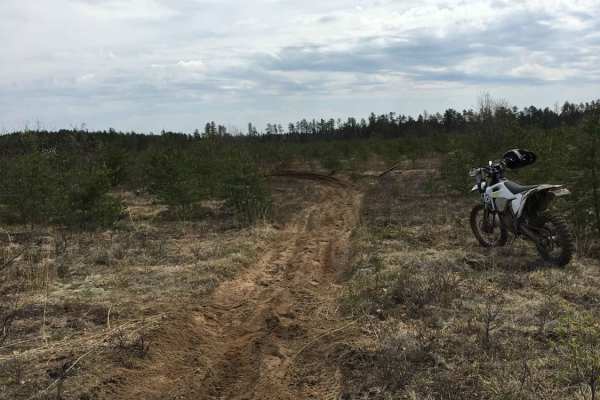
Geels South Loop
Geels South Loop is a fast paced 50" trail, roughly 25 miles long. It contains mostly shallow sand with some soft dirt, in the wooded sections. The trail is well maintained with intersections clearly marked. Geels South Loop is the perfect trail for day trip riders and for beginners trying to learn ...
Learn more about Geels South Loop
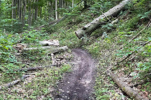
Paul Bunyan North Loop Saga
This is the longest single section of the dirt biking trail at Paul Bunyan State Forest. Though there are some small sections to hop off the trail, it's generally continuous. There are many inclines and declines throughout the trail with some large rocks and roots that typically cross the trail;they...
Learn more about Paul Bunyan North Loop Saga
Silver Creek
Silver Creek is a 50-Inch ORV trail located North of Newberry in the Upper Peninsula of Michigan. This is a black dirt trail with some sand. Silver Creek tends to be a tighter than most 50-inch trails, so when riding with wider vehicles take caution of the roots and stumps on both sides of the trail...
Learn more about Silver Creek
MCCCT - West 30 to West 38
MCCCT - West 30 Road to West 38 Road is a section of the 750-mile Michigan Cross Country Cycle Trail. This 8-mile section consists of a maintained 24-inch motorcycle trail. This section is a great representation of what Michigan trails have to offer. This section is a challenging piece of single tra...
Learn more about MCCCT - West 30 to West 38

Little "O" Motorsport Trail
Little "O" is a 50-inch ORV trail that lends itself more towards a Motorcycle single track. The Trail is generally a easy well burmed flowing trail that has few obstacles and limited whoops. The catch comes for the wider machine riders that attempt this trail. The edges of the trail are littered wit...
Learn more about Little "O" Motorsport Trail
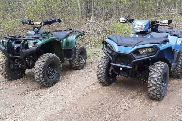
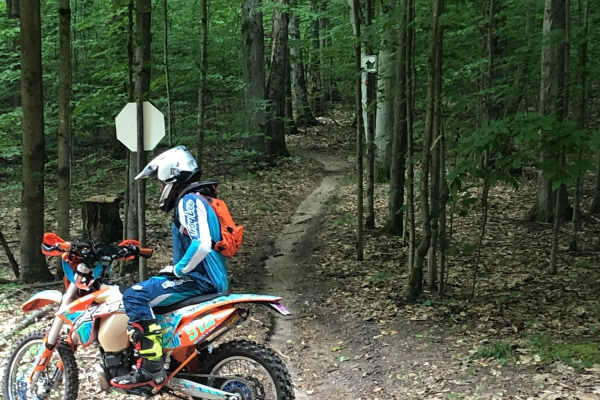
ATV trails in Ontario
Explore ATV-friendly trails in Ontario. These trails are accessible for vehicles up to 50 inches wide, perfect for ATVs and smaller off-road machines.
Wildwood Trail/Partridge Trail
This ride can become three loops with the trails that split off from the main trail, with the ability to create one long ride north of Lakewood and Townsend. Tight twisty terrain flows throughout the forest. Ups and downs in elevation are the norm on this trail.
Learn more about Wildwood Trail/Partridge Trail
Atlanta Trail's - Center Loop
Atlanta Trail's - Center Loop is a 50-inch ORV trail that lends itself more towards a Motorcycle single track. The trail is generally an easy, well-burmed, flowing trail that has few obstacles and limited whoops. The catch comes for the wider machine riders that attempt this trail. The edges of the ...
Learn more about Atlanta Trail's - Center Loop
Pine Mountain Forest Road
A maintained gravel road with many spurs off of it. While the spurs can be narrow and heavily wooded, the main road is standard gravel with regular potholes and bumps, and wide enough to accommodate two lane traffic. There are several official forest service trails that fork off the main road, these...
Learn more about Pine Mountain Forest Road
Thompson Minimum Maintenance Forest Road
Typical narrow minimum maintenance forest road. Some areas of rough mud and gravel. Overall nothing to really be worried about even in a stock SUV. There may be extra water or down branches depending on the weather. Typically 1-2 cars wide or space to pull off to get around other vehicles. Pine Moun...
Learn more about Thompson Minimum Maintenance Forest Road
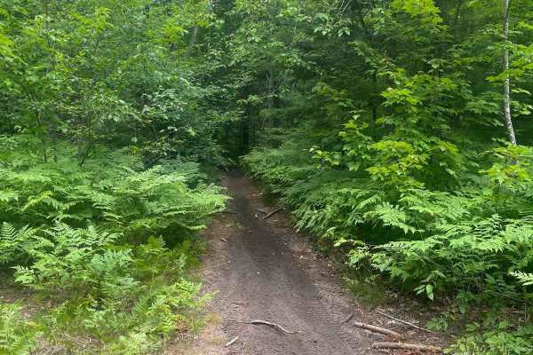
UTV/side-by-side trails in Ontario
Find UTV and side-by-side trails in Ontario. These trails accommodate vehicles up to 60 inches wide, ideal for UTVs, side-by-sides, and wider off-road rigs.
Wildwood Trail/Partridge Trail
This ride can become three loops with the trails that split off from the main trail, with the ability to create one long ride north of Lakewood and Townsend. Tight twisty terrain flows throughout the forest. Ups and downs in elevation are the norm on this trail.
Learn more about Wildwood Trail/Partridge Trail
Pine Mountain Forest Road
A maintained gravel road with many spurs off of it. While the spurs can be narrow and heavily wooded, the main road is standard gravel with regular potholes and bumps, and wide enough to accommodate two lane traffic. There are several official forest service trails that fork off the main road, these...
Learn more about Pine Mountain Forest Road
Thompson Minimum Maintenance Forest Road
Typical narrow minimum maintenance forest road. Some areas of rough mud and gravel. Overall nothing to really be worried about even in a stock SUV. There may be extra water or down branches depending on the weather. Typically 1-2 cars wide or space to pull off to get around other vehicles. Pine Moun...
Learn more about Thompson Minimum Maintenance Forest Road
Spider Lake North State Forestry Rd
This is a smooth well maintained forest road with access to some small lakes and dispersed camping. This road continues on to connect with perch lake minimum maintenance forest road which has some other really pretty lakes and camping spots. The road is primarily sand and gravel and seems to be grad...
Learn more about Spider Lake North State Forestry Rd
The onX Offroad Difference
onX Offroad combines trail photos, descriptions, difficulty ratings, width restrictions, seasonality, and more in a user-friendly interface. Available on all devices, with offline access and full compatibility with CarPlay and Android Auto. Discover what you're missing today!
Open Trail Map