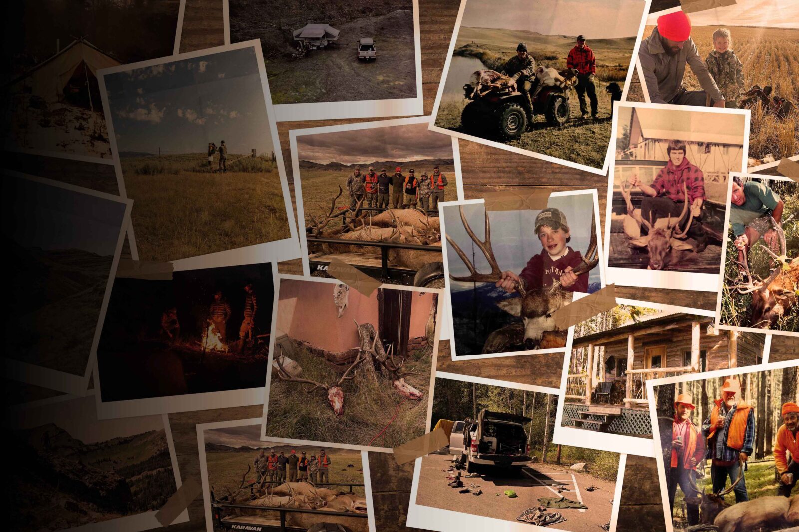
TL;DR: Colorado’s 2026 big game draw runs March 1–April 7, 2026, with results out May 26–29. Key changes include some OTC bull elk units moving to limited draw, multiple GMU restructures for elk, deer, and antelope, and select cuts to sheep and goat tags. Non-resident archery elk (V1A) moved to a draw in 2025, but with nearly every unit going leftover, tags remained easy to pick up, so don’t expect the new system to have thinned the crowd much. The biggest takeaway is for high point holders: Colorado’s point system shifts to a bonus + preference hybrid in 2028, so hunters sitting on points may consider burning them before half the tags go random.
What’s New in Colorado for the 2026 Draw
- 2nd and 3rd season over-the-counter rifle bull elk licenses in units 54, 55, and 551 are moving to a limited draw.
- GMUs 11, 12, 13, 23, 24, 131, 211, 231 are moving back to unlimited antlered bull elk licenses for 2nd and 3rd season.
- 1st and 4th rifle elk licenses in GMU 3, 4, 5, 301, 441, 214, and 14 will be moved to either-sex. 2nd and 3rd seasons are moving back to unlimited antlered bull elk licenses.
- Ranches enrolled in Ranching for Wildlife will now have to adhere to the antler point restriction if their property is in a unit that has a restriction.
- GMU 40 will have a late season cow elk hunt running Dec 1-15 to help manage an above-objective elk herd.
- Antlerless elk licenses in GMU 44, 444, 45, and 47 will be moved back to B list.
- 1st and 4th rifle elk licenses in GMU 21, 22, 30, 31, and 32 will be moved to either-sex.
- GMU 82 is removing the antler point restriction on elk.
- There will be a 4th rifle season deer hunt in GMUs 61 and 62.
- There will be a 1st rifle season deer hunt in GMUs 75/751 and 77/78/771.
- GMU 682 (89% private land) is being removed from the general DAU (deer) hunt codes. It will now have a separate private land-only hunt.
- There will be an archery and rifle hunt added for antelope in GMU 30.
- They will be increasing antelope doe tags in GMU 16, 161, 6, 17, and 171 and creating a second rifle hunt.
- There will be an antelope buck and doe muzzleloader hunt added for GMUs 15/26/231.
- Unit 55 for moose is going to be split into an east and west unit. There will be a non-resident tag for each. 551 is being pulled out of that unit grouping and will be its own new hunt. There will not be a non-resident tag for that unit.
- There will be a wilderness-only cow moose hunt in unit 66.
- For mountain goat, there will be some tag cuts for the Grays Peak Herd spanning G7, G10, G15, and G16, as this is the only population that is below objective.
- The S42 second season bighorn ram hunt is being removed.
- The sheep population in S3 is growing. There will be a non-resident early archery ewe tag for this year.
- They are modifying season dates in S34 to allow for better hunter success.
- S79 is being removed completely to allow sheep numbers to rebuild after multiple successful high harvest seasons.
- S35 is being removed completely as sheep surveys show only three legal rams.
Read more on Huntin’ Fool’s Colorado page.
![]()
Your Complete System for Securing Tags
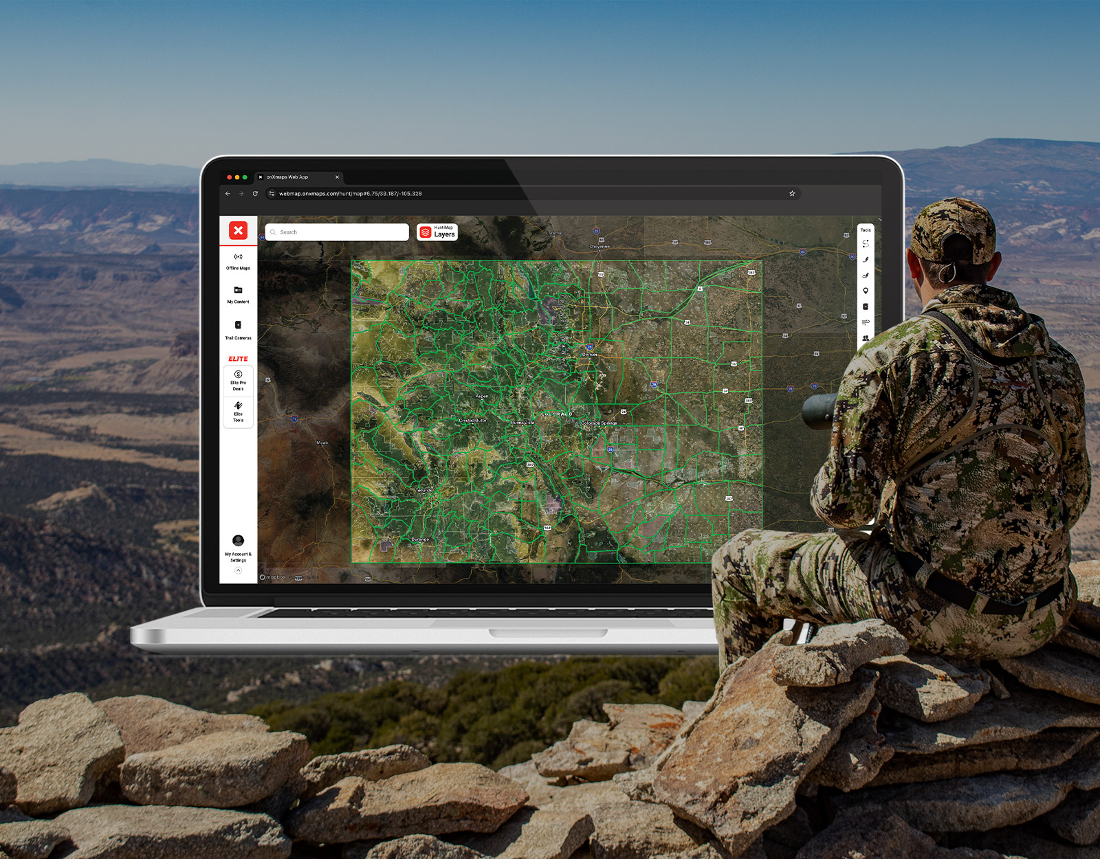
Whether you’re chasing a once-in-a-lifetime hunt or just looking to fill the freezer, your season starts with onX Hunt’s application tools—all included with an Elite Membership:
- Hunt Research Tools: Draw odds, tag trends, and harvest stats for 11 western states (Washington is not yet available) to help you decide where to apply.
- Huntin’ Fool: In-depth insights to navigate state-specific systems and build better strategies.
- HuntReminder: Text and email alerts so you never miss a deadline.
One membership, every tool you need to make 2026 the year.

Colorado Draw Deadlines
Application season runs from March 1, 2026, to April 7, 2026, with big game draw results available May 26-29 (elk, deer, antelope, moose, and bear). Draw results for sheep and goat are released on April 23, 2026. After drawing, your payment deadline for elk, deer, antelope, moose, and bear is June 12, 2026. For sheep and goat the payment deadline is May 7, 2026.
Hunters may apply for licenses with Colorado Parks and Wildlife.
2026 COLORADO DRAW DEADLINES
Primary Draw
Secondary Draw
Unlimited or Leftover Licenses
Reissued Licenses Begin
Free for onX Elite members, HuntReminder’s Colorado page offers timely application season reminders.
Colorado Hunting Application Costs
Colorado hunting license and species costs for tags include:
- A qualifying license. Get the annual small game license for lowest cost (Resident: $38.49, Non-resident: $104.86, Youth: $2.53).
- Non-refundable application and processing fee per species (Resident: $8.93, Non-resident: $11.49).
- Preference and weighted points per species for sheep, moose, and goat (Resident: $50, Non-resident: $100). Youth points are free.
- Non-refundable habitat stamp ($12.76). Fee waived for youth and hunters aged 65 or older.
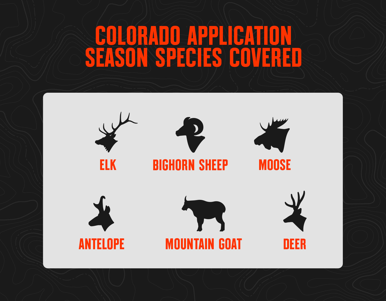
Big Game Species in the Colorado Draw
Colorado Big Game Draw Process
Colorado issues two sets of regulations—one for big game (antelope, bear, deer, elk, and moose) and a separate one for sheep and goat. Be sure to obtain the correct version for your hunting plans from Colorado Parks and Wildlife.
Because Colorado uses a preference point drawing system, it can be a bit easier to plan and predict draw success compared to other states. But expect point creep to continue year over year, especially for the higher demand hunts that take more points to draw. Starting in 2028, Colorado is changing its system. It will move from a pure preference point system to a bonus + preference system. Half of the tags will go to the top point holders, and the other half will go random, with bonus points giving you extra chances to draw a random tag. This will impact high point holders trying to obtain a license in a coveted unit, as they will be fighting for half the licenses. Point creep is going to jump in those mid to high point units.
Point System
For elk, deer, and antelope, Colorado uses a preference point system:
- Preference points are like a place in line: first in, first out. The applicants with the most preference points draw before those with fewer.
- If you apply for and are unsuccessful in drawing your first choice limited license, you’ll receive an additional preference point for future drawings.
- Applicants may apply for preference points only during the primary application window that begins March 1, but you must first buy a qualifying license.
- Preference points are considered for your first choice only. If you draw your first choice for a species, your preference points are purged back to zero.
- If you draw your second choice and on, you will maintain your preference points plus one for the year. Points are not considered during the secondary drawing.
- Applicants’ first choice are awarded before anyone’s second, third, and fourth.
- If non-residents fail to apply or buy a preference point for a particular species in 10 consecutive years, they will lose all accumulated preference points for that species.
For moose, sheep, and mountain goat, Colorado uses a preference point + weighted point system:
- This isn’t a true preference point system but a slightly modified one.
- You must accumulate the maximum three preference points before you may enter the drawing. After that, if you are unsuccessful and you opt to buy a point, it gives you an additional weighted point.
- The formula takes your random number during the drawing and divides it by your weighted points plus one. The lowest final numbers are the applicants who have the best chance of drawing.
- Participating in the weighted point program is optional. Once you have three preference points, you can opt out of paying the additional fee ($100 for non-residents, $50 for residents) to accumulate weighted points.
- There is no point system for desert bighorn sheep; the few available tags in Colorado are issued randomly.
- Preference points are considered for your first choice only. If you draw your first choice for a species, your preference points are purged back to zero.
- If non-residents fail to apply or buy a preference point for a particular species in 10 consecutive years, they will lose all accumulated preference points for that species.
License Allocation
- For elk, deer, pronghorn, or bear hunt codes that require six or more points for a Colorado resident to draw, up to 20% may go to non-residents.
- For hunt codes that require fewer than six points for a Colorado resident to draw an elk, deer, pronghorn, or bear license, up to 25% may go to non-residents.
- Non-resident allocations may increase if licenses remain after all Colorado resident first choices have been drawn for that hunt code.
- License allocations do not apply to private land-only and Ranching for Wildlife licenses.
- In a group of applications made up of both residents and non-residents, all non-residents in the group will count against the non-resident allocation. If all non-resident allocation is gone, the group will not draw.
- Up to 10% of the available moose, sheep, and mountain goat tags can be issued to non-residents.
Resources
- Review all the Application Season Tools You Get With onX Elite.
- Log Into Hunt Research Tools To Start Your Application Season.
- View Colorado Hunting Regulations.
- Apply for Your Colorado Hunting Tags.
- Check Your Colorado Draw History.
- Read Colorado Hunting News and Updates.
Colorado Draw Application Tips
- If you’re a rifle elk hunter, Colorado offers several first, second, third, and fourth season tags that are limited in number and can be drawn with zero preference points (first year applying). There are also unlimited over-the-counter second and third rifle licenses available.
- For moose, sheep, and goat, Colorado’s point system requires you to apply for three years before being eligible for the drawing. But once eligible, you could draw one of these tags with a small number of points if you’re lucky.
- There are unlimited over-the-counter archery licenses for residents. This used to be the same for non-residents, but this past year it moved to a draw. However, every one of the “V1A” (non-resident only archery code) could have been drawn as a second choice. With all but one unit going leftover, expect crowds and hunting pressure. Have a backup plan (or two) in case your primary hunting area is a bust, and think outside the box when scouting for potential unpressured areas (i.e. further from the road may not always be better).
- In a lot of areas, a bear tag can be purchased over the counter and will provide a bonus opportunity for the elk or deer hunter.
- Mule deer licenses are all issued via the drawing; Colorado is known for its trophy deer genetics and generally healthy herd numbers, making it a must-apply-for state if you are a mule deer enthusiast.