
GPS Off-Road Map App
Built for Adventure
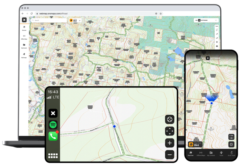
Use the most trusted GPS for off-roading and snowmobiling app, onX Offroad, to discover nearby trails, plan and build routes in 3D, track your trips, and get home safely.
Use the most trusted GPS for off-roading and snowmobiling app, onX Offroad, to discover nearby trails, plan and build routes in 3D, track your trips, and get home safely.
Purpose Built for Off-Roaders
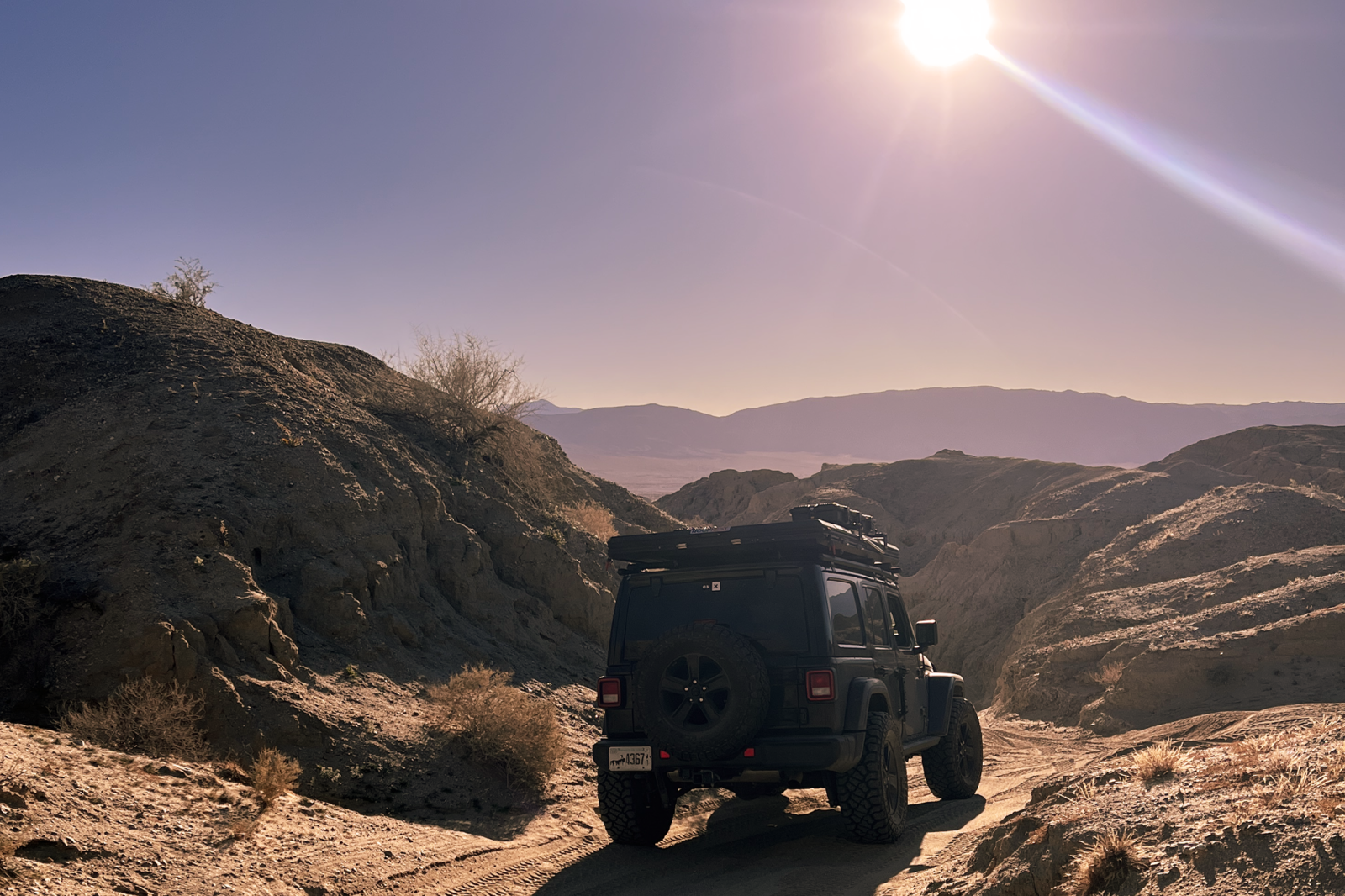
When you’re headed off-road, you should have a mapping and navigation tool that’s designed to leave the pavement.
Powerful 3D Planning
Hold down ‘control’ to explore the mapping solution’s possibilities.
Login or create an account to gain full functionality.
Key Features
Everything you need to know — from landowner details, to trail open dates, to weather forecasts — is all in one App designed for off-roaders.
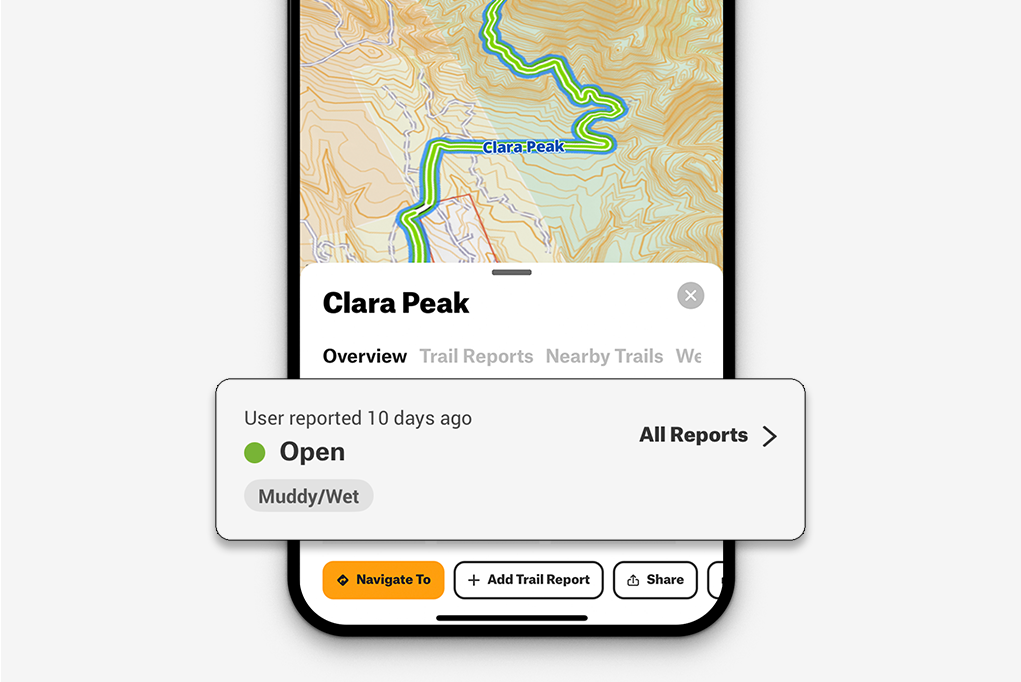
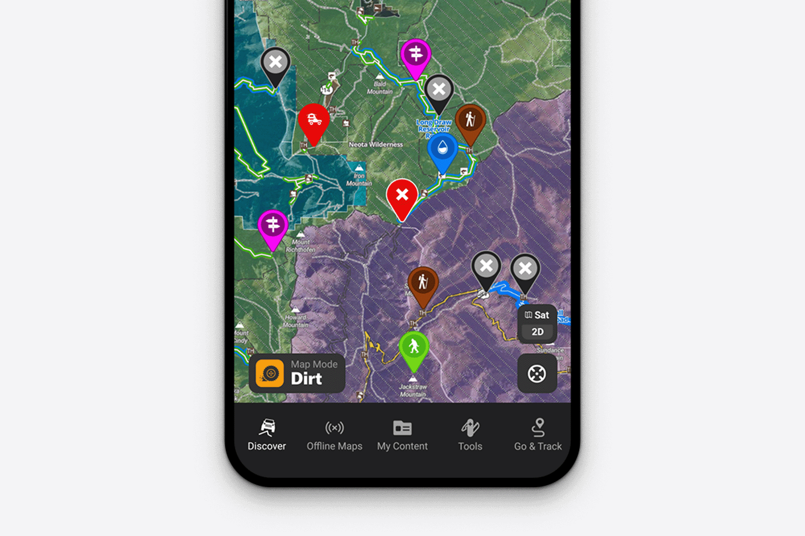
Discover Off-Road Trails
Find trails for SxS, 4×4, ATV, dirt bike, and snowmobiles across the nation. Tap any trail for details such as open and close dates, difficulty ratings, and trail photos. View 500K rec points like campsites, trailheads, and boat launches. Learn More

Public and Private Land Info
Quickly know land ownership information across the nation. Tap anywhere on the map to see public land, like national parks and forests, as well as private land owner names, boundaries, and acreage with Elite. Learn More
Save Maps for Offline Use
Save maps to your phone or tablet, including all interactive land and trail data. You’ll still be able to view your location on your saved maps using your phone’s internal GPS. Learn more.
Customize With Markups
Your maps, your way. Add Waypoints to mark campsites, where you parked the truck, and intersections on the trail. Add lines to create routes, and share everything with friends. Learn more.
Track, Share, and Plan Trips
Easily track your trips, including location, distance, speed, and elevation with Go & Track’s GPS capabilities. Save your trips for future reference with Folders. Planning with others? Make the Folder collaborative so your entire group can view the plan or add their own Tracks, Waypoints, and other custom map markups. Learn more.
Sync with CarPlay and Android Auto
See the land and trails come to life in your vehicle’s dash using onX Offroad with CarPlay or Android Auto. Discover spur trails and campsites as you drive, and see public and private landowner information with Offroad Elite. Learn more.
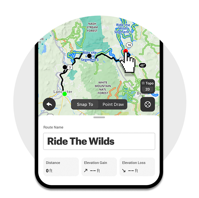
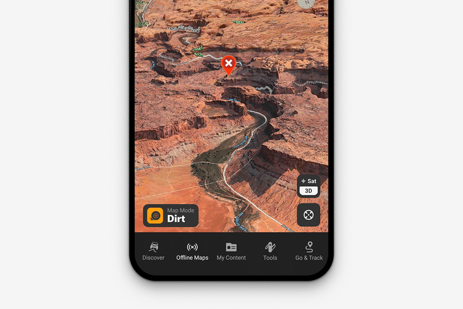
Route Builder
Plan your adventure with Route Builder. Routes snap automatically to roads and trails, allowing you to click two points, and have onX draw a route between those two points. For Premium and Elite users, you have the ability to save those planned routes to your mobile device and follow out on the trails. Routing offline now available on iOS devices.
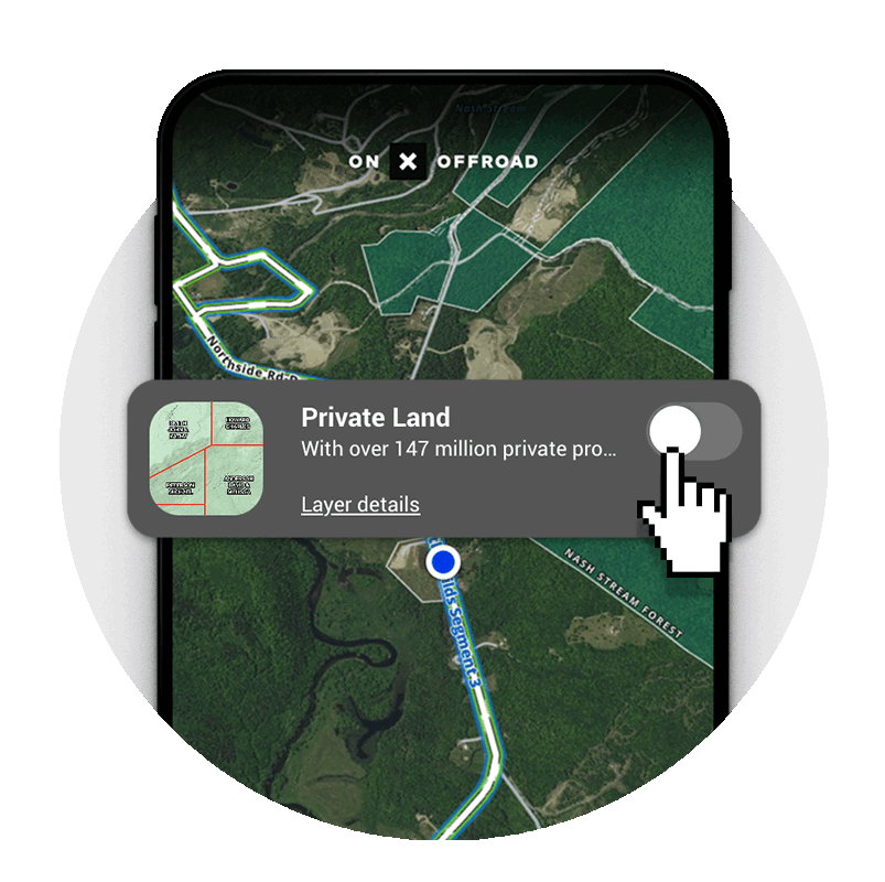
View Private Landowner Names, Boundaries, and Acreage
Private landowner information is available to the public, but under normal circumstances can be very difficult to find. With onX Offroad Elite you can view private landowner names, boundaries, and acreage right in the App. Curious who owns the land around a trail easement? Now you can check. Want to know who owns a private OHV park? Zoom in and easily find the landowner’s name. Tap anywhere on the map for more details.
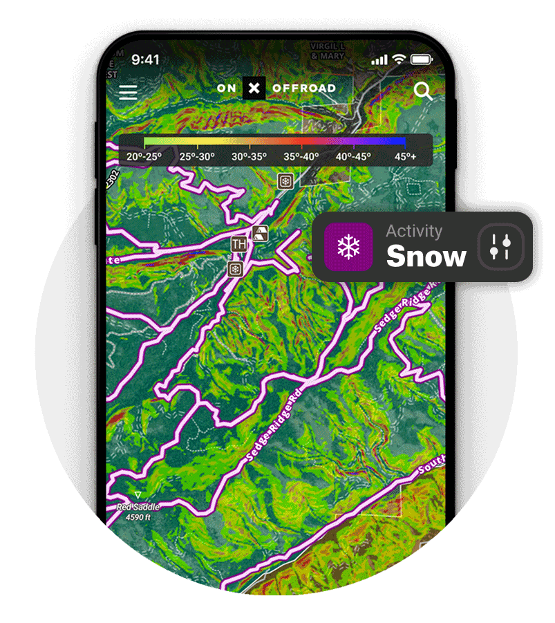
Map Modes
Our dirt off-road app quickly turns into your winter adventure planning tool with the tap of a button. Switch over to Snow Mode to view snowmobile trails with groom reports and management info, avalanche forecasts, slope angle, and weather forecasts. Whether you’re heading out for some big mountain riding, or looking for an all-day cruise on trails through the northwoods, onX Offroad is your ultimate snow moto tool.
More Features
App Reviews
Easy approachable app with good data
Excellent tool for someone trying to learn how to explore blm and dispersed camping.
Excellent tool for someone trying to learn how to explore blm and dispersed camping.
A must have
This is the best resource I’ve found to date for mapping and navigating my backcountry motorcycle routes. extremely well designed and ready to use.
This is the best resource I’ve found to date for mapping and navigating my backcountry motorcycle routes. extremely well designed and ready to use.
Vital to my family’s off-roading
onX has been a game changer in helping my family find the right level of trails, find dispersed camping, hiking, and fishing areas, while staying on legal lands. We can plan more efficient trips, and with backup options.…
Read more
onX has been a game changer in helping my family find the right level of trails, find dispersed camping, hiking, and fishing areas, while staying on legal lands. We can plan more efficient trips, and with backup options. We rely on it!
By The Numbers
Get access to thousands of off-road dirt trails and snowmobile trails across the nation.
650K+Miles of Off-Road Trails
500KRecreation Points
852MAcres of Public Land
76Waypoint Icons
onX Offroad Membership Levels
Off-road close to home or roam across the US, there’s an onX Offroad membership perfect for you.
Premium
Trail Descriptions, Photos, Difficulty Ratings, Offline Maps, Waypoints, 3D Maps, CarPlay / Android Auto, and more.
$34.99/yr
Elite Benefit Discounts
Property Boundaries
Landowner Names
Acreage Information
Basemaps: Topo, 3D, Satellite
Customize Waypoints
Track & Trim Your Route
Localized Weather
Sync content to the cloud
Unlimited Offline Maps
Featured Trails
Trail Status
3D Maps
Public Land Maps
Elite
All Premium features PLUS: see Private and Public Property Boundaries, access Land Owner Info, and save big on the industry’s top brands with Elite Benefits and discounts.
$99.99/yr
Property Boundaries
Landowner Names
Acreage Information
Basemaps: Topo, 3D, Satellite
Customize Waypoints
Track & Trim Your Route
Localized Weather
Sync content to the cloud
Unlimited Offline Maps
Featured Trails
Trail Status
3D Maps
Public Land Maps
Try Before You Buy
Seriously. Try onX Offroad Elite for free for a week — no strings attached. Get access to thousands of off-road dirt trails and snowmobile trails across the nation. View your favorite zones in 3D. Send trails to friends. Start planning the trip of a lifetime now.