
Off-Road Trail Maps
Clean, simple, easy-to-use—that’s what makes our trail maps the best tool for off-roaders riding close to home or setting off on a new adventure. Explore trails based on their difficulty ratings, quickly see and understand vehicle clearance and open/close restrictions, and plan your routes on a map that shows exactly what you need and nothing you don’t.
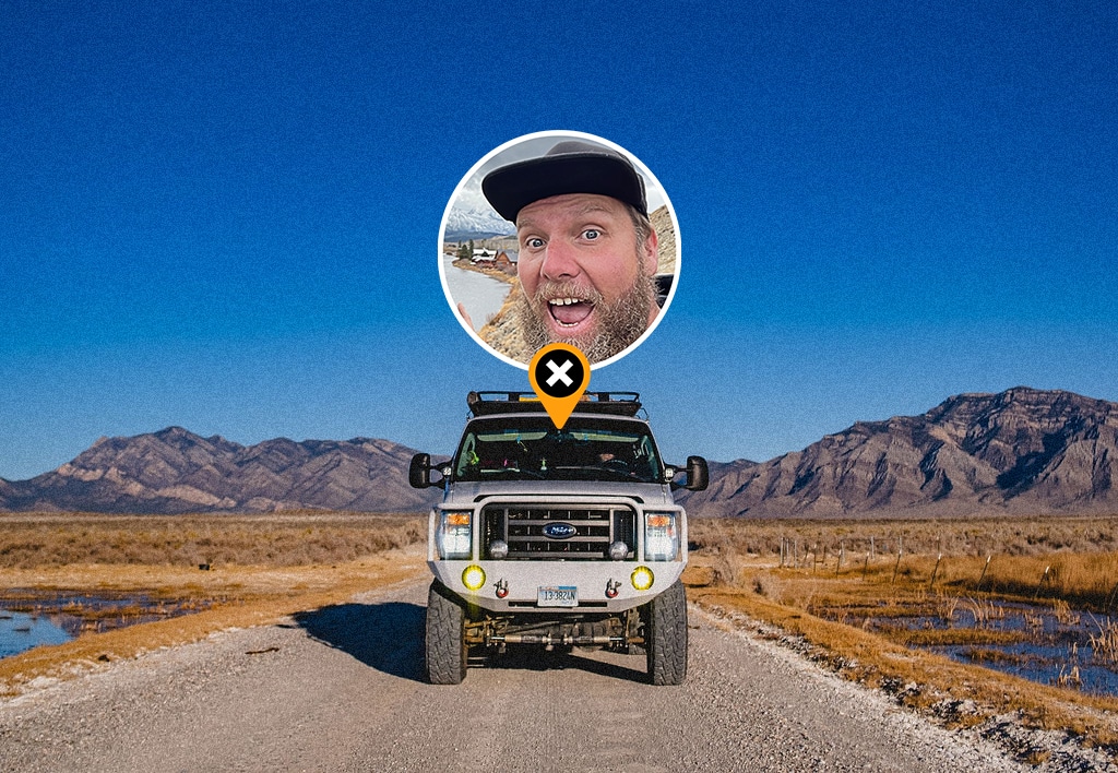
Easy-To-Find Off-Road Trails
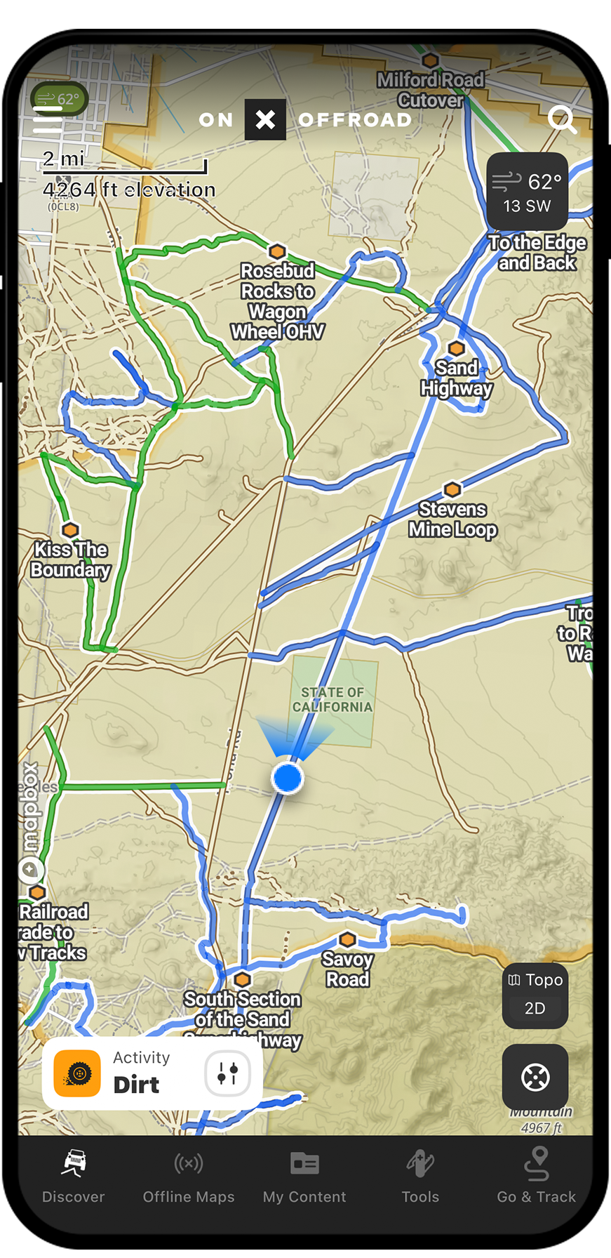
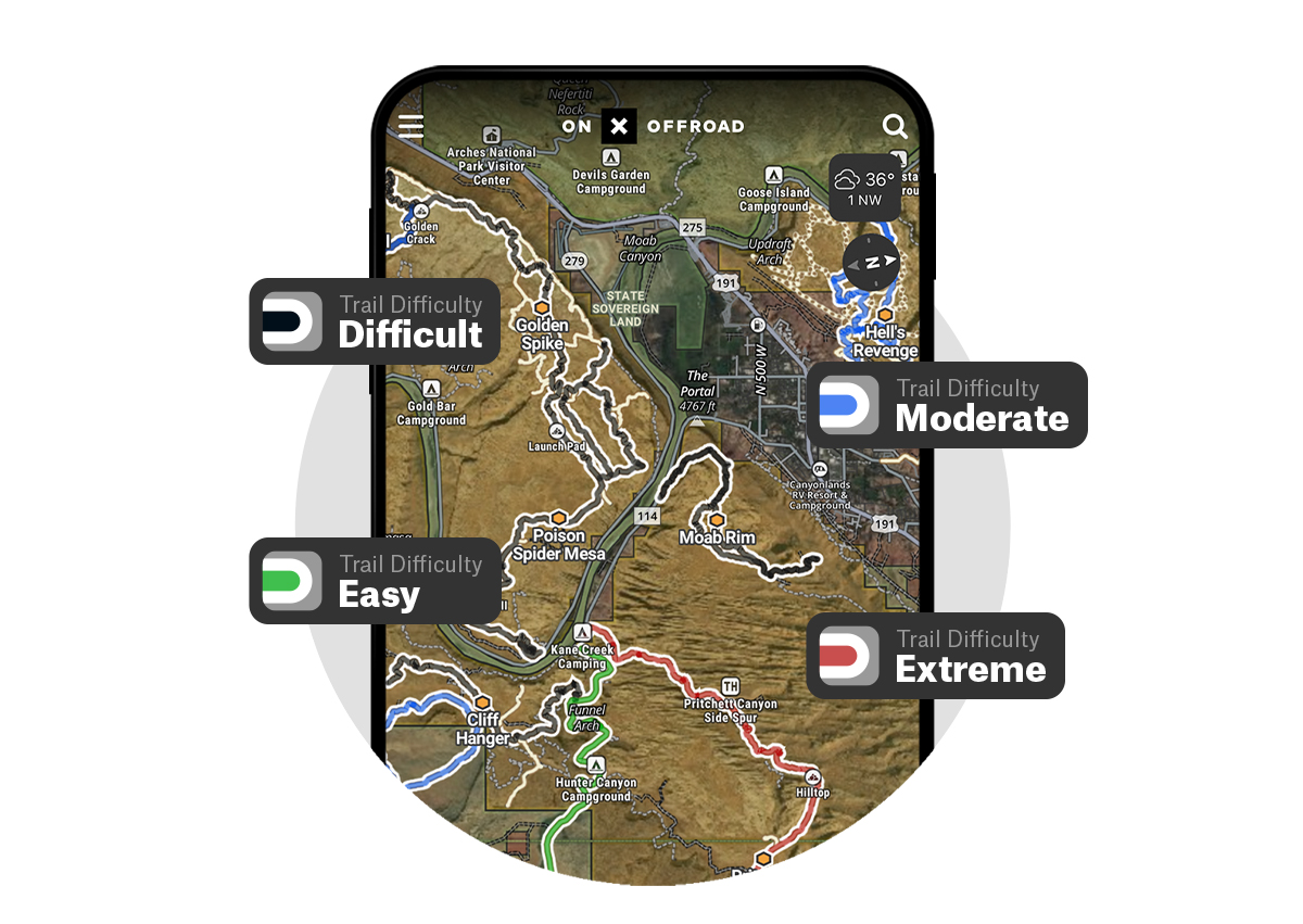
Block out the noise and focus on exactly what you’re looking for with straightforward green/blue/black/red trail rating colors, clear land areas that show where you can and cannot ride, and high-quality aerial image and topo maps that allow you plan your route with precision. Our maps are made by off-roaders for off-roaders so you’ve got a trail guide alongside.
Trial vs Paid
onX Offroad Basic includes limited access to Featured Trails for free. Try the 7-day Trial for fully featured interactive trail maps that are color-coded by open/closed status along with public and private land boundaries and ownership information.
What Makes the Best Off-Road Trail Map?
Research, plan, and hit the trails with the confidence that whether an official onX Offroad Trail Guide or a team of off-roaders has sifted through every detail, you’ve got the best information in your palm or in the dash.

Dirt or Snow
Every season, every vehicle, same nationwide motorized trail data to get you out on sand, snow, or anything in between. Zoom in on a trail network icon to see what’s waiting for you.

Guided Trails
Tap on a trail for guidebook-quality overviews with detailed descriptions, difficulty ratings, vehicle clearance, and more—all vetted by our trusted network of guides.

Vehicle Type
Filter the whole map by trails types for singletrack, 50”, high-clearance, 4×4, and full-width roads, or browse an area and see what toys to take along trail-by-trail.

Open or Closed?
Know where and when you can go with clear access information, including seasonal closures.

You Are Here
Whether you’re looking for camping on BLM land, cruising forest roads, or steering clear of Wilderness boundaries, clearly see what type of land you’re riding on.

Recreation Points
Plan your trip with over 500k recreation points for campsites, boat launches, hot springs, non-ethanol fuel stations, trailheads, and more.
Watch and Learn:
Find Offroad Trails
In this video, Talon Sei walks us through just how easy it is to get all the trail information you need to see if your rig can handle that new area you’ve been scouting out – including trail difficulty ratings, access by vehicle type and any other vehicle restrictions that might be in place for that specific trail. Watch the video to learn how to plan better adventures by getting the most out of onX Offroad.

Plan at Home, Send It On the Go
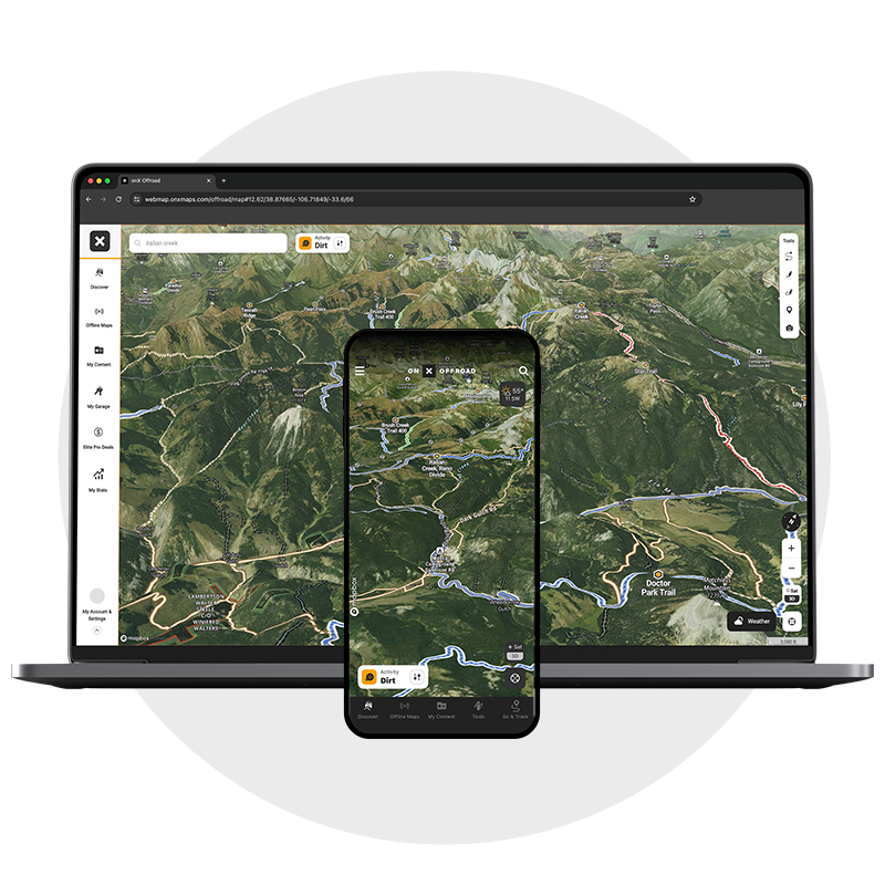
Ultimate At-Home 3D Planning
Level up your planning experience with onX Offroad in 3D on your desktop. Tilt, pan, and zoom along trails as they wind through the terrain, scout open riding areas in the virtual landscape, or find a secluded camp spot with an epic view. Next to wheels on the ground, this is the closest you’ll get to being there.
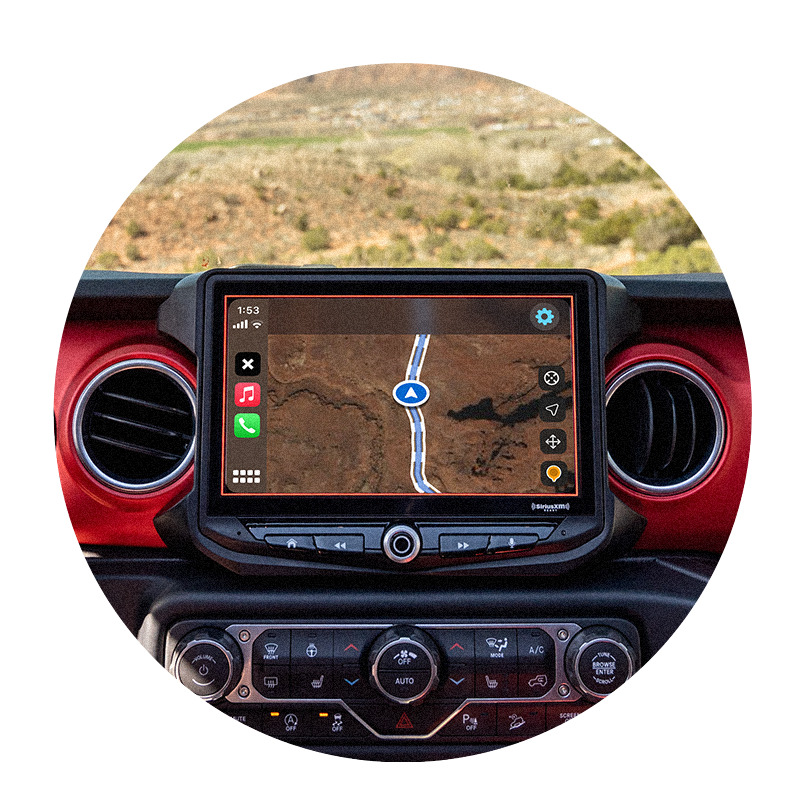
Off-Road Trails In Your Dash
You planned in 3D, now send it in real life with the freedom of hands-free off-road navigation and guided trails with onX Offroad + Carplay and Android Auto.

Explore Nationwide Off-Road Trails Today
The best off-road maps and nationwide guided trails in your palm or in your dash—online or far from cell service—gives you everything you need for adventure. Whether you’re on two wheels or four, exploring close to home or someplace new, ripping dirt or shredding snow, onX Offroad is the tool for finding your next trip off the pavement.
Meet the Mappers
Our Trail Guides are the human-powered machine behind onX Offroad’s guided trails. This passionate team of off-road enthusiasts are out there meticulously mapping and detailing every Guided Trail that is built into our App, and they’re a huge part of why we can offer the most comprehensive set of offline data available.
Frequently Asked Questions
onX Offroad trail maps are built by off-roaders for off-roaders, combining guidebook-quality trail details, land ownership boundaries, and nationwide motorized trail data into one app. Every Guided Trail is meticulously mapped and detailed by a passionate team of Trail Guides.
Yes, you can filter the entire map by trail types including singletrack, 50″, high-clearance, 4×4, and full-width roads, or browse an area trail-by-trail to see which vehicles are compatible.
onX Offroad displays clear access information for each trail, including seasonal closures, so you always know where and when you can ride.
Yes, onX Offroad works online or far from cell service, giving you access to maps and trail data no matter where your adventure takes you.
Yes, the app provides nationwide motorized trail data for every season and vehicle type, covering everything from sand and dirt to snow.
Yes, onX Offroad offers a 3D desktop planning experience where you can tilt, pan, and zoom along trails, scout riding areas, and find campsites before heading out.
Yes, onX Offroad integrates with CarPlay and Android Auto, so you can navigate guided trails hands-free directly from your dash.
Yes, onX Offroad offers a free 7-day trial that includes fully featured interactive trail maps with color-coded open and closed status, plus public and private land boundaries.
You May Also Like
Plan your next trip with onX Offroad’s Trail Pages, and check out the blog for more stories and learnings.