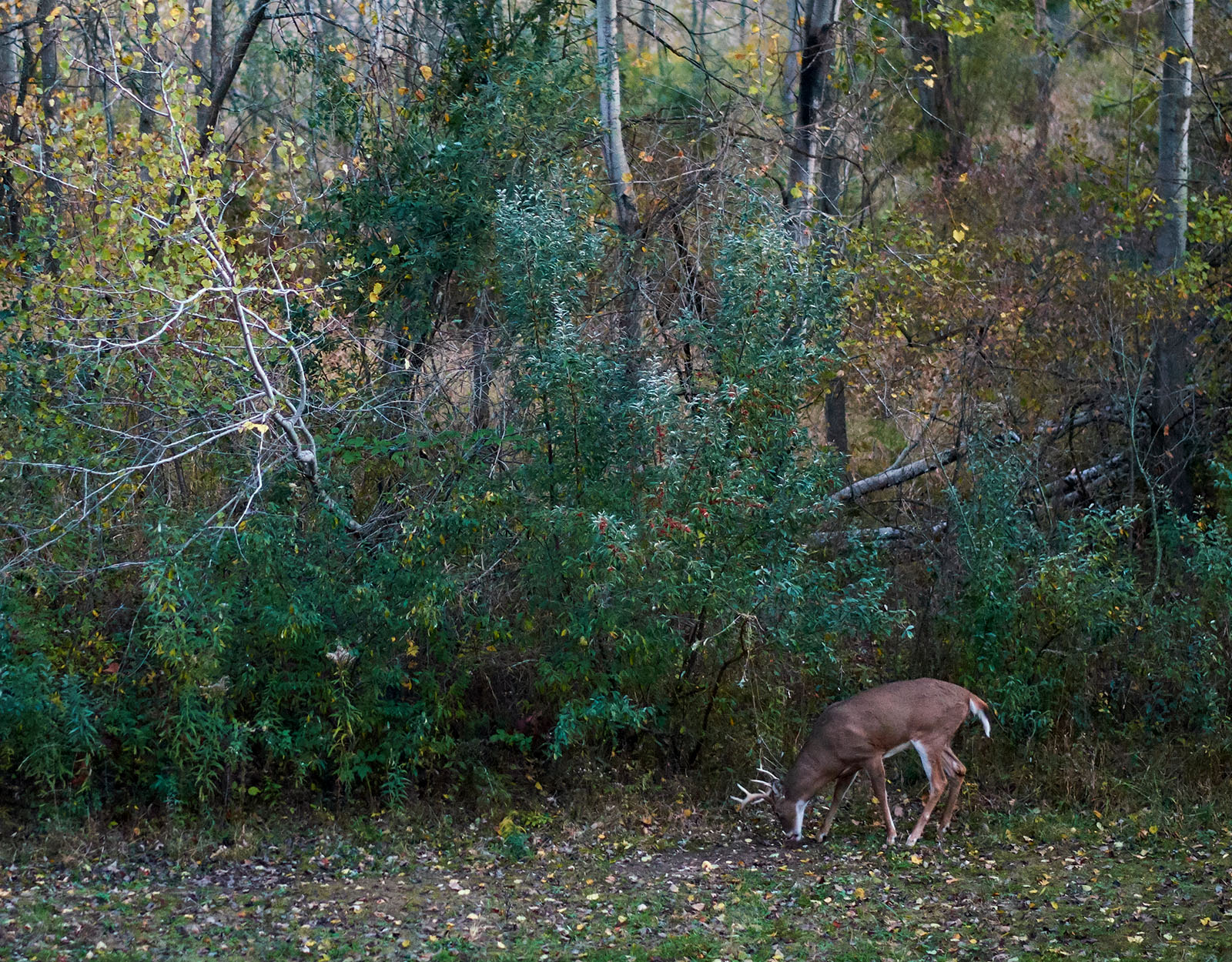
For many deer hunters, Michigan is near the top of their list of places to chase bucks. The Great Lakes State carries a rich hunting heritage, history, and traditions, and for many residents, fall deer hunting seasons are a multi-generational affair. For local, regional, and traveling deer hunters hoping to bring home a trophy whitetail, Michigan is a worthy stopover.
Michigan is bordered by other excellent whitetail deer states: Wisconsin to the southwest (from the Upper Peninsula), and Ohio and Indiana to the south from the Lower Peninsula. Three of the Great Lakes (Michigan, Huron, and Superior) also connect it to Minnesota and Illinois, as well as Ontario. Much of Michigan’s terrain is rolling hills and flatlands, with a few low, forested mountains in the southern part of the state—terrain which lends itself well to growing quality whitetail deer.
TL;DR: Michigan offers diverse deer hunting opportunities across three management zones, with seasons ranging from early youth and veteran hunts to archery, firearm, muzzleloader, and extended late antlerless seasons. Hunters must report all harvests within 72 hours, and notable 2025 changes include extended antlerless firearm seasons and flexible firearm use during muzzleloader hunts in Zones 2 and 3. Michigan has both private and public land options, including the long-standing Hunting Access Program (HAP) and over 340,000 acres of state-managed game and wildlife lands. Hunters targeting trophy whitetails often focus on the southern Lower Peninsula and border regions with Ohio and Indiana, while the Upper Peninsula offers strong deer numbers. Tools like onX Hunt’s Rut Map, Wind Calendar, and private/public land layers help hunters scout funnels, bedding areas, and access points for a successful season.
Michigan Deer Season 2025 Dates
- Liberty Hunt: September 13-14 (for youth and hunters with a disability)
- Early Antlerless (Firearm): September 20-21
- Independence Hunt: October 16-19 (Veteran hunt)
- Archery: October 1 – November 14 and December 1 – January 1, 2026
- Regular Firearm: November 15-30
- Michigan Muzzleloader Season (Zones 1, 2, 3): December 5-14
- Late Antlerless (Firearm): December 15 – January 1, 2026
- Extended Late Anterless (Firearm): January 2-11, 2026
- January Archery: January 2–31, 2026
Michigan Deer Hunting Zones and Management Units
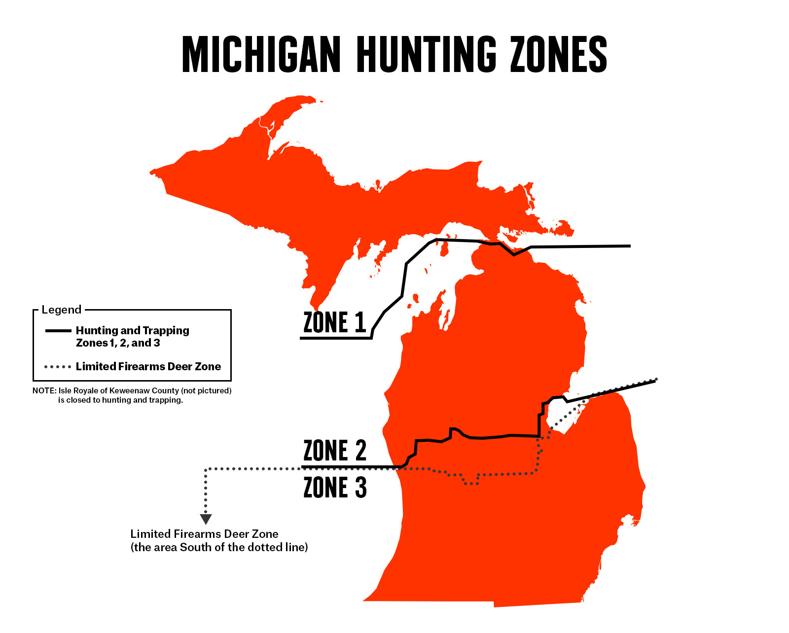
Whitetail hunters can find success across the state, especially when they put in the time to prepare for the season and scout their target deer accordingly. The state of Michigan is divided into Hunting and Trapping Zones 1, 2, and 3. Zone 1 encompasses the Upper Peninsula, Zone 2 is roughly the middle part of the state, and Zone 3 is the lower, southernmost part of the state. Michigan DNR includes a specific Hunting Time Zones Map in their regulations, which shows the divided shooting time zones for the season.
In addition to these defined hunting zones, there are different hunting zones for waterfowl hunting and limited rifle deer zones. Legal shooting times differ within the state as well because Michigan includes parts of the Eastern Time Zone and Central Time Zone. It’s important to read and understand local shooting time laws to ensure you’re setting yourself up for a legal, successful hunt.
Michigan Deer Hunting Regulations
As for any hunting season in any state, it’s important to know and understand local hunting regulations. Michigan’s Department of Natural Resources (DNR) is the go-to resource for hunting regulations in the state, and hunters should ensure they have read the most current copy of the state’s regulations each season.
In Michigan, anyone who holds a state-issued hunting license and shoots a deer is required to report a successful harvest within 72 hours (or before transferring any deer) to the Michigan DNR. Call 517-284-9453 for assistance.
The Michigan Department of Natural Resources lays out a complete set of regulations in an easy-to-download PDF format, making it easy for hunters to download and print a copy, or to view on their mobile device.
Notable Changes for the 2025 Michigan Deer Season
- Changes to antlerless harvest during the early and late archery seasons in the Upper Peninsula have been implemented.
- The late antlerless firearm season has been extended to Jan. 11, 2026, in certain counties.
- The early and late antlerless firearm seasons are open on public and private lands in open DMUs.
- During the muzzleloading deer season, hunters in zones 2 and 3 may use any firearm that is legal for the zone.
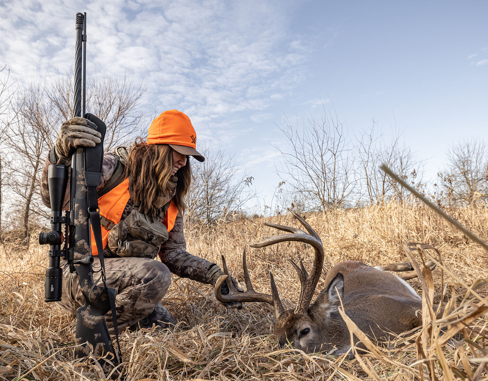
As noted above, Michigan holds a variety of deer seasons, including a Liberty Hunt for youth and hunters with a disability and an Independence Hunt for veterans, in addition to the regular archery, regular firearm, muzzleloader, and early/late antlerless seasons. Details of who may qualify for special hunts are included in the regulations each season, as well as details on what weapons may be used for each hunt, and other key regulations to ensure deer management plans are executed and adhered to.
Shooting Times
Michigan DNR includes a specific Hunting Time Zones Map in their regulations, which show the shooting time zones for the season.
Legal shooting hours for whitetail (one-half hour before sunrise to one-half hour after sunset) for Time Zone A are printed in the table. According to Michigan DNR, to determine the opening (AM) or closing (PM) time in another time zone, add the minutes shown on the map for the zone to the times from the Zone A hunting hours table. The hunting hours listed in the table reflect Eastern Time, adjusted for daylight saving time where appropriate. If you are hunting in Gogebic, Iron, Dickinson, or Menominee counties (Central Time), you must make an additional adjustment to the printed time by subtracting one hour.
Private vs. Public Land
Michigan has opportunities for both public and private land hunters. In addition to specially managed and demarcated public use hunting lands, the state also allows hunting on some national forest lands, as well as some public access to commercial forest lands. See the updated regulations for information on public access for a given piece of land.
For public land hunters, Michigan’s Hunting Access Program (HAP) was created in 1977 to increase public hunting opportunities in southern Michigan, where 97% of the land is privately owned. It has now expanded to include the northeast Lower and eastern Upper peninsulas. HAP is one of the oldest dedicated private lands public access programs in the nation.
Michigan has a system of publicly owned lands managed for wildlife habitat, wildlife watching, and hunting. There are over 100 units in the game and wildlife system covering more than 340,000 acres, increasing opportunities for hunters throughout the state.
Tags and Licensing
- Download the 2025 Michigan Deer Hunting Regulations Summary from Michigan DNR.
- Find information on where to hunt in Michigan.
- Explore information on season dates and bag limits.
- Review Michigan’s complete Hunting Season Calendar.
Best Places To Hunt Deer in Michigan
Many residents say the southern Lower Peninsula is prime whitetail country for quality deer, while the Upper Peninsula boasts good numbers. Hunters targeting trophy bucks should spend a bit of time researching along the Ohio and Indiana borders. Wherever you choose to hunt in the state, a solid combination of e-scouting and boots-on-the-ground scouting will help identify your target buck and set you up for success.
Take time in the months before the hunting season to sit down with your desktop computer or your phone and explore the terrain. Look for funnels, bedding areas, food sources, and more. Our onX Guide to Scouting for Deer can help you use the onX Hunt App to study the terrain and animal patterns, and then formulate a game plan using the information at hand. Key onX features such as Public/Private Land Boundaries, Waypoints, the Wind Calendar, Folder Sharing, and Tree and Crop Data can help you take the guessing game out of planning for a successful hunt.
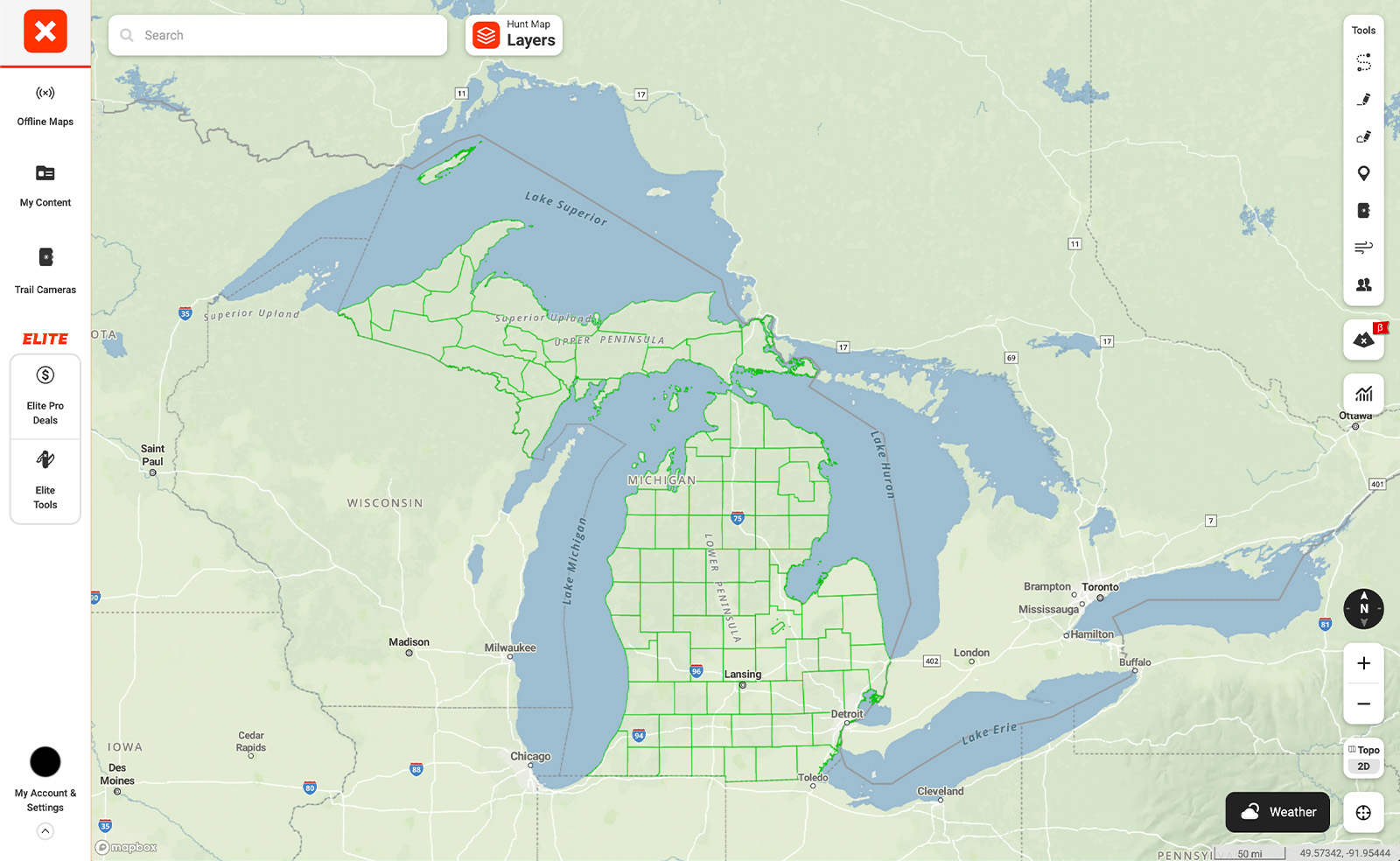
There are many ways to make the most of the rut using onX Hunt. From the Rut Map, which provides a heat map of existing rut data overlaid on your onX maps, to critical wind and weather information including live weather reports, weather forecasts, wind direction, sunrise and sunset times, and barometric pressure, onX tools are designed to help you form a game plan for Michigan hunting seasons.
Why onX Hunt Is the Best Hunting App for a Successful Season
Whether you’re hunting public or private land as you chase whitetail deer in the state of Michigan, you should have hunting GPS maps in your pocket, ready to go. onX Hunt’s Michigan GPS hunting maps give hunters access to Satellite, Topo, or Hybrid Basemaps, over which you can view maps of deer hunting zones, along with State, Forest Service, and other public and private property boundaries. You can view trails and roads, and even download maps to the Hunt App for use offline when you travel beyond the reach of cell service.
Liberty Hunt (youth/disabled): Sept. 13–14
Early Antlerless (firearm): Sept. 20–21
Independence Hunt (veterans): Oct. 16–19
Archery: Oct. 1–Nov. 14 and Dec. 1–Jan. 1, 2026
Regular Firearm: Nov. 15–30
Muzzleloader (Zones 1–3): Dec. 5–14
Late Antlerless (firearm): Dec. 15–Jan. 1, 2026
Extended Late Antlerless (firearm): Jan. 2–11, 2026
January Archery: Jan. 2–31, 2026
Zone 1: Upper Peninsula
Zone 2: Northern and central Lower Peninsula
Zone 3: Southern Lower Peninsula
Yes. Michigan offers national forest access, state game areas, and the Hunting Access Program (HAP), which opens private land to the public.
Southern Lower Peninsula: Known for trophy whitetails.
Upper Peninsula: Offers strong deer numbers and remote hunts.
Border regions (Ohio/Indiana): Good for hunters targeting mature bucks.