Home to some of the most unique hunting opportunities in the United States, Arizona offers 10 big game species, all accessible through public land hunts. Diverse terrain, including mountains, mesas, canyons, and deserts, helps support a healthy population of big game and presents opportunities and challenges for hunters.
Most Arizona hunting licenses are processed through a draw system, with the number of allocated permits adjusted annually. Application season is the first step of most Arizona hunts: keep reading for the information you need to get started.
TL;DR: Arizona has some of the best elk hunts in the nation, and is a must-apply-for state if a trophy bull is your long-term goal. The state uses a bonus point system, but it is possible to draw a premium big game tag in Arizona with zero points if you’re lucky enough in the random portion of the drawing. There are two separate application periods in Arizona: a February deadline for elk/antelope and a separate, early June deadline for deer/sheep/bison.
What’s New in Arizona’s Draw for 2026
New 2026 elk/antelope or 2026 deer/sheep regulations, season dates, and quotas can be found on the Arizona Game & Fish website, including the full 2026 Pronghorn and Elk Hunt Draw Information booklet.
2026 Arizona Antelope Draw Updates
- Unit 8 dropped its October Muzzleloader antelope hunt and added a new rifle hunt in its place. There is now only one muzzleloader hunt, which takes place in September.
2026 Arizona Elk Draw Updates
- Units 7 East and 8 were taken out of the early rifle elk pool.
- Unit 5B will now have an early rifle hunt.
- 50 tags each were added to 7 East and West for the late rifle elk hunt.
- Unit 5A will now have an early muzzleloader elk hunt.
- Units 9 and 27 were taken out of the early muzzleloader pool. Units 9 and 27 will have early rifle hunts.
- Units 1/2B/2C were taken out of the early rifle elk pool. Unit 1/2B/2C will have an early muzzleloader hunt.
- Across all units, 103 antlerless elk tags have been added to the general youth hunt, totaling 1,806.
2026 Arizona Deer Draw Updates
- 2,650 deer permits have been cut this year from mule deer and Coues deer areas in central and southern Arizona.
- Units 7/9, 19B, 22, and 36A all added December rifle mule deer hunts.
- 12AW will have tag increases on early and late hunts.
- 5 mule deer tags were added to the 12B late hunt, which will now allow for a non-resident bonus permit.
- Unit 28 now has a dedicated Coues deer hunt available. Hunt is 11/27-12/6.
- All Coues deer units received permit reductions except 6A, 22, 23, and 34A.
- The youth deer hunt in 8 was removed, and 5A/5B was added in its place.
2026 Arizona Bighorn Sheep Draw Updates
- 15C North desert bighorn permits were reduced to one, and is now only available to residents.
- Two additional desert bighorn hunts were added to 37A North, but unfortunately only have one permit each and are only available to residents. Altogether, 37A North now has three separate hunts with one permit each.
- Units 40B Tinjas, 41 East, and 44B South all had their desert bighorn hunts stratified; each unit now has two hunts.
- Canyon Lake in unit 22 for desert sheep is going to be drained and will remain dry during the desert sheep hunt, making this hunt substantially more physically demanding.
- 6A Rocky bighorn hunt has had another permit reduction, down to one permit, and is now only available to residents.
- The Upper Blue River Rocky Mountain Sheep hunt was split off completely from the Lower Blue River and now has two tags. Non-residents may apply for these tags.
For more details on Arizona’s application processes, go a layer deeper with Huntin’ Fool in the below Masterclass.
Looking for more? Huntin’ Fool’s Arizona page is a thorough, updated resource for ongoing Arizona draw changes.
![]()
Your Complete System for Securing Tags
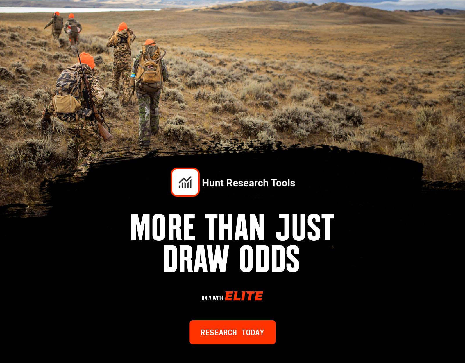
Whether you’re chasing a once-in-a-lifetime hunt or just looking to fill the freezer, your season starts with onX Hunt’s application tools—all included with an Elite Membership:
- Hunt Research Tools: Draw odds, tag trends, and harvest stats for 11 western states (Washington is not yet available) to help you decide where to apply.
- Huntin’ Fool: In-depth insights to navigate state-specific systems and build better strategies.
- HuntReminder: Text and email alerts so you never miss a deadline.
One membership, every tool you need to make 2026 the year.

Arizona Hunting Draw Dates
Application deadlines for pronghorn antelope and elk close on Tuesday, Feb. 3, 2026, at 11:59 p.m. Arizona Time, and tags for deer, bighorn sheep, and fall bison must be applied for by 11:59 p.m. Arizona Time on Tuesday, June 2, 2026.
ARIZONA DEADLINES
Elk & Antelope
Sheep, Bison, & Deer
Bison, Javelina, & Turkey
Non-Resident Archery Deer
Arizona Application Season Cost Overview
Arizona’s hunting license and species costs for permit-tags include:
- Non-refundable Arizona hunting license fee: You need a hunting license to apply for tags or to buy bonus points. For non-residents, Arizona’s hunting license fee is $160. Residents pay $37 for a general hunting license.
- Application fee: $15 per species for non-residents; $13 per species for residents.
- Species fee: If you draw a tag, this is what you pay for the animal you want to hunt.
- Bonus point-only fee: Arizona allows you to apply for bonus points only instead of applying for a hunt, and it’s $15 per species for non-residents and $13 per species for residents. But, keep in mind, Arizona also grants you a bonus point if you’re unsuccessful in a draw, so there’s generally no reason to buy a bonus point vs. applying for a permit unless you truly don’t plan to hunt Arizona that year.
- PointGuard: A bonus point protection program that costs $10 per species, purchased at the time of your application, and allows you to surrender one permit-tag per species and have your accumulated bonus points reinstated if you’re unable to hunt that year for whatever reason. PointGuard is single-use—good for that species, in that year’s draw. For $25, you can purchase PointGuard Plus, which allows you to surrender a hunt permit-tag and have your bonus points reinstated for all eligible big game species for three consecutive draw cycles from the date of purchase.
Hunters may buy licenses and apply for permit-tags with Arizona Game & Fish.
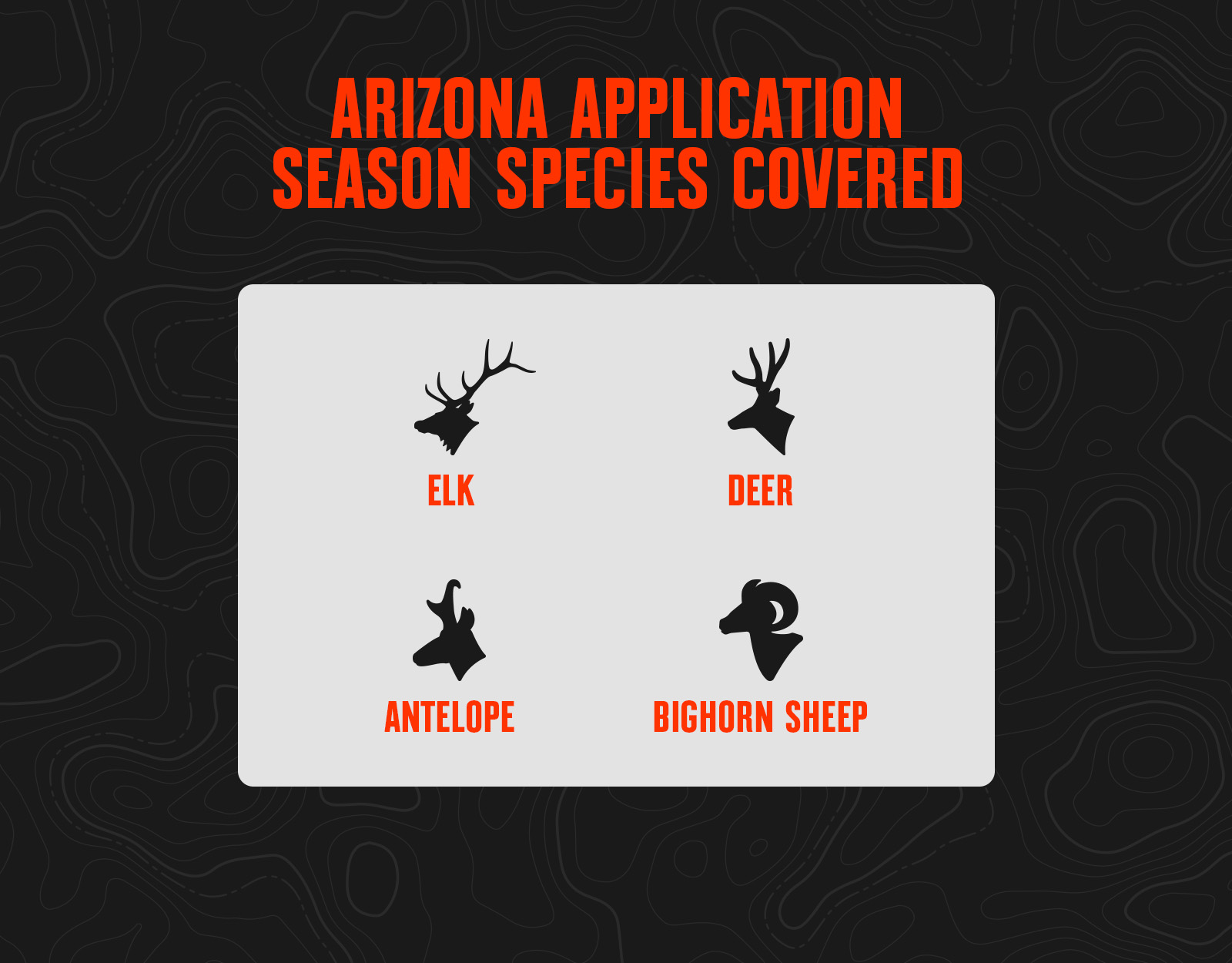
Arizona Application Season Species
Arizona Draw Process Basics
Point System
Arizona uses a traditional bonus point system. Bonus points are like raffle tickets: the more you have, the more “chances” you have in the second and third “random passes” of the draw. You get one chance for your current application, and then one additional chance for every bonus point you have (so with three points, you’d get four chances). If you apply for a tag and are unsuccessful, you will be awarded a bonus point for that species that will apply to next year’s application, or you can also choose to apply for a bonus point each year to accumulate bonus points and not be considered in the draw for a tag.
If you apply for five consecutive years for any species, you will be awarded an additional loyalty bonus point for that species, but you will lose that if you fail to apply in a year. You can also accumulate an additional and permanent bonus point for every species if you complete an approved Hunter Education course in the state of Arizona or the Ethically Hunting Arizona online course.
Tag Allocation
The Arizona draw runs in three phases or “passes.” The first pass is the bonus point pass, the second pass is the first-second choice pass, and the third pass is the third-fourth-fifth choice pass. The second and third passes are also referred to as the “random passes.”
The first pass (bonus point pass) is treated more like a true preference point draw. Here, the first and second hunt choices for all applications with maximum bonus points are looked at first. 20% of the total number of tags for each hunt are awarded in this phase. Even though 20% are available, the 10% non-resident cap is still in effect. If you fail to draw in the bonus point pass, your application will then fall to the second and third passes.
In the second pass, your application will be randomly assigned a number, and applications with the lowest numbers will be pulled and checked first. They will look at your first and second choice and award you a tag if there is one available. If a tag is not available, they will move on to the next application. After everyone’s first and second choice has been read in this pass, they will randomly assign numbers again and pull applications for the third pass. This is where leftover tags will be picked up, but typically by this point, all tags have already been distributed.
For elk, deer, and antelope, up to 10% of the total number of tags can be issued to non-residents. This 10% is not guaranteed, but most buck or bull tags have sufficient non-resident demand to trigger the full 10% allocation. Of the 10% non-resident tag pool, a maximum of half (50%) of those tags may be issued in the bonus point drawing.
As an example:
Hunt Code X has 100 total tags:
- 20% will be issued in the bonus pass: 20 tags.
- 80% will be issued in the second and third pass: 80 tags.
- 10% of the total number of tags can be issued to non-residents: 10 tags total.
- 50% of the total number of non-resident tags can be issued in the bonus pass: 5 tags total.
- The remaining non-resident tags will be issued in the second and third pass: 5 tags total.
- Of the 100 total tags, non-residents can draw 10 (five in the bonus pass, five in the second and third pass).
- Residents will draw a minimum of 90 tags (15 tags in the bonus pass, and 75 in the second and third pass).
Arizona Big Game Draw Resources
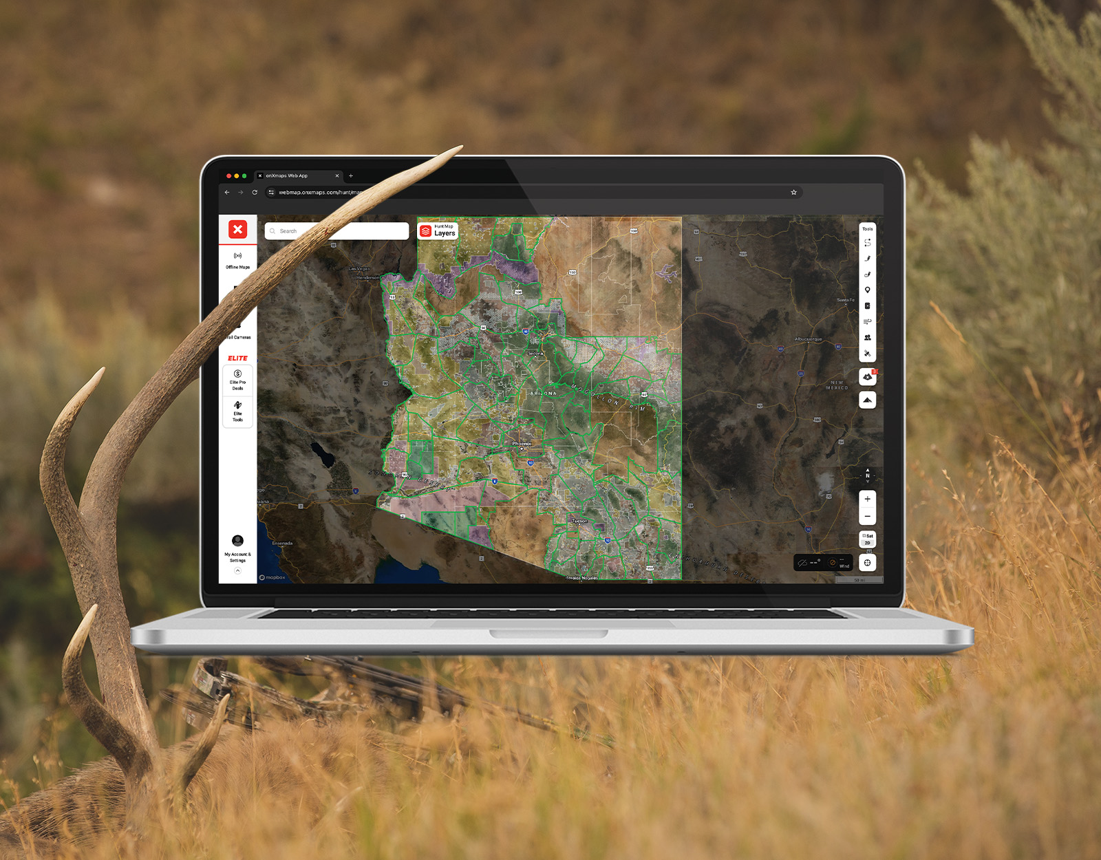
- Review the Application Season Tools You Get With onX Hunt Elite, including Hunt Research Tools.
Arizona Application Tips
- If you’re hoping to draw a tag in the random draw, on your application, you generally want to put the harder-to-draw hunt as your first choice and the easier-to-draw hunt as your second choice. If you’d actually prefer to go on the easier-to-draw hunt, move it to your first choice and consider choosing another easier-to-draw hunt as your second choice so you can maximize your overall odds to at least draw.
- For non-residents, the $160 annual hunting license is a required upfront cost to apply, and each species application costs an additional $15. Because that license cost is already sunk, it’s often cost-effective to apply for multiple species—even if your primary goal is to hunt elk. In Arizona, this strategy pairs well with late-season rifle elk hunts in good units; although these hunts occur outside the rut, they traditionally offer much better draw odds.