
Off-Road Trails in Wisconsin
Discover off-road trails in Wisconsin
Off-Road Trails in Wisconsin
Discover the best off-road trails in Wisconsin. Browse trail maps, check difficulty ratings, and find your next adventure — whether you're looking for a quick ride or an all-day expedition.
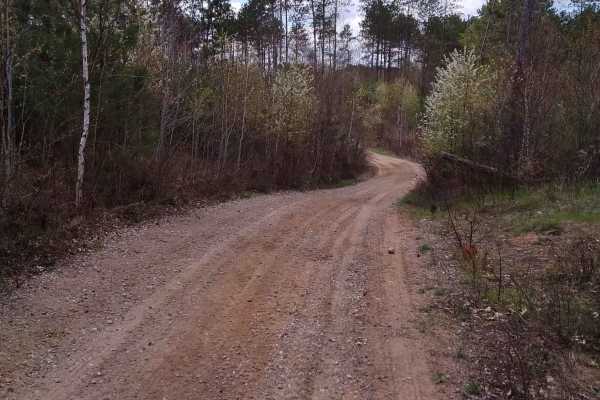
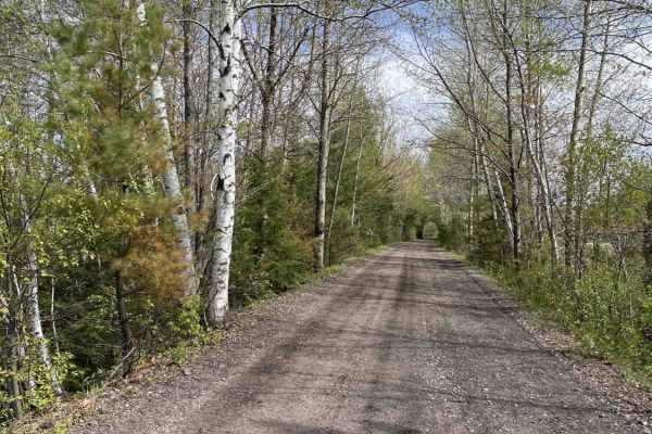
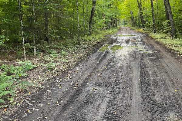
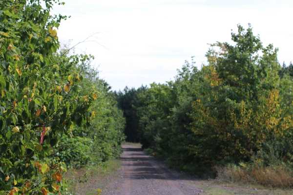
Wildwood Trail/Partridge Trail
This ride can become three loops with the trails that split off from the main trail, with the ability to create one long ride north of Lakewood and Townsend. Tight twisty terrain flows throughout the forest. Ups and downs in elevation are the norm on this trail.
Learn more about Wildwood Trail/Partridge Trail
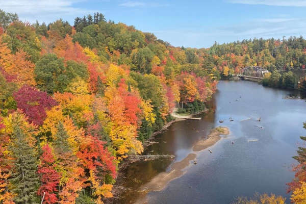
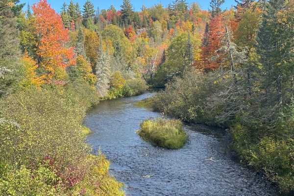
Old Bridge Overlook
Start the day at the CR 510 Old Bridge Overlook to check out the fall colors. Jump back on CR 510 to the trails and take UP 14/CR 510 then took CR GGA to CR GGB. This will bring you to Red Road/North Country Trail. This will bring you back to CR 510. The fall colors on this route are nothing short o...
Learn more about Old Bridge Overlook
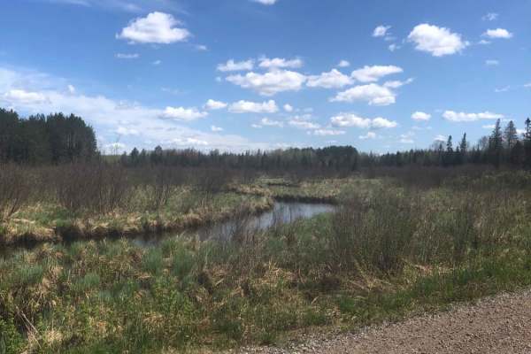
Great Bear Trail
There are a variety of dirt, sand, and gravel routes through forest roads that span from this route. It winds along a few small lakes through Oconto County. The trail runs from Lakewood south through the mountain area and wraps up close to Boulder Lake with a few route alternatives if you want to ex...
Learn more about Great Bear Trail
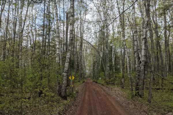
Park Forest, Potlatch, and Hilton Trails
This route is an out-and-back starting from the Gandy Dancer Trail and traversing through the heart of Nemadji State Forest. The route begins at the Park Forest Trail and eventually becomes the Potlatch Trail. The Potlatch is a fun dirt trail that features several standing water areas that can get b...
Learn more about Park Forest, Potlatch, and Hilton Trails
17
Trail 17 from Hurley to Mercer is an easy, railroad-grade trail that's well maintained. The trail follows most of the snowmobile trail 17, with some exceptions where it follows dirt or paved road for short sections. A great family ride. Tons of places to visit and explore along the way. Signs along ...
Learn more about 17
41 Haywire Grade Rail ORV - Part 2
Part 2 of the trails is a short loop before crossing over M-94 from U.P. 419/Juniper/Coalwood Trail. The trail continues on with some stops reading the info about the area's history. The trail is mostly 2 lane dirt. As you can see the trails have a lot of history and the fall colors are a bonus.
Learn more about 41 Haywire Grade Rail ORV - Part 2
Huron Bay-Peshekee Grade Loop
Off-Highway 41 we jumped on Huron Mountain Drive-Eric's to Van Riper Trail which was already mapped. Then we took the Huron Bay-Peshekee Grade Loop for some amazing views and the colors could not have been better on our drive. You will not have cell service so please make sure you are with someone.
Learn more about Huron Bay-Peshekee Grade Loop
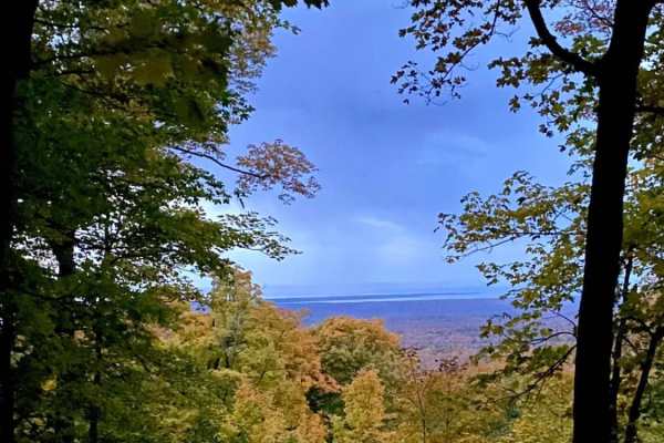
Mount Arvon Overlook
Mount Arvon is the highest natural point in Michigan. Mount Arvon is located in L'Anse Township. When you arrive, make sure you take time for the view, especially with the fall colors. While exploring, you will need to use the onX offline mapping. The track is an out-and-back.
Learn more about Mount Arvon Overlook
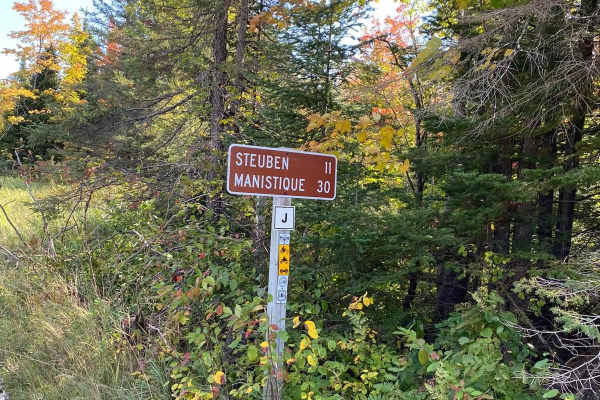
Haywire Grade Rail/ORV - Part 3
This is part 3 of the Haywire Grade Rail/ORV trail. The trail continues on with not only some Michigan history but an amazing ride throughout the upper peninsula. The creeks and fall col are always amazing in the U.P. Of Michigan during the fall. You can end your trip at County road 437 near Steuben...
Learn more about Haywire Grade Rail/ORV - Part 3

Pine Bluff
This is a short route through the rolling hills, forests, and fields of central Wisconsin. This route will take you on gravel roads through a scenic rural area of central Wisconsin. The route is generally well-maintained and accessible to all road vehicles during the 3 non-winter seasons. The east e...
Learn more about Pine Bluff
Huron Mountain Drive Big Eric's to Van Riper
Backroad route from Big Eric's Bridge State Forest Campground to Van Riper State Park. This route passes through the Huron Mountains and touches the McCormick Wilderness area of Ottawa National Forest. The route is mostly well-graded gravel, sand, and natural surface two-lane and one-lane roads with...
Learn more about Huron Mountain Drive Big Eric's to Van Riper
Butler Rock Loop
We traveled Southeast into Marinette County to access the Butler Rock Trails, which was a sandy route through multiple pine and birch forests. The Butler Rock area is a blast with tight twisty terrain with a good bit of elevation change. This route can be accessed via several Nicolet State Trail rou...
Learn more about Butler Rock Loop

Nelson Fire Shortcut
This is a mostly single-lane gravel trail. Will be dry most of the time, but even after a rain, there won't be much if any mud to find. Some areas of the trail have a pretty tight vegetation canopy, which makes larger vehicles tougher to pass. This trail connects Nelson Fire Lane to West Elcho Road ...
Learn more about Nelson Fire Shortcut
Tamcha 2706 To FF Hwy 13 - Part 9
This is Part 9 of the track starting at Tamcha 2706, Wolf Lake 2696, Molly Lake 2436, Gooseneck Lake 2218, and Through River 2688. Continue to follow the track to Round Lake Road. This route is scenic and could have 2-way traffic. The track in the fall can be colorful.
Learn more about Tamcha 2706 To FF Hwy 13 - Part 9
Trail 7 to Buckhorn Resort - Part 11
This is the last part of the track for the day. We ended up at Buckhorn Resort for a nice dinner. Blue Lake 2250, Bay De Noc 2269, Biangle 2559 then Hovey Lake 2473 right to Buckhorn. The trail can be done in one day depending on how much you stop and explore.
Learn more about Trail 7 to Buckhorn Resort - Part 11
Tuscobia State Trail - Park Falls to Loretta
The Tuscobia State Trail runs a total of 74 Miles. This leg is 19 miles but connects to a massive trail system that you can jump onto at a bunch of different intersections. There are a few more stops than normal due to all of those intersections, but it is worth it if you want a day of exploring the...
Learn more about Tuscobia State Trail - Park Falls to Loretta
Au Train Falls Loop
We jumped on the Trails in the Au Train area and headed to Au Train falls. The trails in this area are beautiful in the fall. This loop will connect with multiple trails and we recommend staying in the area to explore and enjoy the fall colors. When you reach the intersection of Ponds (2583) and Buc...
Learn more about Au Train Falls Loop
Murphy Creek to Thunder Lake - Part 7
Murphy Creek to Thunder Lake - Part 7 offers offroaders an easy, scenic journey through the heart of Michigan's Upper Peninsula, making it ideal for beginners and scenic-focused drivers. Spanning approximately 8.6 miles, this trail connects Murphy Creek Trail to Thunder Lake Road, weaving through de...
Learn more about Murphy Creek to Thunder Lake - Part 7
Mill Mine Trail
This trail runs along an old railroad grade off the Bill Nicholls trail back to the Bill Nicholls trail. It is an alternative to running through the towns of Painesdale, Trimountain, and South Range. The trail is easy on the North end but has a couple small water crossings on the South end that vary...
Learn more about Mill Mine Trail
Pratt Junction
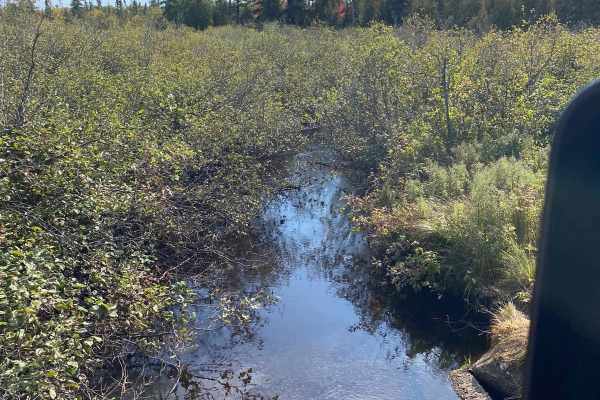
The best trail to take that conjoins Post Lake with Pelican Lake, which can then lead to the Harrison Hills system. The trail is mostly a gravel road, but has a small section of dirt on the Pelican Lake side. Along the way, there are excellent views of the woodlands and a stream. Good chance to see ...
Learn more about Pratt Junction
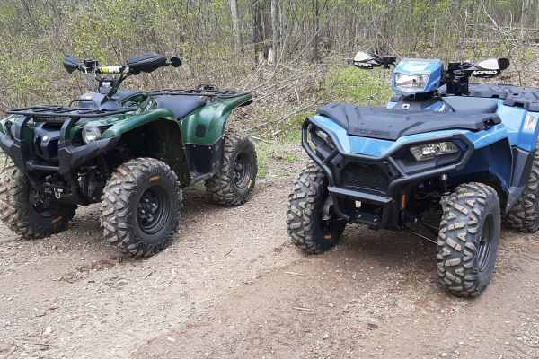
ATV trails in Wisconsin
Explore ATV-friendly trails in Wisconsin. These trails are accessible for vehicles up to 50 inches wide, perfect for ATVs and smaller off-road machines.
Wildwood Trail/Partridge Trail
This ride can become three loops with the trails that split off from the main trail, with the ability to create one long ride north of Lakewood and Townsend. Tight twisty terrain flows throughout the forest. Ups and downs in elevation are the norm on this trail.
Learn more about Wildwood Trail/Partridge Trail
Park Forest, Potlatch, and Hilton Trails
This route is an out-and-back starting from the Gandy Dancer Trail and traversing through the heart of Nemadji State Forest. The route begins at the Park Forest Trail and eventually becomes the Potlatch Trail. The Potlatch is a fun dirt trail that features several standing water areas that can get b...
Learn more about Park Forest, Potlatch, and Hilton Trails
17
Trail 17 from Hurley to Mercer is an easy, railroad-grade trail that's well maintained. The trail follows most of the snowmobile trail 17, with some exceptions where it follows dirt or paved road for short sections. A great family ride. Tons of places to visit and explore along the way. Signs along ...
Learn more about 17
Butler Rock Loop
We traveled Southeast into Marinette County to access the Butler Rock Trails, which was a sandy route through multiple pine and birch forests. The Butler Rock area is a blast with tight twisty terrain with a good bit of elevation change. This route can be accessed via several Nicolet State Trail rou...
Learn more about Butler Rock Loop
UTV/side-by-side trails in Wisconsin
Find UTV and side-by-side trails in Wisconsin. These trails accommodate vehicles up to 60 inches wide, ideal for UTVs, side-by-sides, and wider off-road rigs.
Wildwood Trail/Partridge Trail
This ride can become three loops with the trails that split off from the main trail, with the ability to create one long ride north of Lakewood and Townsend. Tight twisty terrain flows throughout the forest. Ups and downs in elevation are the norm on this trail.
Learn more about Wildwood Trail/Partridge Trail
Great Bear Trail
There are a variety of dirt, sand, and gravel routes through forest roads that span from this route. It winds along a few small lakes through Oconto County. The trail runs from Lakewood south through the mountain area and wraps up close to Boulder Lake with a few route alternatives if you want to ex...
Learn more about Great Bear Trail
Park Forest, Potlatch, and Hilton Trails
This route is an out-and-back starting from the Gandy Dancer Trail and traversing through the heart of Nemadji State Forest. The route begins at the Park Forest Trail and eventually becomes the Potlatch Trail. The Potlatch is a fun dirt trail that features several standing water areas that can get b...
Learn more about Park Forest, Potlatch, and Hilton Trails
17
Trail 17 from Hurley to Mercer is an easy, railroad-grade trail that's well maintained. The trail follows most of the snowmobile trail 17, with some exceptions where it follows dirt or paved road for short sections. A great family ride. Tons of places to visit and explore along the way. Signs along ...
Learn more about 17
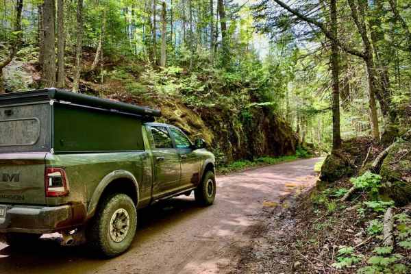
The onX Offroad Difference
onX Offroad combines trail photos, descriptions, difficulty ratings, width restrictions, seasonality, and more in a user-friendly interface. Available on all devices, with offline access and full compatibility with CarPlay and Android Auto. Discover what you're missing today!
Open Trail Map