Gatlin Point South FSR 227
Total Miles
2.1
Technical Rating
Best Time
Spring, Summer, Fall, Winter
Trail Type
Full-Width Road
Accessible By
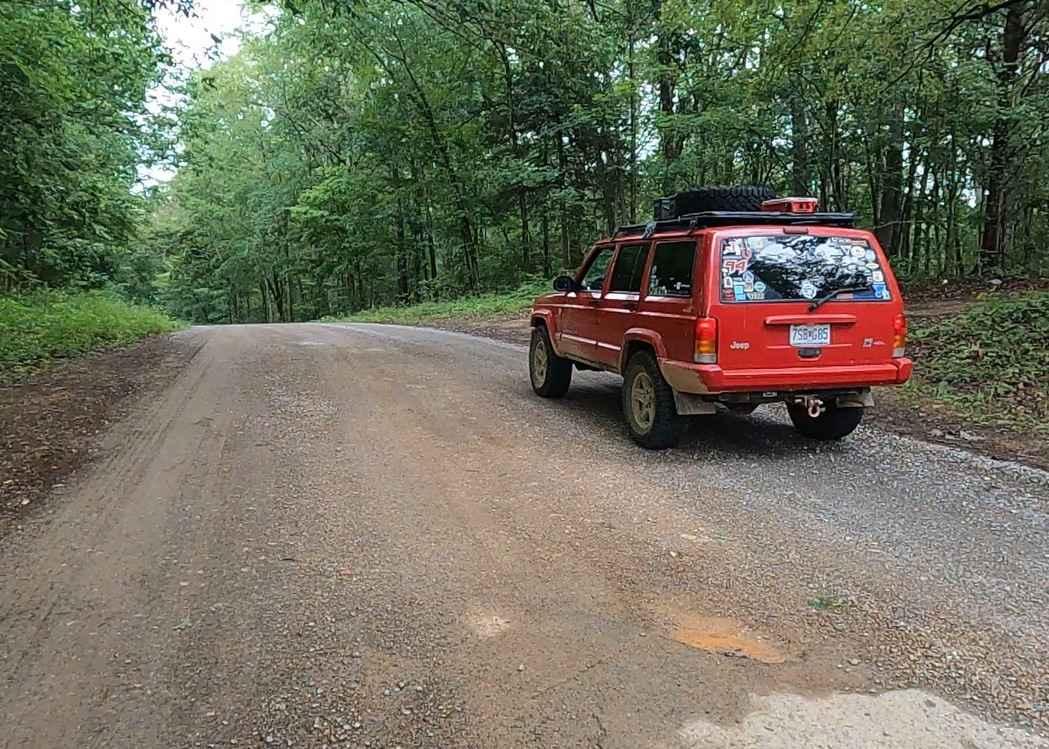
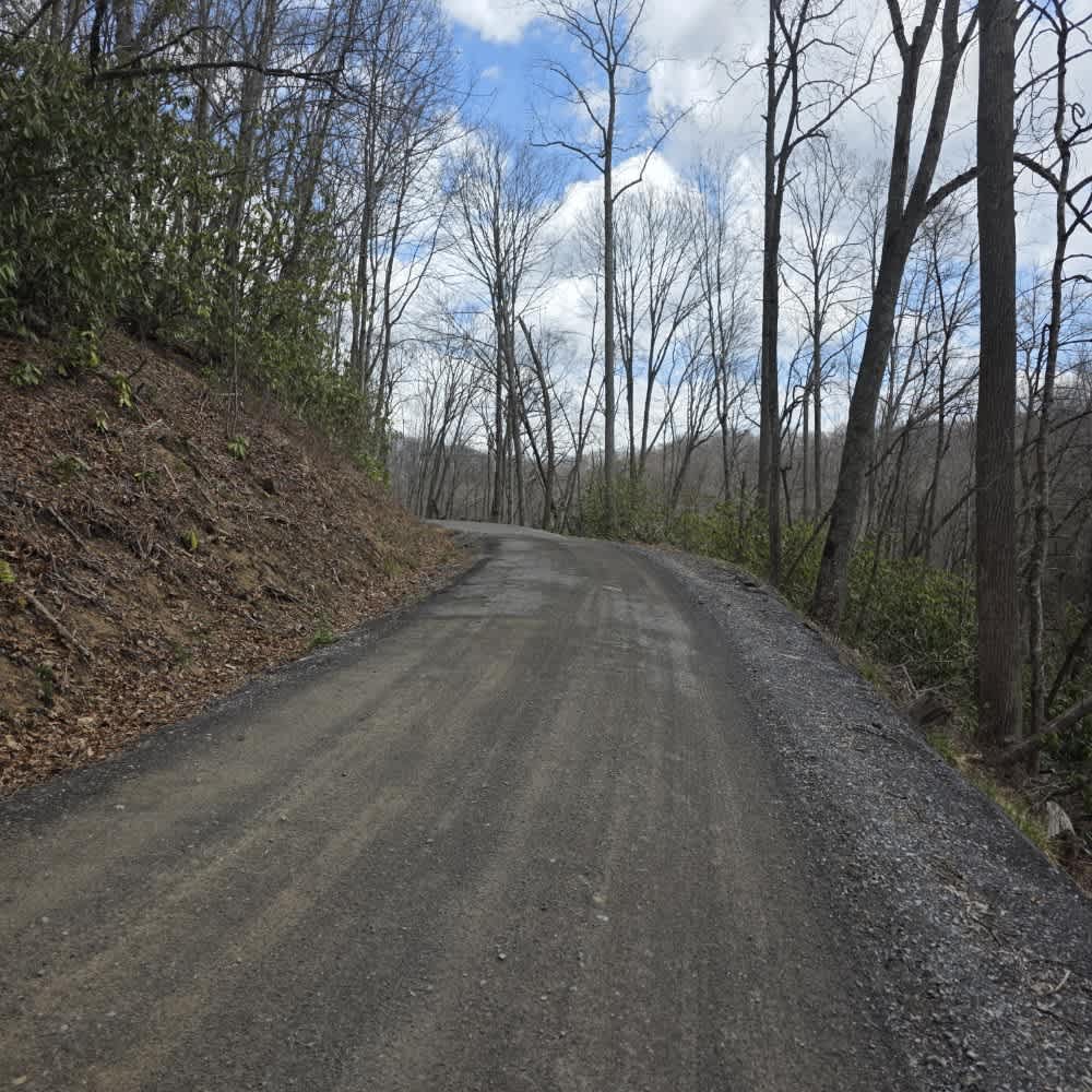
Trail Overview
Gatlin Point South FSR 227 is a gravel forestry road through the southeast corner of the southern Tennessee section, Lake Barkley side, of the Land Between the Lake National Recreation Area. This road features small rolling hills and beautiful treelines, with minimal water collection spots on the road surface and occasional mild soft spots. The road features access to the old Tip Top School site near its entry at the Woodland Trace Road and also features direct access, roadside, to the Jackson Cemetery at the intersection with the Gatlin Point North FSR 228, leading to the far eastern point where it meets the FSR 229. This goes north to the Gatlin Point Campground, also known as Bear Creek Road, and southward as the Gilliam Cemetery Road.
Photos of Gatlin Point South FSR 227
Difficulty
The difficulty of the Gatlin Point South FSR 227 is just mild hills, a few wet soft spots, and gravel complications such as potholes, washboarding, and mounding. It is given a base rating of 1/10 for its simplicity.
History
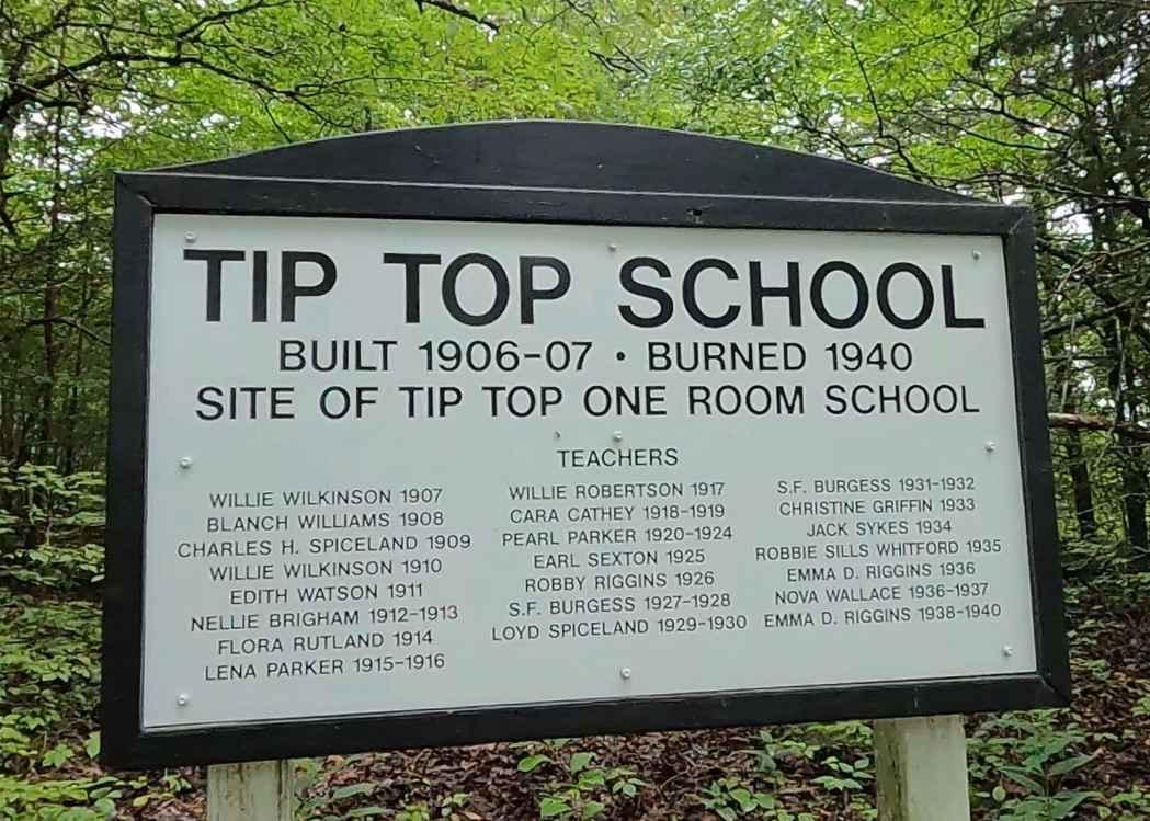
150 feet past the entry from the Woodland Trace Road on the right, there is a sign memorializing the Tip Top School, which was a single-room school that existed between 1907 to 1940, when it burned down. Schools in LBL were already being shut down at this point, due to low attendance issues. Therefore, the Tip Top was never rebuilt, rather the school year finished at a nearby mill house and the kids spread to other schools for the next year. Within the next few years, Tennessee Valley Authority had bought all the land, river to river, in LBL, ending the tenure of schools being in the area. At 36.53610, -87.91581 is the Jackson Cemetery on the south side of the road. To the south near Dover, Tennessee, is the Civil War era site, and US National Park, Fort Donelson, a Confederate 15-acre earth-fortified fort along the Cumberland River. This is also the site of a historic battleground fought over February 13-16th, 1862, both on land and with ironclads via the river. The capture of this Fort alongside claiming Fort Henry and Fort Heiman on the Tennessee River only days before gave the Union its first major regional victory. Long-term, this was evident in the results of the Union's control over the Tennessee River, Cumberland River, and the railroads in the area, which limited vital production from the Confederate supply production super hub in Nashville until it was also captured by the Union in 1864. It's well worth visiting if you love history and want a gift or souvenir pertaining to the region.
Status Reports
Gatlin Point South FSR 227 can be accessed by the following ride types:
- High-Clearance 4x4
- SUV
Gatlin Point South FSR 227 Map
Popular Trails

Old Highway 50

Red Fork Road
A5 Randy's Diner
The onX Offroad Difference
onX Offroad combines trail photos, descriptions, difficulty ratings, width restrictions, seasonality, and more in a user-friendly interface. Available on all devices, with offline access and full compatibility with CarPlay and Android Auto. Discover what you’re missing today!