1211
Total Miles
1.8
Technical Rating
Best Time
Spring, Summer, Fall, Winter
Trail Type
Full-Width Road
Accessible By
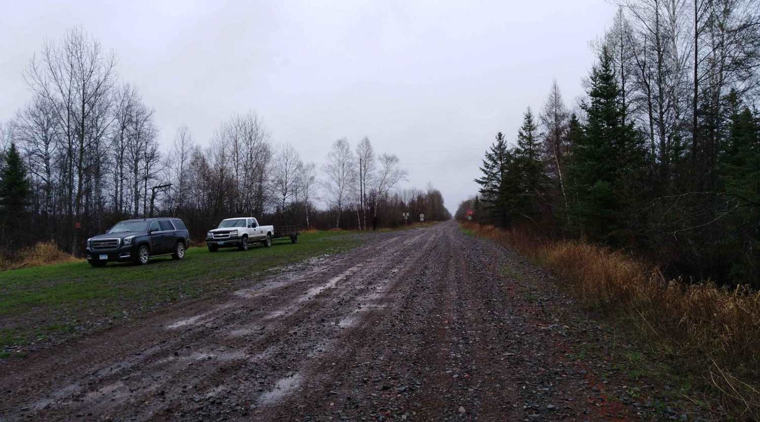
Trail Overview
This trail can be accessed directly from Highway 44 and quickly narrows as it enters the forest. The surface is primarily gravel, but it is uneven in places, with frequent potholes, puddles, and muddy patches that require slow and careful driving. The trail is flanked by dense pine forest on one side and birch on the other, and in summer months, especially July, wildflowers bring some color to the otherwise overgrown surroundings. Several small turnarounds and short offshoot trails appear along the way, though many are also overgrown. Progress becomes more difficult the deeper you go, with the trail narrowing further and fallen logs occasionally blocking the path. At one point, the route forks and theoretically forms a loop, but the continuation requires substantial clearing. Just past the central fork, a small clearing cut into the woods offers a potential camping spot, though the grass is long and unmanaged. The trail also features a very overgrown snowmobile trail and parking for that trail. Dispersed camping is generally allowed in the Superior National Forest as long as you remain outside the Boundary Waters Canoe Area Wilderness. Still, it is advisable to confirm the current regulations with local authorities. There are no developed campsites along this trail, and services are limited, including the absence of toilets, trash facilities, and potable water. Cell service is limited or nonexistent. Anyone camping in the area should follow Leave No Trace principles.
Photos of 1211


Difficulty
This trail is unmaintained, and no evidence of use by other off-roaders. Drive slowly and be prepared for some seasonal mud holes and fallen trees.
History
Superior National Forest, established in 1909, covers over 3 million acres of rugged boreal forest in northeastern Minnesota. While much of the forest is protected wilderness, designated areas offer incredible OHV and multi-use trail opportunities, especially outside the Boundary Waters Canoe Area. Historic logging roads and old mining routes now serve as access points for trail riders, offering a mix of forested paths, rocky sections, and scenic overlooks across the Iron Range and beyond.
Status Reports
1211 can be accessed by the following ride types:
- High-Clearance 4x4
- SUV
1211 Map
Popular Trails

Vermillion Falls - FS 491

County Road 125 Northeast

Nemadji to County Road 3
The onX Offroad Difference
onX Offroad combines trail photos, descriptions, difficulty ratings, width restrictions, seasonality, and more in a user-friendly interface. Available on all devices, with offline access and full compatibility with CarPlay and Android Auto. Discover what you’re missing today!