Circle T
Total Miles
5.1
Technical Rating
Best Time
Summer, Fall
Trail Type
50" Trail
Accessible By
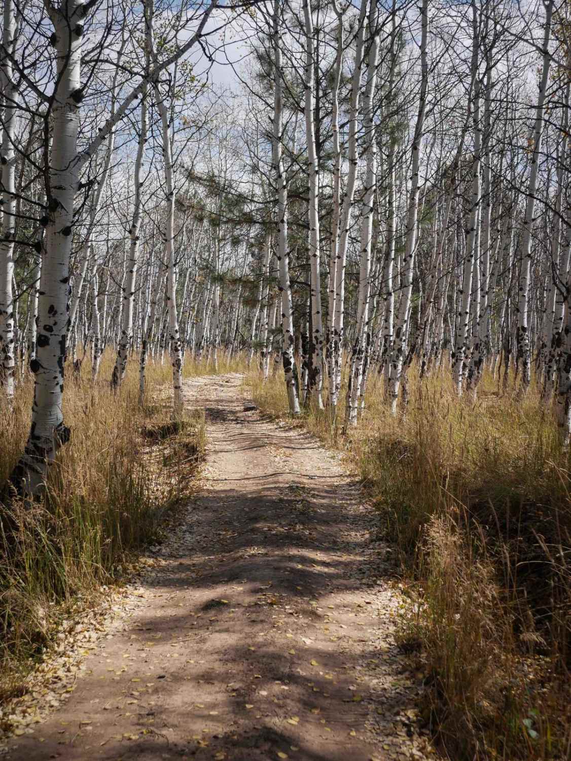
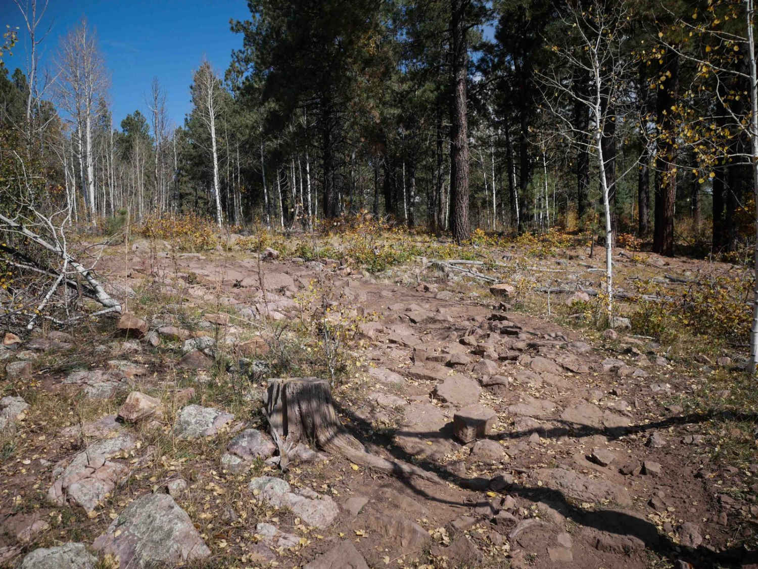
Trail Overview
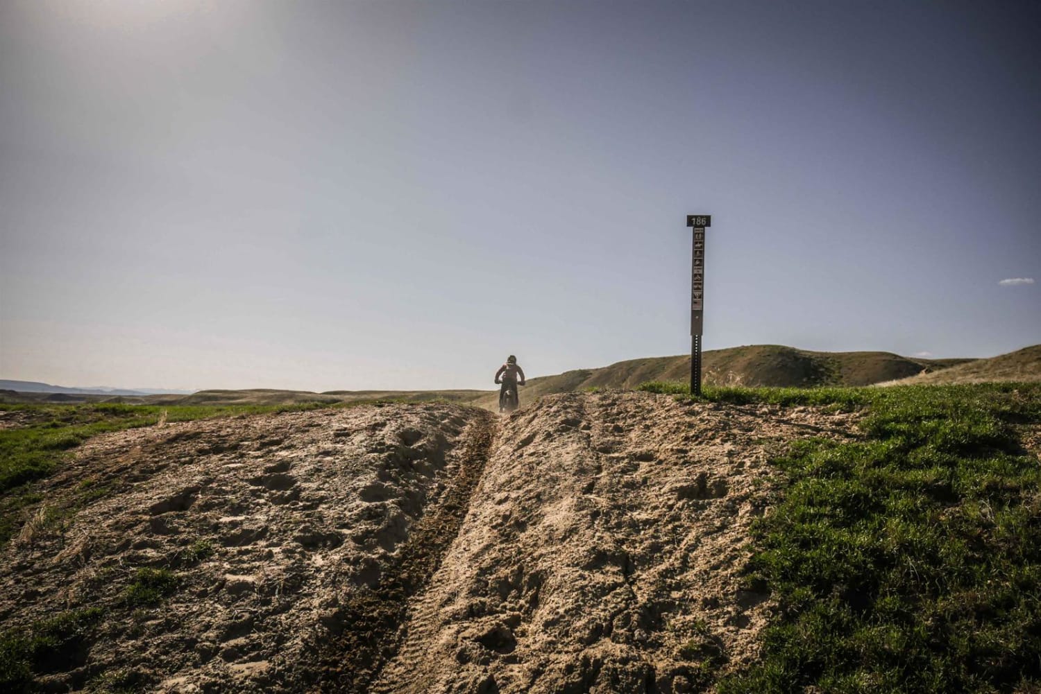
The north end of Circle T starts on Monument Park East Road at a big trail sign. It heads south, riding through big open grassy meadows. The trail is pretty flat for the entire route, not gaining much elevation, and staying very gradual, with a bit of loose rock. It rides through a sparse forest with widely separated tall ponderosa pines. The trail is very smooth, especially in the beginning. At one point it starts to drop off a flat mesa, with a tighter hairpin turn and some more embedded and loose rock. It's like a broken-up slab of rock sticking 4" up from the trail, but still easy to ride over. Overall it's a nice easy trail through beautiful aspen groves and meadows. The trail has some nice views as it keeps going south. After 5 miles, it eventually ends on the South Brockover Trail.
Photos of Circle T
Difficulty
This is an easy trail as it doesn't have many sections of rock and it stays smooth and flat for most of the route.
Status Reports
Circle T can be accessed by the following ride types:
- ATV (50")
- Dirt Bike
Circle T Map
Popular Trails
Browns & Breakneck

La Garita Creek Cutoff Single Track
The onX Offroad Difference
onX Offroad combines trail photos, descriptions, difficulty ratings, width restrictions, seasonality, and more in a user-friendly interface. Available on all devices, with offline access and full compatibility with CarPlay and Android Auto. Discover what you’re missing today!