770 Turtle Mountain Trail (Part 1)
Total Miles
6.8
Technical Rating
Best Time
Spring, Summer, Fall
Trail Type
Single Track
Accessible By
Trail Overview
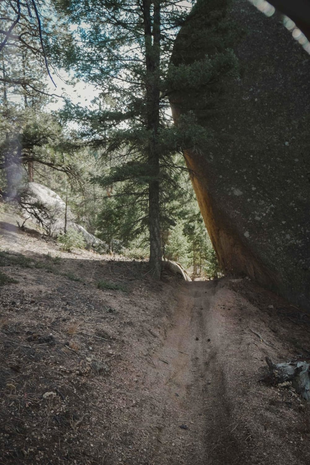
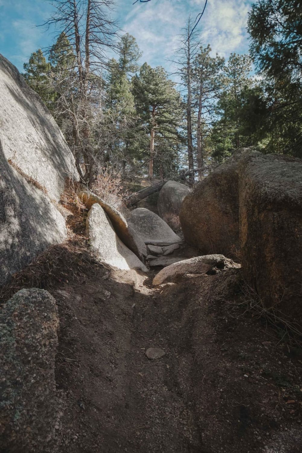
Part 1 of the Turtle Mountain Trail is a 7-mile stretch of narrow single track with several intermediate rock features between Rampart Range Road and Gramps Trail. The trail zig zags through a pine tree forest, with lots of shelfy sections and tight turns between the pine trees where you need to watch your handlebars. There are lots of sections of flat rock slab, and it goes past giant granite boulders. This trail has several splits for easy versus hard sections that split off and meet back up, and they're all marked with which direction to go for most difficult versus intermediate versus easy. One of the more difficult obstacles is a big rock pinch through giant boulders. Another is a narrow section between two giant rock faces like a slot canyon. The trail also goes underneath a giant rock slab at one point like a tunnel. Other features of the trail include troughed-out sections and a pretty cool view once on top of the mountain. After this segment, Turtle Mountain Trail #770 continues south of Gramps Trail towards Log Jumper Trail.
Photos of 770 Turtle Mountain Trail (Part 1)
Difficulty
This is an intermediate single track with several hard/easy/intermediate splits for obstacles of varying difficulty. Most of the harder obstacles have a bypass, so this trail's difficulty can vary based on which obstacles you choose to ride.
Status Reports
770 Turtle Mountain Trail (Part 1) can be accessed by the following ride types:
- Dirt Bike
770 Turtle Mountain Trail (Part 1) Map
Popular Trails

Blair Mountain - FR601
Williams Fork Road - FS 138

Powerline - Cunningham Road
Upper South Park
The onX Offroad Difference
onX Offroad combines trail photos, descriptions, difficulty ratings, width restrictions, seasonality, and more in a user-friendly interface. Available on all devices, with offline access and full compatibility with CarPlay and Android Auto. Discover what you’re missing today!