6035A ATV
Total Miles
3.5
Technical Rating
Best Time
Spring, Fall, Winter, Summer
Trail Type
50" Trail
Accessible By
Trail Overview
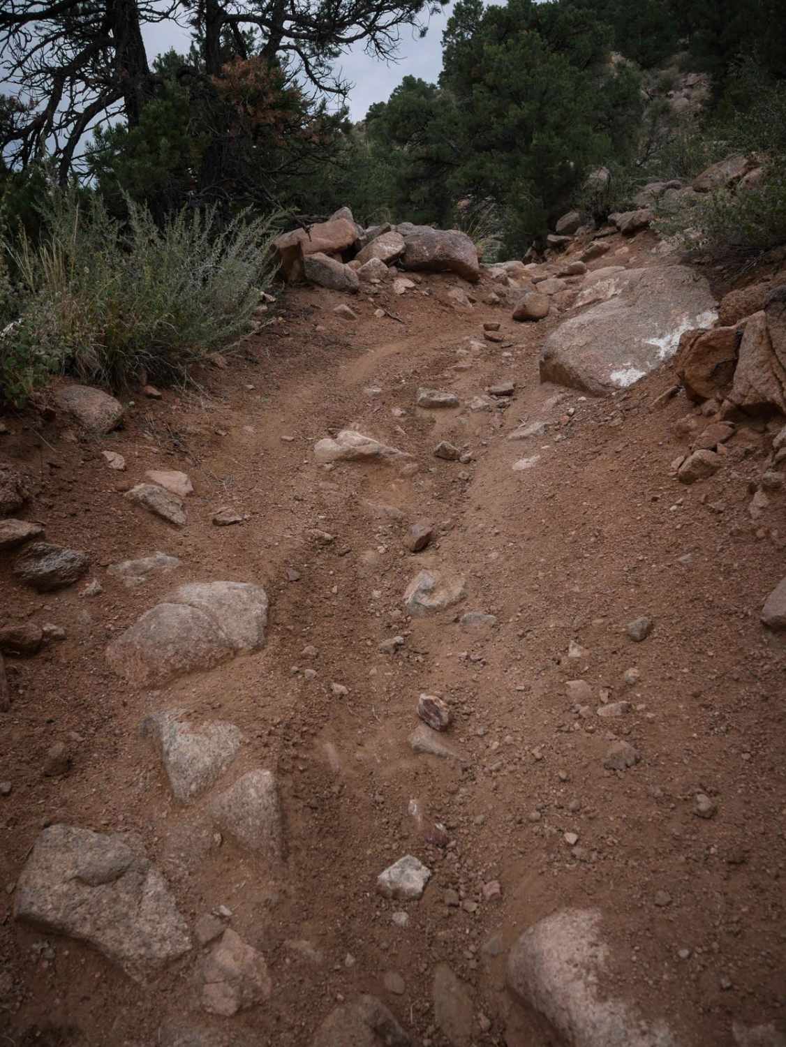
From the north end, 6035A meanders through the sagebrush and pinyon pine, with lots of curves, big dips into ravines, big rollers, and whoops. It heads south, descending down a few steep spots. The track is rutted and washed out and really loose, which makes it more difficult. The trail passes the intersection with 6035B, which you can take to make a loop back to where you started. It continues south in a flat valley with lots of whoops, going next to giant boulder piles, but the track is pretty easy and straight. Near the south end, it starts curving through more pinyon pine trees and has a couple of rockier spots where there are embedded boulders and loose small rocks in the trail. ATVs will have to ride over the boulders, but it isn't very difficult.
Photos of 6035A ATV

Difficulty
This is an intermediate ATV trail that has lots of rocky sections that aren't overly difficult. It has steep hills and descents that are loose, but no significant ledges or obstacles that would hinder the average rider from being able to complete the trail.
Status Reports
6035A ATV can be accessed by the following ride types:
- ATV (50")
- Dirt Bike
6035A ATV Map
Popular Trails
Little Bear Creek Road - FS 151
The onX Offroad Difference
onX Offroad combines trail photos, descriptions, difficulty ratings, width restrictions, seasonality, and more in a user-friendly interface. Available on all devices, with offline access and full compatibility with CarPlay and Android Auto. Discover what you’re missing today!