
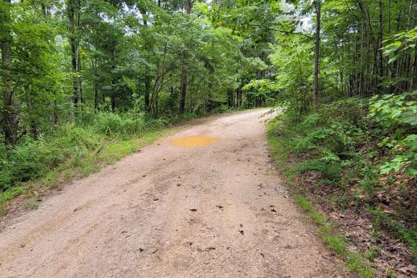
Off-Road Trails in Alabama
Discover off-road trails in Alabama
Off-Road Trails in Alabama
Discover the best off-road trails in Alabama. Browse trail maps, check difficulty ratings, and find your next adventure — whether you're looking for a quick ride or an all-day expedition.
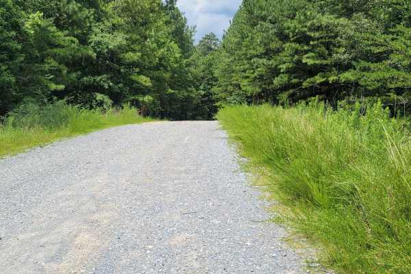
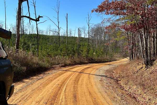
USFSR #601 Wiregrass
USFSR #601 Wiregrass begins at the South end on AL 148 just outside of Sylacauga. It is a winding gravel road with shallow mud holes scattered throughout from the various creeks that overflow onto the road, such as Tallaseehatchee Creek and Bulls Creek. It offers a few side trails that will take you...
Learn more about USFSR #601 Wiregrass
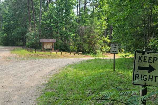
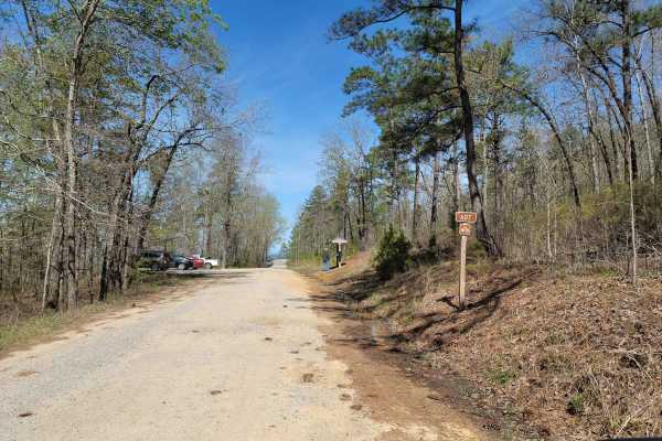
USFSR #643C Kentuck OHV Trailhead
USFSR #643C Kentuck OHV Trailhead is the actual trail entrance to the trail system. It is open to ATV, Dirt Bike or Mountain Bike. There is a 5$ fee per operator and the trails are open from 04/01-12/31. The system has easy to moderate trails with 4 loops totaling 23 miles. Around the trail head an...
Learn more about USFSR #643C Kentuck OHV Trailhead
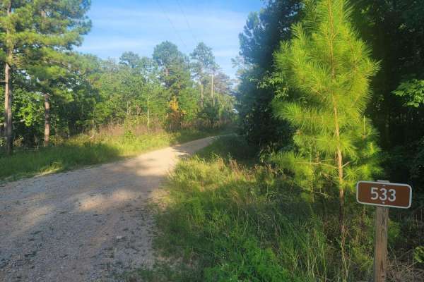
533 - Vaughn Road
533 - Vaughn Road is a lesser-known road that leads into the Shoal Creek District of the Talladega National Forest and leads to Forest Service RD (FSR) 500, which is the primary road in and out of the Management Area. This gated road is normally an open road and eventually lands in the small town of...
Learn more about 533 - Vaughn Road
USFSR #600-1
600-1 and its partner trail 600-2 are the most common trails in Alabama that are on public lands. People come from all over to see the scenic views and to see what the trail is all about. The trail begins just outside the small town of Sylacauga, nestled in the hills of the Millerville community. It...
Learn more about USFSR #600-1
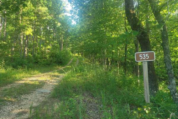
535 - Campbell
Trail 535 - Campbell is a seasonally open trail (10/01-04/01) mostly known to local hunters and hikers for the gentle rolling hills and open clear cuts that allow wildlife to come out into more open areas. These clear-cut areas also open up well-maintained trails for the avid off-road enthusiast to ...
Learn more about 535 - Campbell
USFSR #500K
USFSR #500K is the last trail that spurs off the primary road going in and out of the Shoal Creek Ranger District portion of the Talladega National Forest. This Northernmost trail is outside the Choccolocco Wildlife Management Area but is part of the beautiful Dugger Mountain Wilderness. It is a pop...
Learn more about USFSR #500K
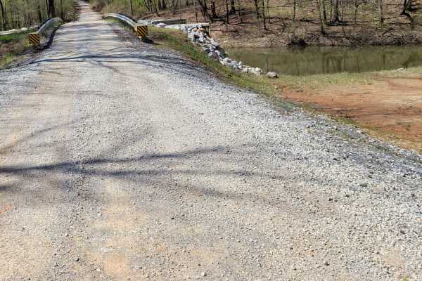
Warrior Cemetery Road
Warrior Cemetery Road is one of the "main" access roads for the Mulberry Fork WMA. The road is mostly graded gravel and is easily traversed with any 4WD and higher 2WD vehicles. There are several small lakes for fishing along the path and the historic Warrior Cemetery is near the end of the road. Th...
Learn more about Warrior Cemetery Road
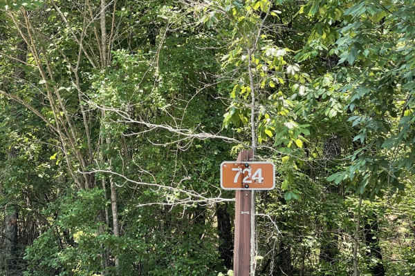
USFS #724
US Forest Service Road 724 in the Oakmulgee division of the Talladega National Forest offers stunning forest views, ample wildlife viewing opportunities, and exciting trail riding experiences. There are several excellent dispersed camping spots along the course of the road. Both the East and West tr...
Learn more about USFS #724
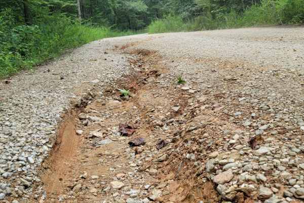
USFSR #600-3 Old Skyway
USFSR #600-3 Old Skyway is where everything is tied together. This short trail, while flat and easy, is riddled with potholes. This trail could see any type of vehicle from mountain bikes to class A campers, so be on the lookout for other people. It is seasonally maintained so more gravel is brought...
Learn more about USFSR #600-3 Old Skyway

Rattlesnake Green Trail
This is a great beginners' trail. It has just about all types of obstacles but they are perfect for first-time off-roaders or those just learning. It is stock friendly and has many beautiful areas along the trail to stop and see. Many places along this trail show newer off-roaders just how capable t...
Learn more about Rattlesnake Green Trail
USFSR #643 Hopeful Stephens St
USFSR #643 Hopeful Stephens St is the main trail into the Kentuck OHV Trail System (See USFSR #643C). It is a seasonally maintained road but will quickly degrade with heavy traffic and trailers. There are quite a few blind turns and the trail crosses over the ATV trails in many places. Maintain slow...
Learn more about USFSR #643 Hopeful Stephens St
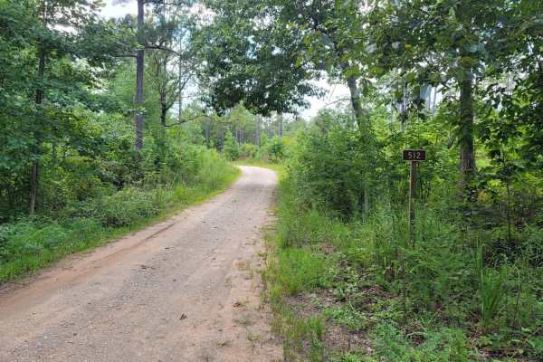
USFSR #512 Ivory Mountain
USFSR #512 Ivory Mountain is a small summit inside the Talladega National Forest and now hosts the spring walk in the Turkey hunt. This area features gradual rolling hills with many trails cut throughout it. It begins on USFSR #591 at a large "Y" shaped opening. This trail is an easy trail that stro...
Learn more about USFSR #512 Ivory Mountain
Meadow Creek Road
Meadow Creek Road or Winston County 357 is a maintained public gravel road running North from Highway 278 through Pine Timber Forestlands to Yankee Trace Road just before Highway 13. Meadow Creek Road offers an easy drive with ample opportunity for wildlife viewing as well as great views of the surr...
Learn more about Meadow Creek Road
USFSR #645 Tree Farm
USFSR #5645 Tree Farm is a seasonal route of varying degrees. It changes from a standard gravel road to a silt-like swamp, back to a gravel road, then back to mountainous terrain. This beautiful trail offers views of a diverse Alabama forest. There are a few mud holes with soft bottoms, which can be...
Learn more about USFSR #645 Tree Farm
USFSR #645C Three Mile Branch
USFSR #645C Three Mile Branch is more of a side spur trail that starts at USFSR #645 Tree Farm. While a shorter trail it does take a little longer to complete due to the overgrowth and how tight the trail is. There are a few off camber spots where water run off has created a rut that most full size ...
Learn more about USFSR #645C Three Mile Branch
USFSR #642K Old Wade Mtwy
USFSR #642K Old Wade Mtwy is a heavily traveled gravel route through a pine thicket of dense vegetation. It begins at Salt Creek Rd in Talladega County and ends in a large clearing before you enter into Cleburne County. The local traffic has consistently made additional paths to connect 642K to 642,...
Learn more about USFSR #642K Old Wade Mtwy
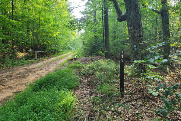
USFSR #515 Watts Mountainway East
USFSR #515 Watts Mtwy East begins at AL Hwy 281 and according to the US Forest Service Motor Vehicle Use Map, ends about a mile down. The eastern section does however, connect to the western section by right-of-way passing through some private land. The trail hugs the mountain side while holding lar...
Learn more about USFSR #515 Watts Mountainway East

Foothill's Cutover
Foothill's Cutover is a side trail that spurs off of USFSR #512A. It is not accessible from the opposite end, as it dead-ends at private property. It is a dense section of the Talladega National Forest that isn't traveled enough to receive a dedicated trail name on the Motor Vehicle Use Map but is c...
Learn more about Foothill's Cutover
USFSR #607 Bulls Gap
USFSR #607 Bulls Gap Trail head is a popular trail for birdwatchers, bicyclist, hikers and other nature lovers. Be sure to exercise caution and share the road! This trail offers scenic views and easy riding. Creeks and streams flow abundantly from water rushing down Horn Mountain, which is located i...
Learn more about USFSR #607 Bulls Gap
USFSR #644 Kentuck Mtwy
USFSR #644 Kentuck Mtwy begins on the East side starting at Kentuck Road and ends at Salt Creek road. This is a very easy ride and maintained frequently. It rides along the ridges of Kentuck Mountain and has many points where the Kentuck OHV trail system intersects. Be aware that other riders on sma...
Learn more about USFSR #644 Kentuck Mtwy
ATV trails in Alabama
Explore ATV-friendly trails in Alabama. These trails are accessible for vehicles up to 50 inches wide, perfect for ATVs and smaller off-road machines.
USFSR #643C Kentuck OHV Trailhead
USFSR #643C Kentuck OHV Trailhead is the actual trail entrance to the trail system. It is open to ATV, Dirt Bike or Mountain Bike. There is a 5$ fee per operator and the trails are open from 04/01-12/31. The system has easy to moderate trails with 4 loops totaling 23 miles. Around the trail head an...
Learn more about USFSR #643C Kentuck OHV Trailhead
Meadow Creek Road
Meadow Creek Road or Winston County 357 is a maintained public gravel road running North from Highway 278 through Pine Timber Forestlands to Yankee Trace Road just before Highway 13. Meadow Creek Road offers an easy drive with ample opportunity for wildlife viewing as well as great views of the surr...
Learn more about Meadow Creek Road
USFSR #644 Kentuck Mtwy
USFSR #644 Kentuck Mtwy begins on the East side starting at Kentuck Road and ends at Salt Creek road. This is a very easy ride and maintained frequently. It rides along the ridges of Kentuck Mountain and has many points where the Kentuck OHV trail system intersects. Be aware that other riders on sma...
Learn more about USFSR #644 Kentuck Mtwy
CR339
County Road 339 is a somewhat maintained public gravel road that offers great views of the surrounding area for those looking to get off the beaten path. Running from Alabama Highway 5 east to Rocky Plains Road, CR339 winds through prime Alabama Forestland, into creek bottoms, and along ridgetops. R...
Learn more about CR339
UTV/side-by-side trails in Alabama
Find UTV and side-by-side trails in Alabama. These trails accommodate vehicles up to 60 inches wide, ideal for UTVs, side-by-sides, and wider off-road rigs.
Meadow Creek Road
Meadow Creek Road or Winston County 357 is a maintained public gravel road running North from Highway 278 through Pine Timber Forestlands to Yankee Trace Road just before Highway 13. Meadow Creek Road offers an easy drive with ample opportunity for wildlife viewing as well as great views of the surr...
Learn more about Meadow Creek Road
CR339
County Road 339 is a somewhat maintained public gravel road that offers great views of the surrounding area for those looking to get off the beaten path. Running from Alabama Highway 5 east to Rocky Plains Road, CR339 winds through prime Alabama Forestland, into creek bottoms, and along ridgetops. R...
Learn more about CR339
Poplar Springs Trail
This trail can be run in either direction but is best run from North to South. Starting at the North part you will head South. The trail is mostly down the mountain. There are areas that have large mud areas that will be slick and can be deep depending on the time of year. A few areas have some dro...
Learn more about Poplar Springs Trail
Mount Olive
This trail is mostly rough dirt roads barely big enough for two vehicles. There are some side trails that are gated and you will pass by some private property, so be cautious of any signage. It can be done in 2WD especially in good weather, though in wet conditions it may get slick on some hills, bu...
Learn more about Mount Olive
The onX Offroad Difference
onX Offroad combines trail photos, descriptions, difficulty ratings, width restrictions, seasonality, and more in a user-friendly interface. Available on all devices, with offline access and full compatibility with CarPlay and Android Auto. Discover what you're missing today!
Open Trail Map