Dispersed Camping and Overlanding: Maps, Access, and Planning Tips
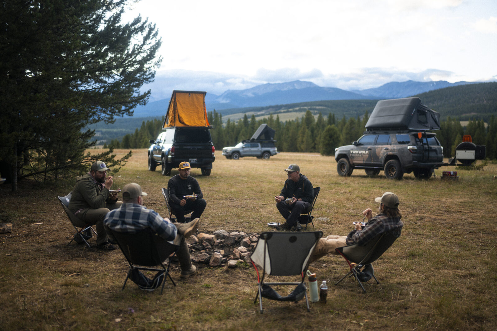
There’s something about waking up miles from the nearest paved road, with nothing but trees, dirt, and silence around you. No campground hosts. No numbered sites. No neighbors 10 feet away running generators until midnight. Just you, your rig, and the backcountry.
That’s the draw of dispersed camping, and a big reason overlanding has grown so popular over the past decade. But finding those spots—legal, accessible, and ones that won’t get you stuck or ticketed—takes more than luck. It takes planning, the right maps, and a solid understanding of where you can and can’t go.
TL;DR:
Dispersed camping lets you camp for free on public lands like National Forests and BLM land, away from developed campgrounds. Most areas allow stays of 14 days before you need to relocate. Good maps showing land ownership boundaries are essential for finding legal spots and avoiding trespassing. Download offline maps before you go since cell service is unreliable in remote areas. Always check current fire restrictions, use established campsites when possible, and follow Leave No Trace principles. Bring enough water, recovery gear, and a backup plan.
This guide covers what you need to know about dispersed camping and overlanding, from understanding land access rules to actually finding and navigating to remote campsites. Whether you’re new to backcountry camping or you’ve been doing it for years, there’s practical advice here worth revisiting.
What Is Dispersed Camping?
Dispersed camping means camping outside of designated campgrounds, typically on public land. You won’t find picnic tables, fire rings, bathrooms, or reserved spots. You’re on your own, which is exactly the point.
Most dispersed camping happens on:
- National Forest land managed by the U.S. Forest Service
- Bureau of Land Management (BLM) land
- Some state trust lands (rules vary by state)
- Wildlife Management Areas in certain states
The appeal is straightforward: solitude, flexibility, and free camping in scenic places. But with that freedom comes responsibility. You need to know the rules, respect the land, and leave no trace.
| Feature | Dispersed Camping | Developed Campgrounds |
| Cost | Usually free | $15–$50+ per night |
| Amenities | None | Restrooms, water, tables |
| Reservations | Not required | Often required |
| Privacy | High | Variable |
| Accessibility | Requires research | Easy to find |
| Rules | Varies by area | Clearly posted |
Understanding Public Land Access
Before you load up and head out, you need to understand where dispersed camping is actually allowed. Not all public land permits it, and the rules can change based on the managing agency, time of year, and local fire conditions.
National Forest Land
The U.S. Forest Service administers the nation’s 154 national forests and 20 national grasslands covering 193 million acres of land. Most National Forests allow dispersed camping, but there are important details to know:
- Stay limits: You may camp in a dispersed area for a limited period of time, usually 14 days, but this can be further limited in some areas.
- Distance requirements: Do NOT camp within 200 feet of any water source.
- Seasonal closures: Some areas close during fire season or for wildlife protection.
- Motor Vehicle Use Maps (MVUMs): Motor Vehicle Use Maps represent the authoritative source for determining legal vehicle access and camping areas within national forests. These detailed maps identify designated routes, seasonal closures, and vehicle restrictions.
Each National Forest has its own specific regulations. The Coconino National Forest in Arizona has different rules than the Bridger-Teton in Wyoming. Always check the local ranger district’s website or in the onX Offroad app.
BLM Land
The Bureau of Land Management administers more surface land (245 million acres or one-tenth of America’s land base) and more subsurface mineral estate (700 million acres) than any other government agency in the U.S. BLM land is generally more permissive for dispersed camping:
- Stay limits: Dispersed camping is generally limited to 14 days within any 28‑day period, though specific stay limits vary by state and field office.
- Relocation requirements: After reaching the stay limit, visitors must move to a new location—often at least 25 to 30 miles away.
- Special Recreation Management Areas: Some popular areas have additional rules or require permits
BLM land can be harder to identify on the ground because it’s often mixed with private property in a checkerboard pattern. This is where good mapping becomes critical.
State Trust Land
State trust lands are managed to generate revenue for public schools and institutions. Rules vary dramatically by state where some allow camping with a permit and others are strictly no camping. Don’t assume state land is open for camping. Make sure to research the specific state’s rules before you go.
Why Good Maps Matter for Overlanding
Here’s where a lot of people run into trouble: they find what looks like a great spot on a satellite view, drive out there, and discover it’s actually private property. Or they follow a road that dead-ends at a locked gate. Or they get stuck because they didn’t realize the road requires high clearance.
Overlanding and dispersed camping demand better maps than what comes standard on your phone.
What You Need from an Overlanding Map or App
- Public/private land boundaries: The most important layer for dispersed camping.
- Road and trail data: Including surface type, difficulty, and legal status.
- Topographic detail: Elevation changes, terrain features, water sources.
- Offline capability: Cell service disappears fast in the backcountry.
- Current information: Roads close, regulations change, fires happen.
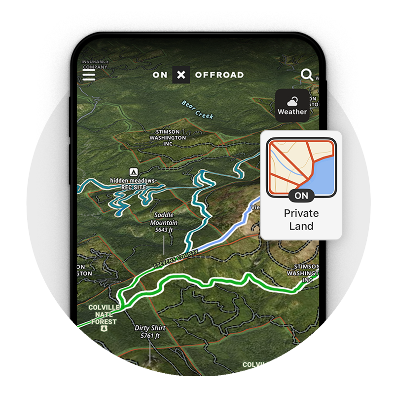
The onX Offroad App addresses these needs by showing public land boundaries overlaid on detailed topographic maps. You can see exactly where National Forest land ends and private property begins, down to the parcel level. The Elite tier includes private land ownership information, for even more detail about the boundaries.
Reading Land Boundaries
Understanding land ownership takes practice. Here’s what you’re typically looking at:
- Green shading: Often indicates National Forest or other federal land.
- Yellow or tan: May indicate BLM land.
- White or unmarked: Usually private property.
- Checkerboard patterns: Common in areas where railroad land grants created alternating public/private sections.
The key is verifying boundaries before you set up camp—not after a landowner or ranger shows up.
Finding Dispersed Camping Spots
Now for the practical part: actually finding good places to camp. This takes a combination of map research, on-the-ground scouting, and sometimes a bit of trial and error.
Start with Map Research
Before you leave home, spend time studying maps of your destination area. Look for:
- Forest roads or BLM roads that branch off main routes.
- Flat areas near (but not too near) water sources.
- Established pullouts visible on satellite imagery.
- Areas away from private property boundaries.
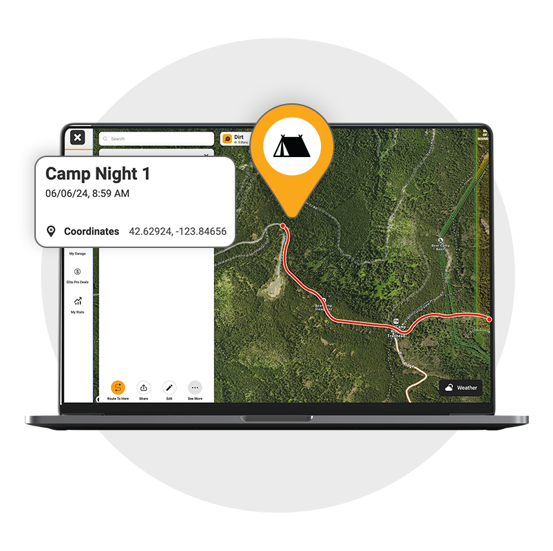
Using onX Offroad, you can drop Waypoints on potential camping spots, measure distances from water and roads, and check elevation profiles to understand the terrain you’ll be driving through. You can also export or share Waypoints with trip partners for coordination.
Look for Established Sites
Dispersed camping doesn’t mean blazing your own trail or setting up wherever looks flat. In fact, most legal and responsible dispersed campsites are existing sites located along legal Forest Service or BLM roads within a few hundred feet of the road.
Signs of established sites include:
- Fire rings (where fires are permitted).
- Flat, cleared areas.
- Short spur roads off the main route.
- Visible on satellite imagery as lighter patches.
Using established sites follows Leave No Trace principles—you’re not creating new impacts on undisturbed ground.
Scout on Arrival
Maps can only tell you so much. Once you’re in the area, drive slowly and scout:
- Check road conditions before committing.
- Look for “No Camping” signs or closure notices.
- Verify you’re actually on public land.
- Assess the site for drainage, shade, and privacy.
If a spot doesn’t feel right, keep looking. There’s usually another option down the road.
Planning Your Route
Getting to a dispersed campsite often means driving roads that don’t appear on standard navigation apps. Planning your route carefully prevents getting stuck, lost, or stranded.
Assess Road Difficulty
Not all forest roads are created equal. You’ll encounter everything from graded gravel to rocky, rutted trails that require serious clearance and traction.
Before you go, try to determine:
- Road surface: Gravel, dirt, rock, sand.
- Clearance requirements: Can a stock truck make it, or do you need a lifted 4×4?
- Obstacles: Water crossings, ledges, tight turns.
- Seasonal conditions: Some roads become impassable when wet.
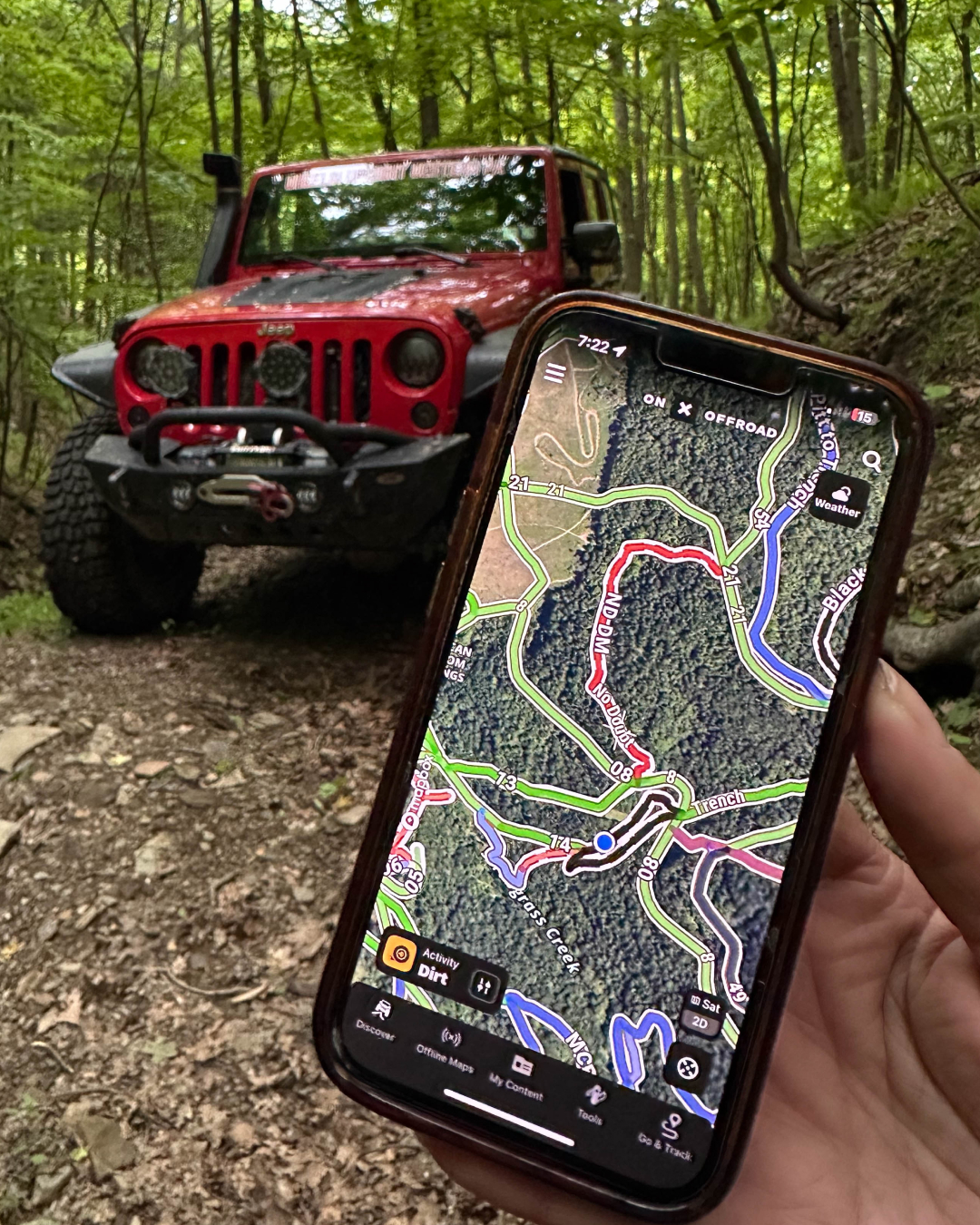
The onX Offroad app color-codes trails by difficulty and includes user-submitted photos and reviews. That combination helps you assess risk before committing to a route with no easy turnaround.
Download Offline Maps
Cell service is unreliable or nonexistent in most dispersed camping areas. Download Offline Maps before you leave home.
With onX Offroad, you can download entire regions for offline use. Your GPS position still works without cell service, so you can navigate, track your route, and find your way back even in areas with zero connectivity. Download the specific areas you need rather than an entire state to save storage space.
Create Waypoints for Key Locations
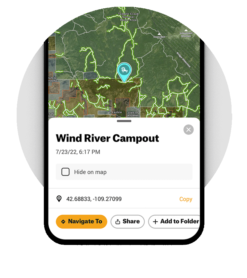
Mark important spots on your App before and during your trip:
- Potential campsites.
- Water sources.
- Trailheads you want to explore.
- The last point where you had cell service.
- Any gates or road junctions.
These Waypoints become your safety net and make it easier to share locations with others or return to good spots in the future.
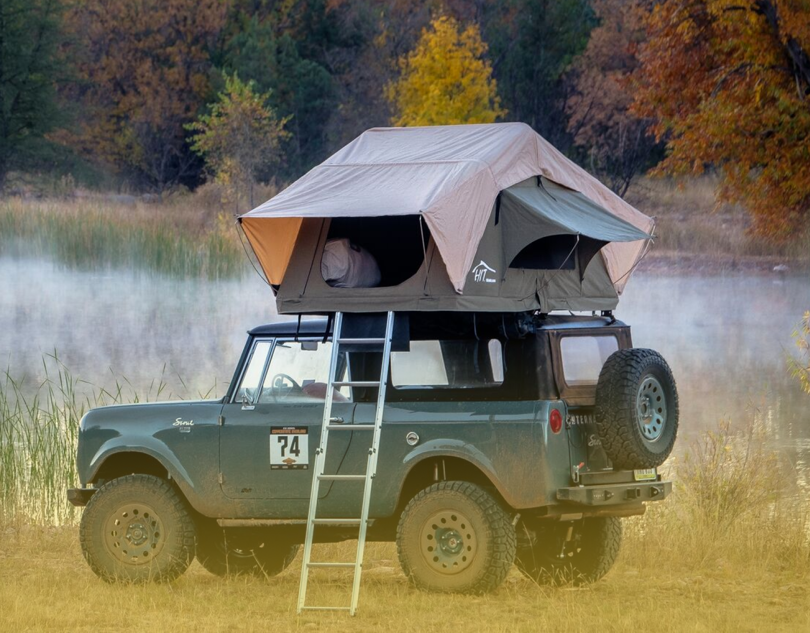
Overlanding Trip Preparation
Dispersed camping requires more self-sufficiency than staying at a developed campground. You’re responsible for everything—water, shelter, safety, and getting yourself out if something goes wrong.
Leave No Trace Principles for Dispersed Camping
Dispersed camping only works if people respect the land. The freedom to camp in remote areas comes with the responsibility to leave no evidence you were there.
Pack It In, Pack It Out
Everything you bring leaves with you. This includes:
- All trash, including food scraps.
- Toilet paper and human waste (pack out or bury properly).
- Cigarette butts.
- Broken gear.
Minimize Campfire Impacts
Where fires are permitted:
- Use existing fire rings.
- Keep fires small.
- Burn wood completely to ash.
- Drown, stir, and feel the ashes before leaving.
- Never leave a fire unattended.
During fire restrictions, use a camp stove instead. It is your responsibility to know if fire restrictions are in effect before you go camping.
Respect Wildlife and Other Visitors
- Store food properly to avoid attracting animals.
- Keep noise levels reasonable.
- Give other campers space.
- Stay on established roads and trails.
Dispose of Waste Properly
For human waste in areas without toilets, deposit solid human waste in catholes dug six to eight inches deep at least 200 feet from water, camp, and trails. Cover and disguise the cathole when finished. Pack out toilet paper and hygiene products.
Consider a portable toilet system for longer trips.
Common Dispersed Camping Mistakes to Avoid

You can learn a lot from other campers’ mistakes, but it’s even better to avoid them in the first place with onX Offroad. Using the right map layers and planning tools before you leave home can help you camp more confidently, legally, and efficiently. onX Offroad includes features like Dispersed Camping Maps, Private Land Boundaries, Trail Reports, Route Builder, Offline Maps, Custom Waypoints, and Turn-by-Turn Navigation that are especially useful when you’re trying to find and reach a legal campsite.
- Trespassing on Private Land: One of the biggest dispersed camping mistakes is assuming open space is fair game. A spot that looks public on a basic map may actually sit on private property or near a boundary line. With onX Offroad, you can use Private Land Boundaries to see land ownership data and pair that with Dispersed Camping Maps to narrow in on places where camping is allowed before you ever unload your gear.
- Ignoring Fire Restrictions: Conditions can change fast, especially during dry seasons. A campsite that was fine last weekend may be impacted by closures, wildfire activity, or shifting access conditions. onX Offroad helps you stay ahead of those changes with Trail Reports for current conditions and closures, plus Wildfire Maps to keep an eye on fire activity while planning your trip.
- Camping Too Close to Water: Another common mistake is picking a campsite without fully understanding how to reach it or what’s around it. onX Offroad’s Route Builder helps you map your approach ahead of time. Once you’ve identified a promising area, you can save potential camp options with Custom Waypoints so you’re not scrambling once you arrive. Make sure to stay at least 200 feet from lakes, rivers, and streams to protect water quality. This also protects wildlife access to water sources.
- Getting Stuck: Overestimating your vehicle’s capability, underestimating road conditions, and poor route planning leads to stuck rigs. A road may look simple on a generic map, but real conditions can tell a different story. onX Offroad’s Trail Maps show trail difficulty and ride types so you know if your vehicle can make it, Trail Reports which help you understand what users are seeing on the ground, and Recent Imagery to see what the trail looks like first hand. That means you can scout smarter, adjust faster, and avoid committing to a bad line without a backup reference.
- Not Having a Backup Plan: Your first-choice campsite might be occupied, inaccessible, or not as good as it looked initially. That’s why it helps to save multiple options before your trip. With onX Offroad, you can mark several camp possibilities using Custom Waypoints, organize trip options, and build alternate approaches with Route Builder so you’re not forced to improvise when your Plan A falls through.
Final Thoughts
Dispersed camping and overlanding offer something increasingly rare: genuine solitude and freedom in wild places. But that freedom isn’t unlimited. It comes with the responsibility to know the rules, respect the land, and prepare properly.
Frequently Asked Questions
Yes, on most federal public lands including National Forests and BLM land. However, specific rules vary by location. Some areas require permits, have seasonal closures, or prohibit camping entirely. Always verify regulations for your specific destination.
Use mapping tools that show land ownership boundaries. The onX Offroad App displays public/private land boundaries and identifies the managing agency. You can also check with local ranger districts or land management offices.
Most areas don’t require permits or reservations. Some regions may require permits for large groups or campfires. Fire permits may be required separately in some regions, such as California.
Dispersed camping is generally limited to 14 days within any 28‑day period on BLM land, though specific stay limits vary by state and field office. National Forests typically follow similar limits. After that, you must move a specified distance, usually 25 miles or more.
Download Offline Maps before you leave. GPS on your phone works without cell service—it uses satellites, not cell towers. The onX Offroad app lets you download maps for offline use so you can navigate even in remote areas.
With proper preparation, yes. The main risks are vehicle breakdowns, getting lost, wildlife encounters, and weather. Mitigate these by maintaining your vehicle, carrying good maps, storing food properly, and monitoring conditions.