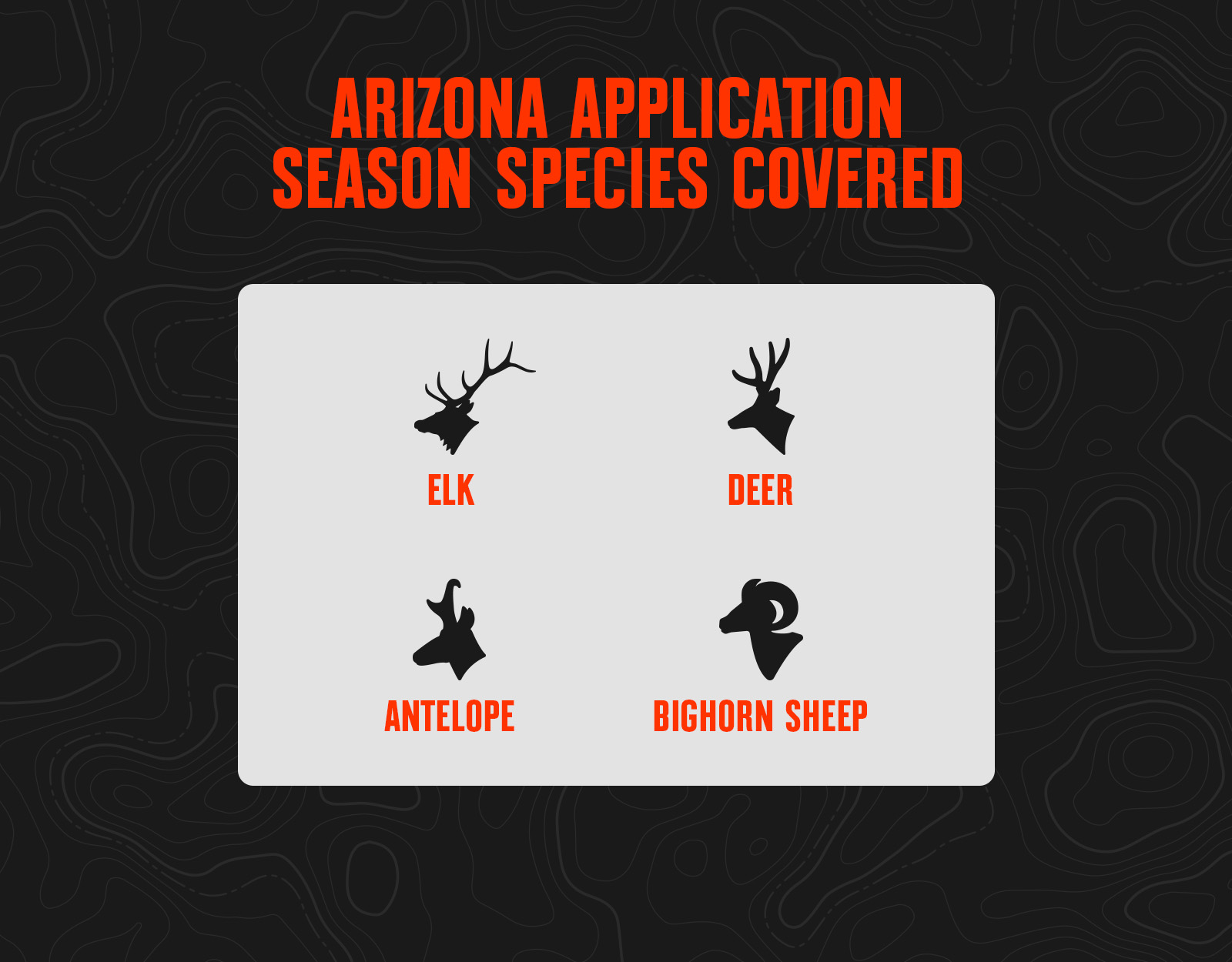
Home to some of the most unique hunting opportunities in the United States, Arizona offers 10 big game species, all accessible through public land hunts. Unique terrain, including mountains, mesas, canyons, and deserts, helps support a healthy population of big game, and presents unique opportunities and challenges for hunters. Most Arizona hunting licenses are processed through a draw system, with the number of allocated permits adjusted annually. Application season is the first step of most Arizona hunts—keep reading for the information you need to get started.
Arizona has some of the best elk hunts in the nation, and is a must-apply-for state if a trophy bull is your long-term goal. The state uses a bonus point system, but it is possible to draw a premium big game tag in Arizona with zero points if you’re lucky enough in the random portion of the drawing. There are two separate application periods in Arizona: a February deadline for elk/antelope and a separate, early June deadline for deer/sheep/bison.
New in 2025 From Huntin’ Fool
New 2025 elk/antelope or 2025 deer/sheep regs, season dates, and quotas can be found on the Arizona Game & Fish website.
Application deadlines for pronghorn antelope and elk closed on Tuesday, Feb. 4, 2025, and tags for deer, bighorn sheep, and fall bison must be applied for by 11:59 PM (Arizona time) on Tuesday, June 3, 2025. More detailed information on Arizona big game draws can be found below.
Elk-specific changes for 2025 include:
- Elk units 9 and 27 rotated out of the early firearm designation and will have early muzzleloader hunts.
- Elk unit 1 rotated out of the early muzzleloader schedule and will have an early rifle hunt.
- Elk unit 6A will not have an early firearm hunt but nearby units 8 and 7 East will both have early rifle hunts in 2025.
- Elk unit 6A added 75 more late rifle elk tags for a total of 825 tags, which leapfrogged unit 5B for the most tags for any elk hunt in Arizona.
- Arizona is issuing 220 more late elk tags in total for the late rifle seasons.
Deer specific changes for 2025 include:
- Deer permits have been cut by 790 this year across all rifle hunts for Coues and mule deer.
- 27/28 rifle Coues deer now have two early hunts in 2025, splitting the permit quota of 600 and having 300 for each early hunt.
- Units 1 and 27 are now draw only for archery mule deer.
- Unit 8 was added to the list of youth deer hunts. The 7/9 hunt was discontinued for this year.
Bighorn Sheep specific changes for 2025 include:
- Non-residents picked up 15A/15B, 15C North, 4A/5A, and an additional hunt in unit 22 for sheep but lost 24B North, 24B South, and 40B Mohawk/Copper Mtns hunts.
- 40B Gila, 40B Mohawk/Copper, and 40B Tinijas units only have one hunt each for Desert bighorn sheep this year instead of two.
- 40B Mohawk/Copper Mtn bighorn sheep is unavailable to non-residents this year with the reduction of tags to one.
- 12B East lost one hunt but still has two hunts available.
- New one-horned ram hunts will be available in select units for both Desert and Rocky bighorn sheep (two Desert and one Rocky). These permits will only be available to resident pioneer license holders.
Hunters may apply for tags with Arizona Game & Fish.
Huntin’ Fool’s Arizona page is an excellent, updated resource for ongoing Arizona draw changes.
Arizona Draw Process Basics
Application Dates and Deadlines: Huntin’ Fool lines out Arizona dates and deadlines.
Free for onX Elite members, Hunt Reminder’s Arizona page is also an excellent resource for timely application season reminders.
Hunting license and species costs for tags usually include:
- Application fee.
- Hunting license fee to apply (usually need a qualifying license before you can apply).
- Species fee (This is what you pay for the animal you want to hunt. Some you pay upfront at application, some you pay for once you get the tag.).
- Points-only fee (fees for people just buying points and not actually applying for a hunt).
ARIZONA DEADLINES
Elk & Antelope
Sheep, Bison, & Deer
Bison, Javelina, & Turkey
Non-Resident Archery Deer
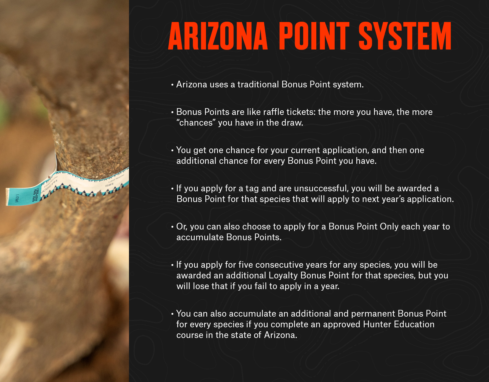
Point System
Arizona uses a traditional bonus point system. Bonus points are like raffle tickets: the more you have, the more “chances” you have in the random pass of the draw. You get one chance for your current application, and then one additional chance for every bonus point you have (so with three points, you’d get four chances). If you apply for a tag and are unsuccessful, you will be awarded a bonus point for that species that will apply to next year’s application, or you can also choose to apply for a bonus point each year to accumulate bonus points and not be considered in the draw for a tag.
If you apply for five consecutive years for any species, you will be awarded an additional loyalty bonus point for that species, but you will lose that if you fail to apply in a year. You can also accumulate an additional and permanent bonus point for every species if you complete an approved Hunter Education course in the state of Arizona or the Ethically Hunting Arizona online course.
Tag Allocation
For every individual hunt code, 20% of the total number of tags for that hunt will be awarded to the applicants with the most bonus points (called “bonus pass”). The remaining 80% of tags for any given hunt code will be issued in the random draw (called the “half pass”).
For elk, deer, and antelope, up to 10% of the total number of tags can be issued to non-residents. This 10% is not guaranteed, but most buck or bull tags have sufficient non-resident demand to trigger the full 10% allocation. Of the 10% non-resident tag pool, a maximum of half (50%) of those tags may be issued in the bonus point drawing.
As an example:
Hunt Code X has 100 total tags:
- 20% will be issued in the bonus pass: 20 tags
- 80% will issued in the random draw (half pass): 80 tags
- 10% of the total number of tags can be issued to non-residents: 10 tags total
- 50% of the total number of non-resident tags can be issued in the bonus pass: 5 tags total
- The remaining non-resident tags will be issued in the random draw: 5 tags total
- Of the 100 total tags, non-residents can draw 10 (five in the bonus pass, five in the random draw)
- Residents will draw a minimum of 90 tags (15 tags in the bonus pass, and 75 in the random draw)
Useful Links
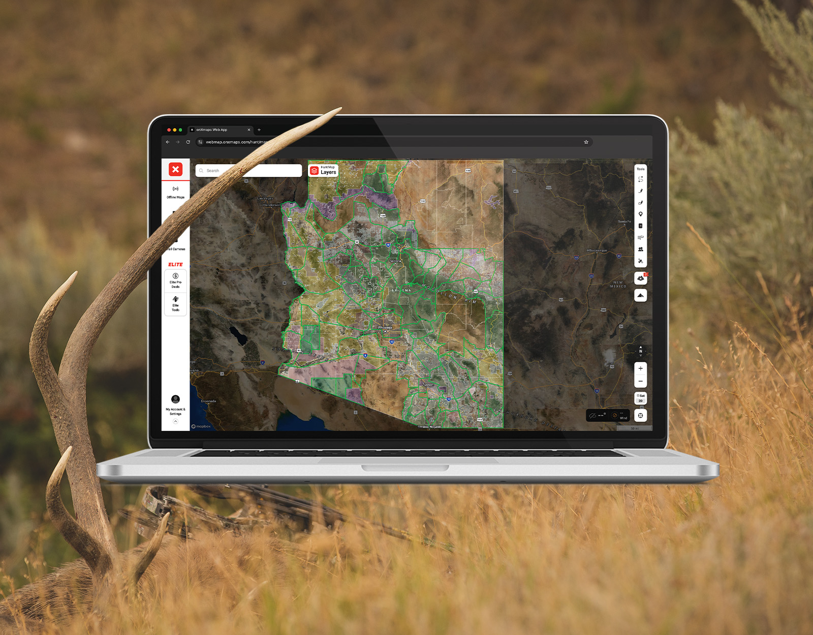
- Review all the Application Season Tools You Get With onX Elite.
- Log Into onX Hunt Research Tools To Start Your Application Season.
onX Hunt’s Top Arizona Application Tips
- If you’re hoping to draw a tag in the random draw, on your application you generally want to put the harder-to-draw hunt as your first choice, and the easier-to-draw hunt as your second choice. If you’d actually prefer to go on the easier-to-draw hunt, move it to your first choice and consider choosing another easier-to-draw hunt as your second choice so you can maximize your overall odds to at least draw.
- You must purchase an annual hunting license ($160 for non-residents) to apply, in addition to a $15 application fee per species. Once you’ve purchased the hunting license, it’s cost-effective to apply for multiple species even if your primary intent is to hunt a specific species (elk, for example). Arizona has a number of late-season rifle elk hunts—in good units—that are outside of the rut but traditionally have much better draw odds.
- For $10 per species (or $25 for PointGuardPlus, an additional tier of PointGuard service that allows hunters to surrender their hunt permit-tag for any reason without losing their coveted bonus points), you can also purchase “Point Guard,” an insurance of sorts that allows you to give your tag back AND still keep your accumulated points in case you draw and are for any reason unable to go on the hunt.
![]()
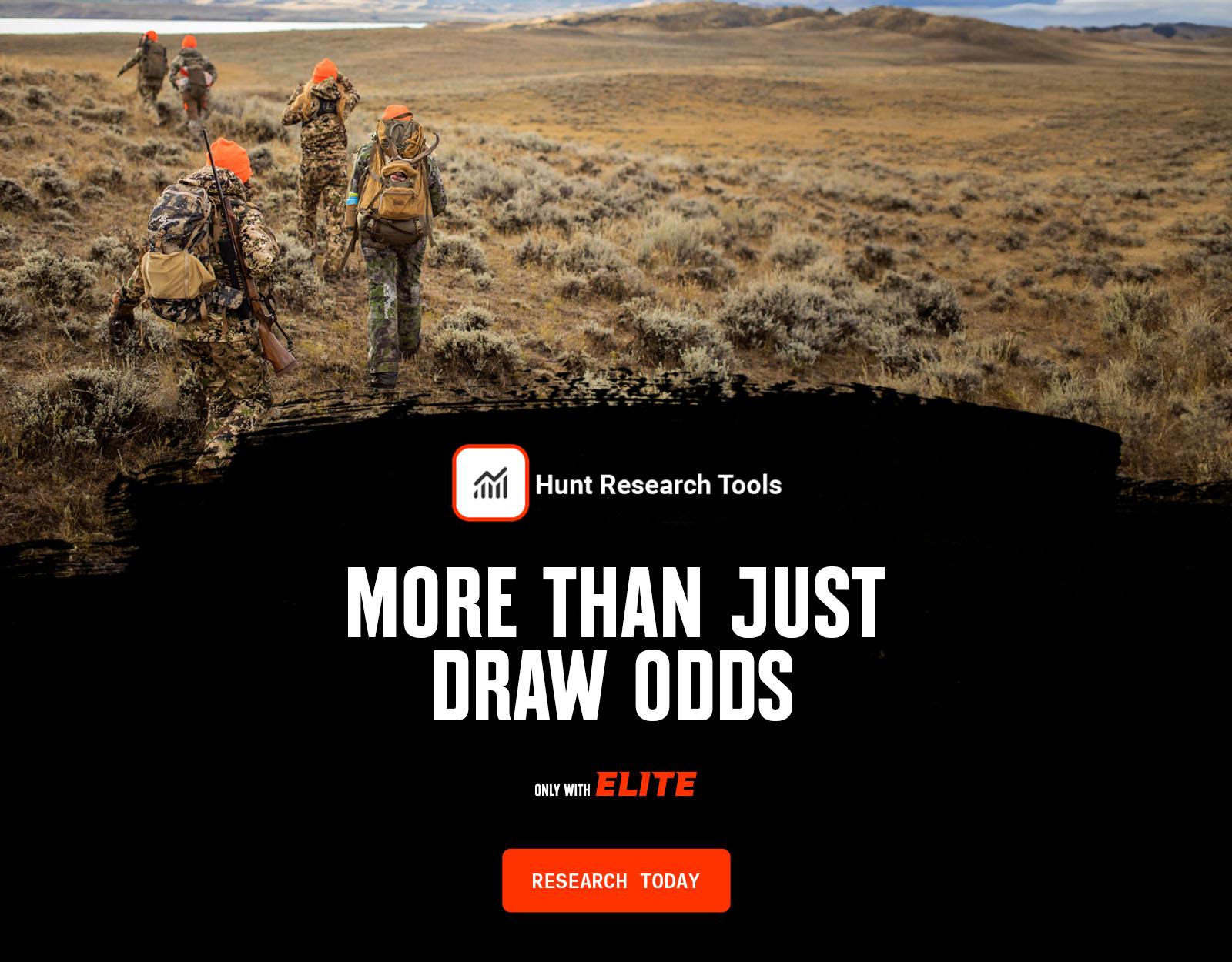
Your Complete System for Securing Tags
Whether you’re chasing a once-in-a-lifetime hunt or just looking to fill the freezer, your season starts with onX Hunt’s application tools—all included with an Elite Membership:
- Hunt Research Tools: Draw odds, tag trends, and harvest stats for 11 western states (Washington is not yet available) to help you decide where to apply.
- Huntin’ Fool: In-depth insights to navigate state-specific systems and build better strategies.
- HuntReminder: Text and email alerts so you never miss a deadline.
One membership, every tool you need to make 2026 the year.