
SNOTEL Data in onX Backcountry
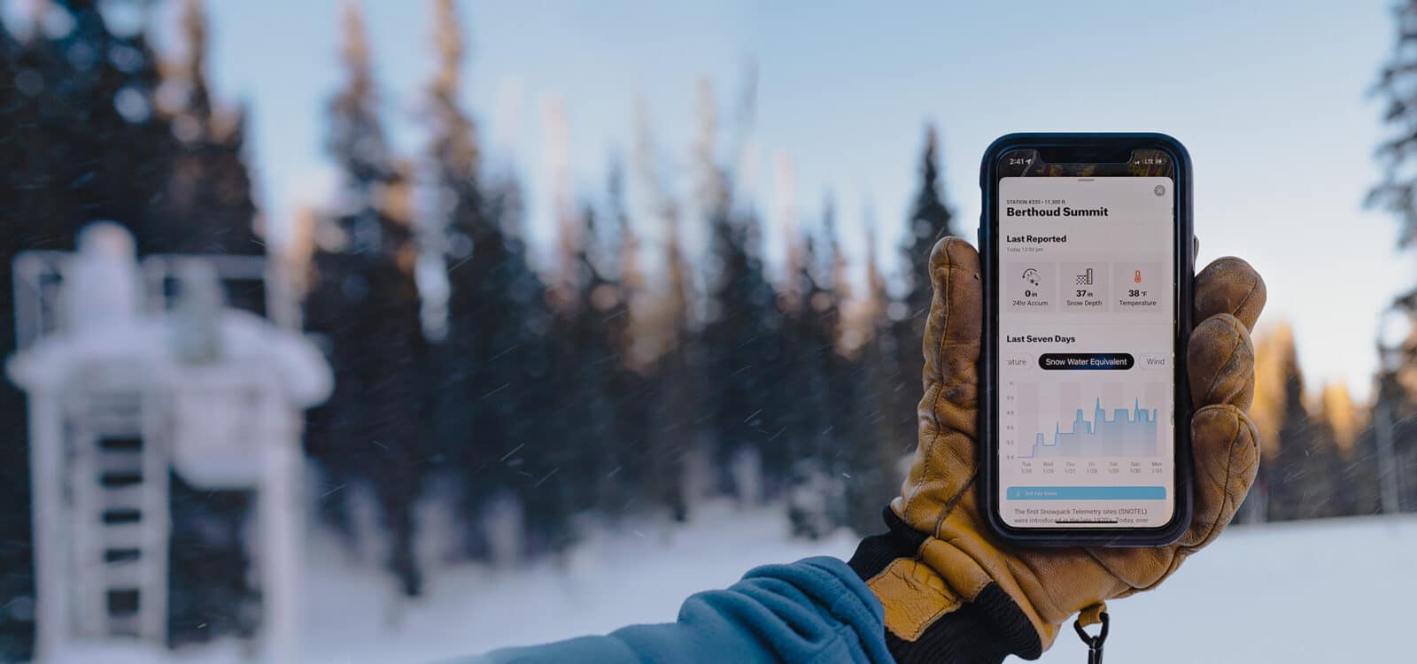
With SNOTEL in onX Backcountry Premium, you have the most up-to-date snow data in the palm of your hand. Use snow depth, temperature, and snow water equivalent to optimize your powder day.
With SNOTEL in onX Backcountry Premium, you have the most up-to-date snow data in the palm of your hand. Use snow depth, temperature, and snow water equivalent to optimize your powder day.
What Is SNOTEL?
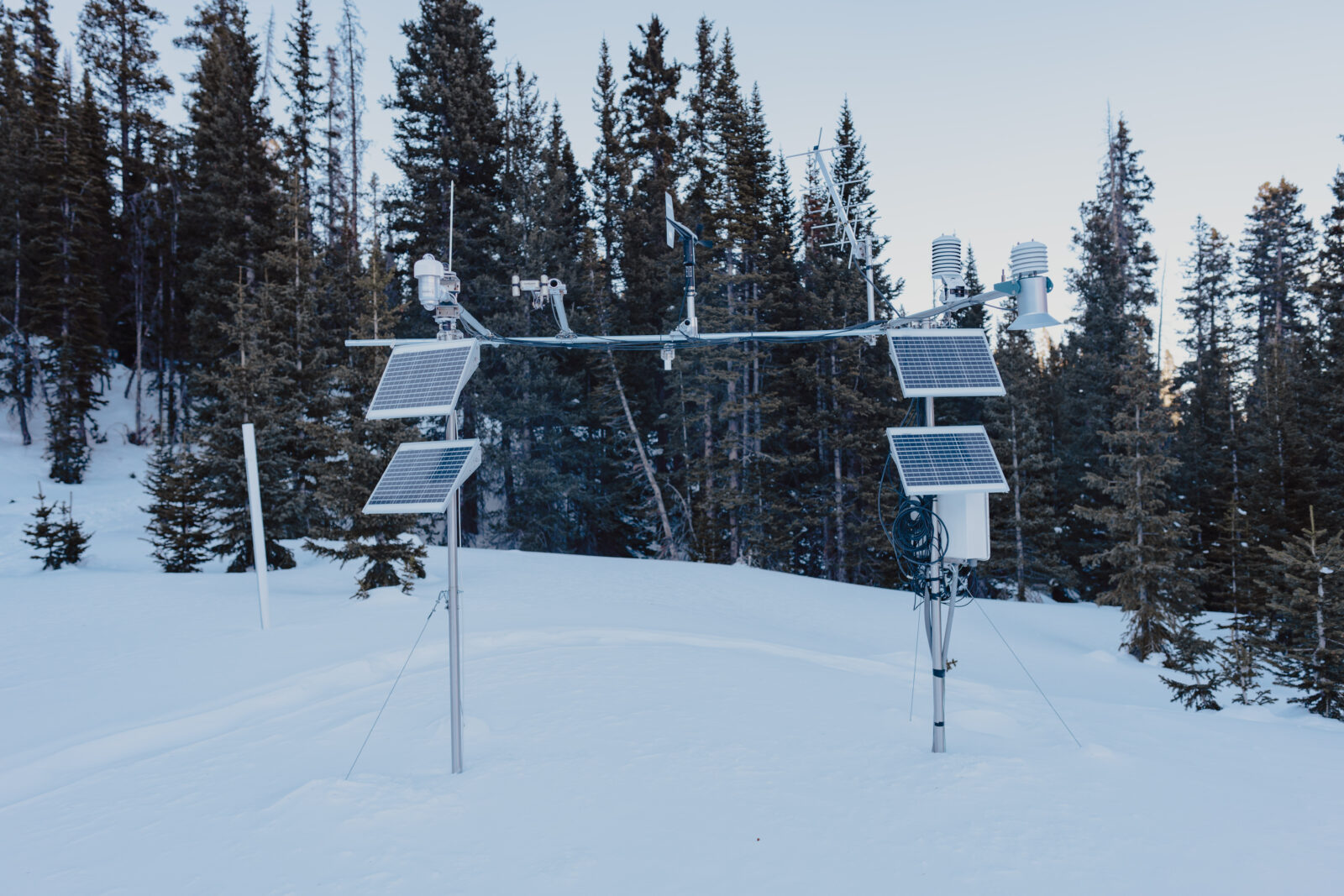
Snow Telemetry or SNOTEL stations are remote sensors located in high alpine areas across 11 states that measure data such as snow to water ratios, temperature, and precipitation. Installations began in the 1970s and are managed by The Natural Resources Conservation Service (NRCS). Data points are reported hourly by the 800+ stations across the West. The calculations are integral for skiers as they represent conditions more appropriate than local weather stations or airports where most forecasts are generated.

“
SNOTEL sites provide me with important snow quantity and wind speeds I use to shed light on what’s going on in the mountains.
Whether it’s my local spot or visiting a new zone, this snow information is fundamental to making good decisions and finding the best snow.”
Mark Smiley
IFMGA Certified Mountain Guide
Current Conditions Reports, At Your Fingertips
Get current snow depth, recent snow accumulation, temperature, and snow water equivalent data information in your favorite backcountry zones anywhere at any time with onX Backcountry Premium.
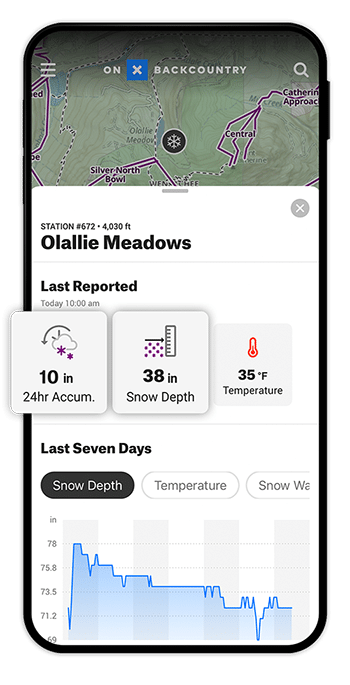
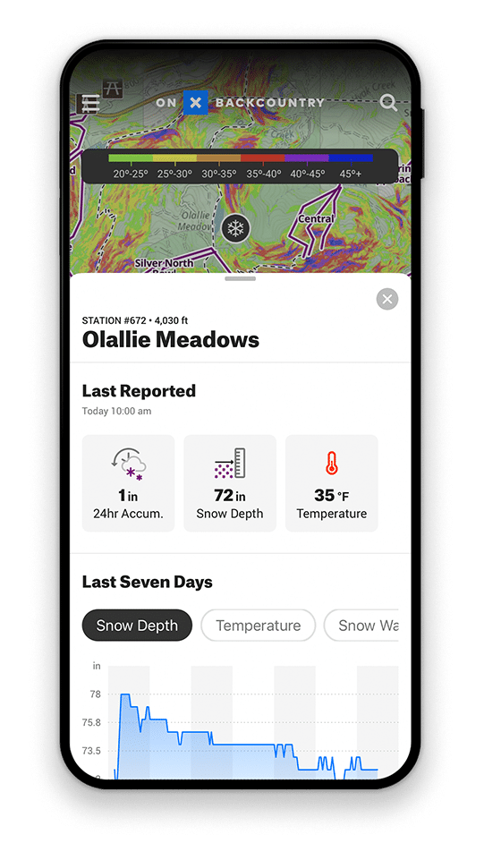
Snow Depth and Accumulation
Perhaps the best thing about SNOTEL sites is their ability to provide real-time snow depth measurements. Depth is measured by a sensor affixed above the ground pointing downward to the snow and as snow accumulates, that distance is shortened.
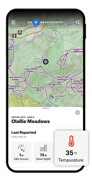
Temperature
Using temperature data, skiers are able to make better-educated decisions about what they’ll find in remote backcountry zones. See weather patterns and interpret how those will impact avalanche conditions.
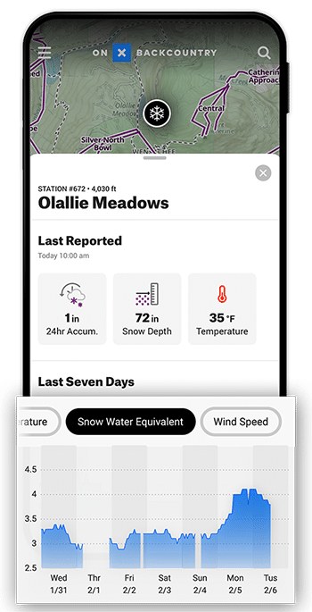
Snow Water Equivalent
Perhaps the most paramount metric derived from these stations is the SWE. This measures the actual amount of water present in the snowpack, calculated by its weight. The less water content, the fluffier the pow.
How to Access SNOTEL Data

On Desktop
- Login to your account on webmap.onxmaps.com/backcountry/login.
- Select Snow Mode at the top of your screen.
- Toggle Snow Mode on.
- Navigate to your favorite backcountry zone and look for the snowflake icon.
- Discover snow depth, temperature, and snow water equivalent.

In App
- Open onX Backcountry on your mobile device or tablet.
- Select Snow Mode on the bottom left of the home screen.
- Toggle Snow Mode on.
- Navigate to your favorite backcountry zone and look for the snowflake icon.
- Discover snow depth, temperature, and snow water equivalent.
Frequently Asked Questions
The sites were designed to predict floods and water storage in high alpine areas, not to predict your powder day. However, using a little inference you can optimize the data for better snow and safer conditions.
The remote backcountry weather station is powered using a small solar panel that operates the data measuring devices and allows for communication with satellites that transfer the information back to the Natural Resources Conservation Service (NRCS).
That’s a judgment call. Ask an east coast skier and they’ll tell you November is “fast grass season,” but using SNOTEL, you’ll know precisely how much snow there is.
Try onX Backcountry’s SNOTEL Data
Find SNOTEL Stations in your favorite backcountry zones in onX Backcountry to view up to date snow totals, accumulation, temperatures, and snow water equivalent. Try onX Backcountry for free for 7 days.