Big Flat Long Flat (FS 40581/Paiute D-3/Trail 1A)
Total Miles
4.7
Technical Rating
Best Time
Spring, Summer, Fall
Trail Type
High-Clearance 4x4 Trail
Accessible By
Trail Overview
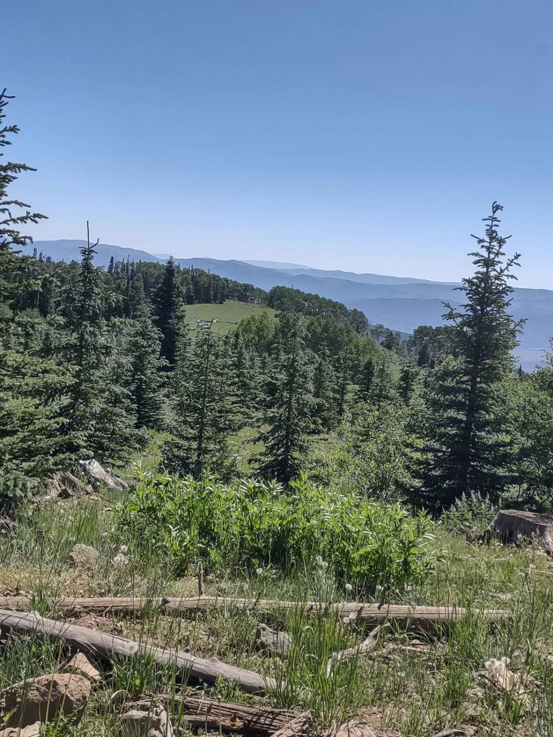
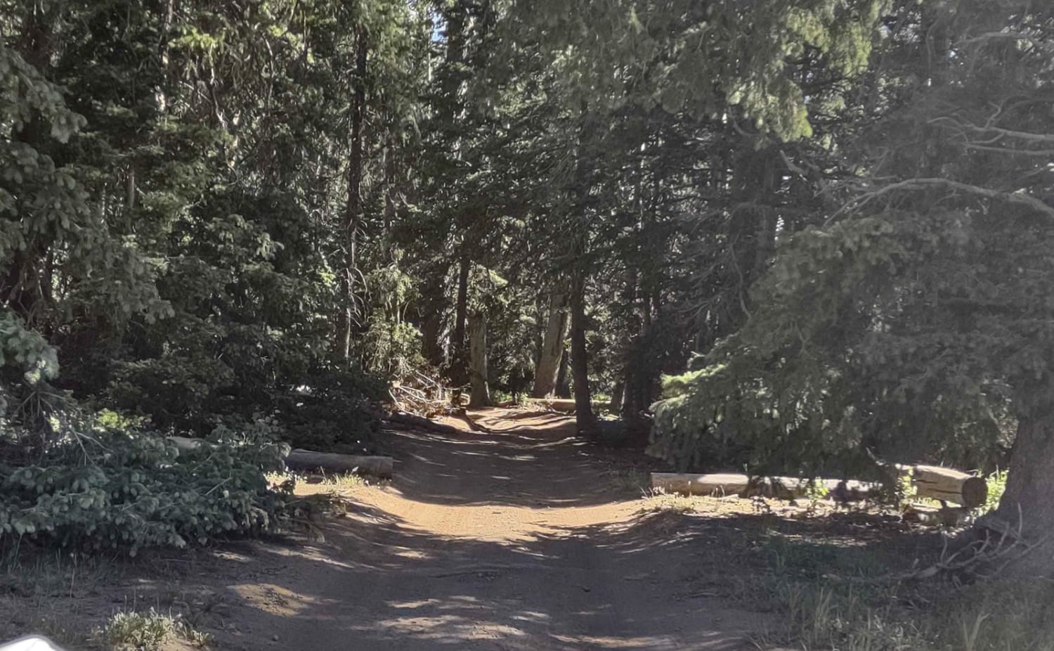
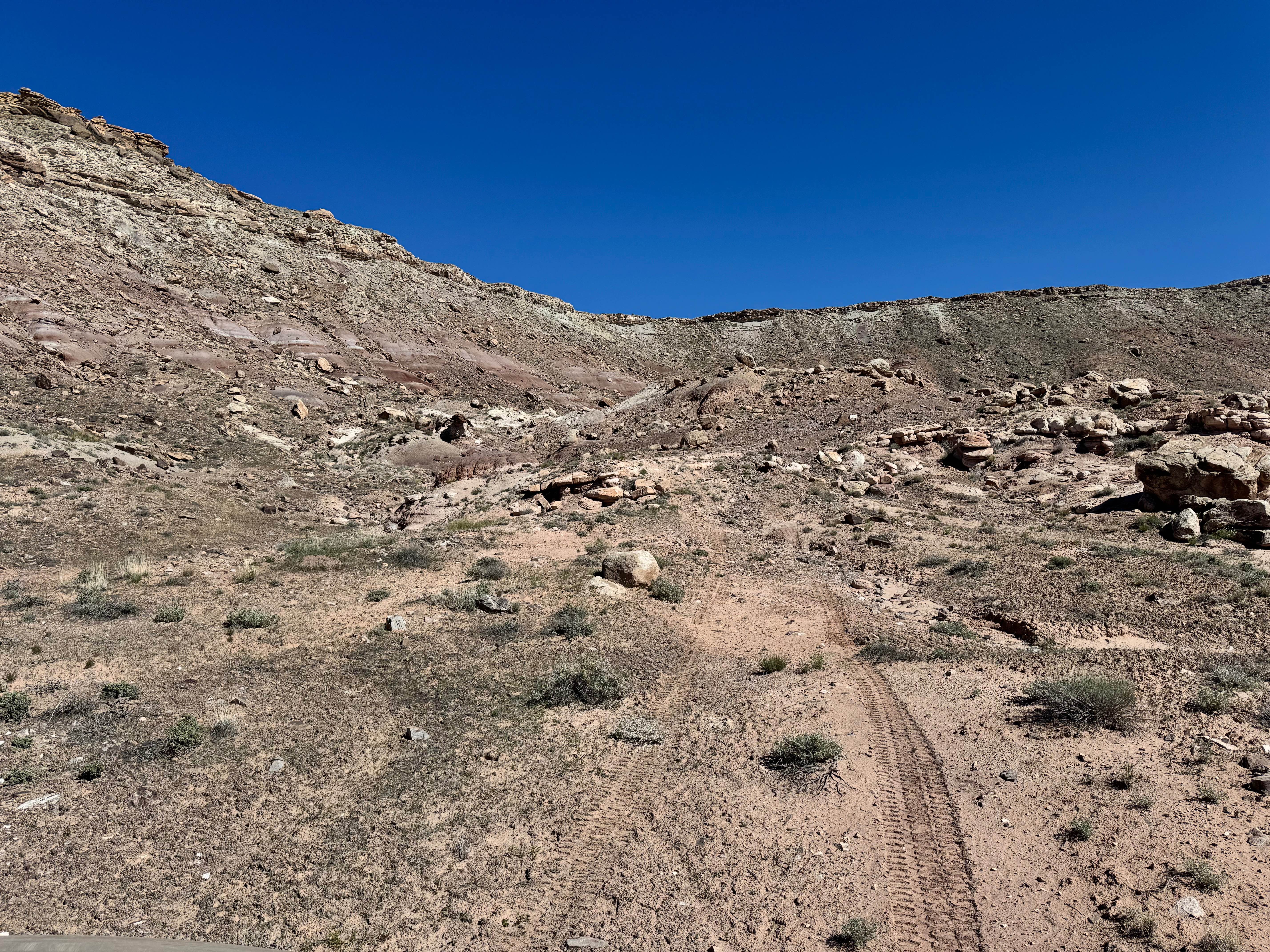
This is not a very descriptive or original trail name, but it's the one that is already on the map! This trail also holds the identifiers of Paiute (D-3), Trail ID 1A, and FS 40581. The south end of the trail is marked as a Paiute 60-inch trail, but a 72-inch, 4-seat SXS fits nicely. The area delineated by Paiute for 60-inch vehicles is the coolest part of the trail. It winds through the trees, both pine and aspen groves; it goes around hills, down through gullies, across a small stream, and comes out on top into some big, open, beautiful meadows. You reach just over 10,200 feet in elevation. There was a 10,000-acre fire here in 1996, but subsequent timber salvage operations and aspen regeneration operations have brought the forest here back to its beautiful self! The trail has areas of erosion, some hills, and some rocks, but nothing difficult-no tight corners, nothing too steep. By mid-July 2023, it was dry except where the stream crosses the trail. Access to this area is not available till late spring because UT-153 is closed in the wintertime, but by mid-summer, the snow has mostly melted, even in a heavy snow year like 2022-2023. Paiute Trails marked as 60-inch don't always indicate the entire trail is limited to 60-inch vehicles. Sometimes it's just a narrow canyon, and there is usually a barrier that won't allow anything wider than 60 inches to pass, but the entire trail ends up with their designation. This is one trail that is full-width. The Forest Service map agrees it's full-width. It's a fun trail to take you up towards Puffer Lake. Remember, to off-road legally in Utah, you need the online education course certificate in addition to an OHV sticker.
Photos of Big Flat Long Flat (FS 40581/Paiute D-3/Trail 1A)
Difficulty
There are areas of erosion, a shallow water crossing, and a few hills, but nothing too difficult.
Status Reports
Big Flat Long Flat (FS 40581/Paiute D-3/Trail 1A) can be accessed by the following ride types:
- High-Clearance 4x4
- SxS (60")
- ATV (50")
- Dirt Bike
Big Flat Long Flat (FS 40581/Paiute D-3/Trail 1A) Map
Popular Trails
Purple Hills Connector - Single Track
Pahvant Butte Loop
Forgotten Mine Road
Where Eagles Dare
The onX Offroad Difference
onX Offroad combines trail photos, descriptions, difficulty ratings, width restrictions, seasonality, and more in a user-friendly interface. Available on all devices, with offline access and full compatibility with CarPlay and Android Auto. Discover what you’re missing today!