Plan B North
Total Miles
1.4
Technical Rating
Best Time
Spring, Fall, Winter, Summer
Trail Type
High-Clearance 4x4 Trail
Accessible By
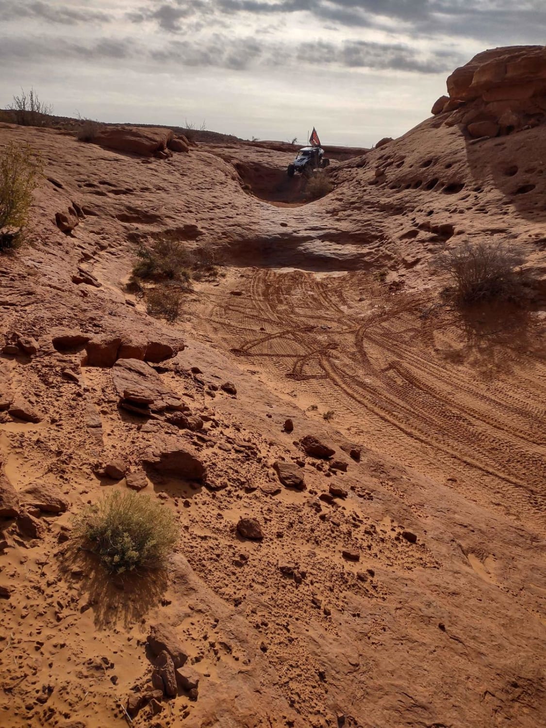
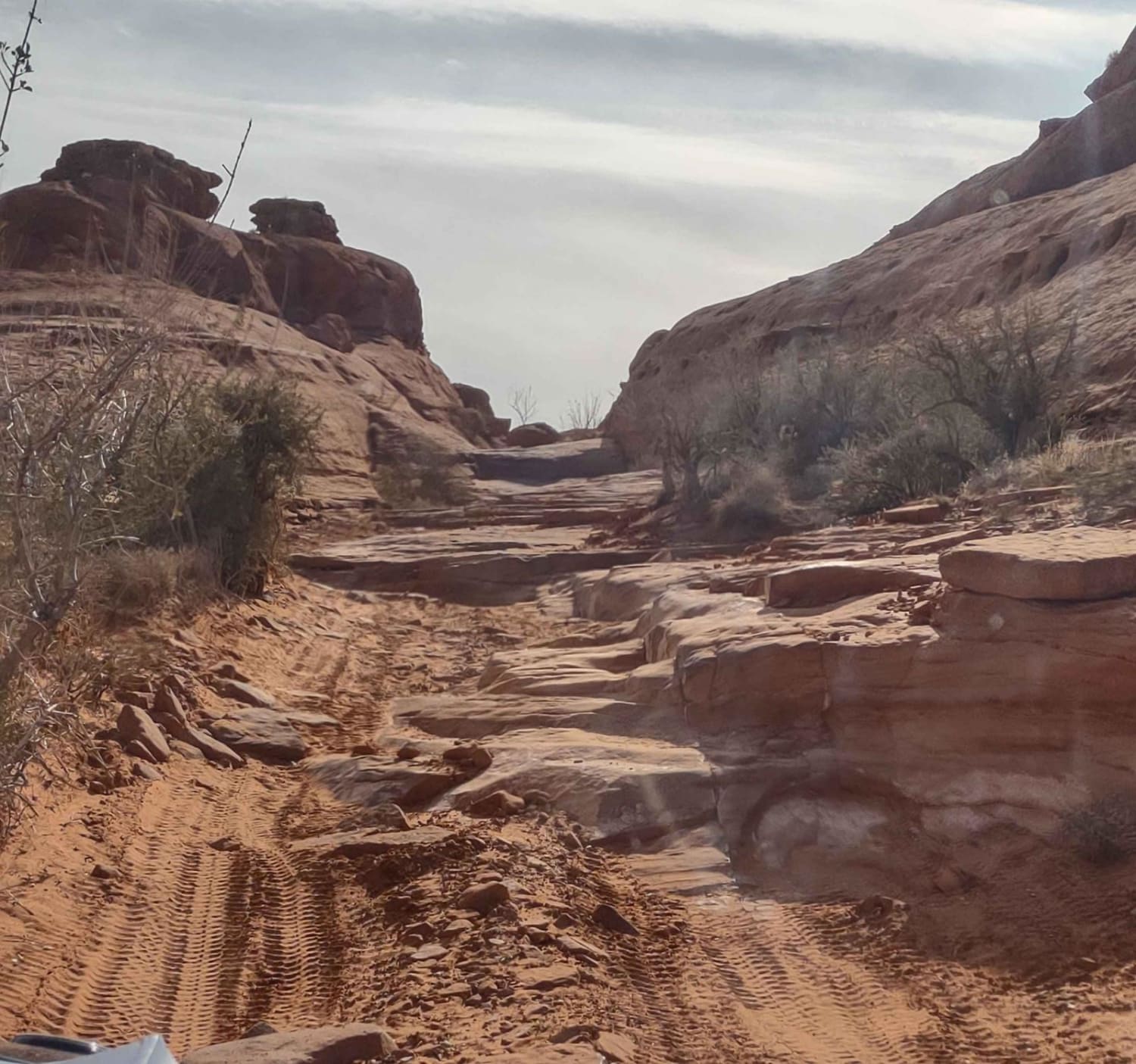
Trail Overview
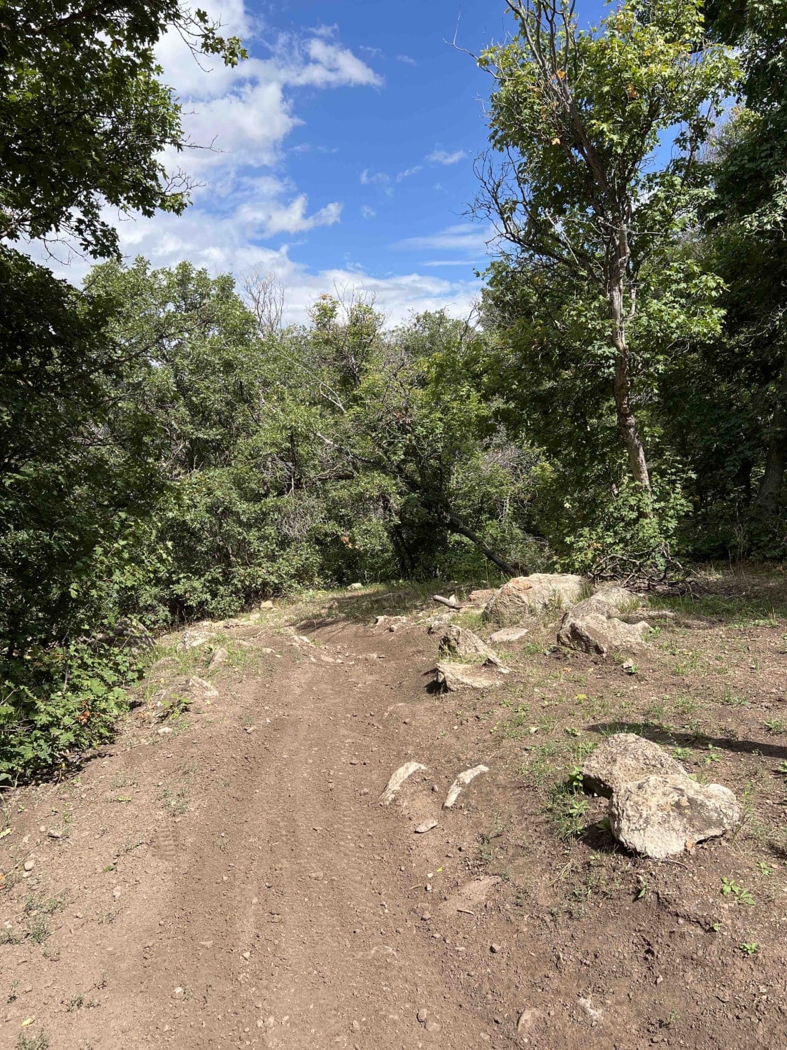
Ah, Sand Hollow...fun obstacles, beautiful red sand andslick rocks. This North End of Plan B is rated a 7 on a local map, Plan B Extended is an 8, and we agree fully with these ratings. The trail almost always has a work-around or a bypass for the hardest obstacles, but you may find an area without a bypass. The heights are not for the faint of heart, but with patience and a spotter, this is a doable trail. Hints for riding the slick rock obstacles: unhook your front sway bars, secure them out of the way, so your front end has more flex in the suspension. If you have the ability to reinflate your tires, taking them down a few pounds is also a good idea on flat rock obstacles. Use a spotter, preferably someone who has done the obstacle previously and knows their way over it. Then the spotter can help all of the other drivers line up their tires in the correct places on each rock to avoid vehicle damage. If you don't have a spotter, in most places you can see black tire marks on the rocks where you are supposed to put your tires. Also, your tires will have better grip in the spring, summer and fall, when the rocks are warm. During the winter months, when there are lots of nice riding days in Sand Hollow, your tires won't grip as well, but the obstacles are still doable. If you take your time and explore your options, you can do this without a expert's help. This North End of Plan B is a combination of drop-offs, rocky climbs, off-camber areas and sand. Our 4-seater SXS with 32" tires had no problem going up a steep, long slick rock, but the 2-seaters in our group had to go around it. This slick rock is a favorite for going down in a lot of the Sand Hollow videos we watch. It was a fun challenge to go up it. The loop in the north end of our track is because we were playing in the area of the rock climb, and then circled back to the trail going down through the canyon a little further. As you move south on this track, you go by the obstacle called Tilt-a-Whirl. It's an off-camber area that's wide enough for Jeeps and SXSs, but it's a bit unnerving if you're in the passenger seat and don't like leaning right. We cut Plan B short on this trip and exited on a loop back to the east/northeast. On our next ride in this area, we're going to come at Plan B from the south entrance, as the "unnamed obstacle" closer to the south end may be easier going south to north. Be sure to bring your camera on this ride. The obstacles, rocks and challenges are photo-worthy. If you knew your way through this track, you could do it in less than 1.5 hours, for sure, but we took our time, explored our options and enjoyed playing on the rocks and sand. On the north end, there is one part of the trail that we missed, but found out about later. It's a high narrow rock that Jeeps and SXSs straddle, one tire off each side, certain roll-over in either direction if you go off this rock, but it's not included in our track because we did the bypass. In case the unthinkable happens, and you get stuck, or worse, and need off-road recovery, there is a local company called Matt's Offroad Recovery. You can call him, because most of Sand Hollow has cell service, and he'll rescue you and your vehicle and leave you with an invoice and a t-shirt. Other obstacles in Sand Hollow, with similar riding, include Double Sammy, the Chute, Toll Booths, the Maze, Slip Rock, TNT Extended, The Ledges, Joint Effort, War Machine, Smurfette, Broken Chain and War Machine. Other trails in this area, that are less technical in nature, include Razzle Dazzle, Water Tank Road, Landslide, East Rim and Sand Dune Way. If you go south of this part of Sand Hollow State Park, down in the valley behind you will find the Dinosaur Tracks, Ft. Pierce and a trail that leads onto East Mesa and or trails that go further south towards and into Arizona. As always, when riding in the desert, watch for rattlesnakes during the spring, summer and fall. Also, this area may have cows in it during the winter months. Not so much up in the obstacles, but on the other trails and down in the valley below. On a day when there are high clouds in the sky, plan it just right to catch a sunset from Top of the World. You won't be disappointed. Starting Feb 2023, Utah is going to begin enforcement of their new law, which requires an online course for all off-roaders. The free course will be available online as of Jan 1, 2023. The state says the online course will take 15-30 minutes, and it's required for all off-roaders, Jeeps, SXSs, dirt bikes, ATVs. You will have to print out something to carry with you which shows you took the course. I have a photo below with this information.
Photos of Plan B North
Difficulty
This trail includes several slick rock obstacles and some sandy trails in between. There are areas of off-camber riding, there are 3-4 foot drop-offs, steep rock climbs, some scary heights and lots of opportunity for vehicle damage.
Status Reports
Plan B North can be accessed by the following ride types:
- High-Clearance 4x4
- SxS (60")
- Dirt Bike
Plan B North Map
Popular Trails
Wilberg Road - Prickly Pear Flat
Kirkman Hollow (8012)

The onX Offroad Difference
onX Offroad combines trail photos, descriptions, difficulty ratings, width restrictions, seasonality, and more in a user-friendly interface. Available on all devices, with offline access and full compatibility with CarPlay and Android Auto. Discover what you’re missing today!