South Twin River - FS 44080
Total Miles
4.0
Technical Rating
Best Time
Spring, Summer, Fall
Trail Type
Full-Width Road
Accessible By
Trail Overview
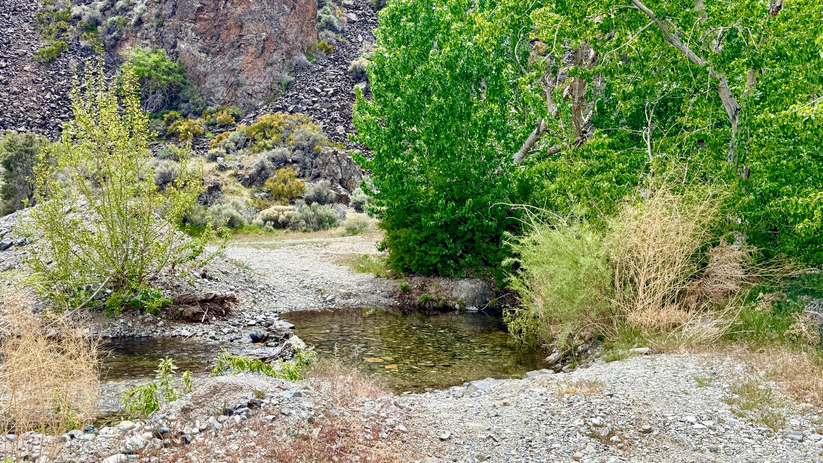
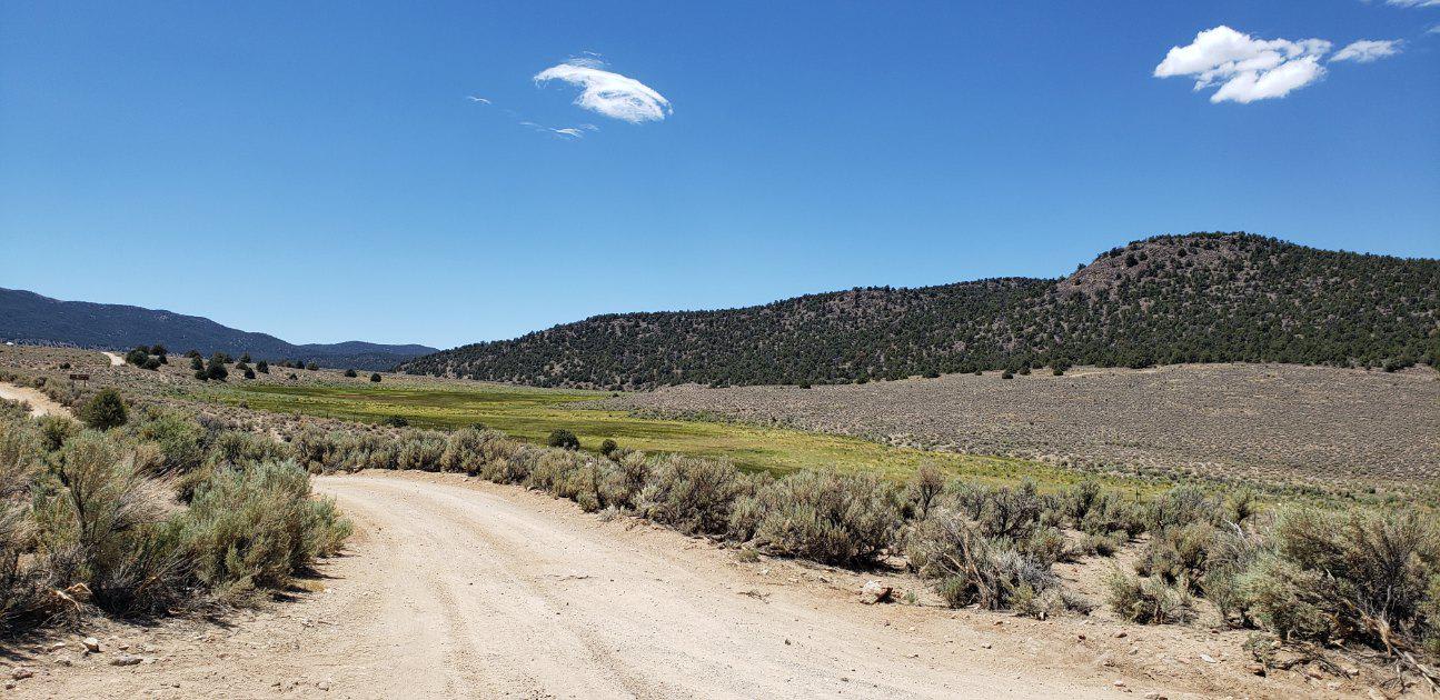
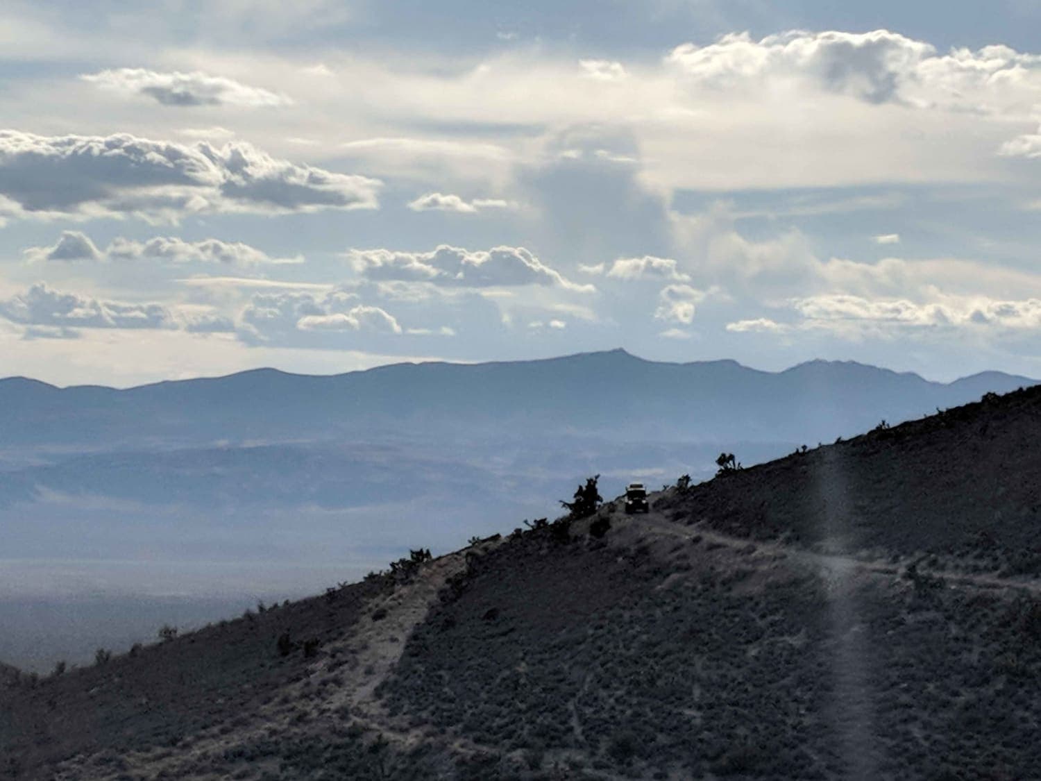
The South Twin River trail is a premier gateway for those looking to conquer the high peaks of central Nevada. This route provides critical access to both the Toiyabe Crest National Recreation Trail and the North Twin River hiking system. The journey begins on a wide, well-maintained gravel road that meanders through the foothills, passing through a large, well-equipped staging area. This main parking zone features a pit toilet and several spacious dispersed campsites, making it an ideal "basecamp" for hikers and riders preparing to head into the wilderness. As you continue past the initial Crest Trailhead, the character of the drive shifts. The road crosses the river and immediately begins a steep, technical climb out of the drainage. This section requires careful throttle control and a focused eye to manage the loose terrain and steep grade. Once you crest this hill, the trail levels out into a steady, rocky cruise that carries you further into the range, terminating at a series of smaller, secluded parking and camping areas near the interior hiking trailheads. While you may find reliable service out on the main valley floor, it disappears almost entirely once you enter the folds of the canyon. Download offline maps before leaving the Highway 376 area.
Photos of South Twin River - FS 44080

Difficulty
High-clearance 4x4 vehicles are required for the section beyond the main parking area. Rated a 3 due to the steep climb encountered immediately following the river crossing.
History
The "Twin Rivers" have long been a landmark for travelers in the Great Basin. The South Twin River serves as a historic corridor into the heart of the Toiyabe Range, a region that has been the ancestral home of the Western Shoshone for over 10,000 years. The Toiyabe Crest Trail, which this road accesses, was established as a National Recreation Trail to showcase the unique ecosystems of Nevada. Traveling this road is a modern way to access the same rugged high country that has drawn hunters, explorers, and silver prospectors for over a century.
Status Reports
South Twin River - FS 44080 can be accessed by the following ride types:
- High-Clearance 4x4
- SUV
- SxS (60")
- ATV (50")
- Dirt Bike
South Twin River - FS 44080 Map
Popular Trails

Gold Bar Road
Desert Creek Loop
Parrotte Springs / Hannapah Road - FS 44505
The onX Offroad Difference
onX Offroad combines trail photos, descriptions, difficulty ratings, width restrictions, seasonality, and more in a user-friendly interface. Available on all devices, with offline access and full compatibility with CarPlay and Android Auto. Discover what you’re missing today!