Norway Point
Total Miles
0.7
Technical Rating
Best Time
Spring, Summer, Winter, Fall
Trail Type
Full-Width Road
Accessible By
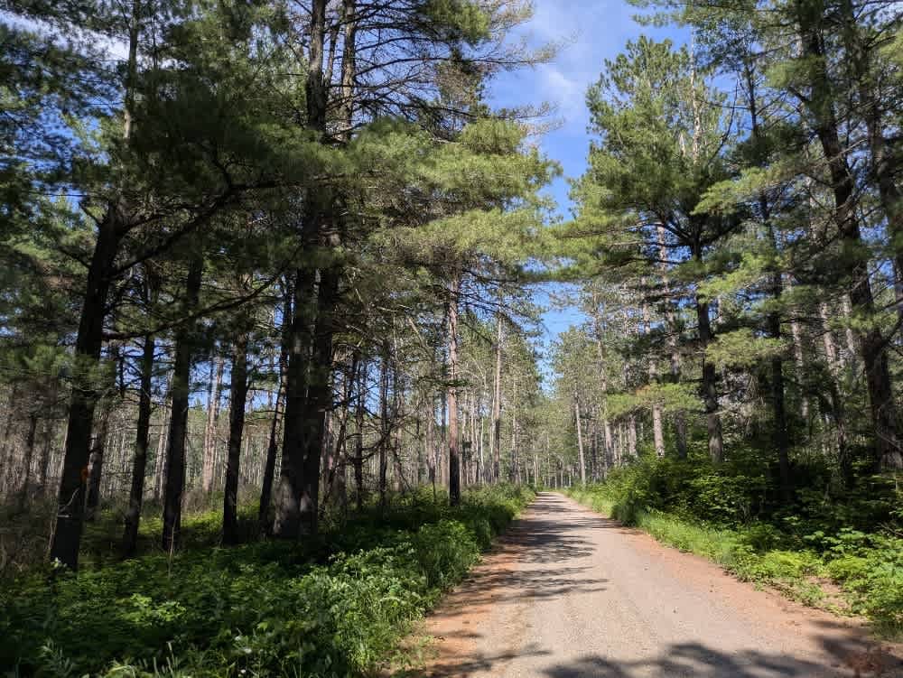
Trail Overview
This trail is accessed from Mooseline Road and offers a scenic drive through the forest before descending toward the St. Louis River. The route is made up of well-maintained gravel and winds gently through wooded terrain, with a few muddy patches closer to the river's edge. While the trail itself is suitable for most vehicles, a narrower offshoot appears better suited for ATVs, side-by-sides, and snowmobiles. Insect activity can be high in the area, with numerous flying bugs and ticks; therefore, some precautions are recommended. At the end of the trail near the river, there is a large open area that serves as an excellent dispersed camping spot. Unlike most locations, this one features a few basic amenities, including a picnic table, a fire ring, a vault toilet, and a boat launch, all situated along the picturesque riverbank. Although it's not a formal campground, it's one of the more accommodating dispersed sites in the region. Dispersed camping is generally permitted in the Superior National Forest, provided you stay outside the Boundary Waters Canoe Area Wilderness and confirm current rules with local authorities. There are no services along the trail, and cell reception may be spotty or unavailable. If you choose to camp, be sure to follow Leave No Trace guidelines.
Photos of Norway Point

Difficulty
This trail is not maintained and is not regularly used by other users. The trail may be overgrown and unused, with debris on the trail.
History
Superior National Forest was established in 1909 by President Theodore Roosevelt to protect the region's watersheds and natural resources after years of heavy logging and mining. The area has long been home to the Ojibwe people, who continue to maintain cultural ties to the land. In 1978, the Boundary Waters Canoe Area Wilderness within the forest was given added protection, making it one of the most visited wilderness areas in the U.S. today.
Status Reports
Norway Point can be accessed by the following ride types:
- High-Clearance 4x4
- SUV
- SxS (60")
- ATV (50")
Norway Point Map
Popular Trails


County Road 33

August Creek

Inner Forest Road 4.6
The onX Offroad Difference
onX Offroad combines trail photos, descriptions, difficulty ratings, width restrictions, seasonality, and more in a user-friendly interface. Available on all devices, with offline access and full compatibility with CarPlay and Android Auto. Discover what you’re missing today!