County Road 37
Total Miles
5.6
Technical Rating
Best Time
Spring, Summer, Fall, Winter
Trail Type
Full-Width Road
Accessible By
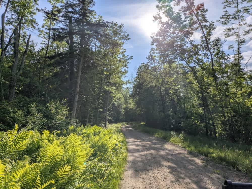
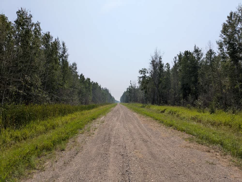
Trail Overview
This trail is a wide and generally well-maintained gravel road that runs through a mix of open fields and forested areas. It begins at a paved road near what appears to be a well-kept grassy RV park, where increased vehicle traffic can be expected, particularly during peak seasons. The trail is mostly straight with a few gentle curves and serves as part of the Corridor Access ATV Route up to the junction with Trail 154. Although official Corridor Access signage ends at that point, it is likely the trail continues to be part of the route. Drivers should exercise caution at the intersection with Trail 154, as cross-traffic does not stop. The trail does not provide any formal or dispersed camping opportunities and lacks basic amenities such as drinking water or trash disposal. Cell service may be intermittent or unavailable along certain stretches.
Photos of County Road 37


Difficulty
This trail is well-maintained and regularly used by other OHV riders, road users, including residents in the area.
History
Covering more than 1.6 million acres of glacial lakes, red-pine uplands, and sphagnum bogs, Minnesota's Chippewa National Forest lets motorists experience the North Woods at an unrushed pace. Paved state highways soon yield to a lattice of numbered forest roads, most of them well-graded gravel that thread between kettle ponds and stands of towering white pine, the tree that helped earn the forest its 1908 designation as one of America's first national forests. The forest harbors one of the highest breeding densities of bald eagles in the continental United States, and patient drivers often glimpse loons, black bears, and white-tailed deer as they move from shoreline to clear-cut regrowth and back again.
Status Reports
County Road 37 can be accessed by the following ride types:
- High-Clearance 4x4
- SUV
- SxS (60")
- ATV (50")
- Dirt Bike
County Road 37 Map
Popular Trails

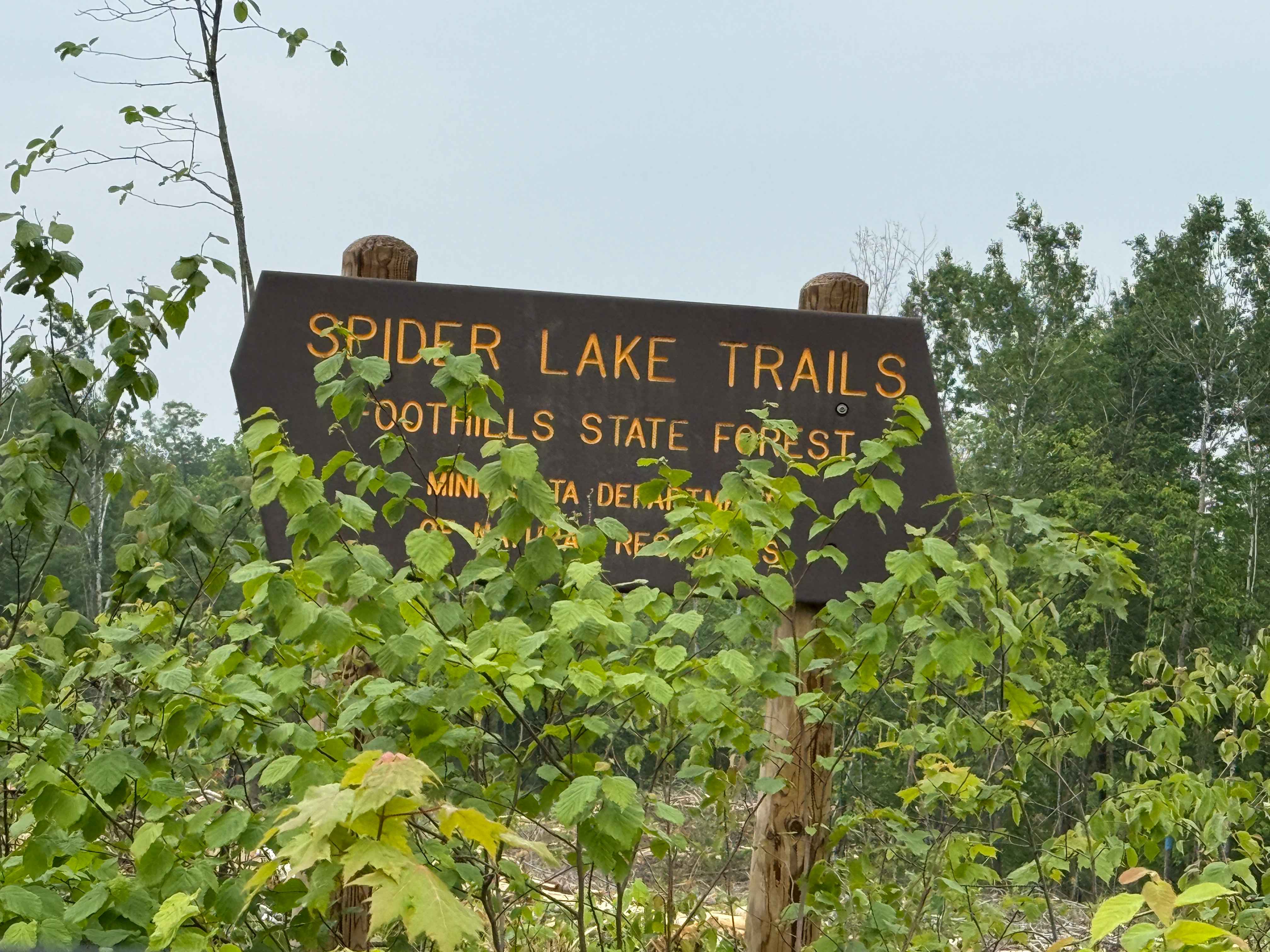
Spider Lake Trails
Loberg Road
The onX Offroad Difference
onX Offroad combines trail photos, descriptions, difficulty ratings, width restrictions, seasonality, and more in a user-friendly interface. Available on all devices, with offline access and full compatibility with CarPlay and Android Auto. Discover what you’re missing today!