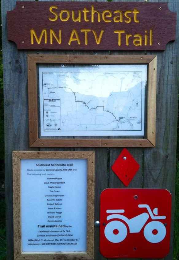
Southeast Minnesota Trail
Total Miles
11.0
Technical Rating
Best Time
Spring, Summer, Fall
Trail Type
60" Trail
Accessible By
Trail Overview
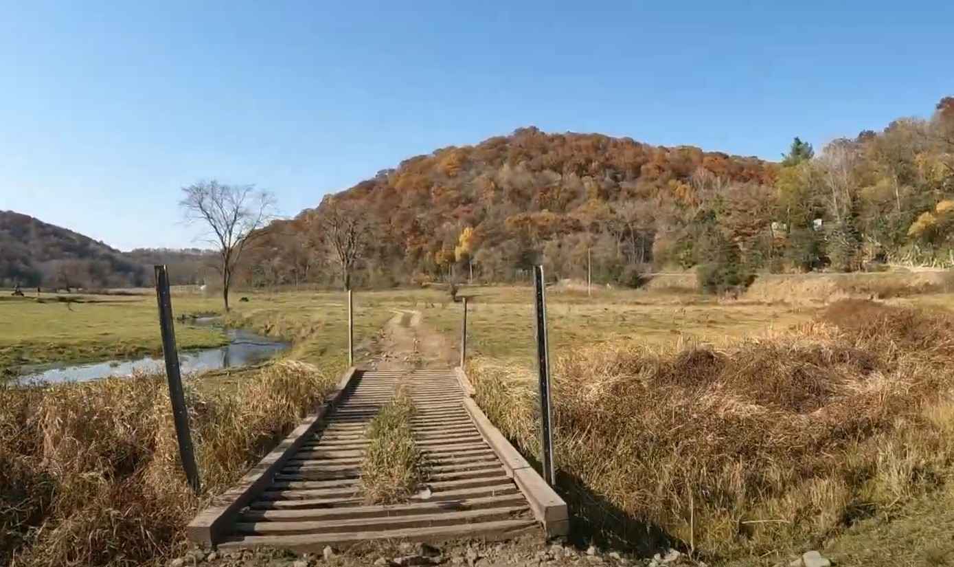
This 13-mile trail connects the southeastern Minnesota communities of Stockton and Altura. The trail winds through a variety of terrain, ranging from rolling farmland to deep, forested ravines and valleys. Portions of the trail will travel across private property (remember to stay on the trail). The trail consists of dirt, gravel, and small to moderate-sized rocks, and crosses several blacktop areas. Wildlife is prevalent within the wooded areas, and there is always the possibility of finding cattle on the trails. Winona County provides the trail, and it is maintained by the generous work effort of the Southeast Minnesota ATV Club. This trail can be run in either direction. There is a small parking area on the southern end, and parking is available near the northern end at the Altura Memorial Park (although limited). Expect lots of water and mud in the May/June timeframe and dusty, dry trails in the early fall before seasonal rains begin. The trail is normally open from 15 May to 31 October for wheeled off-roading. The trail is open to both Class I and II ATVs (with a maximum width of 65" (outside rim to rim). The Minnesota Department of Natural Resources maintains this trail. OHV riding in Minnesota requires either a vehicle registered with the state or the purchase of a non-resident OHV state trail pass. Food can be found in both Altura and Stockton, as well as fuel in Stockton. The nearest full-service sites can be found in Winona. The trail is rated moderately difficult by the Minnesota Department of Natural Resources.
Photos of Southeast Minnesota Trail
Difficulty
Mostly level open two track. Expect mud and shallow water after rains. No obstacles over 12".
Status Reports
Southeast Minnesota Trail can be accessed by the following ride types:
- SxS (60")
- ATV (50")
Southeast Minnesota Trail Map
Popular Trails
UPM Blandin Trail N


South Round River Drive Cut Through
The onX Offroad Difference
onX Offroad combines trail photos, descriptions, difficulty ratings, width restrictions, seasonality, and more in a user-friendly interface. Available on all devices, with offline access and full compatibility with CarPlay and Android Auto. Discover what you’re missing today!