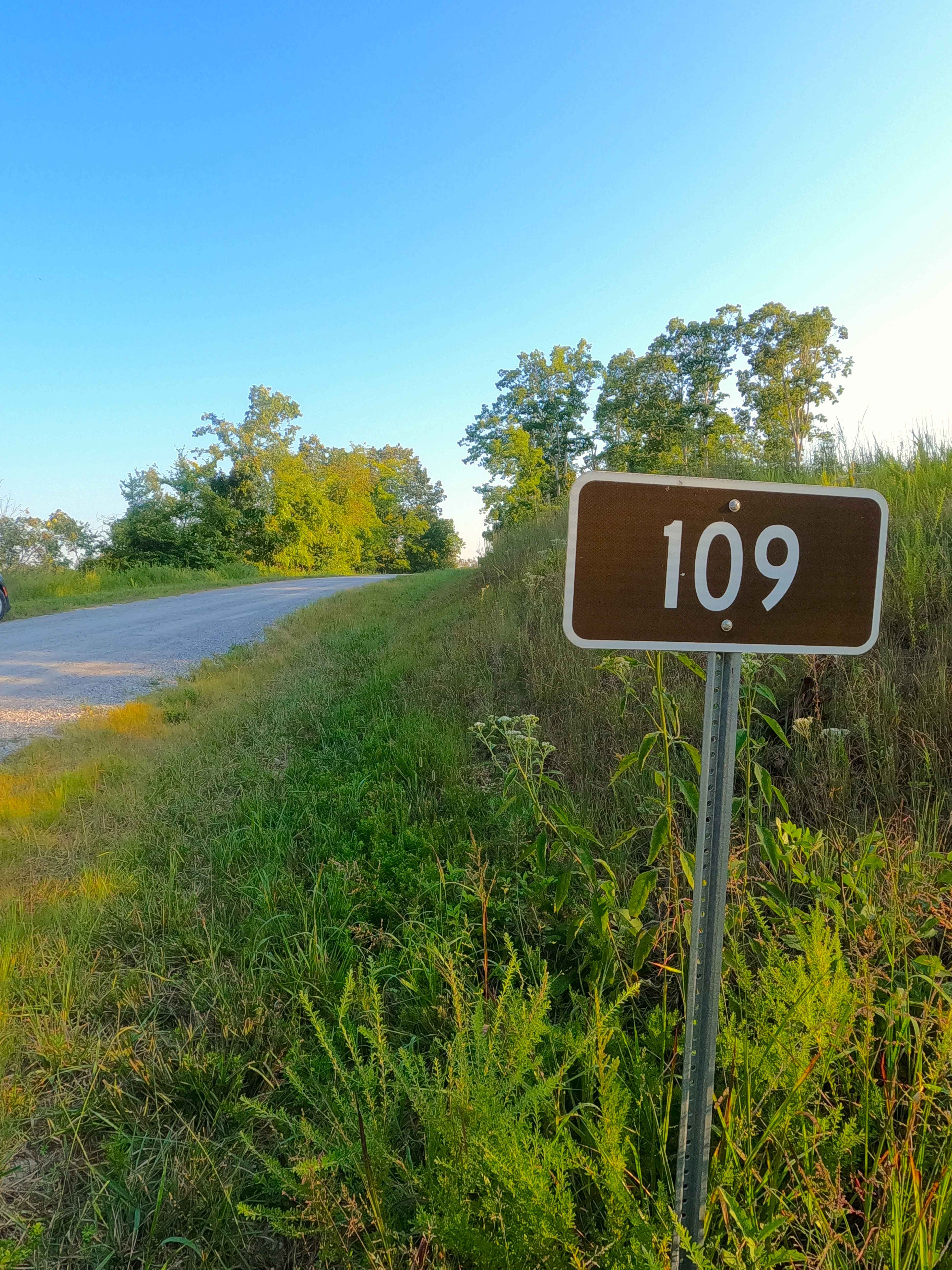
Willow Creek - FS 109
Total Miles
1.2
Technical Rating
Best Time
Spring, Summer, Fall, Winter
Trail Type
Full-Width Road
Accessible By
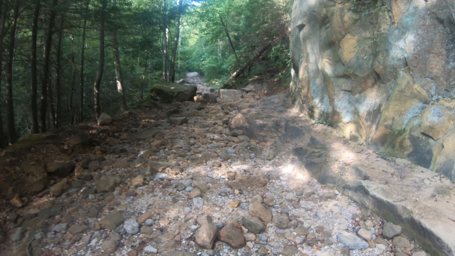
Trail Overview
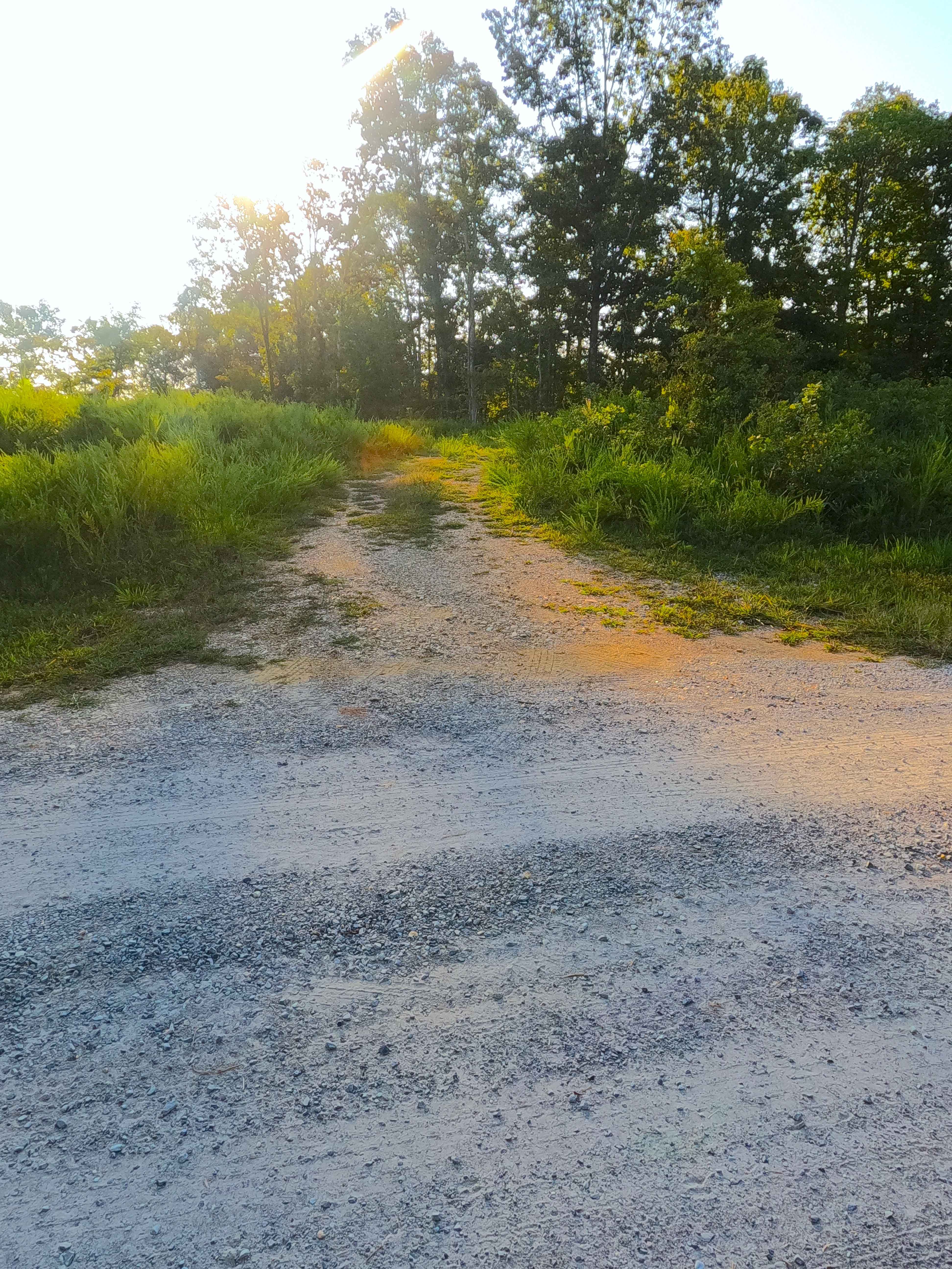
Willow Creek (FS 109) is a semi-maintained gravel forest service road located in the northwest corner, Lake Barkley side, in the Kentucky section of Land Between the Lakes National Recreation Area. This route serves as a logistical alternative to the paved FS 108, as it connects to the Woodland Trace further south, yet still leads to the Willow Bay, and the Demumbers Bay Campground and boat launch. The Willow Creek in its layout, starts at the most southern point at the ridges high along the woodland trace, before cresting at the highest point and then dropping significantly down to the Willow Creek, crossing a large culvert that the creek flows through, shortly after climbing a short hill, before dropping a second time as it crosses a feeder branch of the Willow Creek, to climb the final hill along the Willow Bay, before rapidly dropping down the final grade to the northern ending point at the FS 108, and Willow Bay just 125 feet to the northwest. A gentle road, traversing the northern hills, valleys, and shoreline of Land Between the Lakes.
Photos of Willow Creek - FS 109
Difficulty
Willow Creek is a simple gravel road. Being generally maintained, it is given a base rating of 1/10, consisting of a gravel road being laid out on mildly graded hills, with the expected washboards, potholes, mounding of the gravel, and potential spots where the gravel fades to dirt in between gradings. Difficulty would only increase in seasons of extreme inclement weather, lack of maintenance, and heavy use, but would likely always be mended back to a 1/10 rated state.
History
Just west of the southern end of the FS 109 along the Woodland Trace, was once the former Star Lime Works Church, which was found (at 36.95752, -88.17379) due north of the former settlement also known as Star Lime Works, between the Church and Settlement used to be a road connecting the two, arguably the continuation south from where the modern FS 109 ends at the Trace. This settlement was established by a man named Louis A. Vogle, a Belgian immigrant, who moved to the limestone-rich valley along the Tennessee River in the late 1860s. By 1872, the settlement had its own Post Office, with Mr. Vogle being the first postmaster. This was accompanied by a blacksmith shop and a general store. By 1905, the population had grown to approximately 50, with the lime operations keeping the settlement prosperous up into the 1930s. In May of 1938, congress approved the Kentucky Lake project, and Tennessee Valley Authority (TVA) began the Kentucky Lake Dam project in July of 1938, this was the beginning of the end for Star Lime Works, in 1943 the Post Office closed and the settlement followed suit, followed by the dam being completed in 1944, with towns and settlements like Star Lime Works disappearing as the lake level took them over. Upon further research, another church and cemetery named Star Lime Works Pentecostal was built in 1935 in Lake City, Kentucky. Perhaps this alludes to the community moving to safe ground, before the TVA would have forced them out with the coming Kentucky Lake. This is a common trend seen in the area, as many communities resettled and then reused their original settlement name, sometimes rather far away from the original. The fun historic facts, the boating point of interest known as the Kentucky Lake "Party Cove", is the remnants of the former Star Lime Works Quarry, the primary source of rock used to build Kentucky Lake Dam, due to its heavy deposits of Limestone, the finished product left man-made bluffs, that eventually would be flooded, resulting in the Party Cove now enjoyed by those who boat to it. At the Party Cove/Quarry's location used to be a unnamed cemetery via the 1938 topo of Birmingham, KY, but on the 1955 topo of Birmingham Point, KY the cove is filled with water where the cemetery was, with a new "Murray Cemetery" appearing on the next ridge to the west, these both were the burial location of Alfred Murray, who drown in 1925 on the Tennessee River, and was buried at the location of the eventual rock quarry. His grave was moved the first time to the new Murray Cemetery in 1939 so that the Quarry could be dug out to use the rock for the Dam; his burial was later moved again to Mount Pleasant Cemetery off the FS 301. At winter pool, the area that was once the settlement of Star Lime Works is barely above water just to the east of Hillman Ferry Campground; this can be found roughly at 36.94432, -88.16975. Documented By Christopher Menz in 12/2025. To visually see this history, check out the Chris Nails Historic Trails Shorts Episodes 3, 4, and 5 on YouTube and Rumble.
Status Reports
Willow Creek - FS 109 can be accessed by the following ride types:
- High-Clearance 4x4
- SUV
Willow Creek - FS 109 Map
Popular Trails
Old Fincastle Rd
Oil Center WMA Main Via Ringgold Road
Old Fincastle/Big Andy Ridge
Old Silver Trail - FS 320
The onX Offroad Difference
onX Offroad combines trail photos, descriptions, difficulty ratings, width restrictions, seasonality, and more in a user-friendly interface. Available on all devices, with offline access and full compatibility with CarPlay and Android Auto. Discover what you’re missing today!