
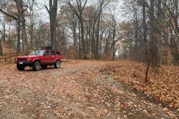
Off-Road Trails in Kentucky
Discover off-road trails in Kentucky
Off-Road Trails in Kentucky
Discover the best off-road trails in Kentucky. Browse trail maps, check difficulty ratings, and find your next adventure — whether you're looking for a quick ride or an all-day expedition.
Hamburg SFR 266A
As a branch of Atwood Road 266, the Hamburg 266A is a bit more of an offroading road and less of a scenic road within Shawnee National Forest. It has an off-camber hill within .2 of the entrance followed by many water collection areas that get muddy, the gravel fades in on the hilltops and out in th...
Learn more about Hamburg SFR 266A

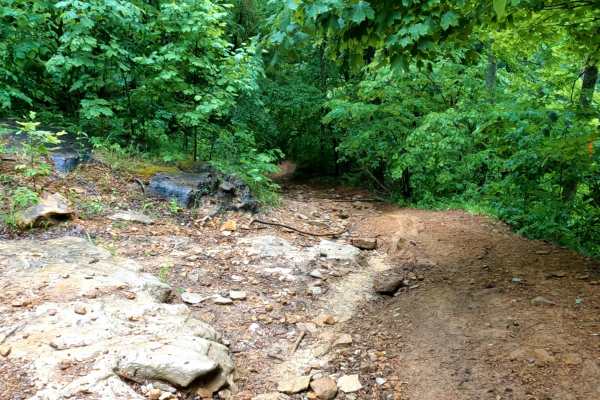
Rock Top SFR 233
The Rock Top SFR 233 is a forestry road on top of Silica Hill within Shawnee National Forest. The Rock Top is just that, natural rock pops out on top of the hill where the trail meets with the Silica Hill Road SFR 645. The trail features steep off-camber grades some being strictly on dirt and some b...
Learn more about Rock Top SFR 233
Old Goat SFR 625 & 625A
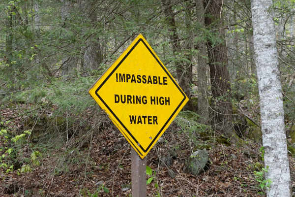
Old Goat SFR 625 and 625A is a State Forest Road in Shawnee National Forest. The road is short at only 1.1 miles long, but packs a punch, dipping through a creek bottom shortly after climbing a steep grade while circling around the first main hill. The hill features small ruts and gravel fading to d...
Learn more about Old Goat SFR 625 & 625A
Silica Hill Road SFR 645
The West Silica Hill Road SFR 645 is a 1.3-mile-long forestry road through Shawnee National Forest. As you travel the road, grades come in waves from gradual incline to steep grades. These steep grades include tight turns, medium-sized ruts, bare dirt sections, and some mild water collection spots. ...
Learn more about Silica Hill Road SFR 645
McCraven SFR 220
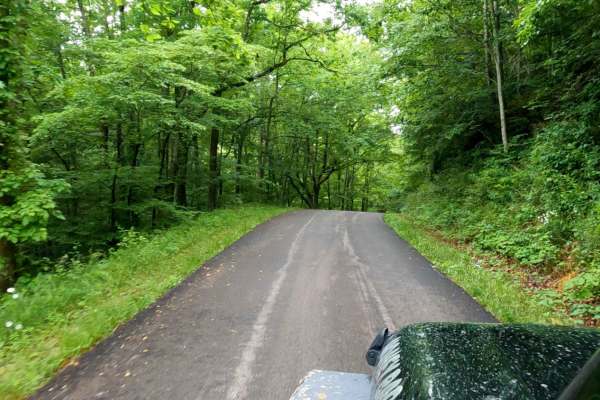
McCraven SFR 220 is a very scenic nature-viewing gravel road in Shawnee National Forest. It is a very easy trail with a minimal challenge, but there are a few muddy crossings and water collection spots within its medium-grade graveled hills. It also features a couple of branch trails, the SFR 504 an...
Learn more about McCraven SFR 220
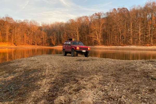
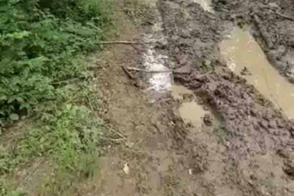
Carmack Bay FSR 121/121C
Carmack Bay FSR 121/121C is a Forest Service Road through Land Between The Lakes National Recreation Area. It is primarily a gravel road that shows serious degradation and wears throughout its path. It has major rutting, mud pits, heavy water collection areas, and one main steep grade leading down t...
Learn more about Carmack Bay FSR 121/121C
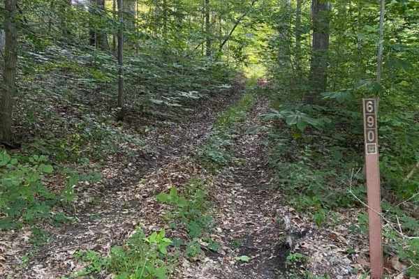
Diswood FSR 690
The Diswood FSR 690 is a natural forest road in the southern portion of the Mississippi Bluffs sector of Shawnee National Forest. Talk about a pinstripe expo, it is tight, tight, tight for the first .3 mile, either commit to go to the top or do a 10-point turn to get spun around. In the bottoms ther...
Learn more about Diswood FSR 690

Fox Hollow Bottoms FSR 219
The Fox Hollow Bottoms FSR 219 is a gravel forestry road through the southern Tennessee section, Lake Barkley side, of Land Between the Lake National Recreation Area. To differ from the other half of Fox Hollow, the Bottoms traverses alongside the feeder creeks that lead to the Fox Hollow bay area o...
Learn more about Fox Hollow Bottoms FSR 219
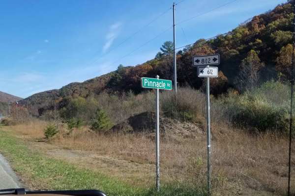
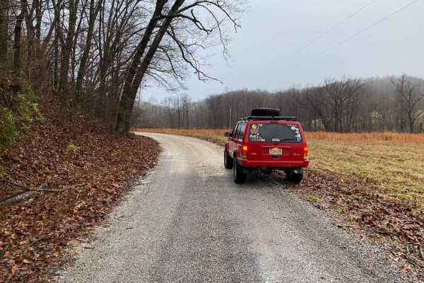
Decoy-Magoffin Loop
As with many trails in the under-development system that will become Eastern Kentucky's expansive off-road trail offerings, this route is a DIY adventure created by locals that know these mountains like the backs of their hands. Accessed from established trailheads like Mine Made Adventure Park and ...
Learn more about Decoy-Magoffin Loop
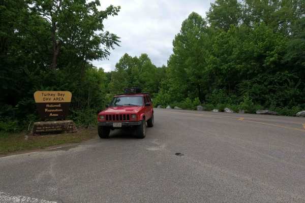
Turkey Bay Gate FSR 167
Turkey Bay Gate FSR 167 is the paved entry to gravel main hub and parking section of the Turkey Bay OHV Area, within the Land Between the Lakes National Recreation Area. At the entry you pass the picture worthy Turkey Bay OHV forestry sign, which shortly leads you to the sign in and fee gate house. ...
Learn more about Turkey Bay Gate FSR 167
Clinch Mountain Fire Tower
Clinch Mountain Fire Tower is an ideal scenic route for beginners, families, and overland travelers looking for stunning Appalachian vistas without the stress of highly technical terrain. This unpaved mountain passage winds up and over the ridge of Clinch Mountain, connecting the historic community ...
Learn more about Clinch Mountain Fire Tower
Wade Adkins Branch Road
This trail is Easy/Medium. We started on a paved road then it turned to dirt. As we went farther the trail was more off-road and we came across some water crossings, hills, mud and woods that had to be navigated. We have much more exploring to do as the area was beautiful. At the end of the trail we...
Learn more about Wade Adkins Branch Road
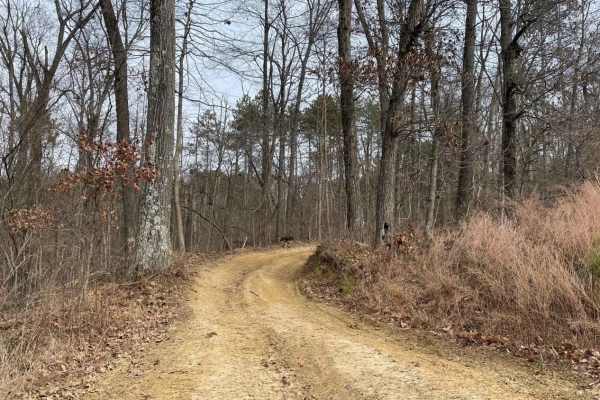
Little Shepherd
Little Shepherd is an unpaved route from Harlan KY to Cumberland KY. This route rides across a mountain ridge giving you wonderful views of the surrounding areas. There are multiple pull-offs that function as overlooks to take in the scenery. This trail is stock 4x4 capable, but keep an eye out for ...
Learn more about Little Shepherd
Rock Creek Road
Rock Creek Road parallels the stream from which it gets its name for approximately 8.2 miles. While there are several day use and dispersed campsites along the road it also passes by some private property. Rock Creek is stocked with rainbow by the Kentucky Department of Fish and Wildlife throughout ...
Learn more about Rock Creek Road
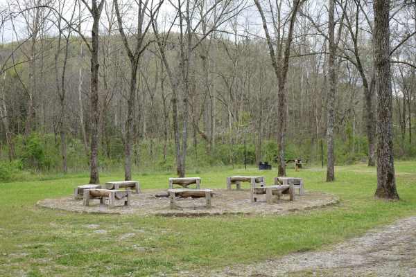
Woods Road
Woods Road is a great area that offers dispersed camping, campground camping, hiking, and fishing options all along the 7 mile stretch of gravel. Woods Road parallels Rock Creek for most of its length and provides a great base to further explore Daniel Boone National Forest and Big South Fork. Gobbl...
Learn more about Woods Road
Myers Fork Road
A very scenic paved back road. This road will take you down and in between many trails in the area. This road is also part of the Daniel Boone Backcountry Byway. A fantastic set of trails that run all over the area. Myers Fork leads to some beautiful parts of Frenchburg.
Learn more about Myers Fork Road
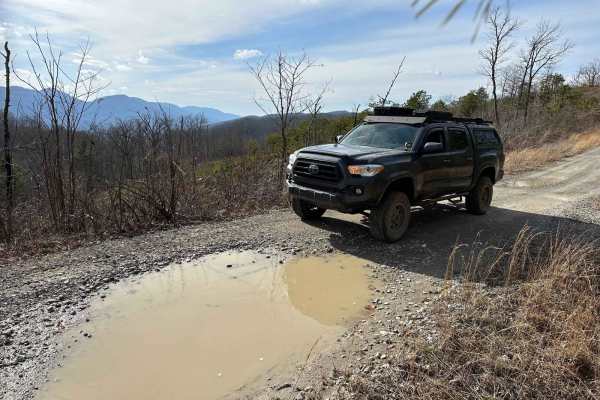
Stephens Knob
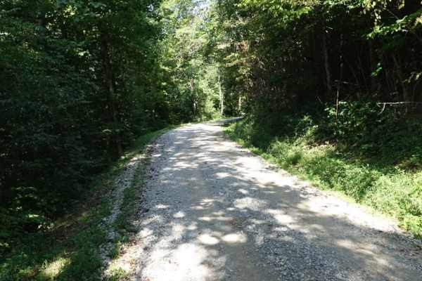
Stephens Knob is relatively unassuming for the majority of its 7.7-mile length. It's a very well-maintained gravel road. During the winter, nice views are available off of the north side. There's a split at the end of the gravel, and both options lead back to a small grassy campsite. Cell service is...
Learn more about Stephens Knob
Wolf Knob
Wolf Knob is an 8.2 mile out and back trail that ends at a closed forest service gate with a grassy road extending a ways beyond it. There is one nice campsite close to the eastern terminus in the shadow of a large rock overhang. This site has room for several trucks and/or tents. At this campsite, ...
Learn more about Wolf Knob
Happy Top
This is a great little back road. One section is dirt with a rutted rocky incline, then its all gravel. There is a cell tower at the top of the hill providing service. Lots of wild rose bushes along the way that bloom in early summer. There are some great views between the trees.
Learn more about Happy Top
East Delta Road
East Detla Road, is the eastern section of the road going through Shawnee National Forest connecting the Opossum Trot Trail System to Elco, IL. The road is a steady uphill climb when headed west, gaining 275 feet over it's trek. The gravel road is mild and only shows slight rutting, washing, and mou...
Learn more about East Delta Road
ATV trails in Kentucky
Explore ATV-friendly trails in Kentucky. These trails are accessible for vehicles up to 50 inches wide, perfect for ATVs and smaller off-road machines.
McCraven SFR 220
McCraven SFR 220 is a very scenic nature-viewing gravel road in Shawnee National Forest. It is a very easy trail with a minimal challenge, but there are a few muddy crossings and water collection spots within its medium-grade graveled hills. It also features a couple of branch trails, the SFR 504 an...
Learn more about McCraven SFR 220
Decoy-Magoffin Loop
As with many trails in the under-development system that will become Eastern Kentucky's expansive off-road trail offerings, this route is a DIY adventure created by locals that know these mountains like the backs of their hands. Accessed from established trailheads like Mine Made Adventure Park and ...
Learn more about Decoy-Magoffin Loop
Turkey Bay Gate FSR 167
Turkey Bay Gate FSR 167 is the paved entry to gravel main hub and parking section of the Turkey Bay OHV Area, within the Land Between the Lakes National Recreation Area. At the entry you pass the picture worthy Turkey Bay OHV forestry sign, which shortly leads you to the sign in and fee gate house. ...
Learn more about Turkey Bay Gate FSR 167
Redbird Trail 5x
Trail 5x is located in Redbird State Recreational Area (Linton, IN), a 1.5-hour drive from Indianapolis, IN. Redbird State Recreational Area is a state-owned and maintained offroad park. Trail 5x is a good beginning trail to get to Trail 5. The trail does have one mud hole halfway through that may b...
Learn more about Redbird Trail 5x
UTV/side-by-side trails in Kentucky
Find UTV and side-by-side trails in Kentucky. These trails accommodate vehicles up to 60 inches wide, ideal for UTVs, side-by-sides, and wider off-road rigs.
Hamburg SFR 266A
As a branch of Atwood Road 266, the Hamburg 266A is a bit more of an offroading road and less of a scenic road within Shawnee National Forest. It has an off-camber hill within .2 of the entrance followed by many water collection areas that get muddy, the gravel fades in on the hilltops and out in th...
Learn more about Hamburg SFR 266A
McCraven SFR 220
McCraven SFR 220 is a very scenic nature-viewing gravel road in Shawnee National Forest. It is a very easy trail with a minimal challenge, but there are a few muddy crossings and water collection spots within its medium-grade graveled hills. It also features a couple of branch trails, the SFR 504 an...
Learn more about McCraven SFR 220
Decoy-Magoffin Loop
As with many trails in the under-development system that will become Eastern Kentucky's expansive off-road trail offerings, this route is a DIY adventure created by locals that know these mountains like the backs of their hands. Accessed from established trailheads like Mine Made Adventure Park and ...
Learn more about Decoy-Magoffin Loop
Turkey Bay Gate FSR 167
Turkey Bay Gate FSR 167 is the paved entry to gravel main hub and parking section of the Turkey Bay OHV Area, within the Land Between the Lakes National Recreation Area. At the entry you pass the picture worthy Turkey Bay OHV forestry sign, which shortly leads you to the sign in and fee gate house. ...
Learn more about Turkey Bay Gate FSR 167
The onX Offroad Difference
onX Offroad combines trail photos, descriptions, difficulty ratings, width restrictions, seasonality, and more in a user-friendly interface. Available on all devices, with offline access and full compatibility with CarPlay and Android Auto. Discover what you're missing today!
Open Trail Map