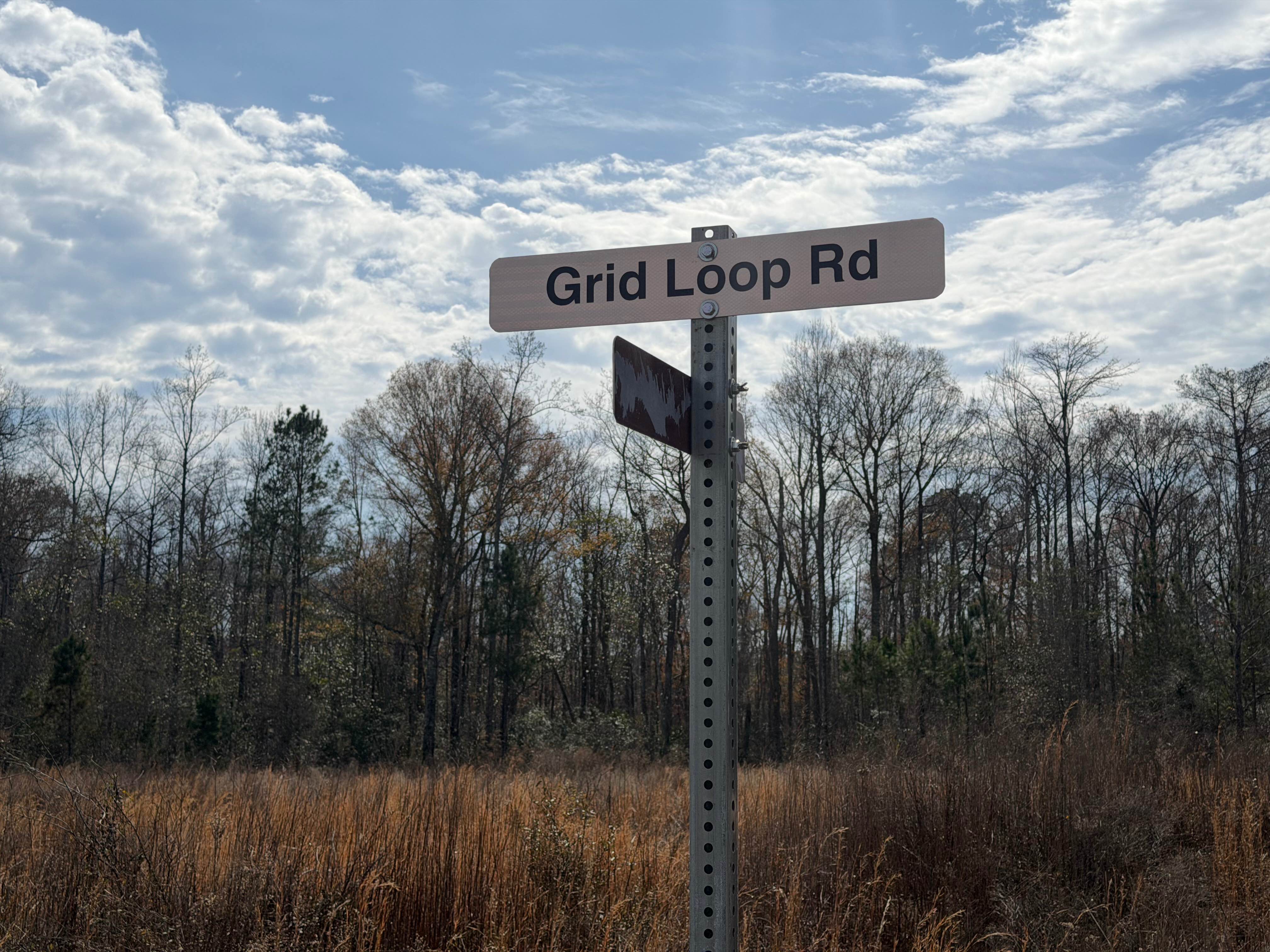
Grid Loop Road
Total Miles
3.5
Technical Rating
Best Time
Spring, Summer, Fall, Winter
Trail Type
Full-Width Road
Accessible By
Trail Overview
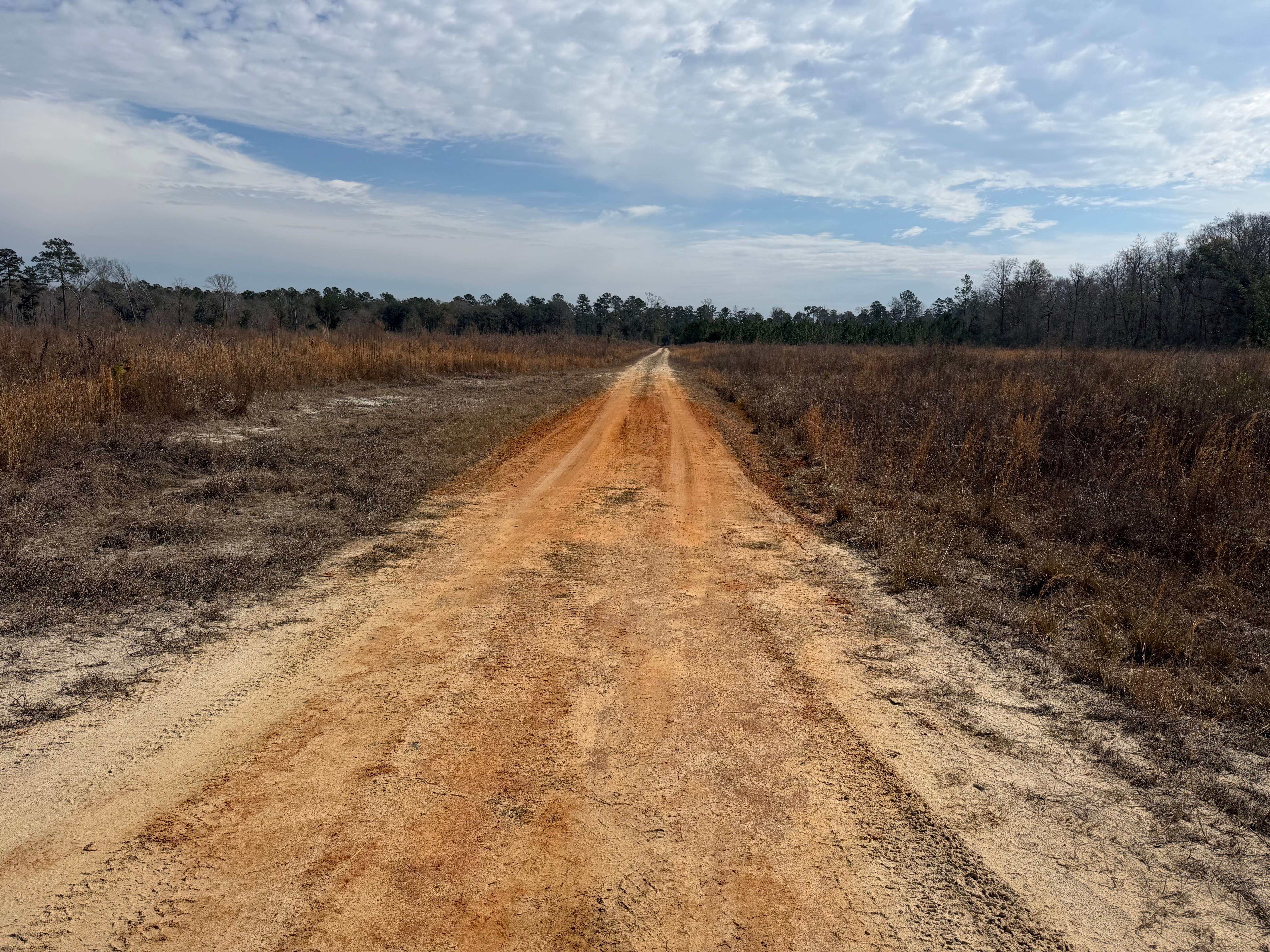
Grid Loop Road runs through the southeastern quadrant of the Chickasawhatchee Wildlife Management Area (WMA). Only street-legal, registered, and licensed vehicles are permitted. Additionally, the Georgia Department of Natural Resources (GADNR) requires individuals to be in possession of the Georgia Lands Pass when entering or accessing state WMA's. GADNR accepts all valid Georgia hunting or fishing licenses in lieu of the Lands Pass. This applies to both residents and non-residents. Purchasing a fishing or hunting license in most cases is less expensive than the Lands Pass. Licenses and the Lands Pass can be purchased through GADNR's website at www.gooutdoorsgeorgia.com or using the following link to the licensing page. https://license.gooutdoorsgeorgia.com/Licensing/CustomerLookup.aspx . Grid Loop Road is a red clay/sand and dirt road mix. There are areas of deep ruts and wet sticky mud. The trail is mostly one vehicle wide. The trail moves through wide open cuts that abut deep, soft dirt/mud or tilled soils. Pulling off to allow passing will require a high-clearance 4WD. Navigating through segments of mud and ruts also requires high clearance 4WD. The trail has a series of switchbacks and whoops with the grades and elevations change. Following rain, snow melt, or storms, trail conditions may worsen and become more impassable. There is the potential of water crossings, standing water, or mud greater than 12 inches. These conditions may make the trail impassable for most low-clearance or 2WD vehicles.
Photos of Grid Loop Road
Difficulty
Unimproved, uneven, rutted, clay and dirt trail with potential for loose debris (e.g. rock, tree branches, washes, etc.). The trail is mainly single vehicle wide with areas to pass. Seasonal water crossings 12 inches deep or more, areas of loose sand, potential for mudholes or obstacles up to 18 inches. Following storms or seasonal weather events, the trails may go unmaintained.
Status Reports
Grid Loop Road can be accessed by the following ride types:
- High-Clearance 4x4
- SUV
- Dirt Bike
Grid Loop Road Map
Popular Trails
FS-68 Lake Conasauga

Nimblewill Road
Locust Stake Road
631- Tatum Lead
The onX Offroad Difference
onX Offroad combines trail photos, descriptions, difficulty ratings, width restrictions, seasonality, and more in a user-friendly interface. Available on all devices, with offline access and full compatibility with CarPlay and Android Auto. Discover what you’re missing today!