South Fork Animas Trailhead
Total Miles
0.5
Technical Rating
Best Time
Spring, Summer
Trail Type
Full-Width Road
Accessible By
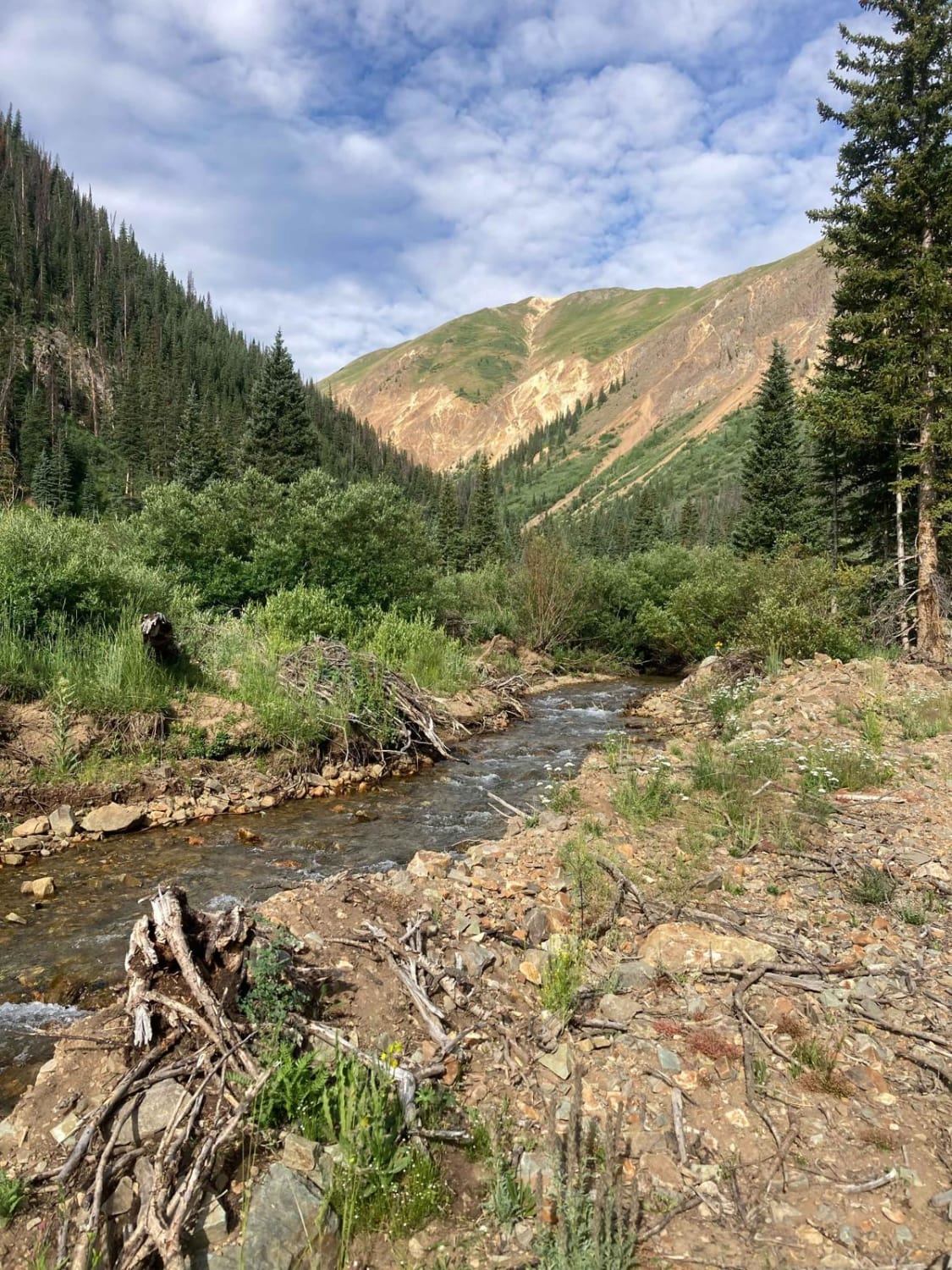
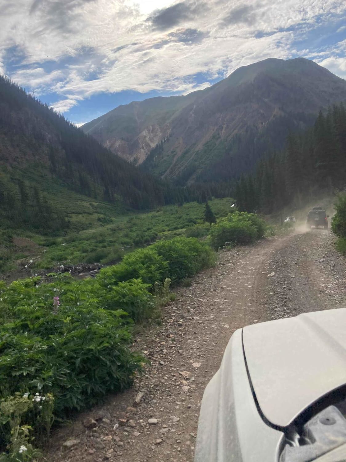
Trail Overview
This is a short spur through a private area down to the South Fork Animas River. The road ends at a gate, short of what the Motor Vehicle Use Map shows, to keep traffic out of the mine ruins. There are no obstacles or technical driving, and the view is great with running water next to the road.
Photos of South Fork Animas Trailhead
Difficulty
This trail may become impassable during high snow and deep thaw.
Status Reports
South Fork Animas Trailhead can be accessed by the following ride types:
- High-Clearance 4x4
- SUV
- SxS (60")
- ATV (50")
- Dirt Bike
South Fork Animas Trailhead Map
Popular Trails

Texas Creek (FSR 755)

Little Dolores Canyon
The onX Offroad Difference
onX Offroad combines trail photos, descriptions, difficulty ratings, width restrictions, seasonality, and more in a user-friendly interface. Available on all devices, with offline access and full compatibility with CarPlay and Android Auto. Discover what you’re missing today!